
Kwanak-san
Overall difficulty level: 7/10
Skill: 8/10 (all routes)
Aerobic: 7/10 (depending on route)
Scenic: 8/10
Crowdedness: 4/10 (9/10 on Saturday afternoons and all day Sunday)
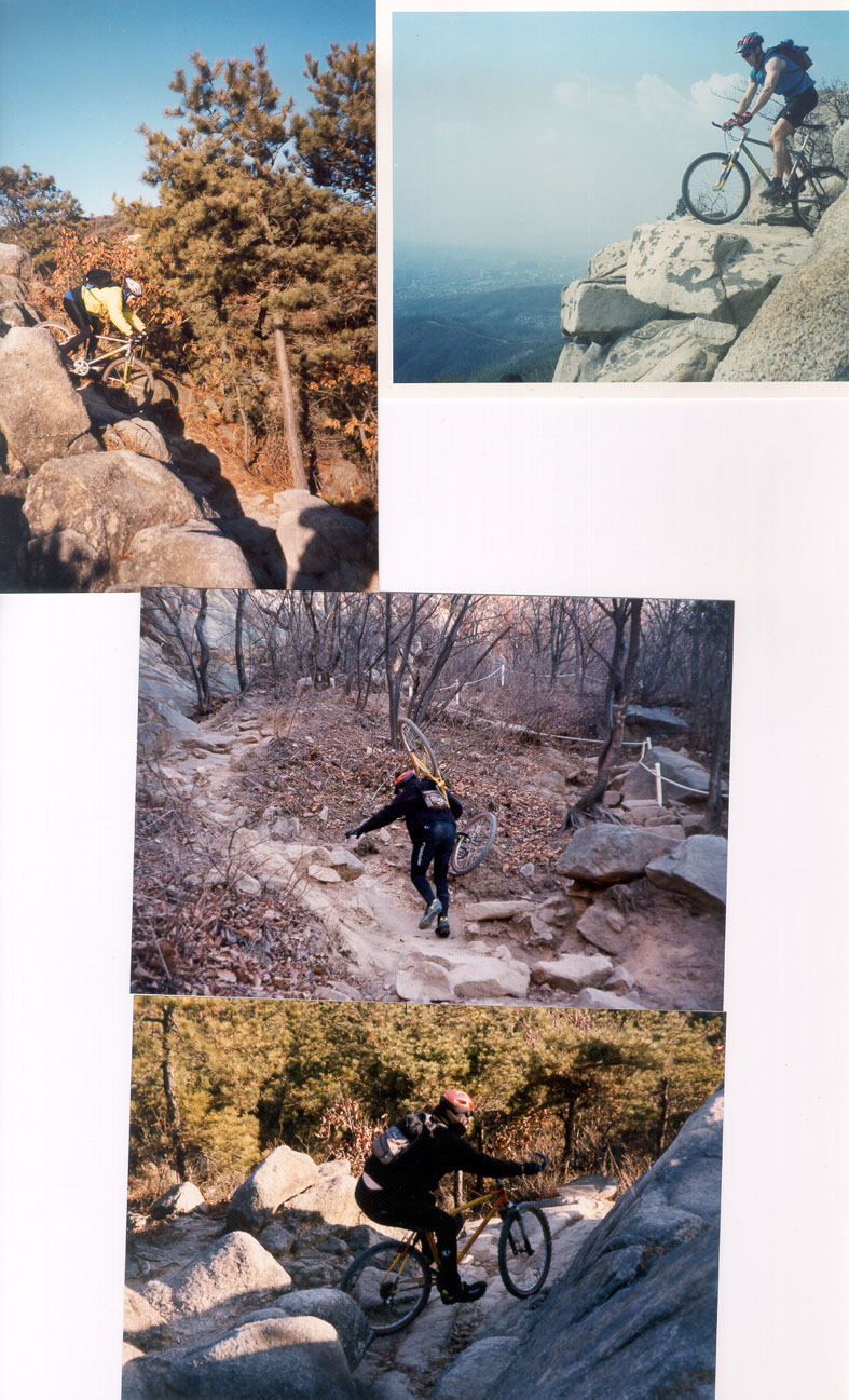
Access: Kwanak-san is the imposing mountain in south central Seoul, between Seoul and Kwachon. It lies to the west of Umyon-san, although the eastern part of Kwanak is militarized and impassable. Our ride described below starts at the western part of Kwanak-san, er, Samsung-san, behind Novotel Toksan hotel (find it on a tourist map). Alternately, you could go up much of the downhill for an out-and-back ride. This option begins and ends in between Kwanak and Soksu Stations, and takes about an hour.
Suggested coursing: I like to start at Toksan-dong or near Nambu Hospital (on the Nambu Ring Rd), which is roughly a 25 minute ride from the Han River. Find the Novotel Toksan deluxe hotel, and wander through the little neighborhood behind the hotel to the mountain's foothills. It's almost impossible to explain exactly how to get there, but with enough wandering you should be able to find some dirt. As usual, find the main ridge trail. If you're on the wrong ridge, don't worry. As Flannery O'Connor's short story tells us, "All points that rise must converge." Uh . . . now that I'm writing this and trying to picture the proper coursing, it's very difficult to describe, as there are too many turnoffs to take. Regardless, ask the way to _____ Temple (___-sa). Once you're in sight of the temple, there should be stairs in front of you going straight up. Carry your bike up this trail and at the top just keep following the ridge from helicopter pad to helicopter pad. This ridge should be almost all rideable and very scenic, with views out to Seoul in the north and Shiheung to the west. A few times I've even been able to see the Yellow Sea on one of the very rare clear days. Riding rom the top, within a kilometer you're going to have to turn right, but there are so many trails it's once again too difficult to describe. You could ask the way to Dog Rock (______), which is where the 4km downhill begins. Once you've located Dog Rock, you're ready to go. Just stay on the main ridge as you descend. There will be some forks in the trail (not T-intersections); at each fork, make a soft left. The bottom should put you very, very close to Shiheung Daero (Shiheung Grand Street), depending on the actual exit trail you took. Heading north on this street will put you on Yoido and the Han River Bikeway, about 35 minutes away by bicycle. About 14km/160 minutes.
Additional notes:l
--Steve Danyo
