After Simsbury the line diverged from the Canal Line and ran across Hopmeadow Street parallel to Route 167. It is still clearly visible most of this way. Upon entering Stratton Brook State park, the right of way is maintained as a trail:

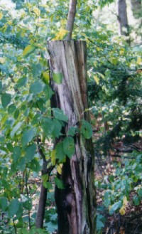
I stumbled upon this section EXTREMELY unwillingly, as a high school cross country runner. Simsbury uses this as the last 800m of their course and I know of nothing more psychologically draining than being able to see the finish and still having to run for about three minutes. We think we've found one artifact here... this post looks like a rail tie and was perhaps a whistle sign?
After the park, Forest Road (with the Simsbury Fire Acadamy) follows the place where rails once ran:

The railroad runs then through West Simsbury, and must cross Route 44 in Canton before the turnoff to Collinsville. It doesn't have much to do with the railroad, but I love this turnoff because it's Dowd Ave. There's some cool remains in Collinsville
back to the Central New England index
