 France - Dordogne
France - Dordogne
France - DordogneAugust 2017
France is such a diverse country and neither of us had ever visited the Dordogne region, so a camping trip was in order. I booked a ferry from Newhaven to Dieppe, a crossing we had not done before. Since we were going in August, campsites were busy and we decided to base ourselves just outside Sarlat and spend our days driving around the area. I booked a week’s stay at the small hilltop ‘Camping Les Terrasses Du Perigord’.
We left Newhaven on a wet Saturday July 29th at 1730 arriving in Dieppe at 2230. I had booked a cheap Formula One in Dieppe and it was supposedly only fifteen minutes from the port. But downtown Dieppe seemed shut down and it was dark with no traffic signs. We drove around in circles, finally asking at another hotel. It was just around the corner but even then we couldn’t find it. When we did, I realised what the problem was. It had no tall Formula 1 neon sign towering above it which you always look for. It was full but I squeezed into the last parking space. It had taken seventy-five mins to find it from leaving the ferry. Doh!
After a crowded grab-whatever-you-can breakfast in the lobby we headed south for a long day’s drive to our campsite. It was Sunday so the shops were all closed. From Dieppe, we headed south down the N27 to Rouen and skirted around the centre. Rather than joining the peage (tollroad) towards Paris, I had read that there were major traffic works north of Versailles so we took a more direct if slower route directly south via Evreux, Dreux and Chartres using the N154. From Chartres we made for Orleans and a coffee stop. Joining the motorway A71/E9 it was back to a fast if crowded (the road was full of Dutch tourists) drive to join the A20-E9 which went on forever. It was over 50 junctions before we turned off and made our way using local roads towards Sarlat. We came across Montignac which was just finishing its July Arts Festival with bunting covering the streets. It looked enchanting and the good news was that there was a wine shop open!
From Sarlat, it took a little while to get our bearings but ten hours after leaving Dieppe, we finally arrived. We had a reserved spot near the facilities surrounded by hedges and room for the car. There was a decent sized pool usually full of kids but next door was a spa which you could pay extra for and where kids were banned. We tended to use this after our days out. There was a bakery at the bottom of the hill for fresh bread and cakes. A little rusty, it took a while to remember how to erect our 3-section tent but we got there. We were set up and glad that we had reserved it in advance. The campsite was usually full all week. The weather was up to 35’c in temperature all week. It was so hot that one bottle of wine popped its cork in the tent from the heat and it hadn’t been opened!
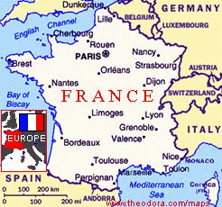
For the next six days, we did days out around the ‘Perigord Noir’ region, dipping into another two of the four Perigords. “From the deep, narrow gorges of the Vezere to the fertile plains of the wide Dordogne valley...the Perigord is a land of contrasts. This varied landscape is also dotted with painted caves, medieval villages and massive castles, traces of human activity that date back to prehistoric times” (Eye Witness Travel). The Dordogne department is the third largest in France
We criss-crossed the region and saw some of the sights quite a few times. For this reason, I am going to list the sights that we saw in no particular order. Ironically apart from using the excellent Carrefour shop, we virtually ignored our base of Sarlat La Caneda. Nestling at the foot of a clusters of ‘pechs’ (small hills), 10km north of the River Dordogne, Sarlat has undergone extensive restoration, returning its narrow streets and courtyards to their original splendour. This centre of trade on the road to Santiago de Compostela grew rapidly in the 13th century and again in the mid-15th century when its splendid Renaissance houses were built. The main pedestrianised street Rue de la Republic, laid out in the 19th century, ran between the picturesque medieval district and the town’s other ancient streets.
Thomas Cook said that Sarlat was a “wanderer’s town...along narrow alleyways full of atmosphere, into streets and squares lined with ancient houses.” Maybe so, but the roads in and out of Sarlat seemed to be gridlocked most of the time. Parking was awful and we only visited the centre once, late in the afternoon when the tourists were thinning out. When it had its traditional Wednesday market, the outlying roads were gridlocked from 7am onwards.
10km south of Sarlat and the Dordogne River, Domme is an exceptionally well-preserved, pretty ‘bastide’ now wholly given over to tourism. Bastides were the new towns of the 13th and 14th centuries, making their mark particularly on southwest France. They were built by both the French and English and examples of town planning, with their characteristic grid layout, the central square for the market surrounded by a covered arcade. The creation of bastides apparently reflected a democratic expansion period in Europe whatever that means.
Standing majestically atop sheer cliffs, affording some of the most stupendous views in the entire valley, Domme is dubbed the ‘Acropolis of the Dordogne’. From the chestnut shaded Esplanade du Belvedere at Domme’s northern edge, we looked out over a wide sweep of river country encompassing everything from Beynac to Montfort. The drop here is so precipitous that fortifications were deemed unnecessary when the bastide was founded in 1281. They lived to regret this when in 1588, a small band of Protestants scaled the cliffs and took the town by surprise and stayed for 4 years. Much of Domme’s 13th century walls and three of the gateways remain. The best preserved is the Porte des Tours, flanked by two round bastions. The main square had the 16th century Maison des Gouverneurs and a 17th century covered market. We didn’t bother descending to the ‘caves’.
La Roque Gageac was nearby on the river’s north bank 5km east of Beynac. Cited as one of the most attractive villages in France it is said to be the country’s third most visited sight (after what?). The village is set tightly between the river and the craggy face of an overhanging sheer cliff and its picturesque streets are a pot-pourri or grand and humble ochre coloured houses. On the cliff above the village lies the remnants of a troglodyte fort which was a virtually impregnable refuge between the 9th Viking raids and the 18th century.
Just up the road from La Roque, and spread out between its castle and the banks of the river, the village of Castelnaud sits at the intersection of the Dordogne and Ceou valleys. This was an English stronghold during much of the Hundred Years War facing the French held Beynac castle. Abandoned at the beginning of the 18th Century the Chateau de Castelnaud has recently been restored. The great fortress dominates an abrupt knoll to the east of the village of Brenetoux, its sturdy towers and red-brown walls visible for miles around. It dates from the mid-10th century but took on its present form – a triangular fort with a massive square keep and three round towers, the whole lot surrounded by ramparts and dry moats – during the Hundred Years War.
Rising steeply from the north bank of the Dordogne, Beynac-et-Cazenac is a pretty eye- catching village of houses dating from the 15th century. 3km west, perched on a rock at the top of a 150m cliff above the river, is the imposing grey coloured Chateau de Beynac. Standing on the site of a much older fortress, the castle dates from the 13th century and was a focal point of exchanges between French and English armies during the Hundred Years War and again during the Wars of Religion in the 16th century. Restoration work started in 1961. Entry was across a double moat and through a double line of ramparts. The 13th century keep was flanked by the main building dating from the same period but remodelled in the 16th century. I felt that this castle was the most impressive sight seen from a distance in the whole region. We would canoe past La Roque, Castelnaud and Beynac later in the week for a different view from the river. The vistas looked even better from there.
The Chateau de Montfort had spectacular white walls and distinctive, ‘Disneyesque’ turrets which dated from its 19th century reconstruction. It overlooks the almost perfect curve of the Cingle de Montfort, the tightest of the Dordogne’s many meanders.
Francois de Caumont, owner of the Chateaux de Castelnaud, had the Chateau des Milandes built in the 15th century for his young wife, who found Castelnaud rather cold and unwelcoming. It was a fine example of Renaissance architecture, with attractive stonework and period features. The chateau fell into ruin after the French Revolution but was famously restored by the music hall star Josephine Baker and its most famous era was during the 20th century. The chateau was one of the prettier ones in this area, and was surrounded by attractive gardens. The exterior of the chateau had turrets, pointy roofs, mullioned windows, stained glass windows and gargoyles, but it was all put together in a beautifully harmonious way. The interior is now restored and maintained in the 1930's style in which Josephine Baker decorated it.
26km upstream from Les Eyzies, Montignac is an attractive town which straddles the Vezere River. The old town lies north of the old stone bridge with numerous timbered 14th to 16th century houses. ”It centres on the pretty place d’Armes, a harmonious square of warm sun bathed stone adorned by hanging creepers and smart blue shutters.” (Rough Guide). South of the river was the Faubourg, with more elegant buildings including the galleried former hospice where the town’s municipal offices are now housed.
Just outside Montignac, lie the Lasceux caves. Discovered in 1940 by four schoolboys searching for a dog that had fallen into a hole, the original cave consisted of four galleries with more than 1500 coloured paintings up to 17000 year ago.. It became such a tourist attraction that carbon dioxide and humidity began to damage the paintings so the cave was closed in 1963. Twenty years later, a replica Lasceau II was built as a ‘copy-cat’ cave, 200m from the original. 1000 tickets are sold every day and when we turned up the queue was endless. I had already booked a tour at a smaller cave that day so we passed on Lasceux II knowing we would see the real thing.
At Thonac 10km to the southwest of Montignac the Chateau de Losse was an elegant residence built in 1576 on the ruins of the town’s medieval fortress. A fortified gatehouse guarded the fixed bridge that led to the main courtyard. The Rough Guide said “Of several castles along the Vezere valley, the Renaissance Chateau de Losse stands out as the most striking.” We just stopped to take photos without going in.
We reached the village of Les Eyzies-de-Tayac through charmingly rustic scenery of rolling hills dotted with woodland and farms and crossed by tumbling streams. Here the Vezere and Beune rivers met. Known as the “Capital of prehistory”, the long thin village stretched out beneath a massive, ochre coloured limestone cliff.
Just outside the village lies the Grotte de Font de Gaume which rivals the famed Lasceux cave, further up the Vezere Valley, in the number and quality of its prehistoric paintings dating from the Magdalenian period (18000-10000 years old). Since they were first discovered in 1901, over 200 polychrome paintings and engravings have been found in the narrow tunnel. In order to preserve them only 180 people a day in groups of 12 are allowed in. When I had applied on-line in June I assumed every tour would be booked up in August and was very surprised when I was offered a tour on August 1st at 1415. We had to climb up a narrow path to the cave entrance where the guide was waiting.
The cave mouth was no more than a fissure concealed by rocks and trees above a small lush valley. It was sealed by an iron door both for security and to keep the temperature constant. Inside was a narrow twisting passage of irregular height over 100m long. We passed through this with no lights – just the guide’s torch and she pointed out various paintings. The majority of the paintings depicted bison (82 of them) but also horses, mammoths, reindeer and wild cats. The first one we saw was a frieze of bison at about eye level; reddish brown in colour, massive and full of movement. Painted on white calcite, the contours of the rock face had been skilfully utilised to give the animals a three-dimensional form. Further on, a horse stood with one hoof slightly raised, resting while another appeared to be galloping or jumping. In another, one reindeer licked another. Probably the most impressive of all was a frieze of five bison with sharp and vivid colours still intact. Shading under the belly and down the thighs was used to add volume with a sophistication that seemed very modern. Another panel consisted of superimposed drawings, a fairly common phenomenon in cave painting which was sometimes the result of successive generations or a technique. Reindeer in the foreground shared legs with a large bison to indicate perspective. The 45-minute tour passed in no time. We felt very privileged to have seen the only original remaining cave paintings available for viewing. I’m sure they will close this cave down to the public as well so try and see them before that happens. Recommended.
After the tour we headed for the Grotte de Rouffignac (Rouffignac cave) which is located 5km south of Rouffignac, a town destroyed by German troops in 1944 and subsequently rebuilt. The only building to survive was the church. The cave apparently had 8km of galleries and chambers decorated with paintings and engravings of prehistoric animals (horses, woolly rhino, bison) from 13000 years ago including 158 depictions of mammoths. It started with a one kilometre ride on an little electric train along the bed of an underground river. The tour was in French and there was no English leaflet. It was also a first come first serve every morning for all the daily tours. It was 4.30pm when we arrived and the tours were all booked. Since it was an hour’s drive from the campsite, we didn’t bother to return early one morning to bag two seats. Maybe it will be something we can do on another visit.
One day, we set off for the Gardens of Marqueyssac which were only three kilometres east of Beynac. Here the Dordogne River looped south round a long and narrow wooded promontory, at the tip of which was the Chateau de Marqueyssac The late 18th chateau was a typically mellow Perigord mansion (open today which was rare). But it was the magnificent gardens that we had come to see and judging by the full car parks so had every tourist. The gardens were first laid out in the 1600s inspired by Versailles, though most features today were added two centuries later including the thousands of box trees clipped into plump cushions. Set in twenty-two acres of parkland, it had 6km of green paths among fine topiary hedges and shrubs. Four terraces were laid out in the style of formal Italian gardens. At the end of the path was a climb to a great viewpoint offering some of the best views over the Dordogne Valley with La Roque Gageac in the distance. It was roasting hot today, at least 35% and many people did what we did – got a cold beer and sat in the shade.
Charmingly sited on a quiet bend of the Vezere River, the village of St Leon sur Vezere had much to offer including one of the loveliest Romanesque churches in Perigord. The church’s elegantly arcaded bell tower stood over the smoothly rounded apse and chapels like a mother hen guarding her chicks. This 11th century church was one of the oldest in Perigord and its interior was decorated with frescos from the 12th to 17th centuries. The village has two castles: Chateau de la Salle, on the square, with a 14th century keep and Chateau de Chabans, dating from the 15th and 16th centuries overlooking the river.
There were two interesting sights involving cliffs. Nearly a kilometre in length and rising 80m above the Vezere Valley between the villages of Tursac and Peyzac-le-Moustier, an imposing cliff was like a prehistoric high rise apartment block with about 100 caves hollowed out on five levels. Known as La Roque Saint Christopher, archaeological findings unearthed there suggested that the cliff dwellings were in use from up to 35000 years ago but what we saw dated from the 10th century. Fireplaces, stairways and carved-out passages, post holes, drainage channels and water tanks provided evidence of continuous human habitation over the millennia. This natural fortress could hold over 1000 people and dominated the landscape. At its peak during the Middle Ages it had grown into a veritable town clinging to the rock face – with its own marketplace, church, prison, abattoir, baker and artisans workshops.
Further along the road was the Maison de Reignac which had been closed to the public until recently. It is now the only intact cliff-castle of its type in France. It was a fortified feudal medieval residence that had been built into the rock. The majority of its roof was the overhanging cliff above it and its modest appearance on the outside belied the scale of the building on the inside. The front of the house was built in the 14th century and its windows added in the 16th century, though the rock shelter had been occupied since prehistoric times. The initial entrance led into a large underground rock chamber which was now used to display some of the prehistoric objects discovered on the site. From here the tour revealed many rooms with their period furnishings but each room had the anomaly of a stone wall or stone roof using the cliff face. The combination of the rock roof and rear walls and various defensive features of the chateau meant that it is one of the strongest of the Dordogne. The rooms included a kitchen, dining room, living room and chapel amongst others.
20km west of Sarlat and 10km south from Les Eyzies, St Cyrien was a non-touristy place set back from the D703. We failed miserably to find a late lunch in town. By 3pm everything had closed. But it did have a very good supermarket on the outskirts. It had been another roasting day and we retired to the campsite spa pool.
On another day, we headed out to Perigord Purple for Le Buisson de Caduoin on the left bank of the Dordogne River. En route, 12km south of St-Cyprien and set on a hilltop, the village of Belves was a fort in the 11th century. The medieval heart with its houses and buildings were strewn around the castle and church. Nearby was a 15th century covered market at the place d’Armes. The town had 7 towers, some of them bell towers.
Cadouin’s market and old houses grew up around the famous Cistercian abbey, Le Cloitre de Cadouin which dated from the 12th century. It is now a World Heritage Site and contains the Cadouin Holy Stroud, which brought pilgrims to the abbey for centuries en route to Compostela. The embroidered linen cloth was believed to have been used to wrap Christ’s head and was brought to Cadouin around 1214 by a priest from Perigord. It has since been proved to be from the 11th century. Behind the abbey’s imposing buttressed façade was the cloister, built in the 15th and 16th centuries in a mixture of flamboyant Gothic and Renaissance styles By pure luck Cadouin was having a fair that day with ancient games, stalls and a singer. Colourful bunting hung from poles sticking out of wooden barrels. I had promised Wendy at least one lunch out and here we found a splendid traditional restaurant with outside tables looking onto the market square. Starting with soup, there were 3 more courses including a yummy chocolate desert. The meal was washed down with local red wine. This small village was one of the highlights of our week.
We had seen canoeists all week on both the Dordogne and Vezere rivers. We discovered that our campsite organised a canoe trip on the Friday. We were picked up by a bus along with other campers and driven down to Vitrac near Domme. Here we put our ‘stuff; in a waterproof barrel, got life jackets and oars and made our way to the two man orange ‘Indian’ canoes. We would be canoing around 15km down the Dordogne. The river was very smooth and we could just drift down with the current. Some parts were shallow enough to rub the bottom of the canoe. The water was very clear and obviously clean with no motor boats able to traverse this section. Beautiful greenery was on either side with the occasional white cliff. Sometimes where there was a bend, the current picked up and we would head over small rapids until the river widened again. Wendy sat in front doing the steering while I added additional power.
We passed under 3 bridges and stopped for a beer en route. It was another roasting day but so peaceful (save for the occasional noisy canoeists who passed quickly) and a wonderful way to experience the Dordogne area. We paddled past La Roque Gageac which looked very different from the river when you had time to take it in. Then the Chateau de Castelnaud appeared on the promontory followed by the Chateau de Beynac on one side and the Chateau de Faynac on the other. We had arrived much earlier than anticipated and had time to enjoy a late French lunch before getting picked up for the return journey. I went swimming in the clear river water while we waited. Recommended.
On our final day, we did a magical mystery tour into Perigold Blanc with the Chateau de Hauteford as a final destination. We passed by fields of geese which were being bred for the petit-fois delicacies of the region.
By complete accident we came across another gem called St Amand-de-Coly. Roofed with slabs of limestone, the old houses of this small village (pop 300) were totally dominated by the fortress-like church that gave the place its name. It was one of Perigord’s best fortified churches, so well protected with its 4m thick walls, that in the 15th and 16th centuries, it was known as St Amand Fort. From a chamber above the main door, its defenders were able to rain rocks and boiling oil down on to the attackers. In 1575, Protestants occupying the church were able to withstand a six day siege by 20000 soldiers backed up with heavy artillery. “Despite its size and bristling military architecture, the 12th century abbey church manages to combine great delicacy and spirituality” (Rough Guide).
The church’s interior displayed the simple, spacious beauty typical of Augustinian architecture with its 48m long nave still evidencing defensive elements, lit by a stained glass window set above the three arched doorway. The floor of the beautifully empty interior sloped gently down towards the choir. Built on the plan of a Latin cross, it was enclosed by 300m of walls. Its 30m high belfry was crowned by a garrison. Concerts of classical music take place in this church and we heard three female singers being put through their paces by a music teacher and accompanied by a pianist. They had to repeat sections again and again until they got it right. The sound of their singing echoed hypnotically around the nave.
As we entered the limestone plateaux of the Perigord Blanc 40km northeast of Perigueux, the Chateau de Hauteford whose massive bulk was extended by two wings ending in towers, and standing on a south facing promontory, was a stunning sight from whichever direction you approached. Fortifications have stood here since the 9th century. It was strengthened in the 16th century to repel attacks during the Wars of Religion. There was a 40 year reconstruction programme that started in 1630 for the Marquis de Hautefort who envisaged a classic building in the style of a Loire Valley chateau. A drawbridge led through to the courtyard and main building with an arcaded galley and steep slate roof. But it was badly damaged in a 1968 fire and has since been restored again.
Our final sight was popping into Perigueux which was the compact little capital of the province of Perigord. Originally the Roman town of Vesunna it is a busy market town. There was only one sight of interest to us, that of the Cathedral St-Front which dates from the 12th century, St-Front was a former bishop of Perigueux. It is one of the largest in France and the 19th century reconstruction work and embellishments were done in the Roman-Byzantine style by Paul Abadie (later architect of the Sacre Coeur in Paris).The building formed a combination of a Latin cross and a Greek cross, separated by a tower. Its five domes are more than 36m high and 24m wide. Abadie also added 11 small steeples. It almost looked Turkish in design.
As with our trip to the Loire Valley, we were enchanted by the Dordogne region and vowed to return and see more of the area. August is a peak month so most attractions were busy but if you came before or after the summer, I think it was be less crowded. That said, we were able to explore narrow lanes and get away from the traffic.
Our return journey only took 8 hours to Dieppe. We knew the way now. We found a lovely hotel (Hotel Balladins) on the outskirts. Arriving back at Newhaven, it took an hour from leaving the ferry until getting out of the port. Despite our passports being checked on the French side, the British were also checking the passports. Had Brexit come early?