Route 66
modified 02/11/01
Approximately 487 miles (12.8 hours ??? including side trips)
Approximately 487 miles (12.8 hours ??? including side trips)
| Oklahoma Slide Show |
|---|
| 1957 Plymouth |
|---|
http://www.forwardlook.net/countdown.asp
|
This page and its contents were "borrowed from a number of sources. I will credit each in the body of this page, either directly or through links. I have been in touch with the Oklahoma Route 66 Association president, Kathy Anderson. I asked her to share tshare her thoughts with me, including the best route (66) to follow and miss the larger cities. She has been very helpful. I have included her suggestions in the following. |
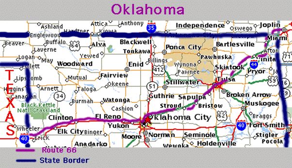
From Baxter Springs(KS) to Vinita
|
|
From Catoosa I am going to follow Interstate 44 through Tulsa to Sapulpa |
|
Exit I-44 at Sapulpa, OK
Warwick Wellston
|
|
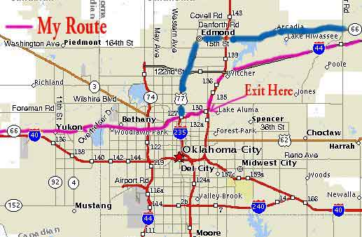
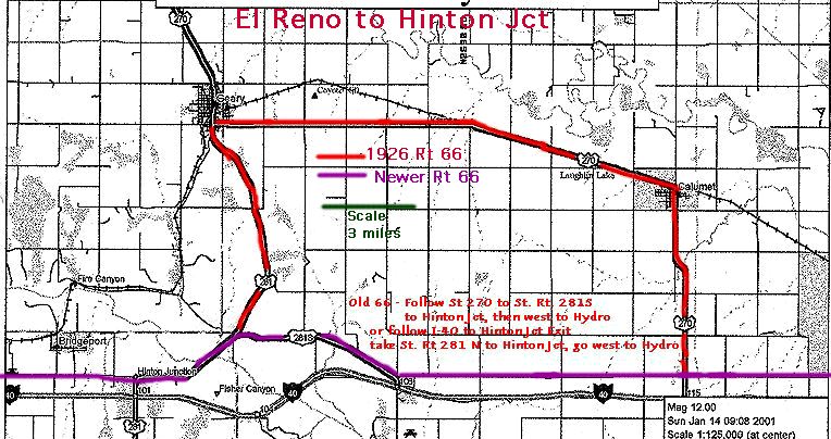
Bethany to El Reno El Reno to Hinton Jct. - Another gem stretch of Route 66
|
Clinton
Clinton to Elk City
Sayre
("Grapes of Wrath")
[
MAP ]
| If you want a quick flashback to the dark days of Steinbeck's
The Grapes of Wrath, turn north off the I-40 freeway into sleepy
Sayre (pop. 2,881).
The landmark Beckham County Courthouse, which looms over the east end of Main Street, was prominently featured in the movie version as Henry Fonda and the rest of the Joads rattled down Route 66 toward California. While on Main Street, stop in for a milk shake at the friendly fountain in the Owl Drug Store on the corner of 4th Street. Take a look in the ever-expanding Shortgrass Country Museum (hours vary; free), housed in the old Rock Island Line railroad depot at 106 E. Poplar Street, with changing displays documenting regional history from Cheyenne times to the arrival of homesteading settlers during the great Land Rush of 1892. East of the museum stands a giant grain elevator that has rusted into a gorgeous orange glow. |
Sayre to Erick
Erick to Oklahoma-Texas State Line
Oklahoma
Motels - partial listing
| This page was modified from
several originals which were by created by
jandersj@home.net To see his original Oklahoma page, go to http://24.0.127.109/oklahoma.html To see Joe's main Page Click here! |
|
Swa.Frantzen@advalvas.be To contact me
|
![[ MAP ]](https://www.angelfire.com/wv/joyrde/Rte66/sayremap.gif)