Is there a shatter cone in front of Aiguilles de Chabričres southside South Alps France) go to http://www.montagne-photos.org and click on Embrunais, then on Aiguilles de Chabričres and on top right?
Shatter cones have a melted skin in Sudbury. It reminds me of Upheaval dome (salt dome or impact ?). Berlin University prooved the impact.
Shatter cones
Shatter cones ?
Shatter cones ? between Ponsonničre pass and Béraudes lake, near Galibier, French Alps (the impact is so recent that the mountain is still smoking !... just a joke). I love this place going from Cerces lake to Béraudes lake, then to Rochilles lake !
Idem, same place, but much better on the left side.
Shatter cones are fractals.
Black Canyon of the Gunnison USA : shatter cones ?
Shatter cones are fractals.
Meije north wall Oisans French Alps with planar shatter cones ? related with Arvan impact ?
Idem for Aiguilles (Needles) de Chamonix and Aiguille du Midi, Mont Blanc, northern French Alps ?
Shattercones ?
Shatter cones ?
Shatter cones ?
Shattercones
Shattercones.
Tsunamis
Are there shapes with the same look east of Turriers basin (France South Alps west of Serre-Ponçon dam) ?
Tearing related with an impact ?
Tearing related with an impact ?
Tearing related with an impact ?
Tearing with side hoodoos related with an impact ?
Idem
Idem
Idem
click on 15 ? For Neville Price, the Rattlesnakes are related with an impact ("Major impacts and plate tectonics" p199)
"Fin" related with an impact ?
Sisteron (France South Alps) "fin" related with an impact ?
"Fin" related with impact schock wave coming up ?
Idem
"Fins" related with an impact ?
Extrusions related with an impact ?
Extrusions and arches ?
Stream tubes related with an impact ?
Cobra Arch, stream tube related with an impact (go to galerien and archliste then click on Cobra arch) ?
Idem ?
For Walter Alvarez, there is an impact.
Idem
Same for Shoemaker
Shapes related with an impact.
Mega breccia related with Saint Laurent Gulf impact ?
Diapirs related with Saint Laurent Gulf impact ?
Flysch sheets related with an impact ? Workshop on impact cratering 2003 Houston : "...Melosh : ... Robert Schmidt saw these flat layers in his centrifuge experiments...Hörz :... That's a phenomenon that is well-studied in industrial technology. Coarse grained aggregates separate... Wikipedia : “Flysch consists of repeated sedimentary cycles with upwards fining of the sediments. At the bottom of each cycle are sometimes coarse conglomerates or breccias, which gradually evolve upwards into sandstone and shale/claystone. Typically the shales don't contain many fossils, the coarser sandstones often have fractions of micas and glauconite…”
Flysch sismographic shaking recording ? with cooking ? flying or landing record ?
Reynolds number ?
Stream tubes related with an impact ?
Stream tubes and arches ?
Upheaval Dome.
Upheaval Dome.
Upheaval Dome
Burning and cooking related with an impact ?
Burning and cooking related with an impact ?
Burning and arches ?
Are the big rock lips related with an in impact heath wave ?
Same question.
Same question.
Same question.
Tafoni related with an impact ?
Tafoni with stream tubes related with an impact (see tafonis on flickr.com or google images to find many bee nests shapes like at Upheaval Dome or Roberts rift)?
Tafoni with round shapes, related with an impact ?
Burned and cooked shapes related with an impact ?
Idem (bochas de la Valle de la luna Argentina) ?
Idem ?
Idem Slovaquia, Tcheckia and Poland : related with mega impacts Tcheckia et Slovaquia ?
Round shapes on hoodoos (Gallup USA, just exactly the same kind as bochas Valle de la luna Argentina)
Idem (Gallup USA)
Idem (sandstone in St André de Rosans South Alpes France) ?
Idem (Red rock coulee) ?
Idem "They are red in color because of iron-bearing minerals, including hematite and goethite, that are also present in the surrounding sediment" ?
Idem ?
Thanks to the author of the site : are they all related with impacts ?
Too cute Moeraki boulders !
Moeraki boulders : which link with cooking ?
Inside Moeraki boulders
Detail
Ohio shale carbonate concretions (Geofacts n°4 Ohio department of natural resources Division of geological survey... Michael C.HANSEN October 1994) : "... carbonate concretions that commonly contain arthrodite bones; some contain exquisitely preserved remains, including soft tissue, of early sharks... around decaying organic matter... soapy matter known as adipocere... The ammonia creates a hight PH halo around the decaying, which causes carbonate to precipitate... adipocere was replaced by calcite... and iron-rich dolomite..."
Moqui marbles
Idem ?
Idem ?
Round shapes factory related with an impact ?
How many impacts ?
How many impacts ?
Impact tectonics butterfly wing patterns ?
Is Cyprus a mega impact (Anatolia from Black sea to Mediterranean Sea) south rim ?
Tools for impacts search
How many impacts ?
Huge impact east of Landes forest with Garonne curl in France South-West
Impacts Etang de Berre and Durance-Bléone (France south-east) with symmetry montagne de Lure, Luberon, Plans de Provence and Dévoluy-Tričves-Vercors southern crests, Champsaur and Ubaye-Larche valley (on Géo Relief PACA bag) and an axis going from Coirons basalt field west of Rhône river towards Roya north of Menton (Côte d'Azur) ?
Etang de Berre (northwest of Marseille France) impact with 11 km geological hole on BRGM France 1/1 000 000 geology map (just like Ventoux impact 11 km geological hole on the same map, also in Provence east of Avignon)and with Beaulieu volcanic plateau and a volcanic dyke northeastwards on Lubéron ridge ?
Impact Etang de Berre impact crater near Marseille (on Michelin map) ?
Beaulieu (Provence, France) : impact related minivolcano following Etang de Berre impact crater rim ?
Impact with crater rim on south-east coast of Florida and Keys ?
How many impacts on earth and how huge?
How many impacts on earth and how huge ?
How many impacts on earth and how huge ?
How many impacts on earth and how huge ?
How many impacts on earth and how huge ?
Mega-impact ?
Idem
Mega impact east of Newfoundland ?
Mega impact on Piemonte with a NE/SW axis ?
Circle centered on Rocca di Cavour (inselberg and central uplift or ring central uplift with the coesite zone crescent ?) and going on Sillon Alpin (annular peripherical graben ?), the -2000 meters curve in Mediterranean Sea, Mt Rose et Cervin/Matterhorn ? are french and italian western Alps the result of the way back wave towards north-east after the transitory crater ? (Atlas mondial Larousse Bartholomew & Son Ltd 1988 page 12) [click on the map to see the circle details]
Tectonic butterfly wing pattern Valence-Bellegarde-Lyon-Chartreuse related with an impact on Lyon with coesite in Monts du Lyonnais, gravity anomaly, thermalism in Charbonničres les Bains, Uriage, Allevard, Challes les Eaux, Aix les Bains and fractured cobble ?
Tectonic "Butterfly wing pattern" Philippines plate ?
Erta Ale the best book for plate tectonics
Alfred WEGENER and Sir Harold JEFFREYS (click on "Rien ne va plus")
Debates
Impact tectonics
Verdon canyon, Marseille's old greek harbour and calanques, linked with a 20 km meteor impact peripherical graben on Castellane, Point Sublime and Artuby canyon ? Meteor impact on Mt Ventoux, inducing Dentelles de Montmirail and Fontaine de Vaucluse and Perrier bubbles ? Switzerland : "astroblem country" ? Why Brenner altitude is 1371 m ? Dolomites and Brazil and Venezuela tepuis : extrusion shapes related with impacts ? Are Wight island and Crimea/Azov sea impact tails ? Is thermalism related with impacts listric faults ? Are hoodoos, fairy chimneys, mushroom rock shapes, demoiselles coiffées, cheminées de fées, erdpyramiden, piramidi di terra, funghi di terra, related with meteor impacts shock waves, stream tubes, dynamic compaction, ballasting, vibroflotation and "Brazil nut effect" ? Is flysch an impact jetting ? Did meteor impacts have a huge impact on Alps, Mediterranean sea sculpted shapes ? idem for Western Pacific ocean, Mexican Gulf and Florida, Hudson bay (double impact) and Great Lakes (Great Lakes were my baccalauréat geography subject and Economic map of the States my licencia docendi subject), South America, Africa south of Congo, Asian Russia, north-east China and Korea ? on plate tectonics and oil ?
The source is in french, with more details, on https://www.angelfire.com/wizard2/solidaires/impact.html . I apologize for my english : it's often difficult for me to translate the technical terms.
On 31/5/06 by letter JD/DD/2006-0297, Jean DERCOURT http://www.academie-sciences.fr/membres/D/Dercourt_Jean_bio.htm "Secrétaire Perpétuel" of French Sciences Academy writed : You sent to Sciences Academy a text with the following title : "Meteors origin of Verdon canyon, calanques, Marseille's old harbour, Ventoux, fairy chimneys and "demoiselles coiffées" ["young ladies with hats" or hoodoos in american], thermalism, Alps and Mediterranean sea configuration ? plate tectonics and hydrocarbons ?"... You may also send it as a "pli cacheté" [text about scientific discoveries in a "sealed envelop" opened after two to hundred years]..." The website site https://www.angelfire.com/wizard2/solidaires/impact.html (in french with quotations in english) was sent as "pli cacheté" by RAR number 4204 1386 3FR on 26/6/06. By letter of 2006 june 28, Florence GREFFE "Conservateur du Patrimoine historique de l'Académie des sciences", answered : "... the Academy accepted on 2006 june 28 the transmission of a "pli cacheté" with your name... under the number 17758..." Afterwards, there were also Soleau envelops sent at INPI Industrial Property National Institute.
| On the geological world map CCGM UNESCO to the 1/50 000.000 (chaired by Jean DERCOURT) is one of the greatest impacts of the world, at the origin of the greatest extinction (transition Permian-Trias) and of a trap among largest, the tectonic “butterfly wing pattern” with an axis departure on the upstream part of Ienissei estuary straight to the Djougdjour Mounts and Paramushir island, axis defining the axis of Okhotsk sea and Kara sea, tectonic “butterfly wing pattern” having for wings tips the Lena delta and Baďkal lake and way beyond the south of Mongolia towards Dalan-Dzadgad, releasing symmetries between the oceanic crust of the south of Okhotsk sea and south Kamtchatka, clarifying the creepage distances Sakhaline/micro plate Seno (Japan of north), Japan sea oceanic crust, Sikhota-Alin: Nipponides of the website about Asia “Turkic-type orogeny and its continental role in the making of the crust”? Are Altaids page 282 of this site the south-western end of the effects of the shock wave of the mega impact of Siberia, with the North-South stretched continental crust, Baykalides stretched North-South and symmetrically south-west/north-east and a small klippe of crust in the middle in the axis of the side ejection? http://atlas.cc.itu.edu.tr/~natalin/Tectonics/S&NTurcicAnRew.pdf What about the Bering Sea and the configuration of its oceanic crust? and of the chain of the Emperor? Is there a second impact in the North-East of Siberia: Verkhoyansk-Kolyma? What about of the relationship between Mercator projection and axes of symmetry within high latitudes? Pages 86-87 of the Atlas General BORDAS 1964 of DERRYN, BLASSELLE and BONNET, on USSR map in equivalent flat projection, the axis of symmetry appears to be Berezovo, Toura, Oust-Maďa and Paramouchir.
http://ccgm.free.fr/index_fr.html click on catalogue, maps distributed by the CCGM, then on reduced geological map of the world to increase it Is there a “butterfly wing pattern” whose tail would be the channel of Santa Barbara and Los Angeles, the ends of wings Yuma and Death Valley, and the head a round shape extruding towards the east the Grand Canyon of Colorado? What about the extraordinary Black Canyon of Gunnison? Page 298 of “Annals of to form world”, of John McPhee: ”… The Colorado river, which has only recently appeared one earth, has excavated the Large Canyon in very little time. From its beginning, human beings could watch the Large Canyon being made… “Page 225 8.8 of “Geology of the American Southwest” of W.Scott Baldridge: ”… is the “metamorphic core complex” heading towards east/south-eastern Arizona symmetrical of Grand Canyon? What about the mylonites of Whipple Moutain
in the axis with the hook of Colorado http://www.uoregon.edu/~rdorsey/Whips.GIF Is the rift of the Lake Superior a tectonic butterfly wing pattern of impact? http://www.minnesotastuff.com/Midcontinentrift.jpg (page 624 of “Annals of to form world” of John McPhee, it has a small aulacogene towards north) Is there an Hudson bay impact http://gsc.nrcan.gc.ca/mindep/synth_prov/slave/images/fig01.gif ? Are there Hudson bay, Nastapoka, St Laurent gulf, Ungava bay, Slave Province impacts http://gsc.nrcan.gc.ca/map/1860a/images/map1860a.jpg ? What about Rio Grande rift? Same for Hudson bay http://gsc.nrcan.gc.ca/mindep/synth_prov/slave/images/fig01.gif ? Idem for Akron magnetic boundary? Is there analogy of shapes, compared to the Plate of Colorado, with Lauragais and Rhone valley rift, around the south of Massif Central, with Texas and Gilf of Mexico mega impacts and basin Algéro-Provençal oceanic crust ? Are Ouachita thrust belt and Ancestral Rocky Mountains orogen related with an impact (tectonic butterfly wing pattern in horseshoe shape with, to the North-West, a side tail Central Colorado trough and its chains of edge) page 119 of “Geology of HT e American Southwest" by W.Scott Baldridge et page 18 of http://jan.ucc.nau.edu/~pm8/PM_dwnld/FINAL_CP_SRM_PrePrint_2002-12-31.pdf ?
Is there an impact between Michigan et Huron lakes with a huge blue tectonic butterfly wing pattern with two big grey spots on wings aimed northwards and a green impact peripherical graben south of the Appalaches ? Is Williston Basin related to an impact ?
Same for Athabasca Basin ? On magnetic anomaly map of the Staes, on Bouguer gravity anomalies maps and on West USA satellite photo :
The 1450 anorogenic plutons on magnetic anomalies map of USA, called in "Annals of the former world", page 652-653, "... unprecedented, unrepeated and unexplained... Leon Silver, a geologist at Caltech, has called the 1450 plutons the "Anorogenic Perforation of North America"...", are they related with a (mega) impacts catena ? "There is nowhere else in the world where a string of plutons of essentially the same age goes across four thousand kilometers." Page 33 of "Geology of the American Southwest" of W.Scott Baldridge : "... If this anorogenic model is correct, then it implies an event that is probably unique in the Earth history..." [page 32; the map Fig 1.17 shows in fact 7 strings 1.43 Ga, 1.44 Ga, 1.38 Ga, 1.46 Ga, 1.48 Ga et 1.45 Ga old from California to Labrador] What about the 24 anorogenic rings of Corsica in Bruno MEHIER's "Magmatisme et tectonique des plaques" Fig IV-52 page 166 and page 161 in "Comprendre et enseigner la plančte terre" by Caron, Gauthier, Schaaf, Ulysse and Wosniak? |
| Key points : - mpacts are 6 times less carved on Earth than on Moon (cf Jehan RONDOT "Les impacts météoritiques Charlevoix et le Ries" page 42). - "... Altogether craters formed in sediments are substantially shallower and may have diameters 2 to 4 times larger than crystalline rock craters formed by bodies of equivalent size..." (ESA 2006 meeting on Impact cratering) - return of materials from the transition crater towards the center of the final crater levels this final crater "...Then the transient crater becomes to collapse; the diameter increased about 23% and the depth decreased about 47% during the collapse..." (ESA 2006 meeting on Impact cratering): is it true for "nappe de Digne" ? what about "bassin de Turriers" ? http://www.geol-alp.com/z_publications/00_schemas_articles/97ga_turriers/10_carte_mouvts_turriers_4.gif - what about "bassin de Turriers" central tearing, combe Genin, Crillon le Brave-Mormoiron hills, Casteljaloux-Bazas axis, Bolzano/Bolzen, Ponticino/Bundchen, Sarentino/Samthein, Campolasta/Asfeld, Riobianco/Weissenbach, Pennes/Pens axis, west coast of Florida, Tan-Lu fault (Pour la Science "L'Ecorce Terrestre" juin 1995 page 43 figure 7), SW-NE tearing of Afghanistan, NS central tearing of East Iran ? http://www.google.com/search?hl=en&q=%22central+uplift%22+%22ring+peak%22&btnG=Google+Search http://www-sst.unil.ch/research/plate_tecto/present_day.htm http://geology.com/world/iran-satellite-image.shtml - difficult to take apart impacts, catena (impacts chains http://membres.lycos.fr/astrojan/hypothes.htm ), rebounds and impacts sedimentary volcanoes (cf Major impacts and plate tectonics by Neville PRICE). - is the Pacific seamounts axis change related with an impact (cf "Major impacts and plate tectonics" by Neville PRICE) ? - why is East and North Pacific (Alaska, Kamtchatka and Japan : cf page 273 "Les grandes structures géologiques" by Jacques Debelmas) a terrane mash and West Pacific a ring chain from north to south ? is it related with a mega impact Philippines plate (cf "Major impacts and plate tectonics" by Neville PRICE) ? are slabs impacts sensitive (rupture and roll back) ? are West Pacific subduction impacts peripherical ring grabens ? Do figure 5.1 page 61 of "De l'océan ŕ la chaîne de montagnes" by Marcel LEMOINE, Pierre-Charles de GRACIANSKY and Pierre TRICART and figure 85 page 120 of "Les grandes structures géologiques" de Jacques DEBELMAS, show the annular and peripherical graben of Tyrrhenean sea ? - are metamorphic core complexes impact related http://en.wikipedia.org/wiki/Metamorphic_Core_Complex ? - are symmetrical shapes (tectonic "butterfly-wing patterns") impacts markers ? ? Is Chile a NS symmetrical shape of Scotia WE plate ? http://www.olympus.net/personal/gofamily/quake/plates.gif ? Is Nile a symmetric shape of Cyrenaic coast ? How strong is the impacts tectonic power : are tectonic "butter fly wing patterns", Argentera (with the V shape of mylonite) with the tearing Jabron-old Marseille harbour, Lyon Bas-Dauphiné/Valence Bellegarde and Swiss Alps Cervin-Davos-Luzern-Como related to a single mega impact W of Po basin ? Is there a symmetry axis Coirons basalt flood near Rhône river/Menton on Côte d'Azur sea shore for Durance/Bléone impact ? http://www.easysharing.fr/images/84032/DSCN0909.jpg.html http://www.easysharing.fr/images/74355/DSCN0910.jpg.html http://www.easysharing.fr/images/68878/DSCN0911.jpg.html - are horse shoe shape oroclines with flysch (Alboran sea, Western Alps, Carpaths) impact shapes ? are horse shoes shape rifts related with impacts ? what about arrow pick shaped flysch at the SW end of Portugal, page 240 in "Les grandes structures géologiques" by Jacques Debelmas ? Is it the same shape with giant Chile/Scotia plate V ? http://www.earth.uq.edu.au/rosenbaum/Rosenbaum_GSA_2004.pdf http://www.google.com/search?hl=en&q=oroclines+flysch&btnG=Google+Search - was vertical axis of Ventoux impact bowing pushing up the northern crater rim, jetting dentelles de Montmirail, opening a "planar shatter cone" Sault-Gignac-Lioux (or is it related with the pre-existing zone)? Was Fidji impact vertical axis bowing extruding eastwards the Fidji/New-Zealand axis et throwing SWwards only Nouvelle-Calédonie with peridotites (Gérard Mottet "Géographie physique de la France" page 714) ? Was Michigan and Huron lakes impact vertical axis bowing for extruding Erie and Ontario lakes and oil eastwards ? Was impact East-Iran/ Afghanistan vertical axis with Makran coffer (accretion prism and subduction) bowing, throwing away Oman ophiolites and Persic Gulf Iran coast diapirs ? with Lut NS central tearing ? see page 166 of "Introduction ŕ la géologie" by Gilbert BOILLOT, Philippe HUCHON and Yves LAGABRIELLE and page 80 of "La Terre une plančte singuličre" by Roland TROMPETTE et http://earth.jsc.nasa.gov/handbooks/arabianpages/makran2.htm - can plutons and batholits be impact markers (Sudbury, Slave Province Craton, Lévezou cf Pierre VINCENT and Christian LAROUBINE, insubrian et periadriatic Alps faults...) ? http://www.springerlink.com/content/3t72344453t62m08/ http://www.ens-lyon.fr/Planet-Terre/Infosciences/Geodynamique/Volcanisme/Articles/calco-alcalin-alps2.html http://impactcraters.blog.fr/?tag=vredefort Is Thelon Basin the head of a Hearne Province impact http://esp.cr.usgs.gov/info/gmna/canada.html ? Is Peru batholit, page 185 of "Magmatisme et tectonique des plaques" by Bruno Mehier, page 85 of "Structure et évolution du globe terrestre" by Paul NOUGIER and page 184 of "Les grandes structures géologiques" by Jacques DEBELMAS, related with subduction... and Western Amazonia mega impact ? - are French Alps dominated by extrusion shapes related with shock waves and impacts peripherical ring grabens ? - are sawshapes (Churfirsten, Devoluy, Aravis, Zion...) impacts shock waves markers ? - there are overturned flaps with slickensides on crater rims and central uplifts ? http://www.rssd.esa.int/SYS/include/pubs_display.php?project=MARSEXPRESS&id=1321044 http://www.fvls.de/projekte/Intel/Ries/ue_ries_e/earbeitsblatt%20Lsg.htm http://www.google.com/search?q=Ries+meteor+impact+crater+%22overturned+flap%22&hl=en&lr=&start=10&sa=N - are there "shatterconing" (Parias above Chorges French South Alps) [see page 330 figure 4 d of "Impact tectonics" by C.KOEBERL and H.HENKEL "strongly fractured gneiss with shatter cone like lineations"] effects within moutain scale ? Is Vars (French South Alps) goose leg shape, from Guillestre to St Paul sur Ubaye and pic de Font Sancte, by Châtelet bridge, a "planar shatter cone" ? same for massif d'Allauch near Marseille (Guide géologique régional de Provence page 213) ? Is Brittany a mega "planar shatter cone" ? Is red and pink Corsica on France 1/1 000 000e BRGM geology map a "planar shatter cone" ? same for New Found Land with St Laurent Gulf impact (see Jehan RONDOT and Jean DERCOURT "Géologie et géodynamique de la France" page 298 Fig 9.7) ? Is Basin and Range a mega "planar shattercone" with NE-SW axis starting from Rupert Idaho ? Are there typical extrusion shapes, ancient greek or roman boat nose, knife blades on summit corner, zig-zags going upwards in the same place, saw shape pushed sidewards (north end of val d'Aspres sur Buech at the departure of Veynes-Gap road, Vercors east rim between Monestier de Clermont and Vif) ? http://www.cliffshade.com/colorado/images/basin_range.gif - Are diapirs impacts markers ? - Is flysch an impact marker ? an impact jetting ? a "Brazil nut effect" ? with "sismographic shaking registering" ? with heath baking sheets like french croissants ? Is flysch an inverted Bouma sequence ? ["FLYSCH , a remarkable formation, composed mainly of sandstones, soft marls and sandy shales found extending from S. W. Switzerland eastward along the northern Alpine Vienna basin, whence it may be followed round the northern flanks of the Carpathians into the Balkan peninsula. It is represented in the Pyrenees, the Apennines, the Caucasus and extends into Asia; similar flysch-like deposits are related to the Himalayas as the European formations are to the Alps. The Flysch is not of the same age in every place; thus in the western parts of Switzerland the oldest portions probably belong to the Eocene period, but the principal development is of Oligocene age; as it is traced eastward we find in the east Alps that it descends into the upper Cretaceous, and in the Vienna region and the Carpathians it contains intercalations which clearly indicate a lower Cretaceous horizon for the lower parts. It appears indeed that his type of formation was in progress of deposition at one point or another in the regions enumerated above from Jurassic to late Tertiary times. The absence of fossils from enormous thicknesses of Flysch makes the correlation with other formations difficult ; often the only indications of organisms are the abundant markings supposed to represent Algae (Chondrites, &c.), which have given rise to the term " Hieroglyphic-sandstone." The most noteworthy exceptions are perhaps the Oligocene fish-bed of Glarus, the Eocene nummulitic beds in Calabria, and the Aptychus beds of Waidhofen. Local phases of the Flysch have received special names; it is the " Vienna " or " Carpathian " sandstone of those regions; the " macigno " (a soft sandstone with calcareous cement) of the Maritime Alps and Apennines; the " scagliose " (scaly clays) and " alberese " (limestones) of the same places are portions of this formation. The grčs de Menton, the grčs d'Annot of the Basses Alpes, and the grčs d'Embrun of Chaillot appear in Switzerland as the gris de Taveyannaz. At several places the upper layers of the Flysch are iron-stained, as in the region of Leman and at the foot of the Dent du Midi; it is then styled the " Red-Flysch." Lenticular intercalations of gabbro, diabase, &c., occur in the Flysch in Calabria, on the Pyrenees. Large exotic blocks of granite, gneiss and other crystalline rocks in coarse conglomerates are found near Vienna, near Sonthofen in Bavaria,near Lake Thun Wild Flysch and at other points, which have been variously regarded as indications of glaciation or of coastal conditions." Are the absence of fossils and the presence of iron impactmarkers ? Jacques Debelmas mentions from page 36 to page 38 of "Discovery of Geology of Southern Alps": "... a rhythmic alternation of sandstone benches, some coarse, the other very fine black silt (called pelitic ...). This sandwich is probably [not] ... from climate origin... such alternatives are known as flysch tertiary sandstone ... these are often folded dramatically. ... The schistosity becomes the rule ... " Is there sorting of coarse-grained and silt and ejection linked to an impact? Does the heat of the ball of fire over 3000 ° operates "mille-feuilles" (thousand sheets pastry in french) cooking ? The Science special file of April/June 2006 "The raging elements" says page 112 ( "Avalanches of mud and snow" by Christophe ANCEY and Eric BARDOU): "... for fast fluid inertia interstitial increases, and the liquid penetrates the grain and contacts. The mixture behaves like a liquid. This is for debris flows and avalanches aerosol. When we add colloidal particles, like clay, the behavior of the suspension becomes more complex, and varies with time. In terms of very short solicitation, the material behaves like a viscous liquid, while on long time, it looks like a granular material. In fact, after few seconds, it breaks the contacts between the coarse particles, causing the "liquefaction" of the material. When we seek the mixture on longer time (several minutes) the particles heavier than the interstitial fluid have time to settle and the fluid between two neighboring particles is expelled [as in LOWE sequences ?]. The material behaves so again granular ... " Workshop on impact cratering 2003 Houston : "...Melosh : ... Robert Schmidt saw these flat layers in his centrifuge experiments...Hörz :... That's a phenomenon that is well-studied in industrial technology. Coarse grained aggregates separate...Melosh : ... There is a well-known phenomenon and a famous paper called "Why the Brazil nut are on top ". If you take a mixture of different particles sizes, even if the big particles are denser, if you shake it for a while the big particles come to the top..." Are LOWE sequences related with impacts ?] - Page 101 of "Découverte de la géologie du Parc national des Ecrins" de Jacques Debelmas, Arnaud Pęcher et Jean-Claude Barféty, can impact heath and pressure make limestone ductile ? what about phase transitions ? what about water and drying ? "...The strength of sedimentary materials is generally lower than that of crystalline rocks and, where porosity is substantial, attenuation of the initial shock wave is greater and a larger proportion of the energy is partitioned into heat..." (colloque ESA 2006 Impact cratering) See the website "Multi-scale condensation in impact-produced vapor clouds" http://www.lpi.usra.edu/meetings/impact2000/pdf/3101.pdf http://geology.geoscienceworld.org/cgi/content/abstract/34/12/1029 - What about coesite, near Zermatt and in arc shape south of Rocca di Cavour (cf "Comprendre et enseigner la plančte Terre" page 147), lechatelierite, stishovite, barytine and fullerenes ? - what about the impact of impacts on PT paths ? - what about impact of impacts on time recording ? Are Oxfordian blackshales an impact mash ? - Are dinausaurs graveyards (Drumheller, Valle de la Luna of Argentina) or prehistorical animals graveyards (Perrier bassin d'Issoire in France, phosphat basins or pits in Morocco or France) impacts markers ? - Are badlands impacts markers ?
KEY POINTS : |
Plate tectonics (continental drift) provides the global and local explanation for physical geography: it defines the system of the landscape. It became scientifical thanks to the geophysicists.
http://www.ens-lyon.fr/Planet-Terre/Infosciences/Geodynamique/Mouvements-plaques/index.html#
http://www.ens-lyon.fr/Planet-Terre/Infosciences/Geodynamique/Mouvements-plaques/Subduction/Videos/conf-Jolivet.html
http://www.er.uqam.ca/nobel/k20322/plien.html
http://www.mantleplumes.org/
The best works (in French) are those of Mattauer ("Mounts and wonders" and "What do the stones say", best initiation), Debelmas and Mascle ("Great geological structures", general panorama), Jolivet and Nataf ("Geodynamic and deformation of the continents", presentation of the mechanisms), Lemoine, de Graciansky and Tricart ("From the ocean to the mountain chain. Plate tectonics in the Alps", a wonder of clearness), under the direction of Avouac and De Wever ("Himalayas-Tibet. The shock of the continents", a wonder of clearness which explains pages 48 and 60 the origin of the molassic basins of Po and Swiss plate and page 62 the collapses type Bassin and Range), Dercourt ("Geology and geodynamics of France"), the websites Tethys http://www-sst.unil.ch/research/plate_tecto/prototet.htm http://www-sst.unil.ch/research/seismic/W_Alps.htm, http://www.geol-alp.com , sous la direction de Avouac et De Wever Elmi and Babin ("History of the earth", with a good history of the continental drift between Rodinia and Pangea) and especially Girault, Bouysse and Rançon ("Volcanos seen from space", world panorama exceptionally clear by its charts and its comments). The website http://www.ulg.ac.be/urap/cours/oceano/Oceano-2c.pdf is excellent for its oceans maps. Allčgre operates a masterly synthesis and an actualization of the knowledge in "Pour la science" October 2002.
| Neville PRICE, London University College, with "Major impacts and plate tectonics", when he was 71 years old, will be the 2000 year WEGENER. Andrew Y.GLIKSON is following not very far from him.http://www.mantleplumes.org/WebDocuments/Glikson1999.pdf http://www.futura-sciences.com/news-asteroides-massifs-ont-transforme-surface-terre_6888.php |
"Neville Price evaluates the mechanisms that give rise to plate movements. Generally, such plates move slowly at about the rate-of-growth of human nails and their tracks are usually smooth, gentle curves . "Major Impacts and Plate Tectonics" presents evidence to show that impacts can cause significant and dramatic changes in track, which cannot be explained by current theories of plate tectonics. The book also demonstrates that such major impact events often coincide with the development of continental flood basalts and oceanic plateau basalts and frequently coincide with major stratigraphic stage boundaries and toxicity, which in turn can be associated with periods of extinction. It concludes that geological history comprises periods of relatively orderly, evolutionary change in Earth and life-forms punctuated by catastrophic changes induced by major impacts that reset the evolutionary clock."
For Gregory Retallack it is possible that a giant meteor impact triggered Siberian traps http://216.239.39.104/search?q=cache:ghi35WSVcEQJ:membres.lycos.fr/jcboulay/astro/sommaire/astronomie/univers/galaxie/etoile/systeme_solaire/terre1/extinction/page_extinction.htm+trapps+impact&hl=en
http://www.nature.com/nsu/020603/020603-6.html
"Previous tests by Poreda on this same layer found shocked quartz and fullerenes, cage-like molecules, containing atoms of extraterrestrial gases, which again hinted at a meteorite or comet strike. These results, however, were disputed by some researchers. Coming at the problem from another angle, Basu and Poreda separated out the magnetic particles from the samples from Graphite Peak and from a source of P/T strata in Meishan, China, and Japan. To their surprise they found that the grains that sorted out contained an iron alloy that does not occur on Earth. Some 40 pieces were tiny fragments of meteorite 4.56 billion years old, while other grains displayed metallic characteristics that were more indicative of being formed by extreme heat, such as that in a severe meteorite impact. The very fact that these grains had not deteriorated from weathering means they must have been buried quickly under sedimentary deposits, again, indicative of a major impact... Critics of the P/T impact theory may point to the lack of iridium, the element that is so rare on Earth but common in asteroids and which alerted Alvarez to the possibility of a meteorite as the death knell for the dinosaurs. The Rochester team's work shows strong evidence that not all collisions with extraterrestrial bodies will leave an iridium footprint. Basu suggests that a collision with a comet, which may have a meteoric core, would be low in iridium."
http://www.eurekalert.org/pub_releases/2003-11/uor-nes112003.php
Panjal and Emeishan are related to rifting and extinction. Traps are linked to less known extinctions : Baltic Shield and Pripryat Dniepr Donets (Dévonian) et CAMP (Trias-Jurassic) avec the begining of North America rifting and a huge trap over America, Africa and Western Europe.
http://64.233.161.104/search?q=cache:HDLbeuc7GWcJ:www.auburn.edu/academic/science_math/res_area/geology/camp/MapsFigures.html+CAMP+basalt+flood+map&hl=en
http://216.239.41.104/search?q=cache:PikAzG-lAQQJ:jpkc.nwu.edu.cn/stru/data/zlwx/zl/5.pdf+Pripyat-Dnieper-Donets+rift++impact&hl=en
http://64.233.161.104/search?q=cache:JE31OenhIOwJ:www.geo.cornell.edu/eas/PeoplePlaces/Faculty/JPM/VerneshotEPSL2004.pdf+trap+basalt+%22meteor+impact%22&hl=en
http://216.239.51.104/search?q=cache:XRKlvB2BMzIJ:www.auburn.edu/academic/science_math/res_area/geology/camp/Discussions.html+CAMP+basalt+flood+meteor+impact+&hl=en
For dinosaurs extinction : "... the occurence of a thick shocked quartz layer below the lowermost lavas flow strongly imply that the Deccan volcanism may have been triggered by the Shiva impact..."
http://64.233.161.104/search?q=cache:1hf2HDtbVKMJ:www.edge.ou.edu/news/SHIVACRATER10-2003.PDF+%22Shiva+crater%22&hl=en
For Jones the giant meteor impact crater is under the trap basalt flood : "Adrian Jones models the effects of impact on the Earth's geological crust. He has a hunch that meteorite crater hunters are looking for the wrong thing. After an impact, the crust rebounds to form a large shallow crater. If the meteorite is truly massive though, an extra process occurs. The combined heat of the impact and rebound is enough to melt the crust. Lava floods through and the crater disappears beneath new crust. If he's right, the Permian meteorite crater can't be found because it doesn't exist." Michael Rampino is often quoted : ""In fact," he says, "I think there's a case to be made that large impacts may be the triggers for large-scale tectonic movements and massive volcanic eruptions. If this is true, then to a large degree, huge impacts control the geology and biology of Earth."... "There are too many coincidences for there not to be a connection between impacts, basalt volcanism and mass extinction," Rampino asserts."
http://www.google.com/search?hl=en&ie=UTF-8&q=%22Michael+Rampino%22+meteor+impact+crater+basalt+flood+extinction&btnG=Google+Search
http://www.gsajournals.org/gsaonline/?request=get-abstract&doi=10.1130%2F0091-7613(1995)023%3C1003:SQITAB%3E2.3.CO%3B2
http://216.239.41.104/search?q=cache:YgWdHUakgCEJ:www.elsevier.com/vj/geobiology/22/show/indexes/index.htt%3FKEY%3DLanci%252C%2BL.+D.V.+Kent,+B.S.+Cramer,+L.+Lanci,+D.+Wang,+J.D.&hl=en
For Becker in Pour la Science mai 2002 p65, at the Permian end a meteor would probably strike Panthalassa with few impact products.
"Massive Meteorites in Geological History" (by David ALT, James W. SEARS, Donald W. HYNDMAN). "The impact of asteroids or comets striking the earth may have cracked the planet's crust, causing cataclysmic lava flows, environmental upheaval, mass extinctions, and plate boundaries... All of the earth's flood basalt provinces appeared suddenly within plates, without any recognizable setting in previous events. No evidence suggests that the earth generates them through its own internal processes; they just happen, exactly as you would expect of asteroid or comet impacts. Most flood basalt provinces are the starting points of oceanic ridges; all oceanic ridges started in flood basalt plateaus. The evidence shows that impacts establish new plate boundaries, thus setting the pattern of plate motion. The earth does not set its own agenda of plate motions; instead, it passively awaits its destiny in random collisions with wandering asteroids or comets."
For Andrew GLIKSON, Australian National University, 1999 "... Isotopic ages of crater clusters and flood
basalts increasingly allow tests of possible genetic relationships
between these clusters, episodic continental flood volcanism, rifting
and continental breakup... "http://abob.libs.uga.edu/bobk/ccc/ce051499.html
http://www.tecos.org/Glikson.htm
http://wwwrses.anu.edu.au/pep/staffandstudents/glikson/gliksonresearch.html
"Massive Meteorites in Geological History" by David ALT, James W. SEARS, Donald W. HYNDMAN, 1990 : "The impact of asteroids or comets striking the earth may have cracked the planet's crust, causing cataclysmic lava flows, environmental upheaval, mass extinctions, and plate boundaries... All of the earth's flood basalt provinces appeared suddenly within plates, without any recognizable setting in previous events. No evidence suggests that the earth generates them through its own internal processes; they just happen, exactly as you would expect of asteroid or comet impacts. Most flood basalt provinces are the starting points of oceanic ridges; all oceanic ridges started in flood basalt plateaus. The evidence shows that impacts establish new plate boundaries, thus setting the pattern of plate motion. The earth does not set its own agenda of plate motions; instead, it passively awaits its destiny in random collisions with wandering asteroids or comets." The same, 1988 : http://chemport.cas.org/cgi-bin/sdcgi?APP=ftslink&action=reflink&origin=catchword&version=1.0&coi=1:CAS:528:DyaL1MXhtlyru7g%3D&md5=80c69c418f049691438c1c6bc71bfbee
http://64.233.161.104/search?q=cache:QI7BRYpNPHIJ:www.worldandi.com/public/1990/august/ns3.cfm+%22Massive+Meteorites+in+Geological+History%22+(by+David+ALT,+James+W.+SEARS,+Donald+W.+HYNDMAN).+&hl=en
http://www.google.com/search?hl=en&ie=UTF-8&q=%22Michael+Rampino%22+impact+extinctions+seti%2Fcrater&btnG=Google+Search
"New theory explains flood basalts of Columbia Plateau and the hotspot track of Snake River Plain as result of giant meteor impact about 17 million years ago." (are Long Valley, Toba, Taupo, meteor impacts like Yellowstone ?) http://www.google.com/search?hl=en&lr=&ie=UTF-8&q=Toba+Yellowstone+%22Long+Valley%22++Taupo+supervolcanoes&btnG=Search) http://216.239.39.104/search?q=cache:lT-20EJVVQEJ:www.mantleplumes.org/RadVolcMigrations.html+Yellowstone+basalt+flood+hot-spot+plume+migration+&hl=en
http://www.geolsoc.org.uk/template.cfm?name=fbasalts
Are Australia, Siberia, Athabasca, Pantanal, deserts basins issued from meteor impacts ? Is there an ophiolitering around Aral sea basin ? What about El Jafr Jordan basin, G.Kharim (Egypt), Kayes (Mali), Hadh El Gharbi (Mauritania), Talak (Algeria, Mali, Niger), Bodélé (Tchad), Dacht-e Kavin (Iran) ? south-west Afghanistan ? Baloutchistan ? Teutoburger Wald and Haarstrang with Oelde-Beckum hill ? What about Corsica ring dykes ? Chicxulub shows through Yucatan's features http://www.jpl.nasa.gov/news/features.cfm?feature=8
What about Caucase et Alps hooks ? Costa Rica and Panama, Antarctic peninsula, New-Zamble and Oural, Philippines, Bowers ridge and basin , Sicilia-Calabria and Appenins-Western Alps, Carpaths, Russia north-east moutains ? What about Calabria, Japan, Weyland, Colombia (South América), terranes ? What about Cap Corse, New-Caledonia and California peninsula ? Is Alpine Corsica a terrane ? What about Japan terranes : are they linked with meteor impacts ?
http://www.google.com/search?hl=en&lr=&ie=UTF-8&q=%22TECTONOSTRATIGRAPHIC+TERRANE++ANALYSIS%22&btnG=Search
http://www.ipgp.jussieu.fr/francais/rub-recherche/scripts/publi_equipe.php?BDB=Theses&Motcle=Gravimetrie%20et%20geodynamique
http://www.gl.rhul.ac.uk/seasia/pubs/Hall_1999_IPA.pdf
Is Nederland an "astroblem country" : Zwolle arc, Uelsen, Dieren and Enschede, with Holten hill in the middle ; Groningue basin with radiants Emmen, Leeuwarden and Zwolle, Nimegue-Limburg arc ; Holland with Zeland lineaments ; Zuidersee ?
The impacts of major meteors are the origin of traps (basalt flood), hot points-plumes and then global plate tectonics, of the changes of direction of the wrinkle of Maldives, Carlsberg and of the chains of the Emperors, the Line and Marshall-Gilbert, in" Magmatism and plate tectonics " Bruno Mehier Ellipses 1995 page 115, massive emission of methane hydrates, extinctions and evolution of life? When you look at the map of the traps and their impact hot points (Iceland, the Azores, Meteor, Tristan da Cunha, Bouvet, Galapagos, Ethiopia with triple crack of the south of the Red Sea which evokes a shock, etc...) in french Figaro newspaper 26/5/99 page 13, "Magmatism and plate tectonics" Bruno Mehier Ellipses 1995 page 145 and by twinning the maps of pages 133 and 114 (have a look to http://home.t-online.de/home/dr.peter.schmidt/hs.htm), it is as obvious as the fitment of the continents, cratons, great structural directions and of the glaciations, correspondence of the fossils, for Wegener cf Dr. Peter J.Smith "Encyclopaedia of the Earth. Athmosphere, Geology, Climates "Armand Colin 1987 page 12.
http://216.239.51.104/search?q=cache:QI7BRYpNPHIJ:www.worldandi.com/public/1990/august/ns3.cfm+basalt+flood+plume+map&hl=en
http://216.239.41.104/search?q=cache:N8K68aDSVhcJ:www.sciencedaily.com/releases/2000/03/000329080630.htm+meteor+impact+moon+life+evolution&hl=en http://216.239.41.104/search?q=cache:HWNKiGE-2v8J:www.mantleplumes.org/WebDocuments/JonesEPSL.pdf+%22G.+David+Price%22+meteor+&hl=en
http://216.239.41.104/search?q=cache:a9EHo3laedMJ:www.mantleplumes.org/WebDocuments/JonesSpringer2003.pdf+%22Axial+focussing+of+impact+energy+in%22&hl=en
http://www.google.com/search?hl=en&lr=&ie=UTF-8&q=Rodinia+Pannotia+Pangea+meteor+impact&btnG=Search
http://www.mantleplumes.org/Impacts.html
http://www.google.com/search?q=%22Shiva+crater%22&hl=en&lr=&ie=UTF-8&start=0&sa=N
http://www.geotimes.org/nov01/NNpermian_impact.html
http://astrobio.net/news/print.php?sid=969
http://www.yenra.com/australia-meteor-extinction/
http://www4.tpg.com.au/users/tps-seti/crater.html
http://www.unb.ca/passc/ImpactDatabase/index.html
http://www.es.ucl.ac.uk/research/planet/field/knodle.htm
http://www.firstscience.com/site/articles/self.asp
ttp://www.ess.ucla.edu/rubey/abstract/.pdf
"A great rift known the Narmada Son, extends east-west across India. Seismic data indicate that it crosses the Moho into the mantle. When the Narmada Son rift passed over the Deccan Traps plume head, basaltic lavas were able to quickly flood through it along a great distance." " The Gulf of Cambay lies on the triple junction as three major tectonic lineaments originate from here: Cambay rift and Panvel flexure running in north-south direction and Narmada-Son rift in EW direction. The Narmada-Son lineament is seismically very active and marks the boundary between shield and Indo-Gangetic plain." Was Indian Ocean rifting due to Shiva impact ?
http://www.gesc.ttu.edu/chatterjee/publications.htm
Was Japan Sea from meteor impact born?
http://216.239.39.104/search?q=cache:Yv19kCEhwVkJ:www.lpi.usra.edu/meetings/lpsc2000/pdf/2096.pdf+%22basalt+flood%22+impact&hl=en
http://216.239.39.104/search?q=cache:Yv19kCEhwVkJ:www.lpi.usra.edu/meetings/lpsc2000/pdf/2096.pdf+%22basalt+flood%22+impact&hl=en
http://www.ens-lyon.fr/Planet-Terre/Infosciences/Geodynamique/Mouvements-plaques/Subduction/Articles/geometrie-arc.html
www.lmtg.obs-mip.fr/user/mjessell/ pdfs/schellart_etal_kuril_2003.pdf
"In the Wrangellia terrane there is considerable evidence for rapid uplift of the sea floor... immediatly prior to eruption..." Are terranes linked with impacts ?
http://66.102.9.104/search?q=cache:nL1z_D3IH0kJ:www.lemig.umontreal.ca/cours/geo1112/LES%2520PROVINC%2520IGN%C3%89ES%C2%A0.doc+Il+y+a+donc+eu+subsidence+de+l%27arc+insulaire,+sans+doute+apr%C3%A8s+la+dynamique+ancienne+des+plaques+(l%27arc+n%27a+pas+%C3%A9t%C3%A9+mis+en+subduction+ou+accoll%C3%A9+%C3%A0+un+continent),+par+refroidissement+du+volcanisme+et+isostasie.+Mise+en+place+de+3,5+km+de+basaltes+sur+les+d%C3%A9&hl=en
www.le.ac.uk/geology/pmet1/abstracts/ACKstruct.html
http://www.treatiseonchemistry.com/contents/sample3.pdf
The wonderful website http://www.mantleplumes.org/ offers an excellent trap map if you click on Siberia. It has a symetrical shape with two lateral antenas going backwards.
Are oceanic plateaus linked with arcs : "Very recent developments suggest that oceanic plateaux in the Precambrian are the focal point of continental growth. Such plateaux even in the Cretaceous are as big as France, and their thick basaltic sequences, coupled with the presence of high-temperature komatiites, suggests they have formed by decompression melting of mantle plumes. Whereas greenstone belts are now widely regarded as Precambrian oceanic plateaux, it is apparent that up to 50% of them have arc-like compositional characteristics, and are extensively invaded by contemporaneous tonalites. This project is designed to examine the relationship between mantle plumes and arcs..." For Neville Price in "Major impacts and plate tectonics" p263-267 Mariannes arc is linked with an impact.
http://www.le.ac.uk/geology/pmet1/project.html
http://www.le.ac.uk/geology/pmet1/CaribbeanGroup.html
http://joides.rsmas.miami.edu/files/AandO/Arndt_ODPLegacy.pdf
http://www.earth.cf.ac.uk/people/summaries/ACK.blackshale.pdf
Is Enderby's sismic profile (Kerguelen) on http://www-geoazur.unice.fr/PERSO/charvis/sisteur/page-Kerguelen.htm an impact one ?
Are triple points linked with impacts ? Is north Fidji, triple point linked with a major impact ? "Shatsky rise... a plume that "captured" a triple junction" or a meteor impact ? "... Not only Shatsky Rise form at a triple junction, but so did the Magellan and Manihiki plateaus. Moreover, other plateaus... (Hess Ridge and Ontong Java Plateau), are in locations that suggest that they too were formed at triple junctions or spreading ridges..."
http://66.102.9.104/search?q=cache:wXctQL-fp94J:www.mantleplumes.org/Penrose/PenPDFAbstracts/Sager_William_abs.pdf+%22oceanic+plateau%22+&hl=en
For Neville Price in "Major impacts and plate tectonics" p259-262 Deccan trap and Mascareignes are related to the same impact.
http://www.gesc.ttu.edu/chatterjee/publications.htm
Was Vogelsberg's rift smashed by Alps, Apulia plate and Africa ? was the rifting west of Groenland smashed by an Island impact ? Was Yellowstone's rifting smashed by terranes or by hot-spot migration to the east while America was going to the west ? Is Bohemian rift related with an impact with known tectits ?
Are Kaiserstuhl and Basel related to a triple point with Moho uplift and an impact [linked with salt]? France BRGM geological map 1/1 000 000 shows a -2000/2500 m hole, south of Colmar and Kaiserstuhl, near Ribeauvillé's faults field and two -2000/2500 m holes near Strasbourg [linked with oil in Pechelbron ?],with Saverne's faults field
If salt is an impact marker, are there impacts :
- Nancy, Lunéville, Blâmont, Sarre-Union, Morhange, with an oval Château-Salins, Dieuze, Morhange ?
- Lons-Salins with Loue-Foręt de Chaux-massif de la Serre, Dole-Louhans (with St Jean-de Losne-Seurre ?)... What about Champagnole Doucier-Syam ?
Is there an impact Villersexel, Lure, Ronchamp, Belfort, Montbéliard... with Doubs river ? Is there an impact Pays des Etangs Luxeuil, Rupt-sur-Moselle, Le Thillot, Servance, Mélisey, , with on the north-west side Fougerolles and Val d'Ajol, then St Loup, Plombičres, Remiremont, on the north-east side Cornimont, Vagney ? Is there an impact Contrexéville-Vittel, Dompaire, Bains-les-Bains, Passavant-la-Rochčre, Lamarche, centered on Darney ? Is there an impact Sion-Vaudémont, Moselle river arc, Pont-St Vincent, Crépey, Vézelise and Pulligny ?
If lakes and ponds are related with impacts (Lorraine des étangs, Luxeuil district...), is there an impact on Brenne with an eye shape ? centered on Rosnays and Maupas, going from Tournon-St Martin to Mézičres-en-Brene, Méobecq, Ciron, le Blanc...
Is there an impact Mt Beuvray (with waves towards Château-Chinon, St Honoré, Luzy, Toulon-s-Arroux, Autun..? Is there an impact Autun, Foręt des Battées, Mt de Rome, Le Creusot..? Is there an impact on Gueugnon..? Bizeneuille's impact induces Venant (and Côtes Matras), Allier, Acolin and Loire... Is there an impact centered on St Pierre-le-Moűtier (Allier, Foręt de Chabet, St Parize-le-Châtel, circuit de Magny-Cours, Mars sur Allier...) ? Is there an impact Foręt de Tronçais centered on Cérilly, going on Urçay, Meaulne, Cosne-d'Allier, Vieure, Ygrande, St Plaisir, with a double double arc on St Amand-Mont-Rond, Bannegon, Sancoins and St Bonnet-Tronçais, Isle-et-Bardais, Champroux ? Is there an impact St Germain des Fossés, Varennes-sur-Allier, St Pourçain ? Montmarault, Vernusse, Lapeyrouse, Hyds... with waves on south-east and south-west sides ? Are there 4 little impacts south of Montluçon ?
Do Morvan's south-east anomaly explains Autunois, Charollais, Synclinal de la Loire in Debelmas "Géologie de la France" tome 1 p167 et 171 and tome 2 p481 and Bresse anomaly "Géologie de la France" tome 2 p482-483 and salt ? Do "Géologie de la France" tome 2 by Debelmas show p482-483near Dijon a faults field related with impacts on Bresse ? Is there an impact near Langres, with Liez lake, Vingeanne Mance symetry, pulling apart Saône river ? Is Bizeneuille impact ralated with magnetic anomaly (Pl.coul.XVIII de "Physique de la Terre solide. Observations et théories" Larroque and Virieux) and with the belt on p180 "Géologie et géodynamique de la France" by Dercourt ? Page 160 in "Comprendre et enseigner la plančte terre" by Caron, Gauthier, Schaaf, Ulysse, Wozniak, 1989 : is Massif Central abnormal mantel (including volcanic areas) related to an impact ? Is the map p544 "Géologie de la France" tome 2 by Debelmas a double impact map : Rhein double impact and Bresse double impact ? p487, is salt related with impact ? p75-76 in "Géologie et géodynamique de la France" by Dercourt is there a double impact in the sea south of Provence et what about Besançon, south-east Morvan et Lyon anomalies ?
There is a fault field under Lyon with horsts and grabens. Is there an impact Montluel, Miribel, Tassin, Givors, Vienne, St Jean de Bournay, with Mts du Lyonnais ? rocking Ile Crémieu eastwards (p57 guide géologique régional "Lyonnais Vallée du Rhône" by Demarcq) ? uplifting Mts d'Or et Pilat piémont ? What about Charbonničres-les-Bains spa with iron in the mineral water ?
Is there a huge impact west of Chartreuse ? on St Geoire en Valdaine and around les Abrets, Châbons (Lyon-Grenoble railway and Paladru lake eastwards), Charavines, St Etienne du Crossey (via les Reynauds), Grand Crossey canyon, St Laurent-du-Pont, les Echelles Entre-deux-Guiers, St Martin de Vaulserre, Pressins. On the south-east side did the impact dig Guiers Mort canyon, Guiers Vif canyon, Cirque de St-Męme et his south symetric carving Dent de Crolles-Granier, building St Pancrasse-Bellecombe balcony, and sculpting Chamechaude and Charmant Som. Westwards creating Plaine de Bičvre to St Désirat and Larin and Cance, Annonay, les Reynauds (bis), Vinzieux, arc. Nothwards, low district with Rhône changing abruptly his way, and chock wave on Bugey. What about Aiguebelette and col du Chat curls ?
France BRGM geology map shows a 11 000 m geological hole on Aix-Marseille basin with Estaque, St Chamas, Salon, Lambesc ? a hole south of Nîmes and a 11 000 m hole for Mt Ventoux. What about Valréas basin ? Die basin ? the 7000 m Buech square hole (from col de la Croix-Haute to Serres) with faults on the west side, carving the jurassic belt on the north-east side ? What about Tričves ?
Clermont-l'Hérault : is there a double impact or a double curl (going with Escandorgue volcanism) ? Are Gardiole and Alpilles northern part of south impacts ? Is Cap d'Agde south side of a mushroom (Bessan, Montblanc, Marseillan, Mčze...) or north side of a sea impact (in Dercourt "Géologie et géodynamique de la France") ? For la Clape, are there waves going north-east ? St Affrique has a double oval with schock waves on the south-west side. What about Lacaune almond ? The oval Paulinet-Massais (with 4 circles), south of St Alban, has schock waves going to Réalmont.
Causse du Comtal oval goes over Rodez. Is Causse du Larzac circle (centered on La Cavalerie) of Chicxulub type ? Same question for Causse Méjean with a canyon belt ?
Is there an impact on Pamiers (schockwaves going eastwards) ? Varilhes arc offers 6 faults on the east side. Is there an impact Quérigut-Foręt des Hares ? Bourg-Madame, Saillagouse, Font-Romeu ? an impact heart Olette, Puig de Trčs Estelles, Vernet-les-Bains, Villefranche-de-Conflent, la Tartčre ?
Are there impacts on St-Germé (east of Aire-sur-l'Adour), Lectoure, Fleurance, Montestruc-sur-Gers with Lauze river ? Craste, Augnax from St-Brčs ? around Bivčs ? an almond around Castéra-Bouzet, Lavit, Montgaillard, Maumusson ? a double bulb on Lubret-St-Luc ?
The Ventoux 1/50 000 map shows a huge impact circus on the 11 000 m geological hole, two curls north-west side (Beaumes de Venise, Vaison la Romaine) and south-east side (Pernes-les-Fontaines, Fontaine-de-Vaucluse). [Guide Géologique régional "Provence" by Gouvernet, Guieu and Rousset, notices p 81 for Montmirail-Suzette : "... géophysical study showed that trias is not going down. If it has no root, the problem of the origin of this klippe - and his relation with Ventoux - is acute..."] The impact head is on Montbrun les Bains spa. There is a northern arc la montagne de Bluye and north-east pulling-apart, la Nible, St Auban sur l'Ouvčze and jetting northwards on Faucon and on the side on Séderon. Villes sur Auzon arc e is marker of the eastwards blow. South-east side symetrical riping : eastwards Roussillon and Calavon towards Apt, nothwards Ouvčze and Aigues. South-east, Rhône and Durance. Southwards Alpilles (with breakings Val d'Enfer, Antiques and Baux), Nîmes (Uzčs basin and Gardons Ardęche) with two curls centered on Nages and Puech de Dardaillon... meeting on Perrier spring ! From Montbrun les Bains to Vergčze, spa and mineral water are an impact scorer. Are Montmajour and Moulin de Daudet scorers for an impact on étang de Berre ? What about the geological hole south of Nîmes ?
Is there a catena Torino+Forcalquier-Valensole (see further)+Aix-Marseille basin+hole in the sea in front of Roussillon grabens+Ebre ? Nîmes-Ventoux-Tričve and Valréas-Diois ? Is the Buech geological hole in the middle of 4 impacts ?
Do meteors frequently arrive in catena :
- Science et Vie 6/99 p131-134 on Rochechouart and Bizeneuille, Obolon, Manicouagan, St Martin, Red Wing, with a very beautiful chart of the double giant impact from Périgueux to Moulins,
http://www.google.com/search?hl=en&ie=UTF-8&q=Rochechouart+and+Bizeneuille&btnG=Google+Search
- For Neville Price in "Major impacts and plate tectonics" p196-197 an impact on South China Sea and CNCF, 220 km map p160, in Nevada are related with late Devonian. "Woodleigh thus constitutes the largest member of a late Devonian impact cluster, which also includes Charlevoix (Quebec), Siljan (Sweden), Ternovka (Ukraine), Kaluga (Russia), Ilynets (Ukraine), and Elbow (Saskatchewan)."
- "Evidence is accumulating that there were multiple impacts across the Cretaceous-Tertiary boundary such as the Chicxulub crater in Mexico, Boltysh crater in Ukraine, Silverpit crater in North Sea, and the Shiva crater offshore western India. [Le Monde 18/9/91 p13 mentions also Manson in Iowa et Popigai in Sibéria] Many of these impact structures are among the most productive hydrocarbon sites on the planet. Among these, the submerged Shiva crater is the largest—about 600 km long and 400 km wide—and has proved to be a rich source of oil and gas." http://www.google.com/search?hl=en&lr=&ie=UTF-8&q=+Chicxulub+Boltysh++Silverpit+Shiva+&btnG=Search
- Chesapeake and Popigai
http://woodshole.er.usgs.gov/epubs/bolide/ground_subsidence.html
http://216.239.41.104/search?q=cache:ZFMoEZCIPOAJ:we.vub.ac.be/~dglg/Web/Claeys/EOB/Popigai.htm+Chesapeake+Popigai+crater&hl=en
- Bassin Bonaparte Timor sea
http://www.google.com/search?hl=en&ie=UTF-8&q=late+Eocene+Carolyn+crater+Timor+Sea&btnG=Google+Search
- Aorounga (in spanish with rebounds photos)
http://64.233.161.104/search?q=cache:fUwl4UX01l4J:www.tayabeixo.org/ssolar/imp_multiples.htm+Aorounga+crat%C3%A8res+multiples+&hl=en
http://64.233.161.104/search?q=cache:U9CY3qmF8FcJ:www-cgi.cnn.com/TECH/9603/chad_craters/+Aorounga+craters&hl=en
http://www.mantleplumes.org/ with a click on Hoggar. Same shape for rebounds than on the website in spanish
- Caroline : comet impacts.http://abob.libs.uga.edu/bobk/cbay.html
http://www.georgehoward.net/cbays.htm
- 8 impacts chain from Illinois to Kansas.
http://64.233.161.104/search?q=cache:hxYDrRSGW3sJ:www.lpi.usra.edu/meetings/impact2000/pdf/3087.pdf+eight+craters+impacts+from+southern+Illinois+to+Kansas&hl=en
- Argentina : rebounds. Are salinas near Andes related to a catena ?
http://www.science-frontiers.com/sf080/sf080g11.htm
- Dead Sea.
http://www.gsanctuary.com/3craters.html
Can we find meteor products in the trap basalt flood ? "Inception of Hawaii hotspot in Sibiria... flood basalt eruption... cause of P/T mass extinction... Much of the meteoritic material from the comet or asteroid appears to remain still in the hole punched in the upper mantle... Iridium continues to be pumped upward with deep mantle material in Hawaii volcanoes to this day."
Look at the end of http://abob.libs.uga.edu/bobk/ccc/cc021501.html
"... the hotspot volcano that produced the Deccan Traps (Piton de la Fournaise on Reunion) is still releasing iridium today... " http://216.239.41.104/search?q=cache:VGkIkiJ_0N8J:filebox.vt.edu/artsci/geology/mclean/Dinosaur_Volcano_Extinction/pages/ktembdys.html+%22the+hotspot+volcano+that+produced+the+Deccan+Traps+(Piton+de+la+Fournaise+on+Reunion)+is+still+releasing+iridium+today%22&hl=en
http://www.unb.ca/passc/ImpactDatabase/CILocSort.html
http://www.geolsoc.org.uk/template.cfm?name=fbasalts
Are African Great Lakes linked with an impact ? What about lake Victoria ? Is there an impact on Kivu Lake ? on north-Bostwana ?
Can we find remainings of impacts in hot-spots ? "Inception of Hawaii hotspot in Sibiria... flood basalt eruption... cause of P/T mass extinction... Much of the meteoritic material from the comet or asteroid appears to remain still in the hole punched in the upper mantle... Iridium continues to be pumped upward with deep mantle material in Hawaii volcanoes to this day."
Look at the end of http://abob.libs.uga.edu/bobk/ccc/cc021501.html
"... the hotspot volcano that produced the Deccan Traps (Piton de la Fournaise on Reunion) is still releasing iridium today... " http://216.239.41.104/search?q=cache:VGkIkiJ_0N8J:filebox.vt.edu/artsci/geology/mclean/Dinosaur_Volcano_Extinction/pages/ktembdys.html+%22the+hotspot+volcano+that+produced+the+Deccan+Traps+(Piton+de+la+Fournaise+on+Reunion)+is+still+releasing+iridium+today%22&hl=en
Is hot-spots map the map of huge meteor impacts ?
http://www.unb.ca/passc/ImpactDatabase/CILocSort.html
http://www.geolsoc.org.uk/template.cfm?name=fbasalts
For Gregory Retallack... it's possible that an impact induced Siberian traps.
http://www.nature.com/nsu/020603/020603-6.html
http://216.239.59.104/search?q=cache:F5-c4eYEf5cJ:jcboulay.free.fr/astro/sommaire/astronomie/univers/galaxie/etoile/systeme_solaire/terre1/extinction/page_extincperm.htm+trapp+Sib%C3%A9rie+carte&hl=en
http://216.239.39.104/search?q=cache:ghi35WSVcEQJ:membres.lycos.fr/jcboulay/astro/sommaire/astronomie/univers/galaxie/etoile/systeme_solaire/terre1/extinction/page_extinction.htm+trapps+impact&hl=en
http://216.239.39.104/search?q=cache:DPEcUYbYOVMJ:geoinfo.amu.edu.pl/wpk/pe/a/harbbook/c_x/chap10.html+Unit+10+tales+from+other+worlds+origins&hl=en
http://www.google.com/search?hl=en&lr=&ie=UTF-8&q=%22asteroid+belt%22+%22plate+tectonics%22+trap+%22impact+crater%22+extinctions&btnG=Search
"Previous tests by Poreda on this same layer found shocked quartz and fullerenes, cage-like molecules, containing atoms of extraterrestrial gases, which again hinted at a meteorite or comet strike. These results, however, were disputed by some researchers. Coming at the problem from another angle, Basu and Poreda separated out the magnetic particles from the samples from Graphite Peak and from a source of P/T strata in Meishan, China, and Japan. To their surprise they found that the grains that sorted out contained an iron alloy that does not occur on Earth. Some 40 pieces were tiny fragments of meteorite 4.56 billion years old, while other grains displayed metallic characteristics that were more indicative of being formed by extreme heat, such as that in a severe meteorite impact. The very fact that these grains had not deteriorated from weathering means they must have been buried quickly under sedimentary deposits, again, indicative of a major impact... Critics of the P/T impact theory may point to the lack of iridium, the element that is so rare on Earth but common in asteroids and which alerted Alvarez to the possibility of a meteorite as the death knell for the dinosaurs. The Rochester team's work shows strong evidence that not all collisions with extraterrestrial bodies will leave an iridium footprint. Basu suggests that a collision with a comet, which may have a meteoric core, would be low in iridium." http://www.eurekalert.org/pub_releases/2003-11/uor-nes112003.php http://appl003.lsu.edu/unv002.nsf/9faf000d8eb58d4986256abe00720a51/fe4ed1a5901f7ba086256d42006edcaf?OpenDocument
What about Panjal and Emeishan related with rifting and extinction ? Baltic Shield and Pripryat Dniepr Donets (Dévonian) and CAMP (Trias-Jurassic) with the beginning of North America rifting ?
http://216.239.39.104/search?q=cache:tZv82zE-i3IJ:www.largeigneousprovinces.org/frontiers.html+COFFIN+++and++ELDHOLM++trap&hl=en
http://64.233.161.104/search?q=cache:HDLbeuc7GWcJ:www.auburn.edu/academic/science_math/res_area/geology/camp/MapsFigures.html+CAMP+basalt+flood+map&hl=en
http://www.google.com/search?hl=en&ie=UTF-8&q=Panjal++Emeishan++impact&btnG=Google+Search
http://216.239.41.104/search?q=cache:PikAzG-lAQQJ:jpkc.nwu.edu.cn/stru/data/zlwx/zl/5.pdf+Pripyat-Dnieper-Donets+rift++impact&hl=en
http://64.233.161.104/search?q=cache:JE31OenhIOwJ:www.geo.cornell.edu/eas/PeoplePlaces/Faculty/JPM/VerneshotEPSL2004.pdf+trap+basalt+%22meteor+impact%22&hl=en
http://216.239.51.104/search?q=cache:XRKlvB2BMzIJ:www.auburn.edu/academic/science_math/res_area/geology/camp/Discussions.html+CAMP+basalt+flood+meteor+impact+&hl=en
For KT extinction : "... the occurence of a thick shocked quartz layer below the lowermost lavas flow strongly imply that the Deccan volcanism may have been triggered by the Shiva impact..."
http://64.233.161.104/search?q=cache:1hf2HDtbVKMJ:www.edge.ou.edu/news/SHIVACRATER10-2003.PDF+%22Shiva+crater%22&hl=en
James Lawrence POWELL, “Night Comes to the Cretaceous: Comets, Craters, Controversy, and the Last Days of the Dinosaurs”, about Deccan traps: “... a group of Indian geologists, led by N. Bhandari...sampled in the Anjar region of Gujurat State, where seven basalt flows are recognized, each separated from the next by intertrappean sedimentary layers several meters thick. The third intertrappean bed from the bottom, ITIII, contains bones and eggshells of dinosaurs.The Indian geologists used the argon-argon method to date the lava beds designated FIII and FIV, which lie above and below ITIII, at 65.5 ± 0.7 and 65.4 ± 0.7 million years, identical to the 65.0-million-year date for the K-T boundary. (This evidence also shows that dinosaurs were still alive up to the very end of the Cretaceous.)” Not only were dinosaurs not found in the first two intertrappean layers, which show that dinosaur fossilization is exceedingly rare in this locality, but they were found in the 3rd layer (along with dinosaur eggshells!), thus simultaneously proving that not only did the dinosaurs survived the first several episodes of volcanism, but they died right at the K-T boundary, and in such large numbers that either the decomposers and the scavengers (which were probably also killed in large numbers) could not finish their work before the sediments covered up the carcasses, or else the iridium rich dust that must have been thrown into the atmosphere in large quantities covered up the carcasses before all of them can decompose completely. BTW, the sediment found immediately above the dinosaurs at this locality is iridium rich while the volcanic basalt is atypically iridium poor, showing that the iridium comes from the meteorite and not the volcanic activity."
For Jones the impact crater is under the trap : "Adrian Jones models the effects of impact on the Earth's geological crust. He has a hunch that meteorite crater hunters are looking for the wrong thing. After an impact, the crust rebounds to form a large shallow crater. If the meteorite is truly massive though, an extra process occurs. The combined heat of the impact and rebound is enough to melt the crust. Lava floods through and the crater disappears beneath new crust. If he's right, the Permian meteorite crater can't be found because it doesn't exist." For Michael Rampino : ""In fact, I think there's a case to be made that large impacts may be the triggers for large-scale tectonic movements and massive volcanic eruptions. If this is true, then to a large degree, huge impacts control the geology and biology of Earth."... "There are too many coincidences for there not to be a connection between impacts, basalt volcanism and mass extinction," Rampino asserts."
http://www.google.com/search?hl=en&ie=UTF-8&q=%22Michael+Rampino%22+meteor+impact+crater+basalt+flood+extinction&btnG=Google+Search
http://atropos.as.arizona.edu/aiz/teaching/a204/dino/Earth94.3.1.42.txt
http://www.gsajournals.org/gsaonline/?request=get-abstract&doi=10.1130%2F0091-7613(1995)023%3C1003:SQITAB%3E2.3.CO%3B2
http://216.239.41.104/search?q=cache:YgWdHUakgCEJ:www.elsevier.com/vj/geobiology/22/show/indexes/index.htt%3FKEY%3DLanci%252C%2BL.+D.V.+Kent,+B.S.+Cramer,+L.+Lanci,+D.+Wang,+J.D.&hl=en
For Becker in Pour le Science mai 2002 p65 : "... At the end of Permian... un impact would probably occur on Panthalassa. With few impact products... "
"Andy Saunders is Professor of Geochemistry and has extensive research experience in the study of mantle plumes. He has carried out investigation into the origin of large igneous provinces for several years and is currently studying the links between flood basalts, bolide impacts and mass extinctions." http://www.le.ac.uk/gl/ads/adsnew.html
"New theory explains flood basalts of Columbia Plateau and the hotspot track of Snake River Plain as result of giant meteor impact about 17 million years ago." (est-ce le cas de Long Valley, du Toba, du Taupo, comme de Yellowstone ?) For Neville Price in "Major impacts and plate tectonics" p199-200, CRBG Columbia River Basalt Group is related with jetting (Rattlesnake and Horse Heaven Hills).
http://www.google.com/search?hl=en&lr=&ie=UTF-8&q=Toba+Yellowstone+%22Long+Valley%22++Taupo+supervolcanoes&btnG=Search
http://216.239.39.104/search?q=cache:lT-20EJVVQEJ:www.mantleplumes.org/RadVolcMigrations.html+Yellowstone+basalt+flood+hot-spot+plume+migration+&hl=en
For Ontong Java an impact is possible : "... Rogers (1982) suggested that the Pacific plateaus represent massive outpourings of basalt formed by the cataclysmic excavation of asthenosphere by large but rare meteorite impacts. We find this hypothesis attractive in that it can explain the absence of a post-plateau seamount chain and any obvious present-day hotspot that can be linked with the OJP... Another potential advantage of the impact hypothesis is that it may help explain the enigmatic 300-km-thick, seismically slow mantle “root” beneath the OJP (Ingle & Coffin, 2004)..." "... Thus as recently suggested by Cofin and Ingle (AGU, EUG Nice Meeting April 2003), the Ontong Java Oceanic Plateau does not seem to be explainable by the plume hypothesis, but rather they advocate an impact origin... The fundamental relationship between impact-generated melt volume (both from kinetic energy and gravitational energy via decompression) and thermal structure is reminiscent of the komatiite conundrum."
For Neville Price in "Major impacts and plate tectonics" p206-210 Ontong Java is linked with an impact and has same age near structures Manihiki, Nauru basin, Pigafetta and East Mariannes basins.
http://216.239.41.104/search?q=cache:x0bbV6I0rgEJ:www.mantleplumes.org/OJ.html+%22oceanic+plateaus%22+%22comet+impact%22&hl=en
http://216.239.51.104/search?q=cache:fmIfTEFn2PQJ:abob.libs.uga.edu/bobk/ccc/cc110703.html+Thus++as+recently+suggested+by+Cofin+and+Ingle+(AGU,+EUG+Nice+Meeting+April+2003),+the+Ontong+Java+Oceanic+Plateau+does+not+seem+to+be+explainable+by+the+plume+hypothesis,+but+rather+they+advocate+an+impact+origin...+The+fundamental+relationship+between+im&hl=en
Are Mexican Gulf and Carribean trap related with impacts ? "Satellite-derived bathymetry reveals a circular depression, some 180km in diameter, on the floor of the Venezuelan Basin, just SE of the Beata Ridge (intersection W70°-N15° falls on its eastern rim at 3 o’clock). I christened this the Beata Crater. I am tempted to relate it to a regional, abrupt and violent Middle Eocene event in which giant olistostromes became emplaced around the Caribbean and to the Eocene strewn field of the SE USA. This was also the beginning of easterly drift of the Caribbean Plate relative to both N and S America. However, the Beata Crater is unconfirmed by geophysical/geological investigation and its age is unknown. It could be an oceanic relative of Chicxulub. A further circular anomaly, which I tentatively name the Tierra del Fuego Crater, occurs at 64°30’W, 56°30’S, close to the tip of S America." For Neville Price in "Major impacts and plate tectonics" p240-255 Carribean and Scotia plates are linked with impacts.
http://216.239.41.104/search?q=cache:WQQTfuaketMJ:infosystems.aapg.org/explorer/2002/12dec/gom_impact.pdf+%22asteroid+belt%22+%22impact+crater%22+extinction+%22plate+tectonics%22&hl=en
http://216.239.59.104/search?q=cache:cJViERweGCYJ:www.largeigneousprovinces.org/June.html+%22oceanic+plateau%22&hl=en
http://64.233.161.104/search?q=cache:tWDNU7aFnfEJ:www.geolsoc.org.uk/template.cfm%3Fname%3DNSG1+I+would+like+to+contribute+two+observations+for+impact+collectors.++Satellite-derived+bathymetry+reveals+a+circular+depression,+some+180km+in+diameter,+on+the+floor+of+the+Venezuelan+Basin,+just+SE+of+the+Beata+Ridge+(intersection+W70%C2%B0-N15%C2%B0+falls+on+its+ea&hl=en
Was Corsica-Sardinia movement linked with an impact ?
For Louis Lliboutry « Géophysique et géologie » Masson 1998 pVI « plate tectonics theory has limits and do not explain that basins occur suddenly on the borders of continents..."
Louis Lliboutry asks good questions p334-342 : Appenins came from nowhere from the west where there is a hole today. Is the Tyrrhenian sea linked with an impact ? Calabria is a terrane. Lliboutry can't understand how it came. The dykes are radiating in the Tyrrhenian sea (E-W, N-S et NE-SW). The Wadati-Benioff plan is fluted. It's the same for Valencia basin, Alboran sea, with an ophiolites belt, RIf and Betic cordillera jetting. For Lliboutry there is no subduction in Ionian basin.
The crust swelled and then collapsed creating Thyrrhenian basin. It's an impact story !
Is it the same for Aegean Sea where a moutain chain disappeared ?
Was hercynian Brittany-Galicia arc destroyed by an impact ?
Antalya-Adalia gulf looks like Bas-Dauphiné with Jura looking like Cilicia and Cyprus. Is Oman related too with an impact ?
For Jolivet in « La déformation des continents » p343 : « In fact thyrrenian extension is related with Appenins collapsing as soon as forming… » Alpin Corsica ["Géologie et géodynamique de la France" by Dercourt p99] looks like Aegean Sea. « … like in the west Pacific one does not understand the engine of this back-arc extension... There is the same process in the Alps in Dora Maira..." Impacts ?
Nastapoka ? "Les impacts météoritiques" by Jehan Rondot p148 : a moutain chain disappeared on the western part of the impact.
What about Syrte gulf in Lybia and the great basin on the south-east ?
WAS THE MEDITERRANEAN SEA CREATED MOSTLY BY ASTEROID IMPACTS ?
"Introduction ŕ la géologie" by Boillot, Huchon, Lagabrielle p155, Western Alps are very different from Central Alps : are they related with an impact on Po basin with Moho at -6 km and another impact on Genoa gulf partially covering the first one («Les grandes structures géologiques» Debelmas and Mascle p102 and 122, p246 and 247 ; "Géologie et géodynamique de la France" by Dercourt p75) ?
« Géologie de la France » tome 2 by Debelmas, p424, Sesia district "... is pushed vertically on piemontese area with intense smashing..."
What about (on Geology map of France by BRGM 1/1 000 000) the huge block south of Limagne between Ambert and Brioude basins ? Are Velay and Forez basins related with impacts ?
Do 3 impacts explain Bassin Parisien ?
- huge curl in south-west Normandy drawing jurassique and crétacé arcs as far as Basse-Seine and Beauce.
- geological 2000 m hole Orléans-Vierzon inducing the curl Val de Loire, Sologne, Beauce, Indre, Berry jurassic.
- geological 3000 m hole Ourcq-Grand Morin drawing East Bassin Parisien (is there an impact going from Champagne to Southampton, with 3 curls Champagne Ile de France Picardie coast and the tail on Southampton).
The micro-maps "cycle alpin" and "cycle varisque", on Geology map of France by BRGM 1/1 000 000de, ask the following questions :
- are the "reliques de croűte subductée" related with impacts (Nantes, Rochechouart, Limagne, Grands Causses, Forez-Lyonnais) and what about Velay ? The huge circle in the Grands Causses V pointing to the north-east gives on Michelin map an extraordinary ovale, centered on Pareloup lake and going from de Pont de Salat to Alrance and Bouloc by Pont de Prunhac with radiating rivers and another wave from Foręt des Palanges to Puech del Pal and Puech de L'Oule.
- are the big faults related with impacts on Atlantic Ocean and on Po basin?
- does Parentis hole draw Arcachon basin and river la Leyre, Landes sands and forest, the jurassic busting Massif Central ?
- what about oligocen busting in south-west Massif Central ? "Géologie de la France" tome 1 by Debelmas p270 : is Toulouse triasic-liasic related with an impact ? What about Pau basin p271 ?
- what about triasic busting Luxemburg ? what about Koblenz volcanism ?
- what about Buech 7000 m geological hole busting Pelvoux ? what about Etang de Berre and Ventoux geological holes ? what about Valensole-pays de Thoard basin cuting montagne de Lure ?
- what about the shapes of Nantes, Montagne Noire, Dora Meira ? Grands Causses heart, south-Limagne Ambert and Brioude basins, Pelvoux, Mercantour-Argenter, Grand Paradis ?
- what about Belle-Ile and Groix almond shape ?
"Géologie de la France" tome 1 by Debelmas p406 : there are two V shapes in the South Alps [ http://skaly.lezec.cz/clanek.php?key=914 shows an ovale near Annot]. The Bornes arc with two symetrical klippes has a hole on the east (Megčve basin and Contamines). There are diapirs on Ventoux Valréas Sisteron Vallée des Merveilles. "De l'océan ŕ la chaîne de montagne. Tectonique des plaques dans les Alpes." by Lemoine, Graciansky, Tricart, p165, asks questions about Dévoluy.
What about 2 impacts on Chamonix and Megčve : with an odd symetry. Chamonix arc (busted south-east by Megčve impact ?), Val Ferret/Dranse de Ferret-Val Veny/Cormet de Roselend, Brévent-Aiguilles Rouges, Col d'Anterne-Mt Buet, Désert de Platée-Cirque du Fer ŕ Cheval, klippes and jetting on Chablais... North-west curl and south-east curls for Megčve, vallée des Contamines, Nant Rouge-Dorinet-Doron, Val de Sallanches- Val d'Ugine-Faverges, Bornes arcs, Aravis extraordinary fluting (like Tyrrhenian sea and east of Valréas... ), klippes.
Pelvoux is also symetric. Mont Blanc and Pelvoux have central "coffee grain" shape. Pelvoux (Val Jouffrey et Val Senestre, Champoléon) and Argentera have "coffee grain" and spread-out shapes. Related with impacts ? Are Doigt de Dieu in la Meige and Dent du Géant, Dibona, Dru and Dent du Caďman, Capucin, Aiguilles de Chamonix and Grandes Jorasses shapes related with impact. If yes, is Fitzroy linked with an impact ?
Is the heart of Vanoise, with les Trois Vallées, the tail of a huge impact ?
Is Arvan valley, south of St Jean de Maurienne, with horseshoe shape, related with an impact ? look at http://www.geol-alp.com/h_maurienne/_lieux_maurienne_Sud/Mt_Falcon.html Valloire valley western side ends with a huge wall . The trail "GR de pays Arvan-Villards" makes a curl around Mt Falcon. Aiguilles d’Arves and Roche Courbe are symetric with three symetric valleys southwards. Northwards there are Charbonnet and Mt Charvin uplifts, Arvan canyon, , foręt du Rieubel listric valley, Fontcouverte byke circus. Eastwards and westwards Valloire and col du Glandon valleys, Setaz and Etendard. Have a look on http://www.geol-alp.com/h_maurienne/_lieux_maurienne_Sud/CombeGenin.html http://morphoglaciaire.free.fr/site_source/Photos_complementaires/aiguilles_cargneule.html Are the rauhwacke "fairy chimneys" ("cheminées de fées") markers like shattercones ? For the website http://66.102.11.104/search?q=cache:q70KICDEUKYJ:www.planetary.org/html/neo/SocietyProjects/Belize/BelizeStratigraphy.html+rauhwacke&hl=en rauhwacke are Chicxulub jetting products on Belize ! Maurice Gidon underlines the rauhwacke under Digne spreading on http://www.geol-alp.com/gap_digne/_gap_digne_general/sudsasse_strati.html
If rauhwacke is an impact marker, is Sardičres monolithe with symetric canyons and Aussois Termignon curl area, north-west of Mt Cenis, related with an impact ? http://www.cis-valcenis.net/vanoise/fiches/monolithe.htm
Mt Charvin looks like "Upheaval Dome" in Utah. Is Valloire valley with Galibier a kind of Taylor Canyon ? Is Rubielos de la Cerida spanish impact a Mt Charvin Mt Falcon shape http://www.impaktstrukturen.de/spain/rubie/Topography.htm [this website in german is wonderful for impact geological markers]
The "demoiselle coiffée" in Albiez le jeune has a curved column and a top rock which looks like a shattercone...
[Is Laus diapir, with "demoiselles coiffées" of Théus, related with an impact as the "demoiselles coiffées" of Bolzano ? Laus diapir is in the center of Gap curl, on SE-NO axis, with a tail on Serre-Ponçon and Remollon klippe on the side. Or is it related with the end of a schockwave coming from Trentino ? There are "demoiselles coiffées" east of Bédoin in the heart of Ventoux impact. UPHEAVAL DOME AND ARVAN SHOW THAT "RAUHWACKE FLAMES SHAPES" ARE ON THE CENTRAL UPLIFT AND "DEMOISELLES COIFFEES SHAPES" ON THE IMPACT CRATER RIM (Albiez le Jeune for Mt Charvin !) Is Crans-Montana Haut-Plateau an impact crater related with Euseigne "demoiselles coiffées" or erdpyramiden or hoodoos ? ]
Upheaval Dome http://www.meteorite.com/impact/upheaval.htm
http://astro.wsu.edu/worthey/astro/html/im-meteor/upheaval-dome.gif
http://utahtrails.com/Upheaval.html
http;//www.ocf.berkeley.edu/~dhs/utahimages/IMG_0836.jpg
http://www.ocf.berkeley.edu/~dhs/utahimages/IMG_0835.jpg
http://meteorite.org/upheaval2.htm
http://crypto.stanford.edu/~eujin/pics/canyonlands2004/ev-5-upheavaldome/
http://ecojb.fiu.edu/Summer03/may03g18.html
http://www.uwsp.edu/geo/projects/geoweb/participants/dutch/Alamo2001/Uplift.htm
http://www.uwsp.edu/geo/projects/geoweb/participants/dutch/Alamo2001/Interior.htm
http://www.uwsp.edu/geo/projects/geoweb/participants/dutch/Alamo2001/rimclimb.htm
http://www.museum.hu-berlin.de/min/forsch/forschprojects/impact/upheavaldome.asp
http://www.ungerfam.com/munger/pages/Comps/Comps.htm
rauhwacke http://www-sst.unil.ch/research/prealps/DEFORM.HTM
http://www.cis-valcenis.net/vanoise/fiches/monolithe.htm
http://www.cis-valcenis.net/vanoise/fiches/pierres.htm
http://www.geol-alp.com/brianconnais/_lieux_Cervieres_ENevache/Izoard.html
http://www.geol-alp.com/h_oisans/_lieux/veneon/muzelle.html#arche_cargneule
"Demoiselles coiffées" http://www.geol-alp.com/gap_digne/_lieux/_gapencais_lieux/avance.html
http://www.geo.uw.edu.pl/ZASOBY/GEOIMAGE/EROSION/segit08.htm
http://www.geo.uw.edu.pl/ZASOBY/GEOIMAGE/EROSION/segit06.htm
http://michiszt.free.fr/fotos/Demoiselles/Demoiselles08.jpg
Bédoin Ventoux http://gitebedoin.free.fr/images/I~000126.jpg
http://www.macabanedh.com/article-03.htm
Rustrel http://perso.club-internet.fr/cal64/html/d0908.htm
hoodoo http://main.amu.edu.pl/~sgp/gw/hd/hoodoo.htm
Bolzano Ritten http://www.erdpyramiden.com/galerie.htm
http://www.enrosadira.it/altoadige/renon-piramidi_ritten_erdpyramiden.htm
Euseigne Valais http://mypage.bluewin.ch/edlibaer/feblick/valais/euseigne/
Mardarel Lauzet http://perso.club-internet.fr/tillier/guions/images/lauzet22.jpg
St Véran http://evm.vr-consortium.com/titres/alpes/zzf/zzon5/72727.htm
Ille sur le Tęt http://jeanluc.lemaitre.free.fr/report/ille/ille.htm
http://www.ille-sur-tet.com/le_tourisme/orgues2.htm
Pénitents des Mées http://eventail04.free.fr/Fr/PhP12.html
http://etienne.chouard.free.fr/Vols/SignesStAuban/sld025.htm
between Asse and Bléone http://www.flying.ineurope.co.uk/france/gatwick-uk-to-nice-france/
Mourres http://pro.wanadoo.fr/pjr/htmFR/Promenades/PROmourres.htm
[Boudes (saints, cirque, sources) : an impact ? http://perso.wanadoo.fr/martine.bruhat/boudepag/saints1.htm ]
What about Flimser Bergsturz Ruinaulta (with mylonite) and Köfels ?
http://www.impaktstrukturen.de/spain/rubie/Monomictic.html
http://www.jugendheim-gersbach.de/Naturglas-Gesteinsglas-Bimsstein.html
Italy has "piramidi di terra" erdpyramiden : Segonzano north-east from Trento ; Renon Ritten and Plata Perca north-east from Bolzano ; Terento north-east de Bolzano before Brunico ; San Genesio au nord from Bolzano ; Cislano Zone noth from Brescia and north-east from lago d'Iseo ; Sondalo north far from Brescia ; Postalesio north from Bergame et au nord-est de Lecco ; Rezzago west from Canzo and Lecco ; St Nicolas en Val d'Aoste ; Protomagno di Sopra in Etruria. They are concentrated near Bolzano curl or near the lakes. For Bolzano curl: Drave Gail axis and on the southside of Bolzano curl around Talvera river. Two on Iseo lake. One on Locarno Bellinzona Gravedona axis, the other Locarno Lugano Lecco axis end of a "ray manta shape". "Demoiselles coiffées" "piramidi di terra" or "erdpyramiden" are not randomly placed.
http://www.lafranciacorta.com/PAG_TURISMOpiramidiazone.htm
http://www.dolomiti.it/ita/itinerari/trekking/pinecembra2.htm
http://www.dolomiti.it/ita/zone/pinecembra/piramidi.htm
http://www.regione.vda.it/territorio/geositi/snicolas_piramidi_i.asp
http://www.waltellina.com/parchi/piramidi/
http://www.maier.it/umgebungitalpiramidi.htm
http://www.pustertal.com/pyra_platten_i.htm
http://www.regione.vda.it/territorio/environment/200220/2002-20_16.ASP
http://www.uffstampa.provincia.tn.it/www/Trentino.nsf/0/dd0b2ebddbc085e1c125660b0042dd70?OpenDocument
http://www.dolomiti.it/ita/itinerari/trekking/pinecembra2.htm
http://www.lom.camcom.it/turismo/vetrina/BS/CBS2201.HTM
http://www.voyagertraveller.com/madeitaly/zone.htm
http://www.renon.com/ritten/erdpyramiden.htm
some rocks on top of piramidi di terra or erdpyramiden look like shattercone shapes http://www.pyramidencafe.it/deutsch.htm
http://www.aptpinecembra.it/trekking.aspx?ID=trekking10&L=ITA
http://www.lebellezzeditalia.it/trentino/trentino_it/trento/piramidi%20di%20segonzano.htm
http://www.sudtirol.com/it/aree/terento/davedere.htm
http://www.sudtirol.com/it/aree/bd-natura.htm
http://www.trentino.to/it/guide/85202sy,it,SCH1/objectId,RGN8636it,curr,EUR,season,at1/home.html
http://www.parks.it/riserva.piramidi.postalesio/
http://www.90est.it/trekkZone.html
http://www.unb.ca/passc/ImpactDatabase/images.html
Is Haughton like Verdon ? Is Kara Kul impact like Arvan ? Is Wells Creek a coffer shape impact ? Do Sierra Madera and Riess impacts have a forehead and a tail (with side valleys for Riess ?) ? Do Lawn Hill and Goat Paddock have a "ray manta shape with curled wings" ?
The southern Préalpes look complicated Ventoux impact (and Neville Price with lateral sedimentary volcanoes in "Major impacts and plate tectonics") shows that impact curls can induce mistakes and are not impacts (but there are also rebounds). Montagne de St Genis, Cręte des Selles, montagne de Céüze, near Val de Durance have extraordinary shapes (like Chartreuse and Ventoux area) and the rocks are vertical in Sisteron [are diapirs an impact marker ?]! Seyne-les Alpes has a double ring with "clues de Chabričres" and "clues de Barles" have also vertical rocks. Is there a huge crater impact Durance-Bléone with an axis Coirons (basalt flood west of the Rhône) and Menton on the sea coast ? with symmetry Luberon and montagne de Lure versus Vercors south rim north of Die+Pic de Bure and Champsaur basi to the rear; Plan de Provence versus Ubaye, Durance and Larche pass in front ? explaining the French South Alps shapes ?
The "Guide géologique régional de Provence", p170-188, shows impact busting remainings for Auriol and Ste Baume, going straight to Marseille's old greek harbour and Château d'If, calanques (in La Spezia way : look at the faults on p386 in "Géologie de la France" tome 2 by Debelmas) ? Port-Miou calanque is related with a lateral arc as La Ciotat is. http://membres.lycos.fr/jgallay/calanques/ http://www.calanquesmarseille.com/ On page 386 in "Géologie de la France" tome 2 de Debelmas, the triasic "bande de Barjols" is aiming Marseille. North-east there is the Grand Plan de Canjuers and Verdon canyon. Eureka ! That's serious, in the Ventoux way, with the 20 km ovale Castellane http://www.lavaurs.com/fr/spot/0811/07 (with gypsum and salt as on St Laurent impact and Mars http://www.ggl.ulaval.ca/personnel/bourque/s2/sel.iles.madeleine.html http://scireview.de/mars/cataecr.htm http://scireview.de/mars/cataecc.htm ), Trigance, Combs-sur-Artuby, Bargčme and pages 126-129 of Guide géologique régional de Provence are dreadful (vertically smashed rocks,scales...). Point Sublime, Gorges de la Mescla, Artuby canyon explain a push towards Marseille. This impact explain, related with Durance-Bléone major impact, also Moustiers-Ste Marie listric carving (as for Sault near Ventoux), plateau de Valensole and Pays de Thoard, Gréoux-les-Bains and Digne-les-Bains spas Maurice Gidon shows the wave related with Durance-Bléone major impact on http://www.geol-alp.com/gap_digne/_schemas/0_general_schemas/bloc_gap_barreme_5.gif on http://www.geol-alp.com/gap_digne/_gap_digne_general/0_nappe_digne.html and underlines the raughwacke under Digne spreading on http://www.geol-alp.com/gap_digne/_gap_digne_general/sudsasse_strati.html .] . A 20km impact or sedimentary volcano related with Po mega-impact in the line of Neville PRICE in "Major impacts and plate tectonics" (Durance-Bléone is 50 kms wide), it's not bad, but the better, it's Marseille's old greek harbour...
and Cap de l'Aigle extraordinary shape in La Ciotat...
http://www.google.com/search?hl=en&lr=&ie=UTF-8&q=+Cordoleani+Aigle&btnG=Search
http://216.239.59.104/search?q=cache:KyVVCNM8Z-kJ:www.virtuall-gallery.com/calanques/ciotat/bec.html+%22Bec+de+l%27Aigle%22&hl=en
http://www.lemidi.com/guide/VILLES/L/LACIOTAT/info.htmA
http://provence.aparcourir.com/html/c_ville/h_ville_Ciotat.html
http://www.ghs13.com/Pages/pagephotos/bec2.html
http://perso.wanadoo.fr/phenomag/Sites%20PACAso/Becdel'Aigle/Becdel'Aigle.html
What about Willamette meteorite shape and Cap de l'Aigle shapes ?:
http://perso.wanadoo.fr/astroclub.toussaint/meteorites/meteorites1.htm
« Géologie de la France » tome 2 by Debelmas p 373-383 for Marseille area : the triasic belts of Barjols and Huveaune cut all the geological structures...
Is the curl in the sea in front of Esterel (IGN map 1/250 000 Provence Côte d'Azur) related with an impact ? inducing volcanism ? what about Ste Maxime, Le Muy, Mons, Gréoličres arc ? (fluting in Briançonnet Bonzon is the same as in St Auban-sur-l’Ouvčze and like Tyrrhenian sea and east of Valréas...)
«Introduction ŕ la géologie» Boillot, Huchon, Lagabrielle p 155 shows ophiolites in Toscana and alpine Corsica. Is alpine Corsica related with Toscana big arc (impact on Pratomagno ?) ? The web site http://www.mantleplumes.org/ , with clicking on Italy, joins Toscana and north-east alpin Corsica. Is there also an impact (Geology of France BRGM map 1/1 000 000) on Genoa gulf inducing La Spezia ? is cap Corse a terrane ?
« La déformation des continents » by Jolivet notes 3 times p373-374 similitudes between Tyrrhenian sea, Aegean sea and Dora Maira.
Mail 13/6/05 :
...,
Can Alboran sea be a meteor impact crater ? You aren't the first one to ask that question! Personally I think not: the geology is consistent with an origin as a Mediterranean back-arc basin similar to the Tyrrhenian Sea, the Pannonian Basin, or the Aegean Sea. All of these have a roughly circular shape with arcuate thrust belts on one side: so if the Alboran Sea is an impact basin, why not the others? The Scotia arc/ Scotia sea, the Antilles arc/Caribbean Sea, the Marianas arc/Philippine sea, and many others, have a very similar geometry. So these could be impact basins too (I think GD Price and N Price suggested this for the Scotia Sea already). It makes for a lot of impact basins, all coincidently lying exactly on plate boundaries! [why not a catena ?]
If you want the Alboran Sea to be an impact basin, then it has to have formed at about 20 Ma (the age of the oldest sediments in the basin) [can it be a jetting coming back down in the crater or backthrusting ? the crater coming back on itself ?]. The thrust belt around it is mainly younger than this, from about 20 Ma to 6 Ma, which presents a problem. The magmatism in the basin is also mainly younger (mainly 15 - 6 Ma).
Arguments ***for*** an impact origin include:
1) the olistostromes that form the oldest part of the basin fill, and also extend on land - age around 18 -20 Ma.
2) the "lithoclastic gneiss" that underlies the Ronda peridotite. This is a sheet of schist breccia with a melt matrix - now mainly crystallized as cordierite-bearing granite - which lies underneath the mantle rocks of the Ronda peridotite. Age is around 20 Ma. Could this be an impact melt sheet?
Good luck!
John Platt.
If flysch is an impact marker, Alboran sea is an impact ( see figure 6 of "Formation of arcuate orogenic belts in the western Mediterranean region" de Gideon Rosenbaum et Gordon S.Lister http://www.earth.uq.edu.au/rosenbaum/Rosenbaum_GSA_2004.pdf ).
What about arcs : Baďkal, Khangaď, Altaď, Iablonovy Mts, Zabchan, Selenga, Keroulen, Argoun, Aldan, rivers... ? What about the huge arcs in Saoudi Arabia Arabie Séoudite starting from Medina-Mecca ? Page 115 in "Comprendre et enseigner la plančte terre" by Caron, Gauthier, Schaaf, Ulysse, Wozniak, 1989, there is a 50 km hole in the center of the Red Sea.
"Les impacts météoritiques" by Jehan Rondot, p42 and 142 : impacts induce ring depressions (Manicouagan and Charlevoix). Are Kola, Collinson, Prince-Albert, Wollasten, de Fox, Brodeur-Borden, peninsula and Roi Guillaume, Prince Charles, Roi-Mackensie, Ceylan or Danish islands, ring depressions ? Is Northern-Irland a double "astroblem country" with double impact : 1°) Belfast curl with Strangford Lough, 2°) Lough Neagh basin and Lough Foyle curl, Foyle, Donegal and Antrim, lough Erne and Ulster canal ? Do Norfolk-Suffolk, Käthiäwä, Rio de la Plata and Bahia Blanca , have the same kind of shape ?
Le Point 9/8/01 p54 : the impact discovered in North Sea by Phil Allen has 10 listrci faults. Neville Price in "Major impacts and plate tectonics" p155 shows concentric waves (coming from air-busting).
« Les grandes structures géologiques » by Debelmas and Mascle p103 shows the Carpats volcanic arcs . Is Slovaquia an "astroblem country" with Little Carpats, White Carpates, Tatra, Hernad, Matra, Danube and Bratislava ? Is Hungary an "astroblem country" with Danube-Drave, Balaton hills ovale, Danube and Tisza-Tisa arcs with Bihor Mts and Somes-Szamos symetry with Danube (like river on Popigai impact http://www.unb.ca/passc/ImpactDatabase/images/popigai.html ) ? Is Rumania an "astroblem country" with Bihor Mts, Carpates and Transylvania Alps, Danube and Prut ? Is Indigirka and Alazeya ring, in Kolyma (Russia), related with an impact ?
« Les grandes structures géologiques » by Debelmas and Mascle p104 relates Carpats and Black Sea and p265 notes oceanic crust in Black Sea and Caspian Sea. There are also jettings. Is it related with impacts ?
«Géologie» by Paquet p101 notices helium in Massif Central, Alsace, Pyrénées, near Mediterranean Sea, in Hungary, in molassic basins of the Alps : is it related with impacts ?
http://www.mantleplumes.org/Penrose/BookChapterPDFs/AndersonScoring_Accepted.pdf
Same for Arizona : "Arizona also has the thickest, youngest known bedded salt (NaCl) deposits in North America, if not the world. One deposit in the Red Lake Basin north of Kingman in Mohave County is estimated to contain more than 400 km3 (100 mi3) with thicknesses approaching 3,035 m (10,000 ft). West of Phoenix lies the Luke salt body, also thought to be about 3,035 m (10,000 ft) thick. Some scientists believe that the Picacho Basin near Eloy in south-central Arizona contains the thickest anhydrite sequence in the world. Anhydrite (CaSO4) is a gypsum-like mineral. The sequence consists of about 90 percent anhydrite and 10 percent interbedded shale and is slightly less than 1,820 m (6,000 ft) thick. Anhydrite is one of the evaporite minerals that form, under certain circumstances, when large volumes of water evaporate. The Pinta Dome east of Holbrook on the Colorado Plateau contains the only knowm helium field in the world where non-fuel gas has been commercially extracted. Normally, helium is a minor by-product in certain natural gas fields. But the Pinta Dome contains only helium and nitrogen."
Is Switzerland an "astroblem country" ? (with a border drawing the impact and its schock wave), with a mega-impact on Tessino (St Gotthard Valle Leventina Val d'Ossola Val Vigezzo Locarno Bellinzona or St Gotthard Valle Leventina Val d'Ossola Stresa Varese Como Lecco Bellagio Bellinzona or Locarno Bellinzona Gravedona Bellagio Lecco Como Varese Stresa : is the impact heart on Lecco Bellagio Lugano Como or Bignasco Peccia Fusio Cristallina Basodino San Carlo Sonierto Fontana ? What about the Mattmark, near Zermatt, "sheath fold" or "pli en fourreau", aiming the nort-west, described by Mattauer, p176-178 in "Monts et merveilles": is it an impact marker ?), with symetry, Rhône-Rhin [ Churfirsten flutting ("La France par dessus les toits" Sélection du Reader's Digest p164-165-166) is just in front of schockwave blow like Aravis for Megčve basin], Bern Alps-Glaris Alps, Neuchâtel lake-Constanz lake, plateau suisse, front lakes and valleys, Valais Alps-Grisons Alps, Val d'Aoste-Come Lake, Maurienne arc-Valteline arc, and on the west side Sillon Alpin, french Préalpes and Pelvoux, Ivrea area, Dora Meira, Moho uplift, Argentera smashing, jetting on the sides of Argentera ? Chablais and Oberland jetting west and east from Rhône ? Jura pushing ? With a problem on the north-east side due to...
Is there a 50 km impact on Bolzano and Vitipeno, with Brenner at 1371m and Dobbiaco at 1209m, opening Drave and Save, Garde Lake? What about Hohe Tauern ?
Or is there a mega-impact : Inn, Innsbruck, Brenner, Adige (with Köfels landslide, radon, chocked quartz, but is it a younger impact ?) ? with the Eastern Alps as tail in Vienna and Neusiedl lake ? Salzach and Enns, Sulza and Mürz ? Gail, Drave, Save ? with Como and Garde lakes ? Arlberg and Allgäu curl ? Danube, Isar and Inn curls ? Salzach and Enns curls?
http://www.jugendheim-gersbach.de/Naturglas-Gesteinsglas-Bimsstein.html
http://www.google.com/search?hl=en&ie=UTF-8&q=K%C3%B6fels+meteor+&btnG=Google+Search
http://tiris.tirol.gv.at/kartengal/bez_tirol.jpg
http://www.unb.ca/passc/ImpactDatabase/images/wetumpka.htm
http://www.peakware.com/encyclopedia/ranges/maps/alps_e.htm
["In der Köfeler Bergsturzmasse (2 kmł!), durch die Ötztaler Ache die Maurachschlucht gegraben hat, wurden geschockte Quarze und Feldspäte gefunden (R.SURENIAN, 1989), die bisher ausschließlich in Zusammenhang mit dem Einschlag von Meteoriten oder Kometen gefunden wurden (bimssteinähnliche Gesteine und Gläser werden in der Bergsturzmasse als Reibungsschmelzen des Bergsturzes gedeutet, ein ähnlicher Fall liegt im Langtang Himal in Nepal vor, dort wird diese Reibungsschmelze Friktionit genannt, H.HEUBERGER, J.T.WEIDINGER, 1984, 1985)."]
Is Wetumpka with double curl alike Bolzano and Tirol circles ? http://www.unb.ca/passc/ImpactDatabase/images/wetumpka.htm
Or is there a symetry and impact axis going from Ortise/St Ulrich to Obergurgel (Geislacher Kogel Hohe Geige Wilgrat being Mt Falcon in Arvan ? Bolzano curl being Mt Charvin in Arvan ?) Namios et Tannheim... with a tail going to Tarvisio ? better for Salzach and Enns turns to the north-west ?
WHAT ABOUT A GLOBAL EXPLANATION OF EUROPE FROM CASPIAN SEA TO CARPATHIANS AND ALBORAN BY ASTEROID AND COMET IMPACTS? IS THERE A SPECIAL GEOPHYSIC SCIENCE TO APPLY FROM CASPIAN SEA TO MEXICAN GULF AND WESTERN PACIFIC OCEAN?
Is pointe de la Mandette a jetting ? what about the ophiolite drop on Luberon on France Geology 1/1 000 000 map by BRGM?
Who will give us a webportal about astroblems as wonderful as geo-alp.com and mantleplumes.org with maps as good as on the website http://www.ulg.ac.be/urap/cours/oceano/Oceano-2c.pdf ?
What about a world research about impact shapes : for example, Haut-Verdon, Carribean plateau, Scotia plate, have the same coffer like end ?
"Géophysique et géologie" by Lliboutry shows p316 a structural map with, in its west part, a symetric shape with ophiolites, on a line Ormuz strait-Pakistan north-west angle", with two crescent fault fields, with an oil lamp shape and lobster antennas shapes westwards : is there a huge impact near Ormuz strait? Is there a link with Oman ophiolites?
On http://ccgm.free.fr ( click to get next page suivante and click on Mercator bottom map and again ) Philippines plate has a same "manta ray shape" http://www.amonline.net.au/fishes/fishfacts/fish/mbirostris.htm [ same for Goat Paddock http://prome.snu.ac.kr/~ohrora/gis/rs/Sect18/nicktutor_18-5.html and, on the right side of the Suez canal photo, for Sinai http://mehcollu.sitemynet.com/mehcollu1984/id5.htm ] and has a spread-out of volcanic axis eastwards. Is Philippines plate an impact ? Does it explain west Pacific high volcanic ridges and plateaus density ?
What about" manta ray shape" of east Muzelle olistolites ? What about the nice curl of west olistolites? Are olistolites impact markers ? Have a look on
http://www.geol-alp.com/h_oisans/_lieux/veneon/muzelle.html
Is "manta ray shape" linked with an impact on a dome or on a sphere ?
Is there a Congo basin impact p37 "Les Afriques au sud du Sahara" Belin Reclus by Dubresson, Marchal et Raison ? with north-south rivers in north-east Angola (like in Picardie and south of Balaton lake in Hungary : fluting ?), in Shaba-Katanga ? with, southwards, north-Botswana basin (or is it another impact ?) ? The north-south symetry asks questions. Is there an impact Haines Junction, White Horse, Atlin, on the south coast of Alaska, with on the north-east symetric rivers, Monts Mackensie, the double angle of Mackensie and Liard rivers (just the same as Danube and Popigai impact on http://www.unb.ca/passc/ImpactDatabase/images/popigai.html ), Great Bear Lake , Amundsen bay and Great Slave Lake, the curl and the tearing of Alaska and Canada coasts ? Were Winnipeg lake and north-east of Lake Superior induced by impacts on Hudson bay or by impacts Regina-Saskatchewan river curl and Michigan-Huron curl ? Was Basin and Range induced by mega-impacts (Great Valley, Colorado Plateau, Yellowstone, CNCF Central Nevada Circular Feature impact) ? Was Somalia-Nairobi arc induced by impact on rivers Awata and Welmel curl with somalian Mesopotamy as impact tail? Was Nigeria central plateau induced by Kaduna impact curl ?
What about arcs with the shape of Lake Superior, Cuba and Caďmans ("La dérive des continents La Tectonique des plaques", Pour la Science Belin preface by Claude Allčgre, notes ophiolites for cuban arc), Thrace and Marmara sea (double impact ?), Karoo, Baloutchistan , Ferghana, Birmania (is there double effect of impact and extrusion ?) and wider north-Fidji, Carribean arc, South-Sandwich ? What about mega-arcs Somalia-Harar-Queen Marguerite lake-Stéphanie lake-Nairobi and New Zeland plateau southwards and alpin fault and Chatam island ? Bornes arc, in french Alps (with 2 symetrical klippes), has the same shape (Debelmas "Géologie de la France" tome 2 p406). Is there a specific shape Mariannes and Istrie, Ancona, Mt Gargano, arcs with also dalmat islands closed by Kapela and Dinara, but with Gospié and Kalovac-Sisak basins ?
Are there shapes type Marseille’s calanques, La Spezia, dalmat islands , Istria and MtGargano, Qatar, Chesapeake Bay, south-east Alaska and Canada coasts ? Is there for Istria and Mt Gargano, an arc in Adriatic Sea, with islands on the way ?
Is there a specific shape with symetrical scales : foręt du Tronçais, Bologna ("Les grandes structures géologiques" by Debelmas et Mascle p97), jetting around Rhône south of Léman lake and scales north of Genoa on France Geology BRGM map 1/1 000 000 ? With symetrical anomalies around Martigny (Pl.coul.XVI in "Physique de la Terre solide. Observations et Théories" by Larroque et Virieux) ? Answer in "Géophysique et géologie" by Lliboutry p276 ?
What about extrusion and impacts for Sumatra-Banda-Philippines; Malaisia-Borneo-Lucon ; China-Korea ; Eastern China Sea ? "La dérive des continents La Tectonique des plaques", Pour la Science Belin preface by Claude Allčgre, p92, shows ophiolite arcs for China Sea and Shikote Alin (with, for Shikote Alin, a long ophiolite line westwards). Are New-Zeland and Kamtchamka alike ? Is there an arc New-Found-Land--St Laurent-Hudson with an impact near Québec (Aylmer lake with river Palmer curl and rivers spreading on south-west and east ?) ?
What about Baltic Sea, on a shield with multiple impacts ? are there 2 impacts in its northern part ? Is Finland an « astroblem country", heart of a mega-impact ? What about Riga bay with central island ? Are Belcher islands an impact crater center with Nastapoka islands on the crater rim ? Canadian Basin ("La dérive des continents La Tectonique des plaques", Pour la Science Belin preface by Claude Allčgre, p 202 and 175), Hudson bay ("La dérive des continents La Tectonique des plaques", Pour la Science Belin preface by Claude Allčgre, p 175 : without Nastapoka and bay James and with western damps , Hudson Bay becomes symetric), Chesterfield bay-Caribou, bay James (with radiating rivers), Cumberland bay, Michigan and Huron lakes : are they related with impacts ? Did Bay James (or Hudson) cut half Nastapoka ? "Les impacts météoritiques" by Jehan Rondot shows, p148-149, St Laurent Gulf (300 km) and Ungava bay (200 km) craters. What about Isua-Godthhaab area, with iron (like Kiruna :is it magnetic ?) on the map of Groenland fitting with Labrador ("La dérive des continents La Tectonique des plaques" Pour la Science Belin preface by Claude Allčgre p 192) ?
« Géophysique et géologie » by Lliboutry p134-135 asks questions about the wonderful circle where one can await a sharp angle , east of Banda sea and with Weber deep at – 7 440 m. Bonaparte bay and and Bedout mega-impact remind us about asteroids. For Neville Price in "Major impacts and plate tectonics" p256-259 the Banda sea circle is linked with impact. What about Bismarck islands (Pour la Science "L'Ecorce terrestre" juin 1995 p26 [and Carpentarie V bay] and «Magmatisme et tectonique des plaques» by Mehier p97), its Toba type volcanism ? What about Bowers ridge and basin ? Géographie Universelle Belin-Reclus "Chine Japon Corée" by Gentelle and Pelletier p 21 : as for Banda Sea one awaits a sharp angle for Red River fault where one find a beautiful curl with Hainan, Paracel, Macdesfield, rift and Spratley (or Spratly). "One model links the opening of the SCS basin with the Red River fault zone, which has at least 500 to 600 km of left-lateral displacement... The deep-water, rhomboid-shaped Central Basin is underlain by oceanic crust... which contains a sequence of seafloor-spreading magnetic
anomalies..."
http://66.102.11.104/search?q=cache:cs0gqS2xQ0oJ:www-odp.tamu.edu/publications/prelim/184_prel/184prel.txt+Spratly+Paracel+Macclesfield+oceanic+plateau&hl=en
http://nippon.zaidan.info/seikabutsu/2002/00222/contents/019.htm
"La subduction océanique" by Lallemand p149 : is Benham plateau related with an impact ? North-east Borneo and Philippines draw a big U.
Structural maps of « Océanographie géologique », on website http://www.ulg.ac.be/urap/cours/oceano/Oceano-2c.pdf , NOAA oceans map on http://www.ngdc.noaa.gov/mgg/image/global_topo_large.gif and map p96 in "La subduction océanique" by Lallemand,ask the following questions :
- what about Mexican Gulf ?
- why Carribean plate has a square shape like Scotia plate («Géophysique et géologie» by Lliboutry p344) ?
- are Kouriles basin, Fidji basin, Caďmans and Golfe de Gascogne alike ?
- what about volcanism west of Gibraltar ?
- what about Capo Verdewith volcanism, Sierra Leone, Guinea, tresholds ?
- what about hook shape of Rio Grande treshold, north-east of Bouvet horseshoe, double horseshoe south-west of Sao Tomé ?
- has Arctic a double impact ?
- what about Norge and Bering basins, Aiguilhas, horseshoe plateaus near Mozambique and south Madagascar, Ceylan, Wallaby, Broken, Naturaliste, Queensland, Scott, plateaus, Andaman sea, Sahul platform ?
- do Wallaby plateau, american basin at the east of USA, norvegian plateau berween norvegian basin and Lofoten, volcanism west of Gibraltar, seamounts near Alaska, have the same shape as Ontong Java described by Neville Price ?
- what about the seamounts near Alaska and the curl of the Pacific coast ? are they related with the southern schock wave of the South Alaska Coast impact (going north towards Mackensie Mts and river and Great Bear Lake) ?
- why are there so many huge plateaus in the central and western Pacific ?
- what about north-east Pacific basins, Bounty basin ?
"Comprendre et enseigner la plančte Terre" by Caron, Gauthier, Ulysse, Wozniak, p75 : what about the huge arc New-Guinea/New-Zeland centered on Nouvelle-Calédonie ? what about the huge arc south-south-east of New-Zeland ? the two holes near the center of South America western coast ? Bermuda curl ? the curl in the ocean west of Angola ? p226 what about the shape of North-Canada and Groenland shield and of Scandinavian shield ? what about the arcs of western Saoudi Arabia ?
Did the survivors (of small size) of the cretaceous-tertiary extinction breathe the fresh air near the ground (cf security instructions in the event of fire posted in the entries of buildings)? Answer on http://www.universetoday.com/am/publish/asteroid_wiped_dinosaurs_hours.html
Will we find dinosaurs cemeteries in Chicxulub tsunami sands in the south of the USA and in the Caribbean or were dino roasted ? Is the meteor of Köfels at the origin of the fear of Gallic to see the sky falling on their heads ? http://www.google.com/search?hl=en&ie=UTF-8&q=K%C3%B6fels+meteor+&btnG=Google+Search
http://www.mantleplumes.org/Impacts.html
http://www.edge.ou.edu/news/SHIVACRATER10-2003.PDF
http://www.geotimes.org/nov01/NNpermian_impact.html
http://astrobio.net/news/print.php?sid=969
http://www.yenra.com/australia-meteor-extinction/
http://www4.tpg.com.au/users/tps-seti/crater.html
http://www.unb.ca/passc/ImpactDatabase/index.html
http://www.es.ucl.ac.uk/research/planet/field/knodle.htm
http://www.firstscience.com/site/articles/self.asp
Haute-Provence earthquake 2008-2013 map p36 in "Les tremblements de terre" BRGM. Fault in Casterine west of Tende, p24 in "Découverte géologique des Alpes du Sud" by Debelmas, teaches about the earthquake danger in Côte d'Azur. For Tokyo, it occurs every 72/79 years, since 1633 (Autrement « Tokyo seisme 60 secondes qui vont changer le monde »), coming soon now after 1923 last earthquake.
Is there oil in impact craters (cf Shiva and "Les impacts météoritiques" by Jehan Rondot p36) http://www.space.com/scienceastronomy/planetearth/asteroid_oil_991213.html
http://geocities.com/internetgeology/L126a.html
Do impacts induce oil ?
http://www.google.com/search?hl=en&lr=&q=H.P.Scott+Indiana+Deep+Planetary+Methane&btnG=Search
Oil fields North Sea (Viking in front of Norfolk-Suffolk curl) , Ile-de-France («Les grandes structures géologiques» Debelmas and Mascle p82-83), Parentis (7000 m hole on France BRGM Geology map 1/1 000 000), south and north Germany, northern Sahara («Les grandes structures géologiques» Debelmas and Mascle p85), Persian Gulf, Caspian Sea, Maďkop (near the ovale Azov Sea , Weatern Manytch, Iegorlyk, Kouban), Western Siberia, near New-Zemble and Oural, Kyzylkum, Dzoungary, Ferghana, Sukkar, Red Bassin, Japan Sea, Thaďland Gulf, Tasmania strait (Pour la Science "L'Ecorce terrestre" juin 1995 p110), California Great Valley (« Les grandes structures géologiques » by Debelmas and Mascle p95), Equador, Comodoro Rivadavia, Neuquén and Mendoza, Mexican Gulf, Maracaibo, Guinea Gulf, Sinai, are they related with impacts ? Spratley plateau too ? Second Bakou, Bakou, north-east of Caspian Sea, Ploesti, south of Siberian trap, Okhotsk sea ? are they related with listric faults described by Neville Price in "Major impacts and plate tectonics"? Is Alaska oil related with Beaufort basin ? What about oil fields south-west and south-east of Himalaya ?
Have a look on the wonderful map, with zoom,of world oil basins : are they related with mega-impacts ?
http://energy.er.usgs.gov/products/papers/World_oil/oil/
It’s astonishing :
- Arabia.
- northern China : impact centered on Pin Kiang, curl going on Kiamusze, Tsitsikar, Tungliao, Liaoyuan, Mou Tan Kiang, with 2 rivers curl on the east side.
- Ordos and Hoang Ho and the bigest China oil field.
- Borneo.
- Tierra de Fuego curl (centered on Falkland ?), Rio Gallego, Santa Cruz.
- north-east of Peru.
- Amazone and brazilian nordeste.
- Colorado plateau triple ring with San Juan river, Mts San Juan, Mts Sangre de Christo) [this plateau is a circle p63 of "Volcans vus de l'espace" by Girault, Bouysse and Rançon], with oil [like Big Horn, north of Mts Davis on Pecos, horseshoe centered on Fort Smith].
- huge arc going from Somalia, Harar, ethiopian rift, to Nairobi [p39 "Comprendre et enseigner la plančte terre" by Caron, Gauthier, Schaaf, Ulysse, Wozniak and p130-131 of "Volcans vus de l'espace" by Girault, Bouysse, Rançon].
- Bahr el Ghazal crescent.
- U shape of Koufra-Tibesti-Ennedi.
- crescent on south Mauritania and Senegal coast.
- south Mozambique, with a curl in Gaza area south of Sabi river.
- Thrace and Marmara Sea .
On Tasmania hot-point :
http://www.es.mq.edu.au/GEMOC/annrep2000/Reshighlights00.htm
Of course, all this was that the astonishment report of a fan of plate tectonics and systemic... or a conjecture type Anschaulichkeit (see pages 125, 135 and 385 of the book "The Poincare conjecture" by George G. SZPIRO) ... or "a false good idea, an example of the error induced by appearances (the shape of the coast of Africa and South America )..." (Claude ALLEGRE "A little more science to everyone page 218) ... or a "storytelling " in the way of "The Springboard " by Stephen DENNING ... or a" word salad "in the way of the customer of Milton H. Erickson (leader of the School of Palo Alto) who said to him: "A little nonsense from time to time, it's good, Doctor" ... or "geopoetry" ( cf "Kaiko, travel to the ends of the earth" by Xavier Le Pichon on Harry HESS page 35).
Claude Allegre (For Science 10/02 P72), Crafoord prize in 1986: "Without new idea, without courageous assumption, without intuition, there is no theoretical approach. "Wegener was meteorologist [" When we melons with Vincent Courtillot to question the terms of global warming, we have received from our colleagues as meteorologists dogs in a bowling "(Claude Allegre" A little more science for everyone "Volume 2 page 218) ], he began evidence of continental drift: it took 65 years to recognize the paradigm. For Claude Allegre (For Science 10/02 p70), "... 78 ... half were French geologists fiercely antiplaque ... Torquemada a conservative inquisition. "Claude Allegre note page 53 of" A little science for everyone ":" ... Being too far ahead of its time n'éveille that skepticism. It also characterized the march of Science, alas !..." Mattauer described p183 of "Mountains and wonders" the triumph of fixisme with CAST: "the Pyrenees were gradually become its exclusive preserve." Thanks to the imaginary , At the complex, ideals, that mathematicians have proved Fermat's theorem (Amir D. Aczel "The riddle of Fermat's theorem"). Articles founders (cited in the introduction) Saul, Donofrio, Rigassi, Alt, etc ... to date there are 30, 25 and 20 years ...
The key systemic in law or Pareto 20/80, is that the Earth ( for subduction terranes are markers impacts? ) was entitled to all of that impacts the Moon. According to Meteors and asteroids "Hugh Whitworth presented at 14:40 on 27/1/05 France 5, the Moon has received 300 000 impacts and the Earth 3 million. Knowing that Jehan Rondot said that the impacts are 6 times less pronounced than on Earth to the Moon (one could speak of "faint traces of impacts patterns as Neville Price spoke of" faint traces of faults patterns "X page of the preface of "Major impacts and plate tectonics). Andrew Glikson and Neville PRICE will be the new 2000 MATTAUER and LE PICHON. Claude Allegre to page 104 of "My truth on Earth": "Nothing in science ever replace the observation of the nature !" The only truth in science is given by the facts, "said Henri Poincaré, yet theorist himself. It is also my opinion! " DEBELMAS 2004 about the Alps: "... The new ideas that will emerge will require certainly to go to the field to look at the surface ..." www.geol-alp.com/z_complements/Regards_Alpes_2004.html
See:
- "Impact tectonics" of the "Response of the Earth System to Impact Processes" of the European Science Foundation,
- The site of the symposium ESA ttp: / / sci.esa.int / science-e/www/object/index.cfm? fobjectid = 39,029
- Publication of the GSA "Impact tectonics III" http:// www.gsajournals.org/perlserv/?request=get-specialpaper-toc&isbn=0-8137-2384-1
Claude Allegre does enforce the new paradigm, including the impact of impacts, in "A little more science for everyone" Volume 2:
- Page 348: "... the huge meteorite impacts [that] have melted inside the globe and caused great Intumescence massive basaltic composition - as the" monster "of the Bushveld in South Africa, which is a huge mass of basalt materials, but texture granite and produces half of world consumption of platinum ... " http://gsa.confex.com/gsa/2006AM/finalprogram/abstract_113785.htm
http://www.futura-sciences.com/news-asteroides- mass-have transformed surface-terre_6888.php
- Page 229: "... If the Atlantic was expanding the Indian Ocean and also, why Africa had it not compression? Africa is contrary to gauge the large suite of fractures Great Lakes ... " (and Alboran and the western Alps and the Aegean Sea and the Chugach-Prince William terrane ...)< BR>
- Page 235: "The sedimentary basins ... a plume arrives in a continent ... this explanation contradicted the assumption that the plates are indeformable, that he would probably relax a little theory ..."
- Page 243: "... a convection driven by the surface like Marangoni ..."
- Pages 236-237: "" ophiolites ". The most famous of them are those of Cyprus and Oman ..."
- Page 237: "The continental paléostructures ... In northern China, the earthquake Tang Shan (700 000 deaths )..."
- Page 241: "... the production of oil by the heat they bring ..."
- Page 243: "... the failure of so-called modeling work for twenty years ..."
and the final estocade page 232: "... Max Planck ...: In science, there is no convincing person to new theories; the old die, and young people who replace impose ."..."
Mail of 7/7/05 :
...
Thank you for the email. I have tried the link, and it is apparent that you have put much work into it. I will forward your work to other geologists here in the states and check into some of your suggested structures. Yes, impact craters have come a long way over the years.
We continue to research impact structures at the the University of Oklahoma, especially as they relate to oil and gas deposits.
The article link there, as you know, is http://www.edge.ou.edu/news.html
[if the link is cutted click on http://www.google.com/search?hl=en&lr=&client=firefox-a&rls=org.mozilla%3Afr-FR%3Aofficial_s&q=%22Richard+DONOFRIO%22&btnG=Search ]. Some of the articles are updated periodically. We expect that, with the significant increase in oil and gas prices, that more drilling of potential astrobleme anomalies will occur.
No doubt you watched the comet impact the other day. Quite an accomplishment!
Regards,
Richard Donofrio
Who is going to sing the love of geographers for plate tectonics (and astroblems pepper grains in the mechanic)? The passion of systemicians for systemic ? Le Pichon, p77 of "Kaiko. Voyage aux extręmités de la mer", speaks about his encounter with Mattauer as an « enchantement ».
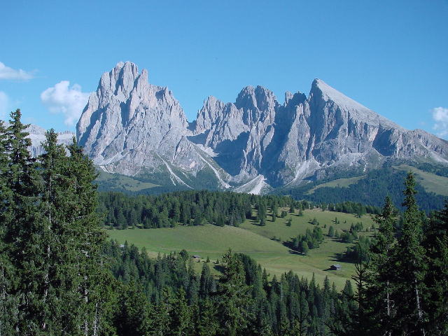
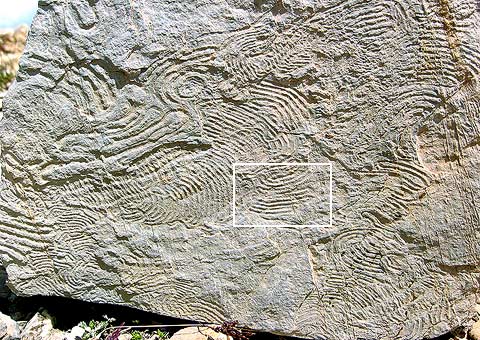
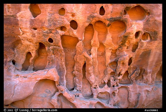
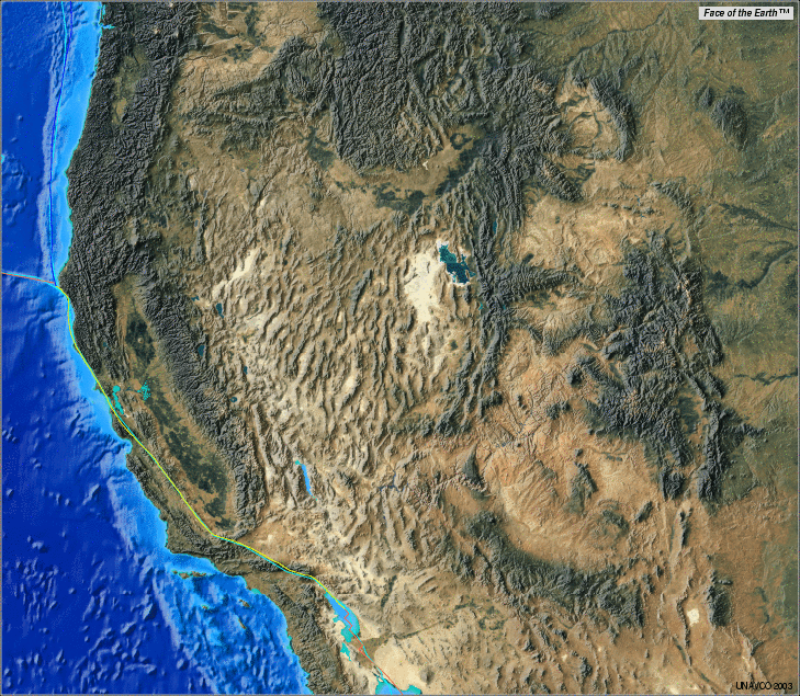
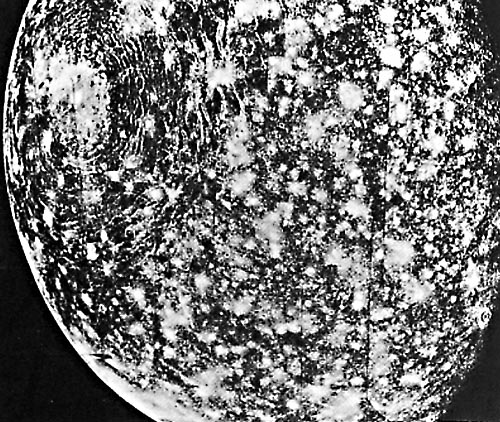
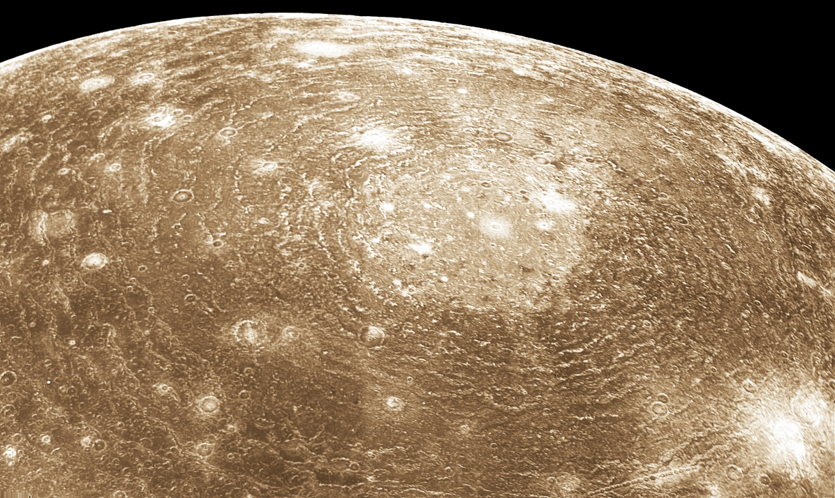
![Circle centered on Rocca di Cavour (inselberg and central uplift or ring central uplift with the coesite zone crescent ?) and going on Sillon Alpin (annular peripherical graben ?), the -2000 meters curve in Mediterranean Sea, Mt Rose et Cervin/Matterhorn ? are french and italian western Alps the result of the way back wave towards north-east after the transitory crater ? (Atlas mondial Larousse Bartholomew & Son Ltd 1988 page 12) [click on the map to see the circle details]](http://img397.imageshack.us/img397/5831/dscn0929.jpg)
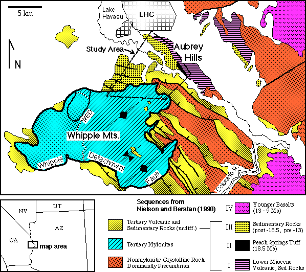
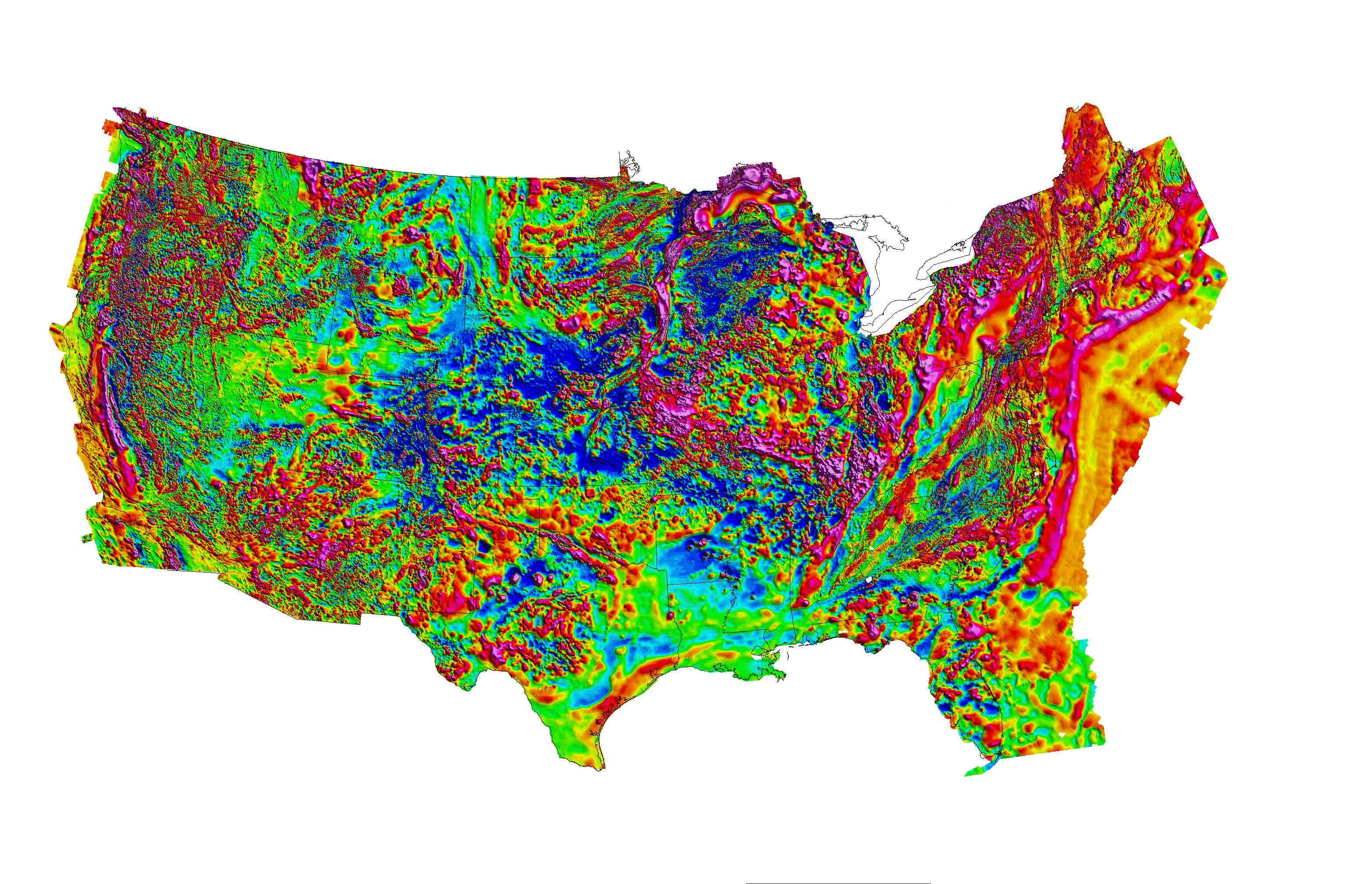
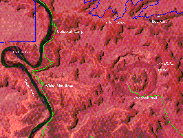
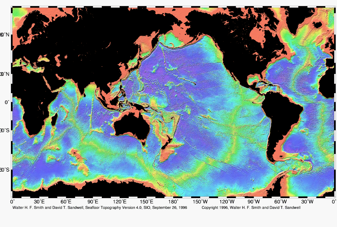