
< US 29 | Home | US 240/340 > | |||||||||||||
|
|
|
|
| ROUTE LOG |
US 250 EB, VA 33: 0 - 0 VA 399: 0.5 - 0.5 VA 399: 0.25 - 0.75 VA 161: 0.25 - 1 VA 197: 1 - 2 HR-RIC LINE: 0 - 2 US 250 WB: 0.5 - 2.5 I-64 (exit 185): 0.75 - 3.25 VA 356: 0.75 - 4 VA 157: 5.75 - 9.75 I-295 (exit 49): 0.25 - 10 HN-HR LINE: 0 - 10 VA 54: 12 - 22 LO-HN LINE: 6 - 28 US 522 SB: 12 - 40 US 522 NB: 1 - 41 VA 22 EB, VA 208 EB: 6 - 47 VA 208 WB: 1 - 48 VA 22 WB: 5 - 53 US 15 SB: 8 - 61 OR-LO LINE: 0.5 - 61.5 US 15 NB, VA 231 SB: 0.5 - 62 VA 231 NB: 0.25 - 62.25 VA 20 SB: 6 - 68.25 VA 20 NB: 0.25 - 68.5 GR-OR LINE: 5 - 73.5 US 29: 2 - 75.5 US 33 Bus: 5 - 80.5 US 33 Bus: 3 - 83.5 SKYLINE DR: 7 - 90.5 RO-GR LINE: 0 - 90.5 US 33 Bus, US 340: 6 - 96.5 US 33 Bus: 1.5 - 98 VA 276: 13 - 111 HAR-RO LINE: 1.5 - 112.5 VA 331: 2 - 114.5 I-81 (exit 247): 0.5 - 115 US 11: 1.5 - 116.5 VA 42: 0.25 - 116.75 RO-HAR LINE: 1.25 - 118 WV STATE LINE: 21 - 139
|
Creation: Appeared in Virginia in 1938. It entered from WV like it does now and proceeded to US 60 Richmond, the same as today except between Gordonsville and Cuckoo. This routing was all part of the original VA 4.
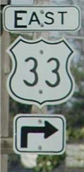
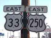
| Adjustments: Between 1942-44, US 33 was straightened out to its current alignment between Gordonsville and Louisa, replacing SR 649. US 33 originally went south with US 15 to Boswells Tavern, then due east to Louisa. Boswells Tavern to Trevillians became an extended VA 22. Between 1945-47, US 33 was straightened out to its current alignment between Louisa and Cuckoo, replacing VA 248 #2 and SR 642. US 33 originally went east from Louisa to Mineral, then south to Cuckoo. VA 22 was extended again to take US 33's place between Louisa and Mineral. Mineral to Cuckoo remained part of US 522. In 1982, US 33 east was truncated to 5 blocks west of US 1-301. From there, VA 33 branched off US 250 to go over the new ML King Bridge over I-64/95. Posting: Fully posted; cutouts in Gordonsville , Harrisonburg, and east towards Elkton. I saw that one US 33-250 cutout assembly still stands in March 2003, on EB Broad St. From I-95 North there are BGS's for US 33 going both directions on Broad St., which hasn't been accurate for 20 years. There was an error VA 33 sign at the US 33-250 WB split for many years, but I think this is gone, too. Comments: US 33 is a rustic route from Richmond to Elkton, with little traffic. Below Louisa it is also full of 40 mph curves. West of Harrisonburg is quite scenic and the serious mountain curves begin right at the WV border. US 33 is shown as VA 33 on the 1944 Official Map Richmond inset. Dave also reports seeing a 1939 map with US 33 shown all the way to Reedville, but no other maps he or I have seen corroborate this. However, the reverse-side historical peninsula maps of the 1951 and 1952 Official Maps do show VA 33 as US 33 in the Saluda area. Like US 360, US 33 should have been extended to the Bay. |
|||
Previous: US 29 |
Next: US 240/340
Top | Virginia Hwy Index
Home
