
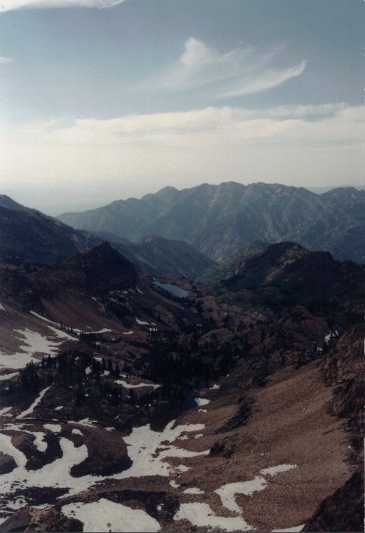
-The view from Monte Cristo Peak to the NW with Lake Blanche below--
Trail Facts
This trail begins at the Alta Guard Station, just across the canyon from Collins Gulch of the Alta Ski Area. The trailhead can recognized as a narrow paved road turning to the north around the guard station. You must park on the main road, however, because no parking is permitted behind the station.The trail follows the paved road around the guard station for a short distance where it then turns into a dirt road. The dirt road continues around a switchback and passes a snow stability/avalanche test site. At this point the trail cuts off to the left (north). *Don't let the snow test site grab too much of your attention or you may miss the cut-off and end up heading toward Grizzly Gulch -- the same mistake I made my first time on this trail.* After the cut-off, the trail makes a few long switchbacks and begins to head more toward the west, following a power line that runs from near the trailhead up to Cardiff Pass. After about .7 mile, climbing nearly 600 feet in elevation, and switching back to the north, the trail comes to a junction. One trail heads north directly towards Flagstaff Mountain, but the trail to Cardiff Pass continues a steady climb to the west/northwest (following the direction of the power line). The trail continues in this direction for about .2 miles, climbing 400 feet, where it then switches back to the north for about another .1 mile, levels out, and curves to the west/northwest. In about another .3 mile and climbing 300 feet, the trail reaches Cardiff Pass.
Superior & Monte Cristo Peaks
The route to Superior Peak & Monte Cristo Peak continues along the Cottonwood ridge to the west. The trail climbs over a rocky slope and passes below a small summit on the north slope. It then continues on a relatively level path along the ridge for about .4 mile with amazing views of upper Cardiff Fork to the north and Snowbird to the south. After this the trail becomes much more tricky and steep and the use of hands becomes required at many points. It is in the last .5 mile that the trail climbs nearly 1,000 feet in elevation. The trail begins this climb just below the ridge on the south side.
A well-beaten path is distinguishable along the rocky ridge that winds its way up to the summit of Superior Peak. Pay close attention to this path because it will cross back and forth between the north and south sides of the ridge several times before reaching the summit. Also be aware that there several well-defined paths that fork off the main path. These paths, however, quickly disappear as they are dead ends and other impassible/difficult areas. If you should find yourself on one of these dead-end paths as I have, it is best to backtrack, search for the true path, and continue up the ridge from there.
The summit of Superior Peak has a great view of Little Cottonwood Canyon, Cardiff Fork of Big Cottonwood Canyon, and portions of the Salt Lake Valley. It stands about 2.4 miles from the trailhead and 11,052' in elevation.
Monte Cristo Peak is about .25 mile west of Superior Peak. The trail from Superior Peak is a fairly easy walk along the rigde climbing only about 90 feet to a minor summit where it curves to the south and climbs the higher summit which is Monte Cristo Peak. Monte Cristo Peak stands at 11,132' in elevation and has a great view looking over Lake Blanche as well as little Cottonwood Canyon and the Salt Lake Valley.
*This is a great trail to see wildlife and wildflowers. In mid to late summer, wildflowers can be found in abundance along the lower half of the trail, as seen in the picture below. Almost every time I have hiked this trail I have seen significant wildlife, especially mountain goats. Large herds of mountain goats frequently roam the ridges around Superior & Monte Cristo peak. Other wildlife I have seen on this trail includes deer and a coyote.
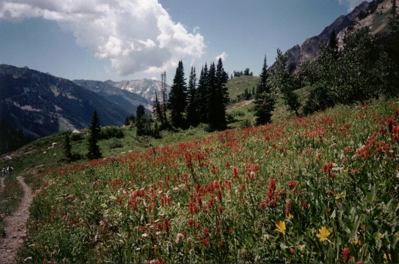 Wildflowers on the lower part of the Cardiff Pass trail looking west. |
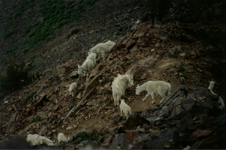 Mt. goats about 30 feet below the summit of Superior Peak. |
