It's nice to be able to get up from a
real bed to start. Typically I end up starting these trips
on a couple of hours of sleep in the car or, last year,
the airport. I say goodbye to Scott and leave about 6:15.
I want to be on the road early enough to get out of the
city before rush hour. I take NY31 east, which continues
to follow the Erie Canal. Despite some construction,
generally 31 is smooth and has a wide shoulder. Traffic
varies from bumper-to-bumper to light. I notice that many
of the schools are still in session.
At Clyde 31 heads southeast and at this point I'm ready for back roads, anyway, so I take county roads through South Butler and Spring Lake. However, they are poorly marked, so eventually I get lost and just try to head east and northeast, but this isn't so easy with the hills and winding roads. They are MUCH hillier than 31, but quite enjoyable - pleasant scenery and minimal traffic. I finally get on NY34 north, and then take a shortcut to Meridian, which actually works out. I probably only lose two or three miles overall. In Baldwinsville, where I rejoin 31, I have lunch.
My goal is to make Smuggler's Notch in Vermont on the third day, and to do it in time to hike Mt. Mansfield. To accomplish this I need about 150 miles today, and I hope for a tailwind, this being my only likely day of the trip to have a tailwind. But instead I get a weak crosswind. Oh, well.
which is about six miles wide and twenty miles long. Incredibly, in the several miles I am riding next to it, I have virtually no view of it! It's even worse than with Michigan lakes. What a waste.
The weather today is clear and warm. Annoyingly, I forgot my little bottle of sunscreen, and I am less than thrilled about stopping somewhere to pay $10 for a bottle that's far bigger than I want. So I don't.
Today I have a fair amount of interest in my trip from the locals. I see lots of cyclists, including one other loaded bike. The drivers have been more tolerant than in Michigan. New York calls townships "towns", and signs each one as "Town of Xxxxx". Seeing these signs and then not rolling into a town keeps me confused, even after I figure out what's going on. Instead they refer to towns as villages, which sounds quainter, but isn't very accurate, as no differentiation is made between tiny towns of 100 and cities of a few thousand.
The bike seems pretty fast. I'm running slightly narrower and lighter tires than last year, hoping
they hold up. Time will tell. Last year's 28mm rear tire was actually nearly 30; this year's is only about 25.
I turn northeast on NY46, which follows a small canal - one of many I see that link to the main one, like roads do. This is a flat, pleasant ride. The town of Rome is congested, but not bad, and parts of it look interesting.
Along here are many places to eat, but I'm not hungry yet, so I plan on eating in the Westerns.
Delta Lake, home of the first state park along 46 northeast of Rome, is big and pretty for a dammed up river, but it isn't quite far enough. The Westerns (Westernville and North Western) end up being nothing, which will turn out to be a common problem this trip. So, it looks like I'll be eating out of my bags
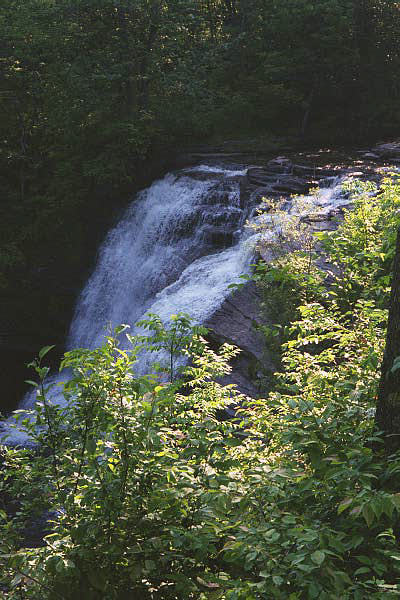
Pixley Falls |
Soon after, 46 starts up the Lansing Kill gorge. The sides become impressively large. Now I'm getting into the Adirondacks, and the road follows the creek upstream. This is a very nice way to gain altitude - gradual and scenic. Still, I'm getting very tired by now and starting to struggle. Even the slow climb is becoming difficult. Finally I reach Pixley Falls. It's $12.75, and has no showers! However, the setting is beautiful, with the sides of the gorge visible. I manage to get my clothes washed, and see the falls, which are fairly impressive but fenced off for 'safety'. I end up hopping the fence and sitting on the brink. The water is not cold, so it must be rain at this point instead of snow.
|
Both the campground and the road are pretty quiet. The women's bathroom has just been repainted (alkyd enamel), so everyone is using the men's, but there's not enough people here to cause a problem.
Songs of the Day: Small Town and Fly Robin Fly (the instrumental part)
Rochester, NY to Pixley Falls State Park
154 miles, 17.2 average
Day Two - June 21
The longest day of the year! Given the time of the year and my location in the northeast U.S., the sun comes up ridiculously early. My plan this year is to get up at first light, and go to bed when it gets dark. This allows me a few hours before tourist traffic gets bad, and since darkness is only about 7.5 hours long at the moment, should work out. I get up at five and leave at six. The bathroom has no light so I can't shave. Despite being in the 80's yesterday, it's only about 55 this morning, yet I have only a slight dew. I guess I did indeed gain some altitude yesterday.
Heading north on 46 I continue a slight steady climb. I'm surprised how many cars are on this rural road at 6 am. Boonville is pretty big and rather interesting, but I don't want to stop yet. I take Hawkinsville road east, which is very nice, and has little traffic. It's rolling hills, with more climbing than descending, but the longest climb is only about one mile. At the bottom of one hill is Hawkinsville, on the Black River. I notice, too late, that the bridge has a grated surface. I hit the brake, but not soon enough, so I'm going too fast, and just try not to move while crossing. It's fairly long, and toward the end the bike is just starting to shimmy. A fall on a grated bridge can be disastrous.
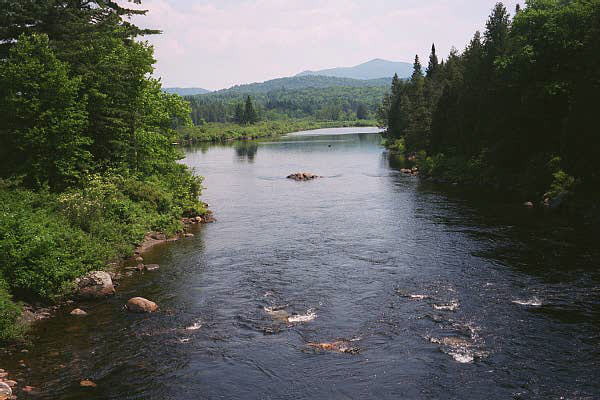
Moose River |
I reach NY28 at Woodgate and continue northeast. 28 is a major route into the Adirondacks, but I don't have much traffic at this hour. The road rolls through small mountains, but I have no great views yet.
|
The wide clear cut makes the road uninteresting. Although I'm following the Moose River, I rarely see it. It seems to take too long to reach Old Forge, where I get breakfast. My butt's already sore - the idea of another long day, mandated by My Plan, is not appealing.
Old Forge has lots of tourist stuff and people, but no real lake (28 follows the Fulton Chain O' Lakes). I also get no view of the 3rd and 4th lake from 28. After Eagle Bay I take a back road to save a couple miles and hopefully improve the scenery. In fact it IS very pretty, but after two miles it turns to dirt! My map does not indicate this. It looks like probably about seven miles of dirt. I reluctantly decide to try it, but it's so sandy I can hardly keep the bike up, so I turn back, losing four miles. Another oh, well.
I have some views of the 7th and 8th lakes, which is a nice improvement. At this point I should be dealing with more tourist traffic, but it never happens. I suppose the real season hasn't started yet, especially since some of the kids are still in school.
|
Seventh Lake |
Road quality ranges from mediocre to excellent, but it's usually very good. And, New York drivers continue to be surprisingly courteous.
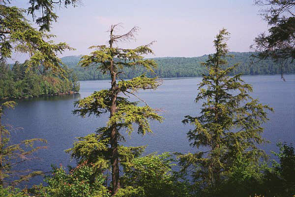
I decide to visit Raquette (pronounced "racket", apparently) Lake, only 4/10 mile off 28. The town looks untouched by either the 90's or the 80's. The lake, the largest natural one in the 'dacks, is quite pretty. Most of the lakes were formed over one hundred years ago with dams built for logging purposes.
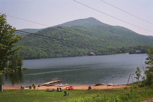
Blue Mountain Lake |
Blue Mountain Lake is the most dramatic so far, with 3800' Blue Mt. behind it. I'm really in the heart of the 'dacks now. A steep 600' vertical climb out of town on the side of Blue Mt. puts me close to 3000', I think. The rest of the ride to Long Lake (about 14 miles long!) is rolling.
|
I stop here for drinks, but the usual 20 oz. prices are ridiculous (plus 7% tax on food), so I get � gallon of lemonade for $1.35.
I take 28N east. It's quite hilly, but nice pavement. The chief problem on this stretch is a complete lack of views, which is a disappointment, but the lack of traffic is certainly nice. East of Newcomb I cross the infant Hudson River. Then I turn left on county roads 25 and 2. Almost immediately the pavement is gone. New York tears up pavement a lot, and the result is so rough it's almost not rideable at all. It's also partially covered in tar. I stop and check my maps. The alternative of taking 28N down to Olmstedville is at least thirty miles longer, and there's no guarantee that road won't be torn up, too. So I continue, hoping this is very short term. After a mile or so, I stop an SUV. The driver is a cyclist, but doesn't know how long it lasts.
He offers me a ride, but I don't think he's serious, as his vehicle is already full. I continue. After another mile, where 25 heads north to Henderson Lake (the source of the Hudson), the pavement resumes. I'm thrilled, but wary of it ending again. I clean the rocks and tar off my tires - fortunately they look OK.
|
Hudson River |
 |
County 2, the Blue Ridge road, is hilly and scenic, but I'm sad to never get a view toward the high peaks of the 'dacks - Mt. Marcy is only ten miles to the north. Pavement is mostly excellent, with some in fair shape. I climb quite a bit, and then have a long downhill to the I-87 corridor. I didn't use my 'granny' gears yesterday, but lots of times today.
|
I take US 9 (in terrible condition) a few miles north to county 4. Guess what? Torn up. Again I have no real alternative, and this is less rough and less tarry than 2 was, so I take it. It lasts SEVEN MILES. It's quite hilly. The flies in the Adirondacks are terrible - black flies and deer flies, and they both bite. Once they find you they don't leave, and the deerflies fly up to 25mph to stay with me. When I reach the next climb, they attack. They're tenacious and their bites draw blood. Meanwhile, my bottom bracket is making so much noise I'm going to have to find a Klein dealer tomorrow to look at it.
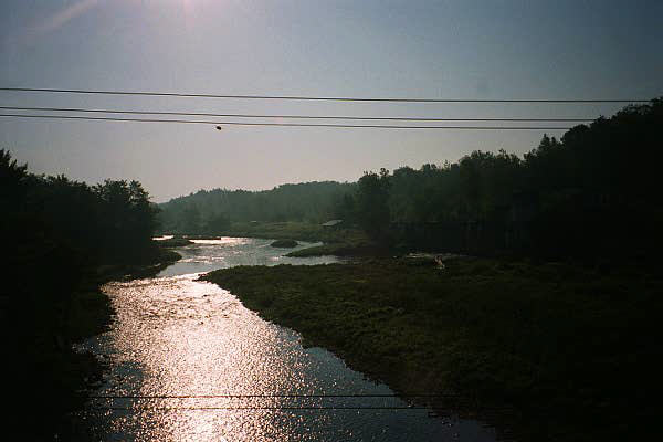
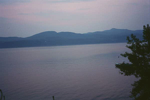
I'm miserable with twenty miles still to go. I find most of the mileage signs are reading low. Finally, when I'm thinking I'll never reach Moriah, the descent starts. I fly by Moriah, and then the last two miles to Port Henry are steeply down. The view of Lake Champlain is quite extraordinary. I find out the lake is at just 100' elevation, so that explains the long descent.
I think Port Henry is very cool, perched on the hill next to the lake. The number of remarkable, very old churches is amazing. On the New York side the mountains come very close to the lake, so I guess the best views are from the Vermont side. The Chimney Point bridge (the only other bridge across Lake Champlain is up by the Canadian border, about 70 miles away) is part of the view. I had hoped for more supper choices here, but instead get something from a Stewart's convenience store.
Although the bridge is close, the lake has a bay here, and it takes eight miles to go around it. The bridge is marked 'toll' on my map, but I see no sign of any previous toll booths. It didn't quite seem tall enough - maybe 125 feet above the water. Not Great Lakes class, but apparently it's never been a problem.
My last view of the Dacks |
I head north two miles to the DAR park. The lady who signs me in is very nice, but looks like she could have been one of the original DAR's. The park has no phone, but she tells me the store � mile down the road has one. If she estimates distances like Kentuckians, it could be three miles! But it actually comes in at eight tenths. I set up camp and shower - it's five minutes for a quarter.
|
I'm so tired I can barely hold a conversation with a guy who tells me his grandchildren take long bike trips, but then I decide to walk over to the lake for a sunset shot, and wake up enough to talk for quite awhile with a man kayaking the length of Lake Champlain with his wife. I bring up the incident a few years ago when Vermont wanted to make Champlain a Great Lake, and he sighs and says "it seems everyone but me thought that was a joke." He loves the lake, but when I point out the lights of Port Henry across the lake, he describes it as "the saddest town I've ever seen". To each his own, apparently.
My maximum speed today is 42.5. Hopefully I can beat that tomorrow.
Pixley Falls to DAR State Park, Vermont
157 miles, 16.3 average
Day Three - June 22
I wake up to rain. I'm figuring on heading to the bike shop in Middlebury, which probably doesn't open for awhile, so a late start is OK. Rain always makes it hard to leave. As I'm packing up, it dawns on me I never got a trash bag to keep my sleeping bag dry, but the lady in the office gives me two just barely big enough. Wet sleeping bag? Ick! I don't leave until 8:30, in fact.
|

Calvin's Rain Dance |
The road (VT125) is still wet, and soon the sprinkles start again. It's flat farmland at first, then rolling farmland, then ridges. I climb "the ledges", the first steep hill in Vermont. On the last ridge before Middlebury, I see many huge new buildings that might be hotels. They appear as if they were meant to look old, but didn't quite make it. I find out later they are all part of Middlebury College, which is very expensive, and "always under construction".
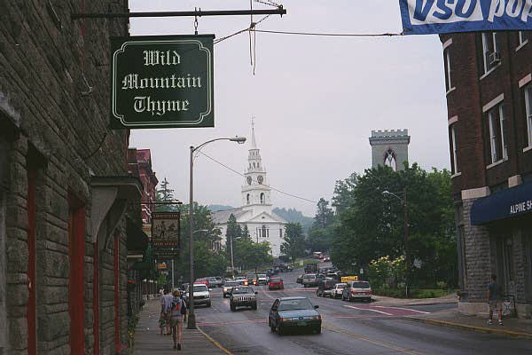
Middlebury When Wet
|
Middlebury is a touristy village, and the headquarters for many of the Vermont bike touring companies. The town is between ridges, so it's very hilly. I find the bike shop, right by Otter Creek Falls. They don't have Klein stuff (Klein bottom brackets last a long time, but unique tools and bearings are required to service them.
|
The employee, Chas, is incredibly nice and calls all over Vermont for me. Only one shop has the stuff - in Stowe, where I was heading today anyway! He shows me the vintage track bike he just bought for $50 - its one gear is a 50 x 12 - insanely high!
Although Middlebury is plainly upscale, I find a simple diner to have breakfast - blueberry pancakes with real maple syrup. It's tasty, but not terribly cheap. As I eat, it's pouring outside, so I wait awhile, but it only slows down. As I put on my helmet, water streams down my face. This will be fun.
I take busy US7 north to River Road, along the New Haven River, and the latter is very nice. Unfortunately most of the views are wrecked by the two to three mile visibility. I only get glimpses of the nearest mountains - the first major ridge of the Green Mountains. I have more construction at Bristol - again they have torn up the pavement before doing anything. Vermont roads aren't signed too well, but I never take a wrong turn. There simply aren't that many paved roads.
The rain continues pouring as I wind northeast on VT17, but once I'm soaked it hardly matters. Still, as the climbs steepen and the rain remains relentless, I can't help but laugh, in the same way I laughed at the horrific headwind in the San Joaquin valley last year. When 17 separates from 116, heading for Appalachian Gap, it follows a stream. Lots of water and rapids are fun to listen to and make the climb easier, even though more rapids mean a steeper grade.
Near Jerusalem I stop for a drink. With the rain I'm not thirsty, but I need to do something. In situations like this I tend to be overly friendly, which I suppose goes along with the laughing business, as a way of coping. "Good morning!" I bellow (actually it's after noon - weird to be so late without many miles in). The proprietor is stony-faced and silent. "I'm almost to the top, right?"
"Six miles by car."
"Then six by bike, too, right?"
"No, about fifty". He still has no hint of a smile. I let it go.
"I'm already over a thousand feet, right?"
"About 1200." Cool! The pass is only 2356. Another 1200 feet in six miles? Easy!
I climb about 200 more vertical feet, but then I have a long descent back down to about 1000. Egad! How will I get back up that high so quickly? Stupid question. I had been warned about this pass. The last two miles are twelve percent grade. Very tough. The top is another in a series of letdowns. No view at all, and very foggy. A few cars are here, and one has a driver present. "Surprised to see YOU here!" he says. I complain about the grade and lack of view, just like I figure I'm supposed to. "But it's still cool," he counters, and he's right. Just being here, and experiencing the climb in less-than-ideal conditions, makes it worth it.
Even in the rain I can smell the pads overheating. I'm not getting much effect from the rear brake, so I try squeezing a little harder. Immediately the rear wheel locks up and starts sliding to my right. Fortunately reflex takes over and gets my fingers off the lever pronto, or I'd be hitting the pavement at around 37mph. If I could have done this descent on dry roads without braking I would have broken fifty.
Eventually the fog clears and the road follows a river to Irasville - this is a great way to descend, as it greatly lengthens the downhill. Instead of coasting and wasting my hard-won altitude on braking, I can pedal hard and stay close to 30 for several miles. I turn north on Vermont's legendary tourist highway, VT100. This road runs the entire length of the state, 220 road miles, and is promoted by Vermont as scenic and quaint. No fast food is allowed the whole length. I want to get a good sampling of it while I'm here. The trouble is, it's also a throughway, so is quite heavily used by the locals. I have terrible traffic all the way to Waterbury, including tourist buses and motorcycles. Only later do I find out a Ben & Jerry's festival in Warren has just let out.
Waterbury does not excite me, and I'm feeling the need to get to Stowe ASAP, so I continue north of I-89. I pass signs for the Von Trapp Family Lodge. 100 is indeed pretty, with mountains on both sides, and traffic now is much more reasonable. I reach Stowe and turn northwest on VT108. I ride 2.5 miles without seeing the bike shop I'm looking for. I head back toward town 1.5 miles and finally see it - an obvious sign - even when I'm trying to be observant I'm not. I also do not find a laundry.
The mechanic, Ron, has the parts to rebuild my bottom bracket, but he doesn't have time to look at it. When he learns I'm touring, he wants to see it, but tells me the Locktite needs 24 hours to dry without using the bike, and I'm not thrilled about that. So I wheel the muddy, dripping bike in - he doesn't seem to care at all about the mess. He pulls the crank and we agree the bearings still feel good, which means I can wait until I get home to replace them.
The bike and panniers, very clean just a few days ago, are now filthy from riding in the rain. Ron cleans the chain and other parts, I pay him $5, and head out. I get some pizza, dry out my maps (even my sheet protectors leaked) and the insides of my panniers, and then head up toward Smuggler's Notch. It's no longer raining, so it's not hard to resist the motels along the way as I slowly climb. I reach the state campground and am told by a young Brit that it's full - no surprise for a small campground on a Saturday, even a rainy one. But I've heard this before and know not to give up so easily - "surely you have somewhere you can put me."
"I really don't have anything right now." But I persist, and when he tells me he's OK with me sharing a sight with someone else, I know I'm in. I ask him about the trails to the Chin (the highest point of Mt. Mansfield) and he shows me a map, and explains "these are hawking trails".
"What? You have hawks around here?"
"They're for hawking only. You can't take your bike on them." Oh, hiking - now I get it.
I find a site without a problem, and later he wanders by, attempting to explain why I can't use the "leaching field" to camp on: "We can't put pigs in the field."
"Why not? Do pigs damage the field?"
"No, pigs. Tent pigs." OK, pegs, right! To his credit, he never asks me to pay for the site, and I never offer. I know I'll be camping more in Vermont, and paying full price, as I had last night. I get a shower and dry off what I can with napkins from the pizza place. Everything is damp and dirty. My computer died in the rain today, so mileage is estimated.