< 30 to 39 | Home | 50 to 59 > | |||||||||||||||||||||||||||||||||||||||||||||||||||||||||||||||||||||||||||||||||||||||||||||||||||||||||||||||||||||||||||||||||||||||||||||||||||||||||||||||||||
| SC 40 not currently assigned | ||||||||||||||||
| Previous SC 40's: |
SC 40: An original SC route. Began in Mt. Pleasant, then headed northeast to McClellanville, Georgetown, Conway, and Green Sea before heading into North Carolina at Tabor City.
By 1926, a ferry was put in place connecting Mt. Pleasant to Charleston, down near the Customs House. It is unclear if SC 40 was on the Charleston Peninsula at this time, as SC 2 and SC 6, the only primary routes in Charleston, did not go near the Customs House. In 1929, SC 40 was placed on a new bridge connecting Mt. Pleasant to Charleston. SC 40 ended at SC 2 King St (current US 78). In 1932, US 701 was assigned to the entirety of SC 40. In 1933, SC 40 met its end when it was removed from US 701. Today the route follows: Lee St in Downtown Charleston; the 1929 bridge was closed in 2005 to be torn down; SC 703 into Mt.Pleasant, I-526 Bus (although there is an "Old Georgetown Rd" that was surely SC 40); US 17 to Georgetown minus a couple minor reroutings; US 701 to Conway; SC 905 in Conway; a piece of US 501 Bus; US 701 to Bayboro, all of SC 410. SC 50 was replaced by US 1 in 1927. Today it is still US 1 except Cheraw to Kollock is no longer part of the primary highway system. SC 50 was the highest number in the original system. |
|||||||||||||||
|
|
|
| ROUTE LOG |
US 17: 0 - 0 Berkeley-Charleston Line: 4.7 - 4.7 SC 402: 14.5 - 19.2 US 17 ALT SB, SC 45: 15.3 - 34.5 Georgetown-Berkeley Line: 1.7 - 36.2 US 17 ALT NB: 4.2 - 40.4 SC 41 Bus: 6.7 - 47.1 US 521: 2.8 - 49.9 SC 41 Bus: 1.5 - 51.4 Williamsburg-Georgetown Line: 0.1 - 51.5 Georgetown-Williamsburg Line: 0.9 - 52.4 SC 527: 0.8 - 53.2 Williamsburg-Georgetown Line: 6.3 - 59.5 SC 51 SB: 3 - 62.5 Georgetown-Williamsburg Line: 0 - 62.5 SC 513: 2.3 - 64.8 Williamsburg-Georgetown Line: 0 - 64.8 SC 512: 1.2 - 66 SC 261: 7.5 - 73.5 Florence-Williamsburg Line: 2.2 - 75.7 SC 341: 2.4 - 78.1 US 378 WB, SC 51 NB: 4.2 - 82.3 Marion-Florence Line: 1.8 - 84.1 US 378 EB: 1.9 - 86 SC 908: 5 - 91 SC 41 ALT: 3.5 - 94.5 US 501: 4.9 - 99.4 US 76, SC 917 EB: 9.7 - 109.1 SC 917 WB: 3.9 - 113 Dillon-Marion Line: 0.7 - 113.7 SC 41 ALT, SC 57: 1.6 - 115.3 SC 9: 7.2 - 122.5 NC STATE LINE: 2.1 - 124.6
|
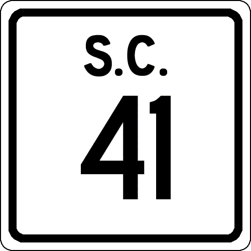
Creation: Appeared in 1937 as a renumbering of SC 94 to match NC 41. Originally ran only from the NC Line down to SC 9 Lake View (probably at 3rd and Main, where SC 9 changes streets). This is the 3rd SC 41.
| Adjustments: In 1939, a discontinous piece of SC 41 appeared from the Dillon-Marion line north 5 miles. In 1940, SC 41 was made continuous in Dillon County and extended southwest to US 76 Marion (East St. at Liberty St.) In 1949, SC 41's south end was moved to US 501 (now US 501 Bus), leaving behind East St. In 1951 or 1952, SC 41 was rerouted at Fork to replace SC 57 to Centenary, replace SC 175 to Hemingway, and replace SC 511 from Hemingway to US 17-701. The old route from Fork to Marion became part of SC 41 ALT. Between 1960-63, SC 41 was placed on a bypass around the west of Andrews, replacing S-45-21. The old route through town became SC 41 Business. In 1970, SC 41 replaced SC 41 Business and again went through Andrews. SC 41 was again placed on the bypass west of Andrews between 1994-96, again replacing S-45-21 and again leaving SC 41 Business behind through Andrews. Improvements: SC 41 was paved from Lake View to NC upon designation in 1937. SC 41 was paved on all segments in 1947 or 1948. SC 41 was multilaned from Hemingway to Johnsonville by 1974. No other multilane segments shown on official maps. Comment: SC 41 provides a pretty direct alternative from I-95 Lumberton, NC to Charleston, SC, but passes through many miles of emptiness and no services. SC 41 passes through the heart of the Francis Marion National Forest. SC 41 southbound technically never does enter Georgetown County, as the county line is in the center of the road. | Previous SC 41's: |
SC 41 #1: An original state route. Ran from SC 50 (current US 1) Cheraw south through Darlington, Florence, Lake City, Kingstree, and Moncks Corner. It is unclear whether SC 41 ended at SC 31 (current US 176) Goose Creek or at SC 2 (current US 78) in the upper reaches of Charleston County.
In 1925 or 1926, SC 41 was rerouted at Kingstree to curl in a western arch to reach St. Stephen. Initially SC 41 went straight south from Kingstree through Lane to St. Stephen. This route became SC 412 and part of a rerouted SC 44 in Williamsburg County (all of SC 377 today). The route across the Santee River to St. Stephen does not exist today. In 1927, US 17 was assigned to SC 41 from Goose Creek to Florence, and US 601 was assigned from Florence to Cheraw. Thus, SC 41 was eliminated in 1928. Today to follow SC 41's last route: US 52 to Strawberry; S-8-791 to Moncks Corner; US 52 to Kingstree; SC 261 through Kingstree; S-45-186 north to US 52; US 52 to Church St in Lake City; a little US 378 Business; S-21-10; US 52 to Florence; Coit Ave (instead of Irby St. above Palmetto); US 52 and US 52 Bus through Darlington and to Cheraw. SC 41 #2: Appeared in 1937 as new primary routing. Ran as a short spur from US 301 to New Zion. In 1938, SC 41 was renumbered as SC 94. Today it is S-14-37. See scan at right. | 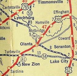 |
||||||
|
|
|
| ROUTE LOG |
SC 41: 0 - 0 US 521: 3.4 - 3.4 SC 41: 1.5 - 4.9
|
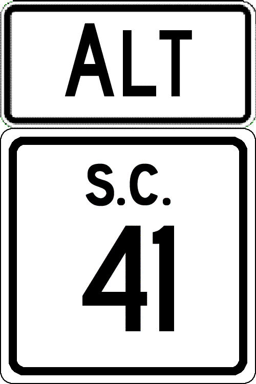
Creation: Resurrected as a business designation between 1993-96, running the way it does today. This was of course mainline SC 41 prior. | Adjustments: SC 41 Business was initially designated between 1960-63 when SC 41 was first put on a western bypass of Andrews. SC 41 was returned to the through-Andrews routing in 1970. Improvements: Fully paved upon designation; no mulitlane segments. Comment: SC 41 Business uses Morgan Ave through town and was originally SC 511. |
||||||||
|
|
|
| ROUTE LOG |
SC 41: 0 - 0 US 501, Begin US 501 Bus: 9 - 9 SC 576: 0.3 - 9.3 US 76: 2 - 11.3 US 501 Bus NB: 0.9 - 12.2 US 501: 3.2 - 15.4 SC 917: 6.6 - 22 Dillon-Marion Line: 0.5 - 22.5 SC 41, SC 57: 1.8 - 24.3
|
Creation: Created in 1951 or 1952, running the way it does today. North of Marion was a renumbering of part of SC 41. South of Marion was a renumbering of part of SC 175.
| Adjustments: None Improvements: Fully paved upon designation; no mulitlane segments. Comment: SC 41 ALT is 3 miles longer than SC 41, but coupled with the US 501 Marion bypass, SC 41 ALT could be the faster option. |
||||||||
| SC 42 not currently assigned | |||||||||||||||
| Previous SC 42's: |
SC 42 #1: Appeared by 1922, running from SC 3 (current US 76 Business) Sumter north to SC 34 Bishopville.
In 1925 or 1926, SC 42 was renumbered as part of SC 30. Today it is S-42-5 in Sumter and US 15 from there to Bishopville. SC 42 #2: Appeared as new primary routing in 1937 or 1938. Ran from SC 4-33 (current US 301-601) Orangeburg to the town of Cordova. In 1939, SC 42 was extended from Cordova west to SC 33 (current US 301-601). The 6 miles of SC 42 were downgraded to S-38-33 and S-38-90 in 1948. |
||||||||||||||
| SC 43 not currently assigned | |||||||||||||||
| Previous SC 43's: |
SC 43: Appeared by 1922, running from SC 20 (current SC 28) McCormick east to SC 21 (current US 25) Pleasant Lane.
About 1930, SC 43 was extended east as new routing to SC 19-24-392 (current US 178-378, SC 121) Saluda. It appears that in 1933, SC 43 was extended west as new routing to the Georgia State Line (continued as GA 70). In 1937 or 1938, SC 43 was extended east as new routing to US 1 Lexington. In 1939, SC 43 was extended east through Lexington to end at US 1 West Columbia. This brought SC 43 to its longest path of 82 miles. In 1951 or 1952, SC 43 was renumbered as part of US 378. |
||||||||||||||
| SC 44 not currently assigned | |||||||||||||||
| Previous SC 44's: |
SC 44 #1: An original state route. In 1922, SC 44 ran from SC 41 (current SC 377) Lane east to SC 40 (current US 17) Georgetown.
In 1925 or 1926, SC 44 was rerouted west of Andrews to today's US 521-SC 377 jct (new routing), then south to Gourdin (replaced part of SC 41), and west to SC 41-261 (current US 52-SC 375 jct). The old route from Lane to Andrews became secondary, though eventually was SC 515. Today it is S-45-16. In 1928, SC 44 was renumbered as SC 26 from Georgetown to today's US 521-SC 377 jct and SC 261 from there to Gourdin and SC 41. Today this is US 521, SC 377, and SC 375. SC 44 #2: Appeared by 1930 as new primary routing. Ran from SC 30 (current US 15) Mannville west to the Sumter County Line. In 1940, SC 44 was extended west to US 521 Rembert, for a total length of 16 miles. In 1948, SC 44 was downgraded to S-43-20 and S-31-7, except for its easternmost mile which became part of SC 441. |
||||||||||||||
|
|
|
| ROUTE LOG |
US 15, US 176: 0 - 0 SC 310: 3.6 - 3.6 SC 453: 4.3 - 7.9 SC 6 WB: 0.8 - 8.7 Berkeley-Orangeburg Line: 6.2 - 14.9 SC 6 EB: 4.7 - 19.6 US 52: 18.7 - 38.3 US 17 ALT SB: 14.8 - 53.1 US 17 ALT NB, SC 41: 3.8 - 56.9 Charleston-Berkeley Line: 13.5 - 70.4 US 17: 6.5 - 76.9
|
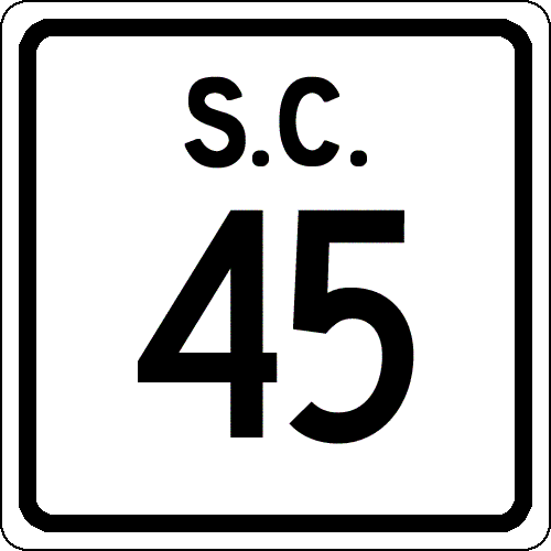
Creation: An original state route. In 1922 SC 45 ran from SC 31 (current US 601-SC 2 jct) St. Matthews to SC 41 (current S-8-27?) St. Stephen.
| Adjustments: In 1925 or 1926, SC 45 east was truncated 4 miles to the new SC 41 (current US 52) location west of St. Stephen (current US 52 and S-8-6 jct). By 1931, SC 45 was extended west through Swansea, ending at SC 24 (current US 178) Pelion. This was all new routing except just west of St. Matthews out to SC 2 (current US 176) was a replacement of part of SC 31. In 1937 or 1938, SC 45 was extended along US 52 east to St. Stephen, then east as new primary routing to SC 179 (current US 17 ALT) near Jamestown. This brought SC 45 to a length of 105 miles. In 1939, SC 45 west was rerouted at Eutawville to head west to US 15-SC 31 (current US 15-176) Wells (new primary routing). Eutawville west to Swansea became part of SC 6; Swansea to Pelion became SC 69 (current S-32-9 and S-32-246). SC 45 was only 49 miles long in this routing. In 1942, Lakes Marion and Moultrie appeared, causing SC 45 to have to be altered. SC 45 was extended east along SC 6 from Eutaw Springs to Cross, then split north around Lake Moultrie to meet back up with the original SC 45 east of Eadytown. The old route became secondary (or underwater): S-38-137 and S-8-31 survive today. In 1948, SC 45 east was truncated to US 52 west of St. Stephen. St. Stephen to Jamestown became secondary. In 1949, SC 45 was re-extended east to SC 179 (current US 17 ALT) near Jamestown. In 1950, SC 45 was rerouted in the Cross area to meet SC 6 2 miles further west instead of right along Lake Moultrie's shoreline as a new bridge over the Diversion Canal was opened. The old route became S-8-132. In 1951 or 1952, SC 45 was taken off its 4-mile US 52 multiplex and given its own routing from Pineville into St. Stephen. This left behind S-8-6. Also, SC 45 was extended east through Jamestown as a multiplex with the new US 17 ALT, and as new primary routing (which was once SC 179) through Honey Hill to end at US 17-701 McClellanville. In the late 90's a one-block multiplex with US 52 in St. Stephen was eliminated. Improvements: The first piece of SC 45 to be paved was between SC 2 (current US 176) and St. Matthews, by 1931. SC 45 was paved between Elloree and Santee in 1937 or 1938; also the US 52 multiplex was paved. In 1939, SC 45 was only paved between Wells and Eutawville (other paved segments were no longer SC 45). In 1949, SC 45 was paved from Eutawville east to the Berkeley County Line and also from St. Stephen to Jamestown. In 1950, SC 45 was paved from the Orangeburg-Berkeley Line to the new Diversion Canal Bridge. The remainder of SC 45 was paved in 1951 or 1952. SC 45 has no multilane segments. Comment: SC 45 serves northern Berkeley County, hugging just south of the Santee River swamp. SC 45 also serves Francis Marion's Tomb (The Swamp Fox). |
||||||||
|
|
|
| ROUTE LOG |
US 321: 0 - 0 US 17: 0.4 - 0.4 SC 170 WB, SC 170 ALT: 5.2 - 5.6 Beaufort-Jasper Line: 0.6 - 6.2 SC 170 EB: 2 - 8.2 US 278: 9.2 - 17.4
|
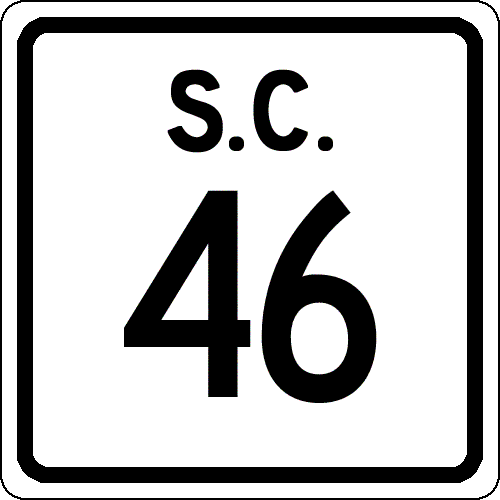
Creation: Appeared in 1939 as a renumbering of part of SC 33. Ran from SC 5 (current US 321) Hardeeville to Bluffton like today, but cut south to end at Brighton Beach. This is the 2nd SC 46.
| Adjustments: In 1956, SC 46 was rerouted at Bluffton to head north a couple miles (replacing part of SC 462), then east to a ferry to Hilton Head Island. SC 46 continued around Hilton Head Island to Forest Beach, bringing SC 46 to a max length of 34 miles. The old road from Bluffton to Brighton Beach became S-7-13. In 1957 or 1958, the ferry to Hilton Head was replaced with a bridge, leaving behind S-7-242. About 1967, SC 46 east was truncated to its current endpoint, replaced by US 278, which it remains today, save for S-7-80 in the Forest Beach area. Improvements: SC 46 was paved upon inception; no multilane segments exist. Comment: SC 46 serves as a back way to get to Hilton Head Island, although prior to the new US 278 routing east of Hardeeville was part of the primary way to reach the resort from the south. SC 46 is blown off by I-95, although a frontage road was built between US 17-321 and SC 46. | Previous SC 46's: |
SC 46 #1: An original state route. Ran from SC 41 (current US 52) Moncks Corner northwest to SC 45 (current S-38-137) Ferguson, a length of 27 miles.
In 1939, SC 46 was renumbered as part of SC 6. Today, much of old SC 46 is under Lake Moultrie. Surviving alignments include the easternmost 2 miles of SC 6; S-8-5 to Pinopolis; all of SC 6 west of S-8-132 (along west Lake Moultrie shore near Cross). |
||||||
|
|
|
| ROUTE LOG |
US 301: 0 - 0 SC 6, SC 267: 5.6 - 5.6
|
Creation: Appeared around 1930 as new routing. Ran as it does today, though its endpoints were SC 4 and SC 45.
| Adjustments: In 1940, SC 47 was extended noth to Lone Star (new routing), then west replacing SC 264 to end at SC 26 (current US 601) near Singleton. This gave SC 47 a length of 22 miles. In 1948, SC 47 was reduced to its current routing, leaving behind S-9-11. Eventually some of this became part of today's SC 267. Improvements: SC 47 was paved from SC 4 (current US 301) to Elloree in 1937 or 1938. The Lone Star to SC 26 (current US 601) piece was paved upon designation in 1940. SC 47 has no multilane segments. Comment: SC 47's south end continues as a dirt road connector to US 176, which I always though should be paved and upgraded. | Previous SC 47's: |
SC 47 #1: An original state route. Ran from SC 40 (current SC 410) Green Sea northwest through Nichols and Lake View before heading into North Carolina, a length of 23 miles.
In 1925 or 1926, SC 47 was renumbered: NC Line to Lake View became SC 94 (current SC 41 and Main St); Lake View to Green Sea became an expanded SC 9. |
||||||
|
|
|
| ROUTE LOG |
I-126 Bus, US 21, US 76, US 176, US 321: 0 - 0 SC 12: 0.5 - 0.5 US 1, US 378: 0.4 - 0.9 SC 16: 1.6 - 2.5 SC 768: 2.9 - 5.4 I-77 (exit 5): 0.1 - 5.5 SC 769: 15 - 20.5 US 601: 7.8 - 28.3
|
Creation: Appeared about 1930, running generally the way it does now. Initially SC 48 began in Columbia at Gervais St. (US 1-21, SC 2-215 then) leaving south on Assembly St.
| Adjustments: Between 1937-46, SC 48 was rerouted in Columbia to begin at Sumter St and Gervais St. SC 48 headed south on Sumter to Senate, then west to Main, south to Whaley, then west to Assembly before heading south out of town. It appears that in 1950 SC 48 was straightened out between Gadsden and Wateree, leaving behind S-40-56. In 1957 or 1958, SC 48 was moved in Columbia to be just Assembly St, ending at Blossom St (US 21-176-321 then). In 1978, SC 48 was extended north on Assembly to its current end at Elmwood, replacing part of US 21-176-321. Improvements: Paved only around Columbia up until 1948. In 1948 SC 48 was paved from Columbia to Gadsden. The remainder of SC 48 was paved in 1949. SC 48 was multilane from Columbia to Atlas Rd. by 1963. Comment: SC 48 serves southern Richland County, as well as the Congaree Swamp National Monument. SC 48 was probably rerouted near the monument, leaving behind substantial S-40-734, but I cannot determine with my sources when this might have occurred. I used to use SC 48 as a back door short cut from Berkeley County to Columbia (via US 176, US 15, SC 267, US 601), which when the speed limit on interstates was still 55 was a viable alternative. |
||||||||
|
|
|
| ROUTE LOG |
US 221: 0 - 0 I-385 (exit 5): 2.4 - 2.4 SC 308: 2.2 - 4.6 Spartanburg-Laurens Line: 3.7 - 8.3 I-26 (exit 44): 0.9 - 9.2 SC 92: 0.9 - 10.1 SC 56: 2.3 - 12.4 Union-Spartanburg Line: 1.2 - 13.6 US 176, SC 215: 14.5 - 28.1 SC 18: 0.9 - 29 SC 105: 8.3 - 37.3 SC 9 WB: 2.5 - 39.8 Chester-Union Line: 0.3 - 40.1 SC 9 EB: 0.3 - 40.4 York-Chester Line: 3 - 43.4 SC 322: 2.2 - 45.6 SC 97: 3.1 - 48.7 SC 211: 5.3 - 54 US 321: 5.5 - 59.5 US 321 Bus SB: 0.4 - 59.9 SC 5 Bus: 0.5 - 60.4 US 321 Bus NB: 0.4 - 60.8 SC 5, SC 161: 1.5 - 62.3 SC 55, SC 274 SB: 9.5 - 71.8 SC 274 NB, SC 557: 2.1 - 73.9 NC STATE LINE: 2.9 - 76.8
|
Creation: Appeared in 1937 as a renumbering of SC 163. Ran from US 321 York northeast to the North Carolina Line. This is the 2nd SC 49.
| Adjustments: In 1956, SC 49 was extended southwest to its current end, replacing: SC 91 from York to Monarch; SC 92 from Monarch to west of Cross Anchor; SC 30 from there to Watts Mill. In 1960 or 1961, SC 49 was rerouted at Lockhart. Up to this point, SC 49 followed SC 9 to today's SC 105, then dropped south to Mt. Tabor. From here forward, SC 49 followed mostly new construction southwest from Lockhart directly to Mt. Tabor. A small piece of this was once part of SC 91 (which mostly used S-44-10). The old route from SC 9 south to Mt. Tabor became an extended SC 105. Improvements: Fully paved upon designation. SC 49 was 4-laned from SC 274-557 to NC between 1998-2000. SC 49 was 4-laned from SC 274-557 to SC 55-274 in 2005. Comment: SC 49 provides a direct routing from York to Charlotte, NC. SC 49 is one of the longer state routes that I have driven very little. | Previous SC 49's: |
SC 49 #1: Created about 1927. Ran from SC 26-40 (current US 17-521 jct) across a ferry and up the Grand Strand, entering North Carolina above Little River.
SC 49 north was truncated to Myrtle Beach in 1932, replaced by US 117 (current US 17, a little SC 90, S-27-20, US 17 Bus). The rest of SC 49 was eliminated in 1935 when US 17 was routed along the coast. |
||||||
Previous: SC 30 - 39 |
Next: SC 50 - 59
Top | South Carolina Hwy Index
Home