

Our arrival in Wallis Island was a bit nerve wracking. We had left Asau Harbor on Savaii (Samoa) an hour after Opus 4. By nightfall, we had the Inter-Tropical Convergence Zone (ITCZ) descending on us, which meant rain squalls and fickle winds. One minute we were reefing down doing 10 knots, the next we had the motor on. Thankfully it was a short passage (only 220 miles). During one of these weather changes, we had a particularly heavy squall, with no wind, so we were motoring with the reefed main tied in. Because of the way it was tied, the rain water collected in the loop of sail from the reef. By the time we noticed, there was a ton of water there. Rob's first thought was lets have a bath, so we did. We climbed into the sail and had a lovely soak, until the wind came up and we started rolling. With the sail flapping, it was like being in a washing machine. End of bath! Now, how to get the water out? It was impossible to lift or move the sail. We had to let the whole main down on the deck to let the water run out. We were sailing again, and just the right speed for tuna - we caught two - a skipjack and a frigate.

Main Sail Bath
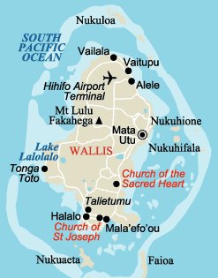
We arrived at the pass just on dark. Opus was behind us by then, and had sensibly decided to heave to for the night. We saw from our chart the pass in to Wallis was lit, and thought if it was clear we would enter and anchor just inside. As we were approaching, we heard our friends Dragonfly on the VHF. They were anchored at the spot were we were heading. They confirmed our calculations as to tide and waypoints, and said they would stand by. We approached what should have been the lead lights, but there was only one. Also the pass had one mark unlit. The wind was getting up, and there was absolutely no moon, so it was as dark as the inside of a cow. We decided to heave to outside the pass. Then Dragonfly got the idea to go in their dinghy to where the second lead light should have been. Using them as a lighthouse, we thought we would try it.
We had our radar, providing us with our distance off the various marks and islands. This was the first time I had tried using our electronic chart program to navigate under way. The GPS is connected to it, showing the boat's position on a chart on the computer. If the chart is correct, it is a very accurate way to navigate. The problem is the chart is rarely correct, especially when the pass is only 100 meters wide and can have up to 6 knots of current in it. We managed to get through, pick up our lighthouse friends and anchor without a hitch, but not without a lot of nail biting and a good measure of yelling as the boat's position veered on to the reef on our computer in a couple of places. It was a relief to be inside for the night, safely tucked up and getting a good night's sleep. Opus came in at first light, only marginally seasick from a rolly night.
|
Notes: I.T.C.Z - (Inter Tropical Convergence Zone) This is a zone of converge between the trade wind regimes of both the northern and Southern Hemisphere. This zone closely parallels the axis of the equatorial trough. It is characterised by as a narrow east-west band of vigorous convective clouds with heavy precipitation. The Inter-tropical Convergence Zone migrates from North and South with the sun, being in the northern hemisphere in the northern hemisphere summer and in the southern hemisphere in the southern hemisphere summer. This system migrates from its southerly position near the equator in February-March to its extreme northerly position 10° N by August or September. |
