
![]()
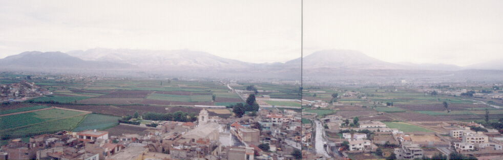
The valley of Arequipa
INTRODUCTION
Lying between the coast and the high plains, the mid-sierra valley of Arequipa is crossed my numerous ancient and traditional roads which form important routes of both local and long distance communication. Some of the roads that were in use during the Inca occupation of the region, and which are cited in ethnohistoric sources, include:
Numerous other roads and pathways, many of them less formal than the main roads, cross different sections of the Arequipa Valley, forming a web of internal communication routes within the Arequipa region. We know from historical sources that these routes were important during the Inca occupation of Arequipa, but archaeological sites including rock art are associated with many of the roads, indicating that some of them may be as much as 10,000 years old. Certainly many of the roads and paths existed long before the arrival of the Inca. Recent research by the Center for Archaeological Research in Arequipa (CIARQ) helps reveal the role of the ancient roads and rock art sites in the cultural development of the south-central Andes.
CIARQ RESEARCH RESULTS: GEOGRAPHY AND ROCK ART STYLE IN AREQUIPA
As part of an ongoing systematic archaeological survey of the Arequipa region, Augusto Cardona and CIARQ personnel have recorded nearly 200 archaeological sites in the Arequipa Valley. The survey, which to date has covered a little under 100 Km2, has so far been focused along sections of the rivers and tributaries flowing through two major environmental sections of the Arequipa Valley, the Low Mountain Desert (1700-2300 m.) and the Low Mountain Desert Scrub regions (2300-3100 m.).
The Low Mountain Desert of Arequipa includes the areas of Quiswarani, Uchumayo, and Socabaya. The lowest portion of this area, between Quiswarani and Uchumayo, is extremely arid, with virtually no measurable precipitation during most years, while rainfall in the Uchumayo to Socabaya area is limited to just a few milimeters in most years. The nature of the river valley also varies in these two areas of the Low Mountain Desert. In the Quiswarani-Uchumayo area the river valley is entrenched, leaving only small areas suitable for agriculture along the borders of the river. These agricultural plots are high risk areas, as they are destroyed each time the river rises when there are good rains in the higher sierra.
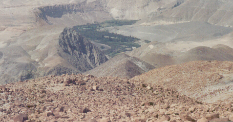
The Quiswarani section of the valley
The Uchumayo-Socabaya area is characterized by a much wider valley bottom, with prime agricultural terrain that has been sculpted into terraced irrigated fields that have been in use for several thousand years.
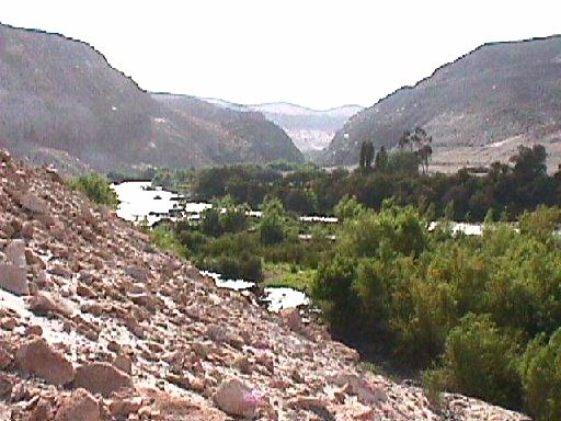
The Socabaya section of the valley
In the slightly higher elevations that form the Low Mountain Desert Scrub region of the Arequipa Valley, rainfall is more regular and the rivers and tributaries have been canalized and used to irrigate not only the river bottom but also hill slopes along streams and washes (quebradas), where terraces in areas such as Paucarpata, Sabandía and Sogay produce rich yields of crops of all kinds.
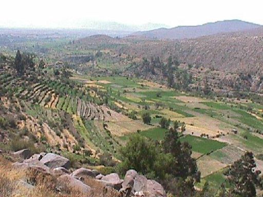
Agricultural terraces of Sogay
THE ROCK ART OF AREQUIPA
Each of the three subsections of the valley described above is characterized by distinct patterns of archaeological settlement, and by distinctive patterning in the rock art that is found there. The CIARQ archaeological inventory is demonstrating that, to begin with, much of the rock art found in the lower elevations consists of petroglyphs of figures of all kinds, including many kinds of animals and anthropomorphs, as well as some geometric designs that appear related to Middle Horizon designs. In the upper areas, rock art tends to be more geometrical.
As mentioned above, rock art is often associated with ancient roads as well as with other archaeological sites (ancient settlements, Tambos or waystations, and other sites). One of the more striking cases of rock art found along an ancient pathway is the site of Cullebrillas, in the Uchumayo area. Here, numerous panels of petroglyphs are found where a narrow pathway that crosses a deep wash allowing access to the river.
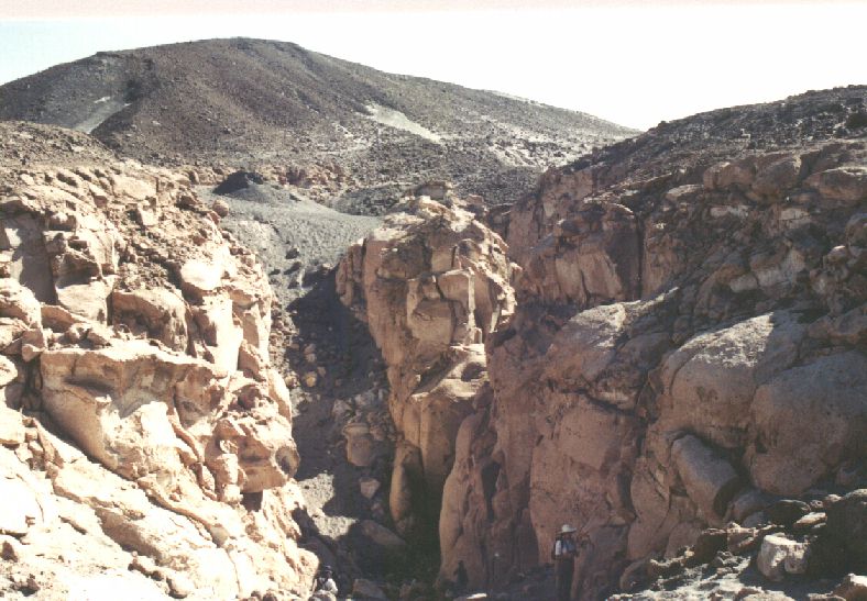
Cullebrillas, a petroglyph site associated with an ancient roadway. The petroglyphs cover the rocks seen along both sides of the pathway.
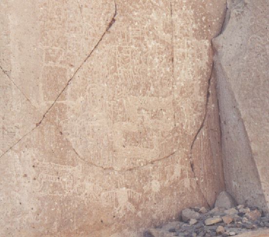
Example of petroglyphs of Cullebrillas
The style of rock art found in the Quiswarai-Uchumayo area is distinctive, consisting of naturalistic felines, two headed serpents, and hunting scenes featuring human figures shooting spears at deer, among others. Many of the panels containing the rock art are found along ancient routes of communication, such as is the case at the site of La Caldera. Other rock art panels are found in association with architectural ruins and pottery dating to the Formative Period.
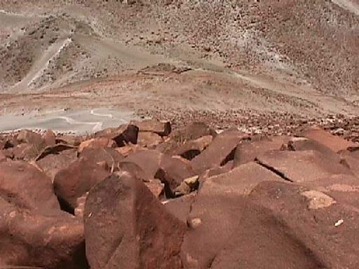
La Caldera, note the Camino Real in the background
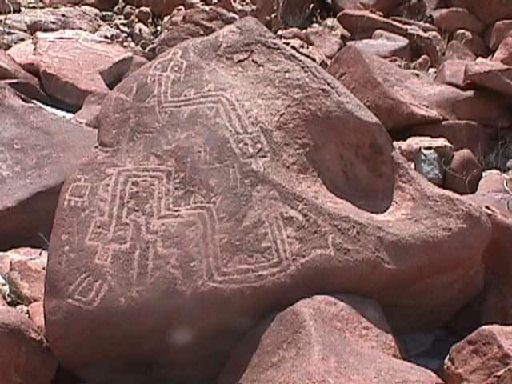
Geometric figures from La Caldera
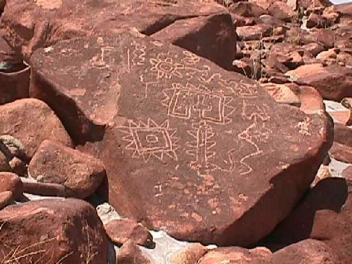
Geometric figures from La Caldera
At the interface between the Uchumayo-Socabaya and Socabaya-Sogay areas the rock art is distinct from that seen in other parts of the valley. The pictographs of Mollebaya, shown below, are examples.
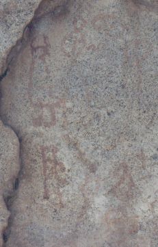
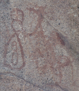
Pictographs from Mollebaya
The variations observed in the rock art of Arequipa is interesting, and more in depth analysis based on detailed documentation of the figures depicted, associations, orientation, techniques, and iconography will provide a picture of its role in the system of communication of the region. Clearly the roads associated with much of the rock art were important for both regional and long distance communication. The form and style of artifacts and rock art helps archaeologists to identify affinities both within and between regions, and the preliminary evidence we have indicates that Arequipa was a crossroads, where trade and communication between ancient groups from the central and south-central Andes took place. Evidence of this includes pottery and other artifacts from distant regions, such as the pottery sherd shown below, which is of a style associated with the altiplano.
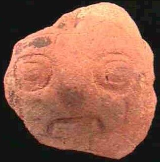
Pukara style pottery fragement from the site of Sonqonata
In conclusion, archaeological evidence including artifacts, rock art, ancient roads and ancient human settlements indicates a long and rich sequence of human occupation of the Arequipa area. The rock art of Arequipa and surrounding areas is one of the most interesting of the cultural features found in the region, and its study holds the potential to help understand the long term cultural development of Arequipa and its place in regional and pan Andean cultural history.
TEXT AND PHOTOGRAPHS BY AUGUSTO CARDONA, KAREN WISE, AND CIARQ. ALL RIGHTS RESERVED.
BIBLIOGRAPHY
Berenger R, José 1995 "El arte rupestre de Taira dentro de los problemas de la arqueología atacameńa. En Revista Chungará 27/1: 7-31. Universidad de Tarapacá, Chile.
Galdos Rodriguez, Guillermo 1982 "Descubrimientos e investigaciones arqueológicas en el sur del Perú". En Diálogo Andino 1: 85-153. Universidad de Tarapacá, Chile.
Gordillo Begazo, Jesús 1996 Miculla Petroglifos. La magia de los signos. EPF Editores, Tacna.
Hitishi, Takahaski 1988 "Algunos datos sobre la utilización de los recursos naturales en la costa de Arequipa, época colonial". En Recursos Naturales Andinos, pp 59 -79. Shozo Masuda, Editor. Universidad de Tokio.
Nuńez A., Lautaro &Tom D. Dillehay 1979 Movilidad giratória, armonía social y desarrollo en los Andes Meridionales: patrones de tráfico e interacción económica. (ensayo). Universid del Norte. Antofagasta, Chile. Publicación de la Dirección General de Investigaciones Científicas y Tecnológicas, Universidad del Norte. Antofagasta, Chile.
Linares Málaga, Eloy 1979 "Como inventariar arte rupestre en los Andes Meridionales" Presentado en la Segunda Reunión de las Jornadas Perú - Bolivianas de Estudio Científico del Altiplano Boliviano y del Sur del Perú, La Paz, Bolivia.
Lorandi, Ana María 1966 " El arte rupestre del Norte argentino (área del norte de la Rioja y sur centro de Catamarca). En Dédalo 4: 1-184. Sao Paulo, Brasil.
Pease, Franklin 1988 "Ají: Recurso e intercambio en el sur peruano" En Recursos Naturales Andinos. pp. 81-110 Shozo Masuda, Editor. Universidad de Tokio.
Ravines, Roger 1986 Arte rupestre en el Perú, Inventario General. Instituto Nacional de Cultura.
Introduction to the Archaeology of Arequipa
