
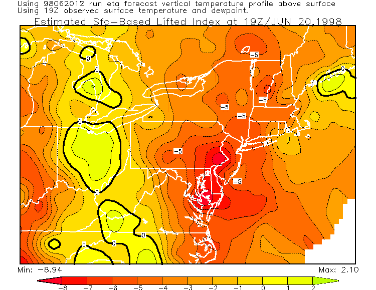
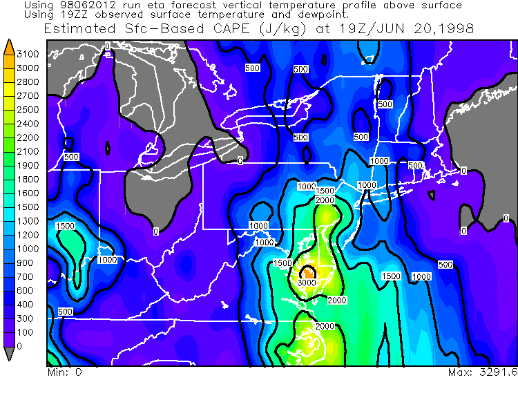
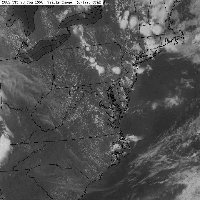
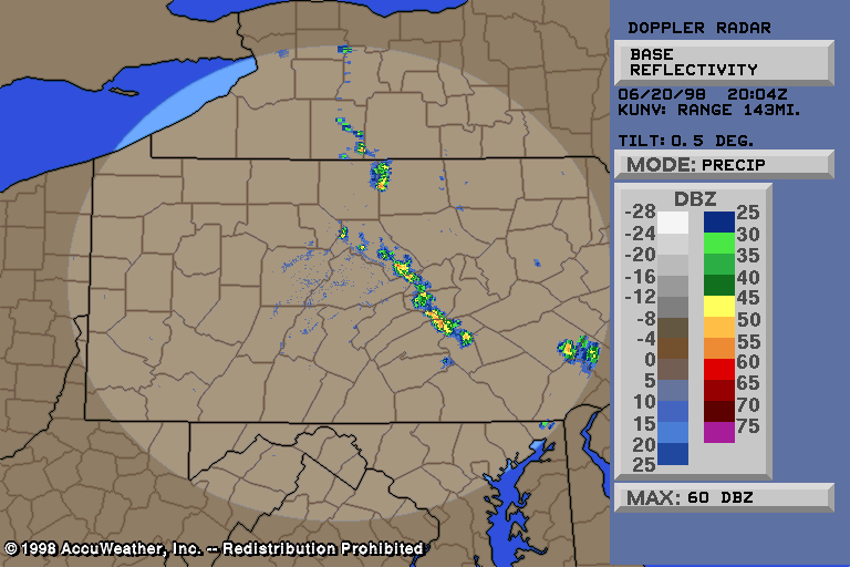
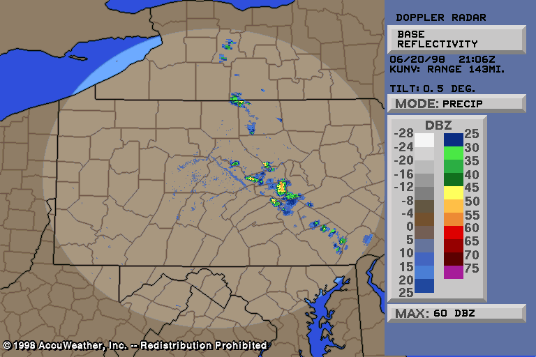
Isolated Severe Weather Event of June 20, 1998Very isolated thunderstorms developed during the afternoon hours, and a couple became severe. Today's kind of thunderstorms are called air-mass thunderstorms. They rely completely on the sun for development. In other words, if it was a cloudy day today, there would have been no thunderstorms, let alone severe ones. The visible satellite image at 1630Z (12:30 pm) showed cumulus clouds developing rapidly. By 1655Z (1255 pm), NEXRAD Doppler radar showed scattered showers and thunderstorms developing with surface heating. Thunderstorms continued to develop in central and eastern PA. The 19Z (3 pm), LI and CAPE values were enough to continue thunderstorm development. The 1915Z regional radar showed a line of thunderstorms developing, from near the Centre/Clinton county line, southeast through western Union & western Snyder counties, into northern Dauphin county. Hail was indicated with these storms, and the storm tops were up to 35,200 feet. At 1941Z, radar showed the broken line of storms, with the most intense (62 dbz) one now in southern Clinton county. The visible shot around 20Z (4 pm) showed the storms nicely. The only notable thunderstorm damage was in Clinton county. A severe thunderstorm warning was issued at 349 pm. The damage occurred around 4 pm, and this radar image is from around that time. Shortly after the damage happen, Dr. Greg Forbes, a Professor of Meteorology at Pennsylvania State University, surveyed the damaged areas. He determined that three downbursts struck the area, two of them microbursts and occurring on the southern periphery of the main, larger (and relatively weaker) downburst. This main downburst was about 4 miles long and 3/4 of a mile wide... extending from the southern/eastern slopes of a mountain in Bald Eagle Township about 3 miles west-northwest of the City of Lock Haven... southeast into the town of Lock Haven itself. Two microburts occurred in the southern part of the main downburst, and contained a more concentrated and significant area of damage. Over 100 trees were downed across the 4 mile long path, many of them within the strongest microburst area. The strongest microburst likely featured convective winds briefly gusting 75-85 mph (F1 strength)... and occurred in a small area from a mile northwest of Flemington to a mile northeast of Mill Hall... passing through western and southern portions of Flemington and areas just outside of Flemington Borough around the Bald Eagle Creek. Extensive tree damage was observed... with about 100 trees downed, and several cars were struck and damaged by falling trees. The other microburst... striking in the center of Flemington... probably contained maximum wind gusts in the 50-70 mph range, downing trees and power lines from Flemington to western parts of the neighboring city of Lock Haven. A car and house were damaged by falling trees, which amounted to over a dozen. Dime size hail was also reported with this thunderstorm. You can see a PNS here from the NWS, containing some of the survey information. A severe thunderstorm warning was also issued for Snyder county, but no severe weather was reported there. Radar looked like this. Today is a good example of how an isolated, airmass thunderstorm can produce a strong downburst... causing significant damage, which is what happened today. Go here for a complete listing of all images/text available for this event.Email: BowEchoCPA@suscom.net |
