Highway 24-27 runs northeast from Charlotte NC entering present day Cabarrus County and crossing Rocky River before continuing through Stanly County. Both Presbyterian of Scotch-Irish decent and German Lutheran began settling along this stretch of the river by 1760. Hearing of the opportunity for a new and better way of life, German Hessian John Reidt abandoned his duties during the American Revolution leaving Charleston behind him. Making it up to the backwoods of Piedmont North Carolina, it is believed he laid low at first, working within the community before marrying Sarah, the daughter of Peter Kiser. John and Sarah raised a family on lands he acquired on the east side of Rocky River. And then in 1799, John’s son Conrad discovered gold, from whence began the first rush in America.
Reed Mine Road turns off to the left just as you pass Rocky River heading east on Hwy. 24-27. The road crosses over Big Meadow Creek and then Little Meadow Creek before jogging back towards the river and then turning sharply northward where it continues to run the crest of the river ridge. Less than a mile up the road, Reed Gold mine is situated off to the right along the hills surrounding the banks of Little Meadow Creek.
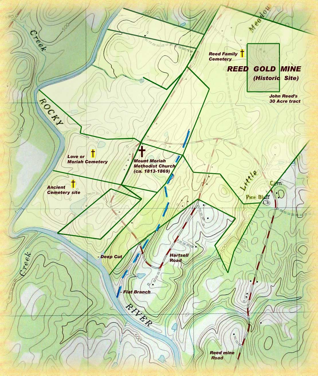
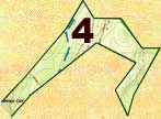
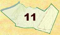
In order to better understand the impact of gold, I have begun to plat the lands of those living in this neighborhood. On the map below you will find Reed Mine Road and Hartsell Road that loops off to the south. Rocky River, Little Meadow Creek, and Flat Branch are also located. And drawn loosely to scale, key tracts of land are identified and traced forward in time. The tracts are numbered and correspond to a written discussion that follows.
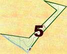
 John Reed (Grant # 196, Cabarrus NC) entered 1797, 1799 and 1800; surveyed 20 Oct 1800; issued 5 Dec 1800. The story of the discovery of gold is best told through our understanding of this tract. Note in the upper right hand corner of the map a small rectangular piece of 30 acres situated on Little Meadow Creek. Identified as an “old deed” in the original survey of 330 acres issued to John Reed by the North Carolina Secretary of State, the inclusion of the smaller tract shows clearly that John owned first the 30-acre piece of land before the 330 acres was granted. I have yet been able to trace the purchase of this smaller tract.
Surrounding the 30 acre deeded land, the boundaries for the 330-acre land grant also appear in red. Surveyed 20 Oct 1800 and issued 5 Dec 1800, the land was actually made up of three separate entries taking place at different times. Entry No. 217 occurred 20 Jul 1797 before gold was found. Then in early 1799, Conrad Reed’s discovery put into motion the need to acquire and formally lay claim to lands. Dated Jul 26 1799, John Reed entered tract No. 316. And then on 8 May 1800 he entered the last piece known as entry No. 370. So though gold was discovered in 1799 on possibly the 30 acre deeded tract, John Reed kept quiet the discovery until he had clear title as issued in late 1800.
As per the boundaries mentioned in the 1800 survey, the west side boundary line of this tract runs up Flat Branch and James Love’s line and turns westward before running north along George Tucker’s line. The lines then run east crossing Little Meadow Creek before turning south and running along the lines of John Tucker lands. The boundary then jogs back west before heading again south along the line of Isham Clay’s land (tracts 7 and 8 on the map). The last four lines running westward across the southern boundary adjoin lands of James Little. Note that James Little and George Teeter served as chain bearer for the survey.
 James Love (Grant # 323, Cabarrus NC) entered 6 Jan 1804, surveyed 12 Jul 1805, and issued 22 Nov 1805. Being for 91 acres, the warrant states this tract of land adjoins that owned by John Reed, George Tucker, and George Garmon. Drawing out the plat, it nests perfectly against Flat Branch and the west lines of John Reed’s 330 acres. But note that in 1800 the survey for John Reed’s land identifies a line of that tract as adjoining Love’s line. And that was before James Love had even entered the tract for issuance by the Secretary of State. This indicates James Love was there and claiming the land earlier, even though he was not formally the owner. John Reed and Jonah Love served as chian bearers for survey of this tract.
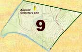
 As identified in later grants and deeds, James Little owned at least two tracts in this area on the banks of Rocky River situated west of Little Meadow Creek. James may have mined this land for gold. That, or at least made it appear the land contained gold. Raising his children in this location, James Little sold the land to speculators and removed to what is now southeast Stanly County. The mouth of Flat Branch is also located on this land just to the west of Little Meadow Creek. John Reed's son Henry and Isham Clay owned land to the east of this area. I am not sure of this yet, but a bit further down I believe is where we will find the Kiser mills.
 James Little (Grant # 234, Cabarrus NC) sur. 15 Aug 1800. Wrapping around “his old tract” the survey for this piece of land appears like a backward seven. Beginning on The Rocky River at a “Deep Cut,” the western boundary of this tract runs north along three conditional lines adjoining lands of George Garmon. The last of which runs along Flat Branch where it ends at the corner of Reed and Love lands. Then the lines run east along John Reed’s lines before turning back south along Isham Clay’s lines. The tract then wraps back inside adjoining James Little’s own lands.
Dated 25 Jan 1805, William Bedford and Nathaniel Morton of the City of Baltimore in Maryland began purchasing the holdings of James Little. The news was out and these two were speculators seeking to gain wealth from any gold found on the lands recently issued to James Little. They paid $1,200 for James Little’s grant # 234 (6-14, Cabarrus NC). Then they paid $200 for 32 acres (6-15, Cabarrus NC) on the Rocky River and west of Little Meadow Creek. And then they paid $1,400 for what was known as tract No. 2 (6-16, Cabarrus NC). And finally, over on Big Meadow Creek, James Little sold these two men 170 acres including the “Baptising hole” (6-17, Cabarrus NC). Later in that same year, THE EVENIG FIRESIDE published in Philadelphia PA published the following dated 14 Dec 1805:
RALEIGH (N. C.) By the Representatives in the present General Assembly for Cabarrus county, we learn that the Proprietors of the Gold Mine in that county, continue to collect that precious metal, though in smaller quantities than heretofore. We learn also, that the gentleman from Maryland, who purchased a quantity of land last year at a high price, with the expectation of finding gold in it, is about to establish works upon the land, and is likely to succeed. Small pieces of Gold we are informed, have been found several miles from this place where it was first discovered.This may or may not be attributable to Morton and Bedford. Another notable Marylander purchased large quantities of land in adjoining Montgomery County. In 1811, we know from deeds that William Thornton, designer of the United States Capitol Building, purchased over 50,000 acres in adjoining lands in what is now Stanly County.
Acquiring Little’s grant # 234 and the two other tracts between it and the river, there are no further records for Bedford and Morton until in Oct 1828, the court ordered the division of their lands. Wm. Watson, John H. Bost, Daniel Bogar, and Jonah Love were appointed as commissioners to divide the lands (11-176, Cabarrus NC). Nathaniel Morton received 175 acres known as tract 1. At this time, what was the northern half of James Little’s lands now adjoined Jonah Love to the west running then up Flat Branch to James Love and John Reed’s corner. The line then runs south along now Jon Reed Junior’s line and then back west to the beginning. William Bedford received the southern half of land lying against the River and then adjoining Jonah Love’s land to the west, Morton lands to the north and John Reed Junior’s land to the east. It appears Morton and Bedford went bankrupt as their names appear together in a list of bankruptcies appearing in records from New York.
The above records are very important as they fill in gaps in the Love family history. As will later be shown, our James Love did in fact acquire the lands west of James Little’s lands. Our James Love died in the early 1820’s and the details of his estate settlement have not survived. Now we know that as younger son, Jonah Love gained ownership or control of the lands west of those belonging to James Little. But yet, note that at the northern extent of his holdings, these records indicate the lines of Bedford and Morton lands as ending at the corner of Reed and “James Love” lands. Is this a mistaken throwback or are we seeing evidence of lands passed down to a younger James Love we believe to be a son of elder James Love.
And lasty, dated 9 Aug 1831, Sarah Williams, David Stewart, M. A. Stewart, George C. Morton, and M. A. Morton of Baltimore sold the 175-acre (11-402, Cabarrus NC) Nathaniel Morton tract to George Tucker. This deed again confirms that Jonah was still the neighbor o the west. And still, the northwest boundary of this tract adjoined the corner of John Reed and James Love. Jonah Love witnessed the deed. Though the metes and bounds are subtly different, George Tucker of Cabarrus County sold this same tract (15-271, Cabarrus NC) on 20 Mar 1844 to John Reed Jr. The deed was witnessed by George Barnhardt and Mary E.or C. Tucker. We know that George Tucker II married Mary C. McCloory or McClure.
 George Garmon (Grant # 335, Cabarrus NC) surveyed 20 Mar 1806. Adjoining James Little’s corner at the “Big Cut” on Rocky River, the east conditional lines of this tract run north till meeting Flat Branch and then continuing along the branch to a corner in James Love and John Reed lands. The lines then return southward along James Love’s line before cutting back east towards the first lines. The lines then continue towards the river where near the bank a last line runs diagonally west towards the bank.
Dated 27 Dec 1806, James Love purchased several tracts (6-135, Cabarrus NC) from George Garmon. John Hagler and Thos. Berry witnessed the transaction. The first tract is undefined other than it is described as adjoining the Rocky River on the west and south, Garmon’s own land on the east, and that of James Love to the north. This appears to be the southwest portion of tract 9 from the map above.
 The second tract being 40 acres had been granted to Garmon on 2 Nov 1784. Being part of an 81-acre tract granted to Garmon by Arthur Dobbs and wife Julianna on 25 Jun 1764, this is tract 6 on the map above. And the last tract sold to James Love by George Garmon is grant # 335 above. So from this it appears James Love owned the lands in the Big Bend of Rocky River west of the lands belonging to James Little.
Though not yet confirmed, there are two other transactions that may very well relate to this deed. Dated 31 Jul 1790 and recorded Jan 1793, George Hoice of then Mecklenburg County sold 101 acres on both sides of Rocky River to James Love. Being the first known land in the area owned by our James Love, this land also adjoined that of George Garmon. And at the same time, George Hoice and wife Catherine sold to James Love 50 acres on the east side of Rocky River adjoining the lands of George Tucker. Could this be the lands just to the north of the land deeded to James Love by George Garmon?
 Dated 19 Jun 1838, Jno. B. Allstot sold to Andrew Hartsell 142 acres (14-114, Cabarrus NC) in what is described as “that tract or plantation” situated in the “Big Bend of Sd. River.” There are only two lines defined in the deed. Just as appears on the map above and also confirmed on present day GIS tax maps, the lines from this deed show without doubt that this land once belonged to James Love. Not knowing anything of John B. Allstot, we can trace back through events and realize how and why Andrew Hartsell gained control of the land.
Andrew Hartsell first married Catherine Reed, the daughter of John Reed. After her death, Andrew married Sarah Love in 1833. She is the daughter of James Love’s son Jonah. Looking back through the records concerning James Little’s lands, we learned that Jonah Love gained control of James Love’s estate lands situated in the big bend. Around 1833, Jonah Love removed to the area known today as Stanfield in present day Stanly County. Somehow, the lands controlled by Jonah fell into the hands of Jno. B. Allstot and then from there into the hands of Andrew Hartsell. And this after the marriage of said Hartsell to Jonah’s daughter Sarah.
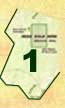
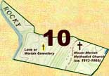 Dated 3 May 1849, William A. Burkhead sold to Jesse D. Cox 152 ľ acres (28-195, Cabarrus NC). At that time, the land adjoined Andrew Hartsell’s line on the south, then northeast a short line to John Reed’s corner, then up Flat Branch to John Reed’s old corner. The lines next run west adjoining Martin Randleman’s land (tract 11 on the map) until meeting a corner of the church lot.” From there the lines jog around westward till they meet the Rocky River. Later, dated 9 Oct 1869, this church lot is further identified in a deed (27-273, Cabarrus NC) by Thos. B. Shinn, Martin Widenhouse, and A. H. Smith representing a committee of the Mount Pleasant Circuit of the Methodist E. Church of South Carolina. As representatives of the church, they sold to Jesse D. Cox that piece of land “known as the Mount Moriah Church Ground.” It has been written that James Love donated land for Mount Moriah Methodist Church in 1813. Figured from metes and bounds of these deeds, the map above identifies where Old Moriah once stood. It is said by people living in the neighborhood that the church burned and the congregation decided not to rebuild. Situated down the hill from where the church once stood, the old Love Family cemetery quietly marks the resting place of many who once lived on these lands.
Looking at this deed, just who was William A. Burkhead and how did he gain access to the land? We know that William married Sarah N. Love, who in the past, has been believed to be the daughter of James Love and a second wife Esther Carriker. But we now can prove and discuss the existence of a younger James Love who married Polly Tucker. And as supported by the 1820 Cabarrus County census, Sarah may very well be the daughter of James and Polly Tucker Love. And from the records found on this page, we see that a portion of elder James Love’s lands fell into the hands of his son Jonah. And yet the lands just to the north of Jonah were identified as belonging to “James Love.” If Sarah were the daughter of younger James Love, then after his death, it is possible that the land eventually fell into the hands of Sarah’s husband.
 Jonathan Martin Rendleman married Elizabeth, the daughter of Conrad and Martha Love Reed. Elizabeth died prior to 1845 at which time Jonathan married second to Mary E. Tucker. This family removed to Union County IL in 1868. Choosing as their agent John M. Glenn, Jonathan and Mary his wife sold tract eleven above (22-26, Cabarrus County NC) to George and Allen Barbee. The deed mentions “a dog wood at the corner of the church lot.” It also indicates that Andrew Hartsell owned the adjacent land further to the north.
 Dated 12 Aug 1817, Jacob Tucker, Lewis Tucker, and Isaac Howell sold this tract to Evan Howell (10-443, Cabarrus County NC). Geo. Little, Wm. Crayton, and S. M. Shinn witnessed the conveyance. The legal description traces the bounds up from the river around to a branch, thence following the branch back to the river and up the same. Notice the branch is still there. At that time, the deed mentions adjoining the lands of James Love to the southeast. As appears on the same page in deed book 10, Evan Howell next sold the land on 23 Jan 1824 to Andrew Hartsell. Using the same legal description, this second transaction was witnessed by W. Crayton and Green H. Swearingan.
 Dated 25 May 1831, John Reed sold this 30 1/4–acre tract to Andrew Hartsell (11-401, Cabarrus County NC). James S. Burkhead and Conrad Reed witnessed the transaction. At this time Andrew was married to John’s daughter Catherine. She soon died and Andrew married second the daughter of Jonah Love. In this same deed, John Reed also sold to Andrew Hartsell another 81-acre tract adjoining this one to the north. This other tract wraps around the extreme northwest corner of the Reed mine tract. Not visible on the above image, click on the arrow at the top to view this and other lands north of Reed Mine.