
|
A little story about a great map
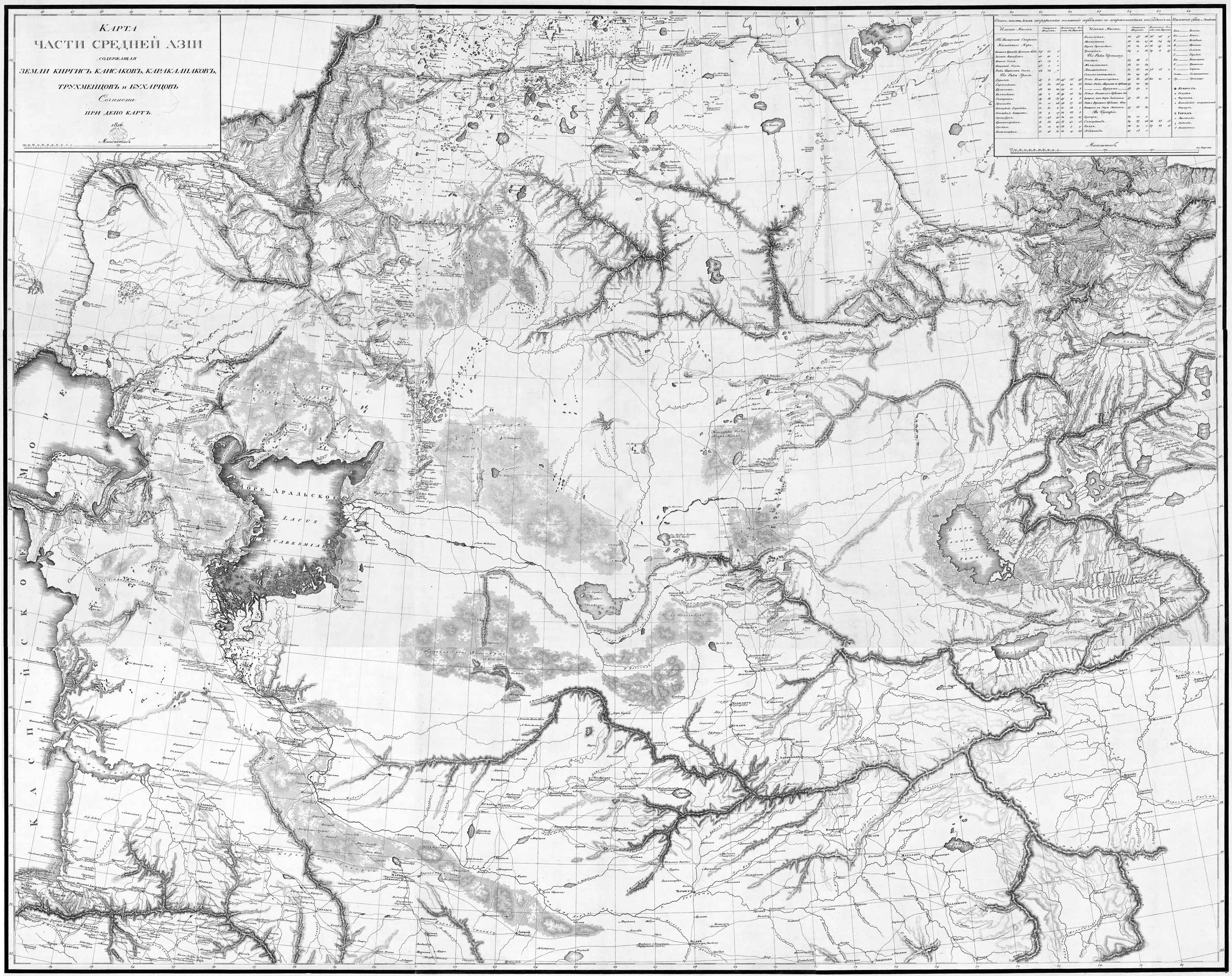
On a my favourite map in my collection is the map of Pansner: "Karta Casti Srednej Azii Soderzascaja Zemli Kirgis Kaisakov, Karakalpakov, Truchmencov i Bucharcov It's a map in 9 single sheets (about 41 x 33 cm) what gives a map of 123 x 99 cm if you stitch them together. I did it using my computer and the result you can see here.
In comparing the map of Arrowsmith with different recent sources, he also used the map of Pansner and he found no good words about Arrowsmith's map, kindly speaking! I hope soon to include Klaproth's text in my Digital Archive and to present it here so that everyone who understand the french language could read his fascinating pamphlet.
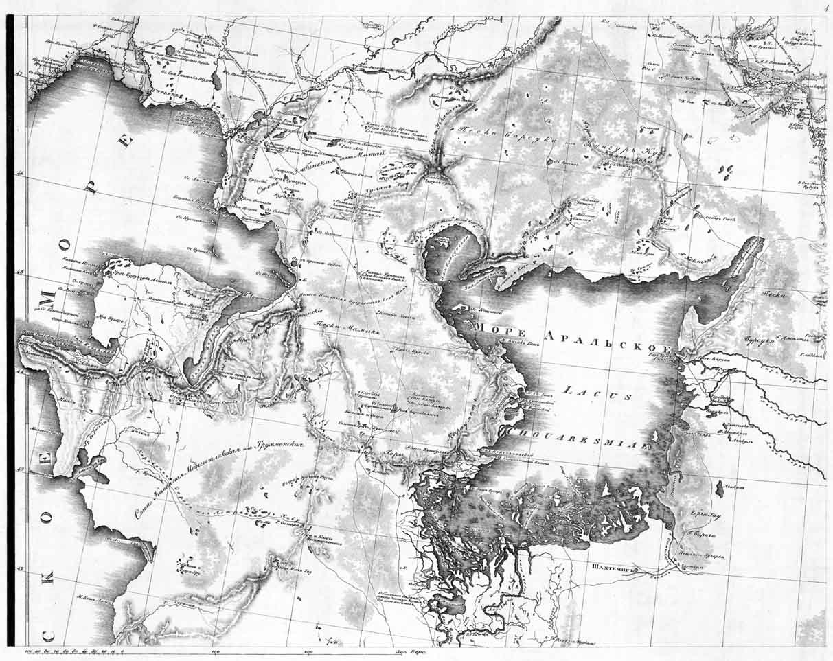
Another source is the very interesting book of Fedcina about the mapping of Central Asia. Unfortunately only in russian. Here you find the map in the context with the development of mapping in that period. There is also a a reprint of sheet 4 (Lake Aral) "Kak sozdavala´s karta Srednej Azii, These are the two main sources I know about the map. But first it was Mr. Alexei Postnikov who gave me the first hint about the map.
Who knows ...
|
