|
THE FLINT HILLS IN KANSAS |
|
This site contains many large pictures and will take a long time to load. If some picture do not load (a red X will be displayed) "Refresh" your browser to download the missing pictures. |

|
|
Hill Top - Tallgrass National Prairie Preserve |
|
Contrary to popular myth Kansas is not really flat. The Flint Hills are an ocean with giant waves of rock and soil, covered in grasses, wild-flowers, and animals. So slip on your Ruby Slippers and join me for a virtual tour through the Flint Hills. One of my favorite places. "When settlers first moved to Kansas, many of them passed the Flint Hills by. They wanted good farmland, and the rocky soil was too hard to plow. Although the area is now used for grazing cattle, not much of the land has been plowed to grow crops, and the Flint Hills remain, for the most part, a natural prairie grassland." (KGS - Kansas Geological Survey - http://www.kgs.ukans.edu/Physio/flinthil.html )
|
 |
|
Big SKy - A place never penetrated by the plow. |
|
"The Flint Hills region, which runs north and south through east-central Kansas, is one of the few large areas of native prairie grassland left in the United States. The grassland that covers the Flint Hills once covered most of central and western Kansas and the surrounding states. When people moved in, the prairie in other areas became covered with farms and cities. Away from the roads and buildings, the Flint Hills region looks much as it did 10,000 years ago." (KGS)
|
 |
| All is Calm on the Prairie |
|
"Although the Flint Hills region is known for its rolling grasslands, it is named for flint, a type of rock that is found embedded in the limestone that forms the hills. Flint, also called chert, doesn't erode as easily as the softer limestone. When the limestone at the surface is eroded by wind and water, it eventually breaks down into soil. The exposed flint is broken down into gravel, which mixes with the soil and makes the ground rocky." (KGS) Years ago, crossing Kansas on my way to somewhere, I stumbled into the Flint Hills. Since then I have visited and explored the area on foot, by car, and by motorcycle whenever I can. The Flint Hills, like the desert, has a strong unexplainable pull on some of us. Many time I have driven the 120 miles each way from my home in the Missouri to spent all day until dark wondering the endless maze of gravel roads that traverse the area. Some days I might not see more than 4-5 other vehicles all day.
|
 |
|
ROAD TO SOMEWHERE |
|
Over the years there has been much discussion about making the Flint Hills a national park but most of the Flint Hills remains in private ownership. This is an emotional subject to many people and I am not knowledgeable enough to do either side justice but hopefully the establishment of the Tallgrass Prairie National Preserve and the Konza Prairie near Manhattan addresses the needs and concerns of all sides. You can drive miles and miles on gravel roads in the Flint Hills and not see anyone. The flint gravel can be lethal to your tires though, so be prepared, especially in the winter or summer. One of my favorite past-times is to turn off Hwy 177 on some unknown gravel road and get lost for the rest of the day. I wonder around for hours until it gets late in the afternoon then I more methodically choose a direction that I hope will take me out of the Flint Hills to a paved road and on home. This sometimes gets interesting since a road that starts out going east sometimes turns north or south several miles later. No problem, I just keep going and take the next turn that goes east. So far I have always popped out on a paved road somewhere eventually. But, I have had to ford some shallow streams or backtrack from a dead end occasionally too. But before you head off down a gravel road to get lost in the Flint Hills I recommend you take along:
|
If you prefer paved roads and want to focus on the highlights of the
area try these two daytrips:
|
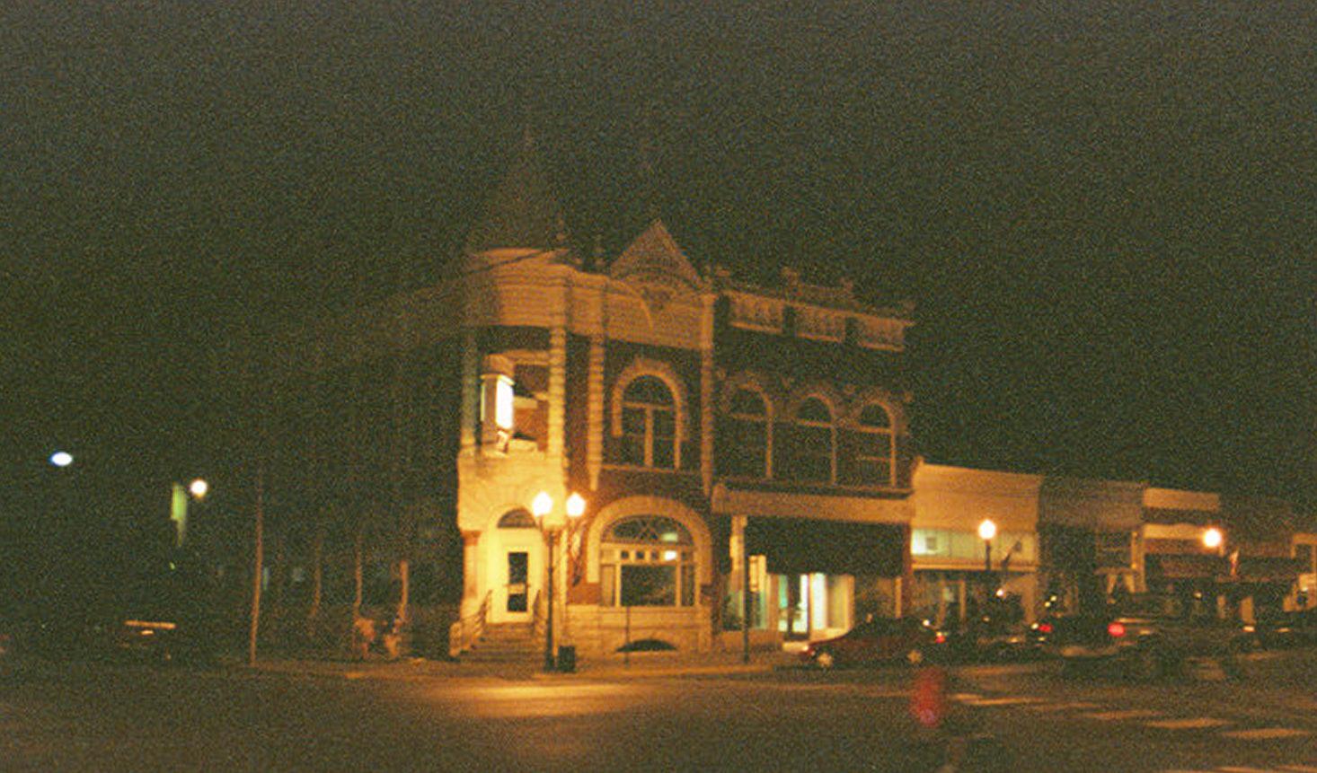
An 1825 treaty with the Osage Indians established access for overland freighters through the area and for years Council Grove was the last outpost on the Santa Fe Trail for travelers heading west from the Missouri River toward Santa Fe, New Mexico. Traffic on the Santa Fe Trail peaked in 1860 with reported traffic of 3,000 wagons, 7,000 men, & 60,000 mules. The River walk along the Neosho River is great place to stretch your legs and have a picnic or you could eat at the historic and popular Hays House - "reportedly the oldest restaurant in continuous operation west of the Mississippi." Some other points of interest are the; Council Oak, Kaw Methodist Mission (1849), Last Chance Store (1857), Old Hayes Tavern (1857), the Custer Elm (1867 campsite of Custer and his 7'th Cavalry.), and the Farmers and Drovers Bank shown above. (1892) Council Grove Lake, north of town, is a good place to camp while exploring the area. |

|
| White Pelicans - Council Grove Lake |
|
Tallgrass National Prairie Preserve
The Tallgrass Prairie National Preserve located two miles north of Highway 50 on Highway 177 is an interesting place to visit. The pictures below were taken in the Preserve. The main activities are hiking trails through the prairie, touring the historic Spring Hill Z Bar Ranch barn, out-buildings and mansion, and taking a bus tour of the Prairie. The bus tour is very informative and well worth the time so check on departure times when you arrive. "This fragile ecosystem is home to 40 species of grasses, 200 species of birds, 30 mammals, plus reptiles, amphibians and as many as 10 million insects per acre." Be alert and you may see a Red-tail Hawk, coyote, rabbit, fox, or some interesting reptiles like the Collared Lizard or even a Mississauga Rattlesnake. I probably shouldn't tell this story but I was squatted down in an opening in a stone wall for an extended period of time taking a close-up of a wild flower. As I stood up pulling the camera away from my eye I saw what appeared to be a Massasauga Rattlesnake between my feet. It scarred him as much as me and he was made a hasty retreat into the stone wall. Snakes are rare and not a problem if you stay on the trails and watch where you are steeping. Leave the stone walls to them and stuck to the trails.
|
|
|
| Hill Top - above the Spring Hill Z Bar Ranch |
|
|
| Hill Side |
|
|
| OVER THE TOP - hiking trail |
|
|
| Almost Blown Away |
|
|
|
Cool & Wet |
|
|
| AFTER the Fall RAIN |
|
|
| Pyres in the Gloom |
|
|
|
Web of Dew |
|
|
|
Little Ranch House on the Prairie - Spring Hill Z Bar Ranch |
|
|
| Bend, Don't Break |
|
|
|
Springs and cottonwoods - Fires preserve the Prairie. Where there is water and rocky terrain trees take hold. |
|
|
|
Fading Color |
|
|
| Hill Side 3 |
|
|
|
Lone sentinels - The government paid ranchers subsidies to build fences. At the time rock was plentiful so that was the material of choice. Later rock was replaced with barbed-wire fencing and many of the rock was sold to be crushed as gravel or used as building material. |
|
|
| COWBOY'S MONET |
|
|
|
Brown 'n Blue - Manmade lakes now dot the landscape to provide water for the cattle. |
|
|
| Hill Side 3 |
|
|
| School in the Fog |
|
|
| School in the Sun |
|
|
| FAMILIAR CORNER |
|
WANDERING AROUND IN THE FLINT HILLS The pictures below were taken while wandering around the Flint Hills. See the Marion and Chase County references in the LINKS SECTION below for some good trip ideas and historic maps. |
 |
|
Littler Ranch House on the Prairie |
|
|
|
FROZEN Waves on a prairie ocean |
|
|
|
Shades of Red |
|
|
|
Solar POWER |
|
|
|
Great Balls of Wire |
|
|
|
Cow Garden #1 |
|
|
|
Cow Garden # 2 |
|
|
|
Wired |
|
|
|
Ding-DONG - 2 & 3 |
|
Flowers in the Flint Hills |

|
|
WISPS of Blue |
|
|
|
Spring Flowers 1 |
|
|
|
Spring Flowers 2 & 3 |
|
|
|
Spring Flowers 4 & 5 |
|
|
|
Fall Asters SUMAC |
|
|
|
Formal Cow Garden with sculptures |
|
|
|
Cows tending their Gardens |
| LINKS:
Flint Hills Scenic Byway (K-177) http://www.byways.org/travel/byway.html?CX_BYWAY=2095 Kansas Geological Survey - http://www.kgs.ukans.edu/Physio/flinthil.html Chase County (good source of useful information/maps) - http://skyways.lib.ks.us/kansas/counties/CS/ Marion County (good source of useful information/maps) -http://skyways.lib.ks.us/kansas/counties/MN/index.html
|

 From Kansas City take Hwy 56 west to Council Grove, then follow Hwy
177 south - a KS Scenic Byway - down to I-35 at Cassoday. Follow
I-35 north-east back to KC. Allow yourself several hours to explore
Council Grove in the morning, eat lunch, and then explore the
Tallgrass National Prairie Preserve in the afternoon. Be sure to
explore Cottonwood Falls two miles south of Hwy. 50 and see the
beautiful Chase County Courthouse, in operation since 1873.
From Kansas City take Hwy 56 west to Council Grove, then follow Hwy
177 south - a KS Scenic Byway - down to I-35 at Cassoday. Follow
I-35 north-east back to KC. Allow yourself several hours to explore
Council Grove in the morning, eat lunch, and then explore the
Tallgrass National Prairie Preserve in the afternoon. Be sure to
explore Cottonwood Falls two miles south of Hwy. 50 and see the
beautiful Chase County Courthouse, in operation since 1873.