Site hosted by Angelfire.com: Build your free website today!


Located in Maries County MO

Clifty Creek Information
Clifty Creek Map

A Little Information on Clifty Creek

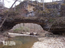
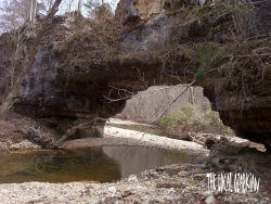
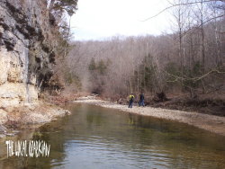
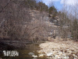
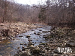
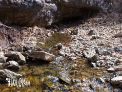
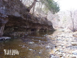
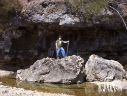
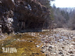
Although the walk to the natural bridge is one mile, it is well worth the effort. There is no marked path and the best route is in or by the creek bed much of the way, passing scenic bluffs on both sides most of the way. The bridge is developed where a tributary of Clifty Creek goes through some dolomite. The arch has a span of forty feet and is thirteen feet high. The ridge in which it is formed is forty feet high and thirty feet wide. About 350 yards downstream is a shallow cave that is about fifteen feet deep and has an entrance on the main bluff side and another facing the valley. The cave ceiling is about six feet high and the arch has an opening of about fifteen feet wide at the base. Although the cave is officially called "Unnamed Cave #7" , it has two local names called Red Mans Cave and Clifty Hollow Cave.


I hiked and took these pictures in March of 2004 with my girlfriend and best friend.


Clifty Creek was most likely named after the cliffs and bluffs along the creek bed. Some overhang some 30 to 40 feet above which make for some great pictures.


*Dustin the Great Explorer*


Clifty Creek flows through a small canyon in certern areas.


Early next year, I plan on going back here and checking out the cave. I didnt know it was there till later on when I was reading up on this place. I will update and add the pictures of the cave when I go.


Or you can catch me on MSN Messenger.


Important Notice

All photographs used on this site, The Local Ozarkian, are the property of Jonathan Sharp.
You may use, or copy these pictures if only you say you have gotten them from The Local Ozarkian.
Do not distribute, sell, or publish my photos without prior written permission.


Home Page Personal Info Club Adrenaline Passports Blog Ozark Mills Ozark Caves State Parks Website Updates Area Links