
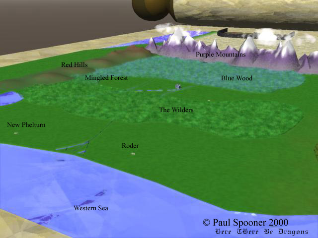
Overview from west, looking east.
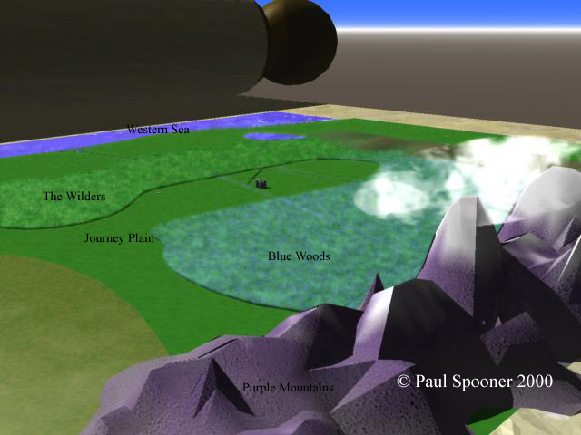
Purple Mountains, the Bluewood, the Wilders, Journey Plain, Western Sea.
To the north Ceri Lake, the Red Hills, Mingled Forest.
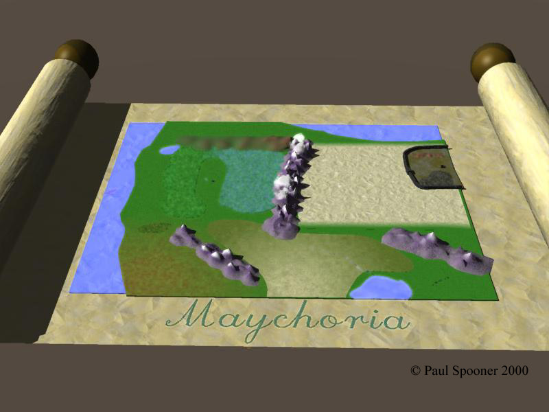
Between the Wilder and the Bluewood, Maychoria, Tappuah north of River Shreliri.
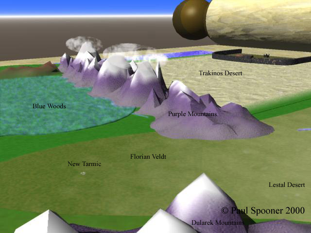
Dularek Mountains, New Tarmic and Lestal Desert in the Southern Frontier.
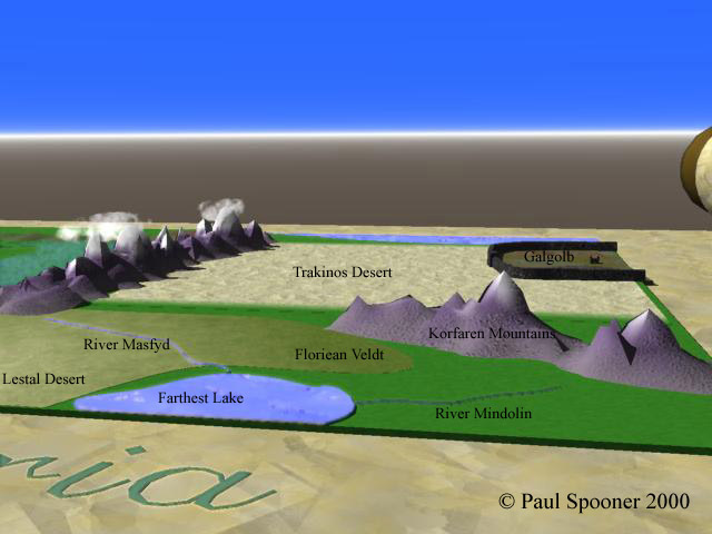
Beyond Purple Moutains, the Trakinos, far away, Galgolb and the Icy Sea.
Viewing north from Unexplored South.
 Closeup of Galgolb.
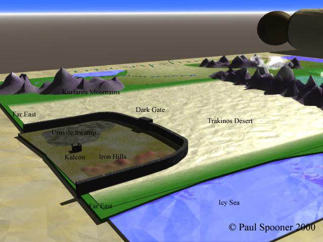
Surrounded by Witch's Wall are Kakon, Urnvile Swamp, Iron Hills, Katamobic Waste.
Trakinos Desert around it all.
Far East is off the map, it's so Far.
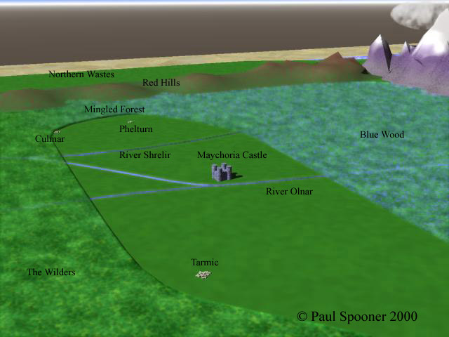
Culmari and Phelturn are in Tappuah.
(Phelturn is Tappuah's capital, incidentally.)
River Shreliri is political boundary between Maychoria and Tappuah.
Tarmic is much smaller than as depicted in this representational drawing.
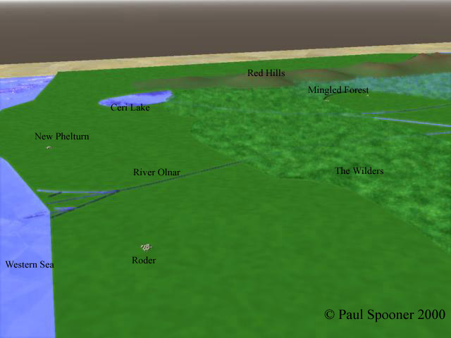
The Western Colonies, between the Wilders and the Western Sea.
The Tappuan Colonies, including New Phelturn, are north of the River Olnar.
Roderi and the Maychorian Colonies are south of the river.
Some brave Maychorians in the south have begun discovering or inventing the art of sailing, this historian is not sure which.
It's not going too well, due to the dragons.
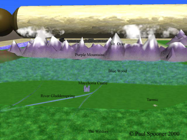
The River Gladdenspring is in Maychoria, from beginning to end.
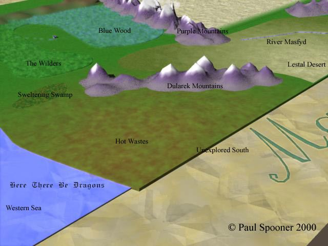
Southwest corner of Madra.
Unexplored South is off the map.
Nobody's come back alive yet, from there or from the Far East. (No word on dead people returning, but it doesn't sound too probable.)
| Main Page | Other Writing | From Email | Darkrender Contents | Glossary |
