


Michigan Road Photos
Welcome to Michigan Road Photos! This page will showcase various highway scenes from the Wolverine State. If you have a photo you would like to contribute, please contact me at michohioroads#yahoo.com (change "#" to "@" to e-mail).
Features | Guide Signs | Shields and Other Signs | Road Scenes
Photo Link & Description |
Photographer & Date Taken |
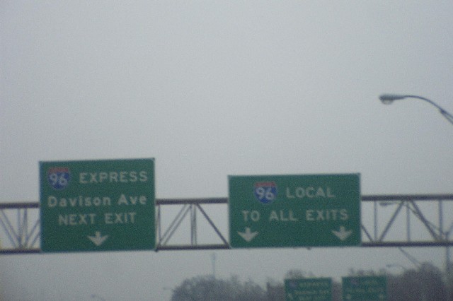
| I-96 EXPRESS / LOCAL overhead signs on I-96 East at the M-39 interchange, Detroit, Wayne County. I-96 has a 6 mile long express / local configuration in the western part of Detroit. The M-39 interchange is in the middle of this stretch. In both directions, there are crossovers from the express lanes to the local lanes, and vice versa, amidst the M-39 interchange. | Doug Weasner; 4/2002 |
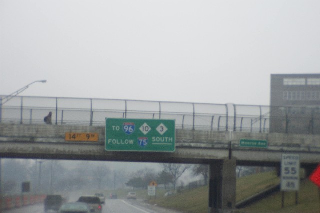
| TO I-96 M-10 M-3 FOLLOW I-75 SOUTH overhead sign on I-375 North, Downtown Detroit, Wayne County. This signage is near the north end of I-375. I-75 North continues straight ahead, but access to I-75 South is via a one-lane ramp. In turn, I-75 South provides access to the major highways listed on this guide sign. | Doug Weasner; 4/2002 |
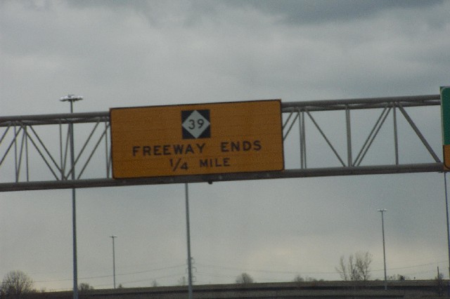
| M-39 FREEWAY ENDS 1/4 MILE overhead warning sign on M-39 South at I-94, Allen Park, Wayne County. Even though the freeway ends at I-94, M-39 continues on as an eight-lane boulevard for another two miles before coming to an end at I-75. | Doug Weasner; 4/2002 |
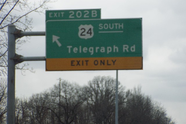
| US 24 SOUTH left-side exit sign on I-94 West, Taylor, Wayne County. The US 24 interchange with I-94 dates back over 50 years, and the design shows. Left exit and entrance ramps are featured on both sides of I-94 at this interchange. The left exit ramps, such as this one, cross the median, and then cross over US 24 on the bridge from the opposing direction, separated from the other roadway by a Jersey barrier. Then, it follows a loop ramp to connect to the corresponding direction on US 24. Plans are for this interchange to be converted into a Single-Point Urban Interchange (SPUI) starting in 2004. More information on this, the Gateway Bridge project, can be found by clicking here. | Doug Weasner; 4/2002 |
Photo Link & Description |
Photographer & Date Taken |
| Keith Butkovich; 7/06/2003 | |
| Keith Butkovich; 6/29/2003 | |
| Keith Butkovich; 5/16/2003 | |
| Keith Butkovich; 5/16/2003 | |
| TO US 37 sign goof on south Karlin Road near County Line Road, Grand Traverse County. This US 37 marker, which should be an M-37 marker, also features a 3 and a 7 of variable sizes! Karlin Road is the road which continues on after south M-137 comes to an end at Interlochen State Park. | Barry Camp; 4/19/2003 |
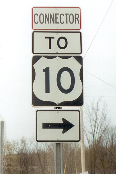
| CONNECTOR TO US 10 shield located near the western terminus of Business US 10 near Reed City, Osceola County. Of note on this sign assembly is that the CONNECTOR plate has a red border around it, which is contrary to the standard black border. Connector US 10 is a two block shortcut between Business US 10 and US 10, whose primary function is to connect west Business US 10 with east US 10. The angle at which west Business US 10 meets US 10 is more beneficial for traffic looking to use west US 10. | Barry Camp; 4/19/2003 |
| ALTERNATE TO I-69 / I-94 shield assembly on south M-25 at Krafft Road, Port Huron, St. Clair County. To help traffic wishing to access M-25 from I-69 or I-94, and vice versa, avoid possible delays in the vicinity of the Blue Water Bridges, a new alternate route was recently designated along a combination of state highways and county roads. Northbound is signed as ALTERNATE TO M-25, while the southbound shields say ALTERNATE TO I-69 / I-94. | Geoff Hatchard; 3/16/2003 |
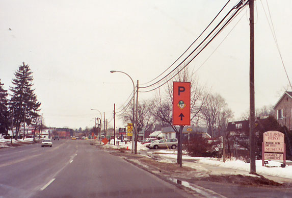
| Example of a special orange sign used in Williamston during the recent reconstruction of M-43 to direct traffic to municipal parking, Ingham County. It has been difficult for traffic to both enter and exit the road during the two years worth of widening and resurfacing. | Geoff Hatchard; 3/13/2003 |
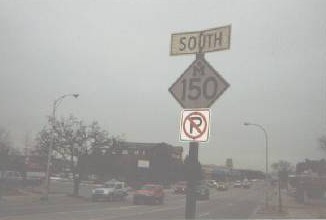
| 1960s SOUTH M-150 cutout shield on south Rochester Road, Rochester, Oakland County. Not only is this forty-some year old cutout M-150 marker still standing on south M-150 as it enters into downtown Rochester, but a new NO PARKING sign has been installed beneath the cutout. | Keith Butkovich; 2/06/2003 |
| US 131 and M-55 shields on the northbound side of the US 131 freeway around Cadillac, just north of Exit 177, Cadillac, Wexford County. This sign assembly is located on the stretch of the US 131 freeway extension that was opened in fall 2000, just north of the southern BUS US 131 interchange. With the opening of this stretch of freeway, M-55 is now routed onto the new US 131, and then follows M-115 to return to its original routing. An interesting note about this sign assembly is that the US 131 and M-55 shields are both freeway-standard size. If this assembly followed the normal M.D.O.T. standard, the US 131 shield would be freeway-standard size, and then the M-55 shield would be a 2-lane standard sized one, mounted below the US 131 marker. | Adrian Leskiw; 10/12/2002 |
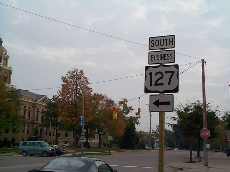
| Concurrent BUS US 127 and BUS US 27 shields on Ithaca BUS US 127, Ithaca, Gratiot County. As the transition from US 27 to US 127 took place in 2002, most shields on the mainline US 127 and its respective business routes from Gratiot County northward were replaced during the summer of that year. But, not all of them. As seen here, of the two shields marking the business route at this intersection, one was replaced and one was not as of October 2002. | Adrian Leskiw; 10/12/2002 |
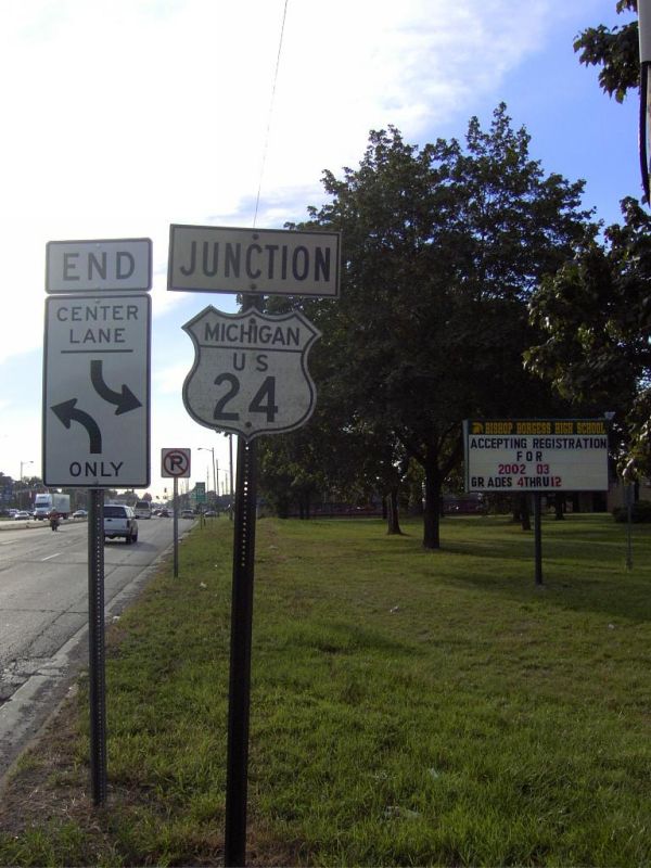
| 1960s JUNCTION US 24 cutout sign assembly on west Plymouth Road (Old M-14), Redford, Wayne County. Some 40 years after this sign was erected, this cutout US 24 shield paired with a JUNCTION tab still stands along the former routing of M-14. | Rich Rowland; 9/25/2002 |
| Remnant M-14 shield on west Plymouth Road (Old M-14), west of US-24, Redford, Wayne County. Although Plymouth Road has not been designated as M-14 since I-96 opened in this area in the mid 1970s, this M-14 marker still stands along Plymouth Road as it enters into Redford from Detroit. Note that Plymouth Road is still maintained by M.D.O.T. today, however. (A side note: Oddly, three new WEST M 14 sign assemblies were erroneously erected west of US 24 on Plymouth Road in May 2002.) | Rich Rowland; 9/25/2002 |
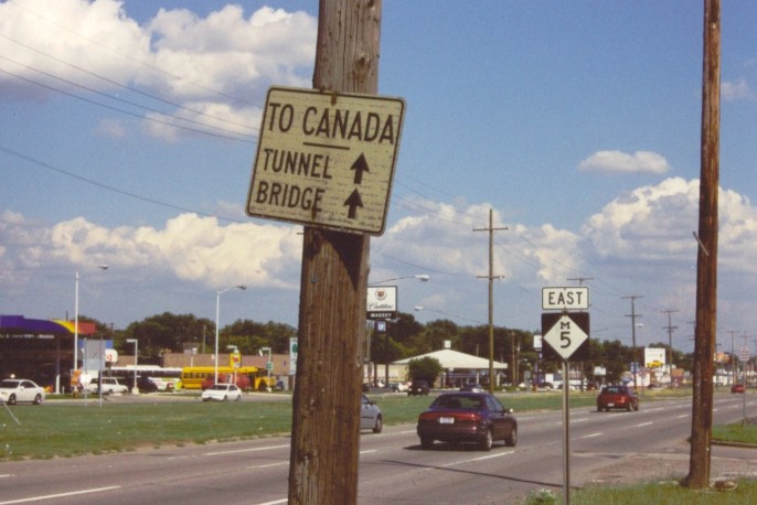
| TO CANADA sign on east M-5, Detroit, Wayne County. This decades-old sign directs traffic toward the Detroit River crossings in downtown Detroit. There are a few more signs like this along eastbound Grand River Avenue as it closes in on downtown. | Dan P.; 7/31/2002 |
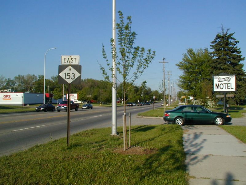
| Wide M-153 shield, Westland, Wayne County. Most 3-digit routes have the route number placed thin on a 2-digit sized shield. This older shield is a rare 3-digit sized one. | Ed Wilson; 5/26/2002 |
| Unusual EAST M-45 trailblazer, Ottawa County. This rather peculiar sign is the first M-45 trailblazer just east of US 31. It appears to be a wooden sign. | Rich Rowland; 5/26/2002 |
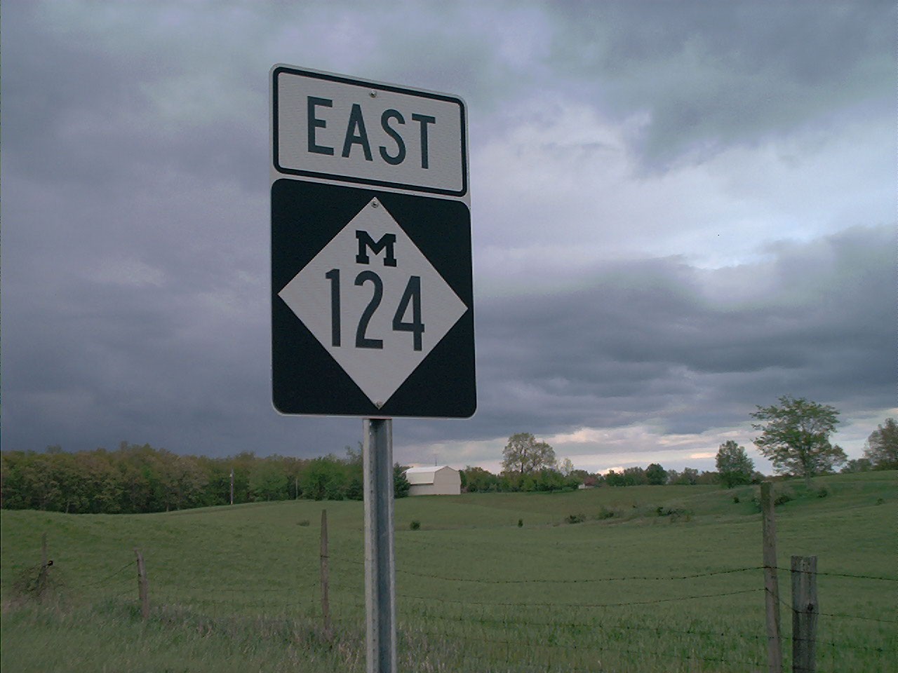
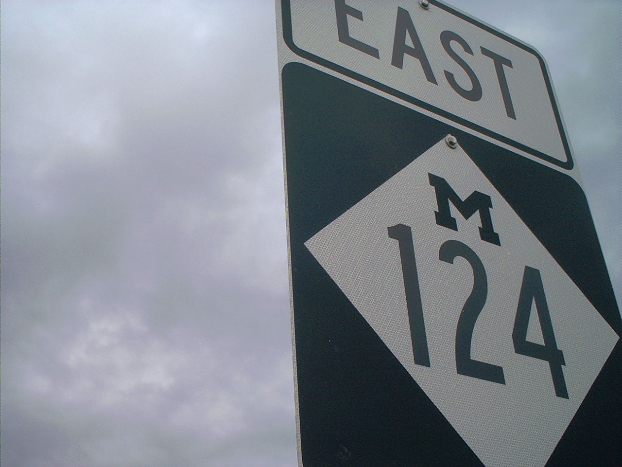
| One-piece EAST M-124 sign assembly, Jackson County.
Normally, there would be separate EAST and M-124 signs. Here, a single sign
does the work of two. 1) Wide view of the front of the sign. 2) Close up view of the front of the sign. 3) Close up view of the back of the sign. |
Michael Swope; 5/18/2002 |
Photo Link & Description |
Photographer & Date Taken |
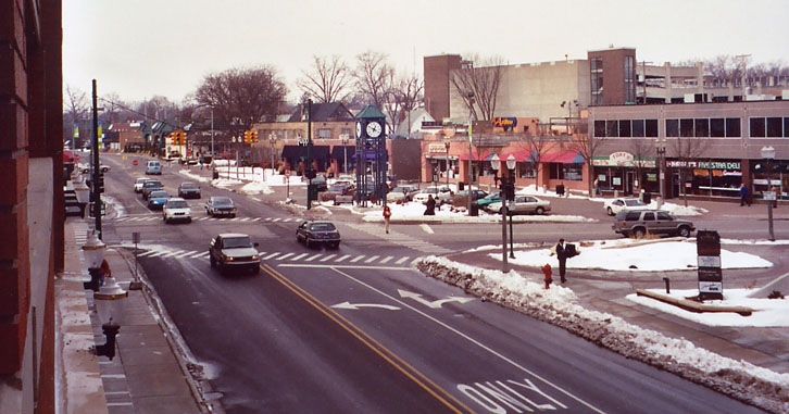
| Scene of downtown East Lansing, looking west down Albert Street from a new parking garage at the M.A.C. Avenue intersection, Ingham County. This location is one block north of the Michigan State University campus. | Geoff Hatchard; 3/13/2003 |
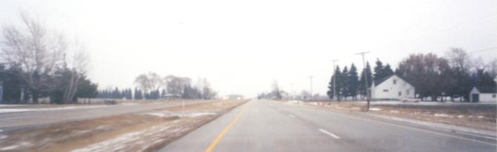
| View of M-15, looking south from just south of the junction with M-138, Bay County. This is a rare scene for Michigan: a four-lane divided highway in a rural setting that is not a freeway. | Geoff Hatchard; 1/08/2003 |
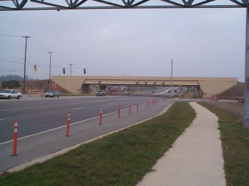
| Perspective of Michigan's first SPUI, located on the future M-6 freeway, from northbound Kalamazoo Avenue, Kent County. A SPUI, which stands for "single-point urban interchange", refers to an interchange where all ramps meet at a single point, with a single traffic signal. The first such interchange in the state of Michigan is at the Kalamazoo Avenue interchange off of the future M-6 freeway, south of Grand Rapids. This photo shows the southern approach to the interchange. Also of note are the dual bridges that will carry M-6 over Kalamazoo Avenue: these, and all of the other bridges along the M-6 corridor, are unique in design for the state of Michigan. | Adrian Leskiw; 10/12/2002 |
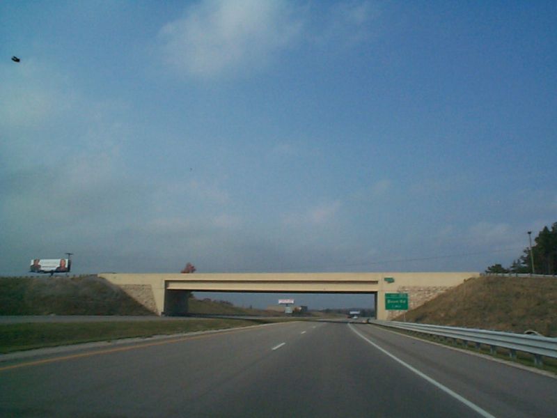
| Single-span bridge over US 131 freeway east of Cadillac with unique abutment, Cadillac, Wexford County. This overpass is not only unusual in that it is a single-span bridge over a freeway with a grassy median, but it has a very unique abutment design, as well as a few other bridges that cross over US 131 east of Cadillac. The abutments contain rock in addition to concrete. | Adrian Leskiw; 10/12/2002 |
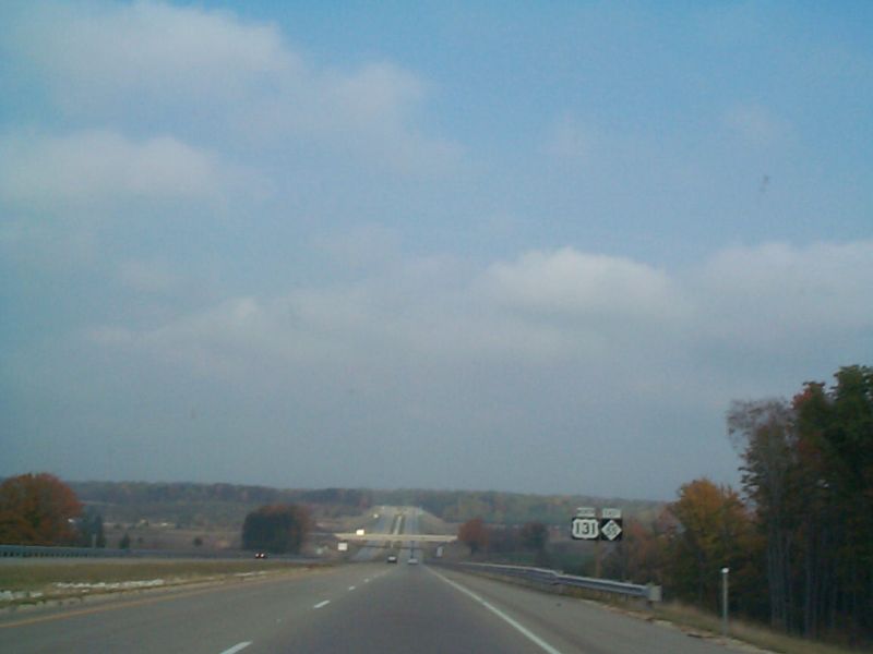
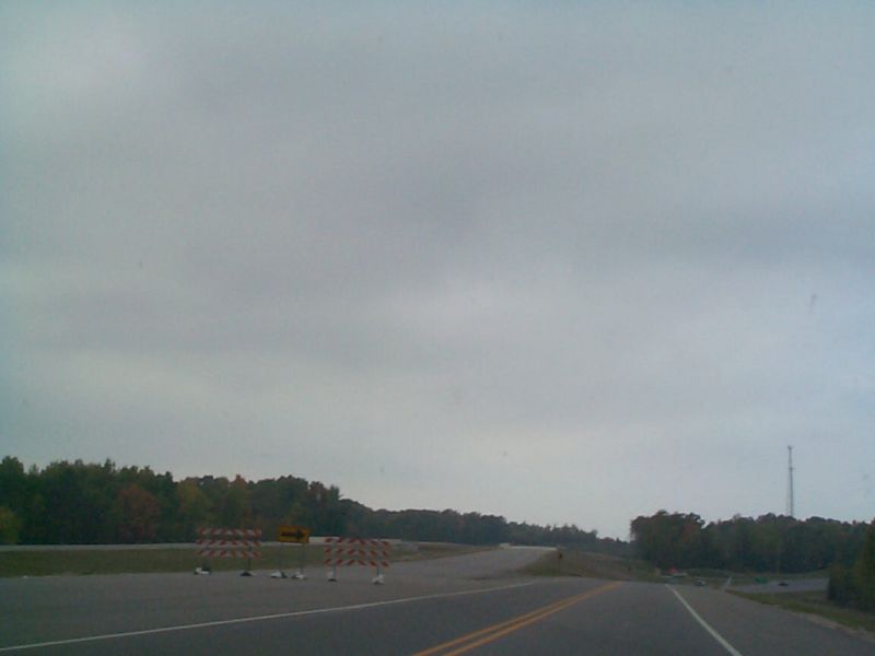
| Current northern end of US 131 freeway, Wexford County. At approximately milepost 187, 4 miles south of Manton, is the current northern end of the US 131 freeway, where US 131 curves back into its original alignment. Old US 131 now meets the current US 131 at a blinker that can barely be seen on the right side of this photo. The overpasses on the left side will carry the next part of the freeway extension over Old US 131. However, there will not be an interchange at this point; the next interchange to the north will be for M-42 in Manton. (See the next listing for a photo of this future interchange.) | Adrian Leskiw; 10/12/2002 |
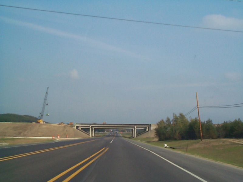
| View of overpasses being constructed for future US 131 freeway over M-42, Manton, Wexford County. This is part of the next phase of the US 131 freeway northern extension, north of Cadillac. This future interchange with M-42, just east of Manton, looks to be a four-ramp partial cloverleaf (parclo) interchange, with all ramps on the north side of the interchange. | Adrian Leskiw; 10/12/2002 |
| Autumnal view of south US 127 between Houghton Lake and Harrison, Roscommon County. | Adrian Leskiw; 10/12/2002 |
| Edward Vielmetti; 8/2002 |
Links
| Subscribe to Great Lakes Roads | |
| Powered by groups.yahoo.com | |
© 2002-03, Dan Garnell
Page Created: October 27, 2002
Last Updated: September 23, 2003
![]()
![]()
