
Welcome | Generally | The Beaches
In this web site, you will find useful information
about Ayia Napa in general and its Beaches.
This is the map of Cyprus. Ayia Napa is on the bottom right side.
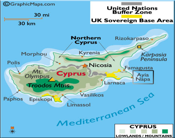
The Yellow area is British Military Bases. They've been here since way back before the Turkish invasion in 1974.
The dark grey line along the middle is the border line. This is guarded by the Military and the United Nations forces. The border is open , on specific spots, for access in and out, as a "friendly" measure to finding a solution between the 2 sides.
Are you coming to Ayia Napa? Or have you been here already? Well, you might find this useful. Where ever you will be staying, you will be wondering where the beaches are, what they look like, what they have, how to get there and what you will need. I put here the most important info which I hope will give what you need to know to make things easy and simple. First, have a look at the picture below and then click on the links to see one by one.
Ayia Napa city and the coast, with the Beaches, from left to right:
The Dome, Makronissos, Landa, Nissi, Sundy Bay, Pernera, Katsarka, Pantahoo, Kampouri and Kermia Beach.
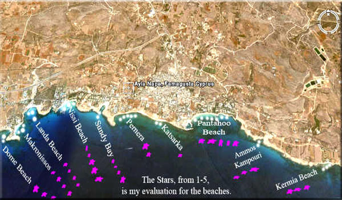
Ayia Napa is on the side of a hill, looking downwards to the beautiful blue Mediterranean Sea.
On the center of the picture, its the town and the main Beaches along the coast.
Here you will find info about all the beaches of this area. Just click on The Beaches link here or above
and start checking them out one by one. It will help you to have a general idea about things.
For details about every beach click HERE.
Ayia Napa

Welcome | Generally | The Beaches
