Abington-Ayer
Okay; lets get started
ABINGTON 02351
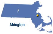
County: Plymouth
Population: 14,605
Size (sq.mi): 10 (306th)
Density: 1,465 (73rd)
Crime Rate (1998): 25
Crime Rate (1999): 22.5 (105th)
MCC: Larcenies
Town Type: Residential
Land Setting: Suburban/Rural
Metro Center: Brockton
Land distribution: How much space do certain property types take up?
Residential (Where people live): 84.42%
Commercial (Stores, offices, etc): 4.2%
Industrial (Factories, shipping, etc): 1.4%
Vacant Land (Empty land): 8.1%
Public Housing Units: State: 112, Federal: none
GETTING AROUND
How do you get here?
Routes 18, 123, & 139
Public Transit
Rail: yes
Bus: yes
Local Rail: no
Local Bus: no
Paratransit: yes
Abington has one MBTA commuter rail stop (Abington: zone 4) on the Plymouth/Kingston line, from South Station. There's also that Dial-a-bat paratransit bus and Carey's Bus Lines, a commuter bus that provides service from Abington & N. Abington to Boston. So basically, you need a car here.
Miles of public roads: 56
Distance from Metro Center: 4 mi E
Distance from Boston: 19 mi SE
Who lives here?
97% of the population is white and 26% of the population is under 18.
Average single family property value: $192,792 (132nd)
Residential tax rate (as of 2000): $16.05 (101st)
(.23%) of Massachusetts residents live in Abington.
How was it like back then?
Abington was a part of Bridgewater from 1712 until 1727. Since then, it gave up some of its land to the town of Hanover and until 1874, it was known as Rockland. In 1875, it changed its name to S. Abington, then later Abington.
Personal: It's kinda boring here. The highlight is Wal-mart, and I heard of some good restaurants & shops along route 18. There are also lots of elderly people here too.
------------------------------------------------------
ACTON 01718-20

County: Middlesex
Population: 20,331
Size (sq.mi): 20 (186th)
Density: 1,014 (105th)
Crime Rate (1998): 13.5
Crime Rate (1999): 9.5 (217th)
MCC: Larcenies
Hood Rating(0-10): 0
Town Type: Residential
Land Setting: Suburban/Rural
Metro Center: Lowell
Land distribution: How much space do certain property types take up?
Residential (Where people live): 84.84%
Commercial (Stores, offices, etc): 4.5%
Industrial (Factories, shipping, etc): 1.2%
Vacant Land (Empty land): 8.1%
Public Housing Units: State: 142, Federal: none
GETTING AROUND
How do you get here?
Routes 2, 2A, 27, and 111
Public Transit
Rail: yes
Bus: yes
Local Rail: no
Local Bus: no
Paratransit: yes
Acton has one MBTA commuter rail stop (So. Acton: zone 6) on the Fitchburg line, from North Station. There's also the LRTA road runner and Council on aging paratransit buses and Yankee Bus Lines, a commuter bus that provides limited service to Boston. So basically, if you live here, you need a car.
Miles of public roads: 101
Distance from metro center: 13 mi SW
Distance from Boston: 25 mi NW
Who lives here?
88% of the population is white and 29% of the population is under 18.
Average single-family property value: $331,310(36th)
Residential tax rate (as of 2000): $16.33 (89th)
(.32%) of Massachusetts residents live in Acton.
How was it like back then?
Acton was a part of Concord from 1735 until 1780. Since then, it gave up some of its land to the towns of Carlisle in 1780 and Boxborough in 1783.
Acton is rich in history.
Acton has a good public school system.
Personal: N/A Never been here
-------------------------------------------------------
ACUSHNET 02743 & 45
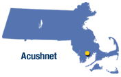
County: Bristol
Population: 10,161
Size (sq.mi): 18 (205th)
Density: 565 (165th)
Crime Rate (1998): 32
Crime Rate (1999): 25.5 (86th)
MCC: Aggravated Assaults
Hood Rating(0-10): 0
Town Type: Residential
Land Setting: Suburban/Rural
Metro Center: New Bedford
GETTING AROUND
How do you get here?
I-195 and US 6
Public Transit
Rail: no
Bus: yes
Local Rail: no
Local Bus: yes
Paratransit: yes
Acushnet has one bus route (12 Acushnet/Sassaquin) from the SRTA (Southeastern [MA] Regional Transit Authority) based in New Bedford. SRTA and Council on Aging also provide paratransit. So basically, having a car here is a good idea.
Miles of public roads: 48
Distance from Metro Center: 4 mi E
Distance from Boston: 51 mi S
Who lives here?
97% of the population is white and 23% of the population is under 18.
Average single family property value: $141,979 (223rd)
Residential tax rate (as of 2000): $12.98 (246th)
(.16%) of Massachusetts residents live in Acushnet
How was it like back then?
Acushnet was a part of Fairhaven until 1860. In 1875, it gave up a large part of its land to what is now New Bedford.
Personal: N/A
-------------------------------------------------------
ADAMS 01220

County: Berkshire
Population: 8,809
Size (sq.mi): 23 (137th)
Density: 383 (199th)
Crime Rate (1998): 25.5
Crime Rate (1999): 24 (91st)
MCC: Larcenies
Hood Rating(0-10): 0
Town Type: Residential
Land Setting: Suburban/Rural
Metro Center: North Adams
GETTING AROUND
How do you get here?
US 8
Public Transit
Rail: no
Bus: yes
Local Rail: no
Local Bus: yes
Paratransit: yes
Adams has one bus route (1 Pittsfield-No. Adams) off the BRTA (Berkshire Regional Transit Authority). BRTA also gives paratransit. So basically, having a car here is still a good idea.
Miles of public roads: 53
Distance from Metro Center: 6 mi S
Distance from Boston: 133 mi NW
Who lives here?
98% of the population is white and 22% of the population is under 18.
Average single family property value: $86,949 -cheap!-(333rd). Adams has the 8th cheapest single-family property value in the state, out of 340 towns who released that information (instead of 351 towns)
Residential tax rate (as of 2000): $17.56 (47th)
(.14%) of Massachusetts residents live in Adams.
How was it like back then?
In 1778, there was a town named East Hoosac, which changed its name to Adams. In 1793, Adams gave up part of its land to what is now Cheshire and in 1878 it gave up more land to form North Adams.
Personal: N/A
-------------------------------------------------------
AGAWAM 01101
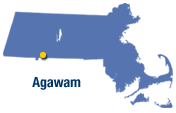
County: Hampden
Population: 28,144
Size (sq.mi): 23 (134th)
Density: 1,205 (85th)
Crime Rate (1998): 33
Crime Rate (1999): 30.5 (59th)
MCC: Larcenies
Hood Rating(0-10): 0
Town Type: Residential
Land Setting: Suburban/Rural
Metro Center: Springfield
GETTING AROUND
How do you get here?
Routes 75, 187 and US 57.
Public Transit
Rail: no
Bus: yes
Local Rail: no
Local Bus: no
Paratransit: yes
Agawam can be reached by transit bus (14 Feeding Hills/Agawam) off the PVTA (Pioneer Valley Transit Authority). It is also served by Peter Pan.
Miles of public roads: 90
Distance from Metro Center: 4 mi S
Distance from Boston: 94 mi SW
Distance from Hartford, CT: 21 mi N
Who lives here?
96% of the population is white and 22% of the population is under 18.
Average single family property value: $122,919 (269th)
Residential tax rate (as of 2000): $15.17 (149th)
(.44%) of Massachusetts residents live in Agawam.
How was it like back then?
Agawam came from W. Springfield in 1855.
Personal: This is a peaceful place and a majority of the people are nice. Six Flags is holdin it down too!!!
------------------------------------------------------
ALFORD 01266
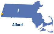
County: Berkshire
Population: 399
Size (sq.mi): 11.6 (292nd)
Density: 34 (326th)
Crime Rate (1998): 0
Crime Rate (1999): 0. Alford is among the lowest in crime rates for the state.
MCC: None
Hood Rating(0-10): 0
Town Type: Residential
Land Setting: Rural
Metro Center: Great Barrington
GETTING AROUND
How do you get here?
Route 71
Public Transit
Rail: no
Bus: no
Local Rail: no
Local Bus: no
Paratransit: no
Alford has no public transit; there's not even a gas station here (literally). You definitely need a car to live here unles you got a horse or donkey or something
Miles of public roads: 17.5
Distance from Metro Center: 4 mi NW
Distance from Boston: 140 mi W
Who lives here? (Nobody!)
99% of the population is white and 21% of the population is under 18.
Average single family property value: $269,412(63rd)
Residential tax rate (as of 2000): $7.74 (334th)
(.01%) of Massachusetts residents live in Alford.
How was it like back then?
In 1773, Great Barrington gave up land to what is now Alford. Alford then lost some of its land back to Great Barrington in 1779 and 1819 and it also gave up land to what is now West Stockbridge in 1847.
Personal: N/A
------------------------------------------------------
AMESBURY 01913
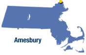
County: Essex
Population: 16,450
Size (sq.mi): 12.65 (280th)
Density: 1,300 (81st)
Crime Rate (1998): 16
Crime Rate (1999): 17.5 (138th)
MCC: Larcenies
Hood Rating(0-10): 0
Town Type: Residential
Land Setting: Suburban/Rural
Metro Center: Haverhill
Land distribution: How much space do certain property types take up?
Residential (Where people live): 83.5%
Commercial (Stores, offices, etc): 4%
Industrial (Factories, shipping, etc): 2%
Vacant Land (Empty land): 7.3%
Public Housing Units: State: 263, Federal: none
GETTING AROUND
How do you get here?
Routes 110, 150, I-95, I-495
Public Transit
Rail: no
Bus: yes
Local Rail: no
Local Bus: yes
Paratransit: yes
Amesbury is served by the #51 bus (Haverhill-Newburyport) off the MVRTA. If you live near Market Square (Amesbury Center) then your pretty much fine with the bus, at least until around 6pm.
Miles of public roads: 61
Distance from Metro Center: 11 mi NE
Distance from Boston: 43 mi N
Who lives here?
97% of the population is white and 26% of the population is under 18.
Average single family property value: $190,592(138th)
Residential tax rate (as of 2000): $18.28 (27th)
(.26%) of Massachusetts residents live in Amesbury.
How was it like back then?
Amesbury came from a part of Salisbury in 1668 It then took some more land from Salisbury in 1844 and also gave up some of its land to what is now Merrimac in 1876. It 1886 it took some more land from Salisbury.
Personal: N/A
-------------------------------------------------------
AMHERST 01002
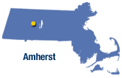
County: Hampshire
Population: 34,874
Size (sq.mi): 28 (91st)
Density: 1,259 (83rd)
Crime Rate (1998): 14.6
Crime Rate (1999): 10 (209th)
MCC: Larcenies
Town Type: College Town
Land Setting: Urban/Suburban/Rural
Metro Center: Springfield
Land distribution: How much space do certain property types take up?
Residential (Where people live): 79%
Commercial (Stores, offices, etc): 5%
Industrial (Factories, shipping, etc): 0.5%
Vacant Land (Empty land): 12.62%
Public Housing Units: State: 179, Federal: 15
GETTING AROUND
How do you get here?
Routes 9 and 116
Public Transit
Rail: yes
Bus: yes
Local Rail: no
Local Bus: yes
Paratransit: yes
Amherst can be reached by several bus lines off the PVTA. These include:
B34 UMASS Northbound Campus Shuttle
B35 UMASS Southbound Campus Shuttle
B37 Amity Shuttle/UMASS
B43 Northampton/UMASS via Hampshire Mall
G32 West St/Bay Road/UMASS
G33 Pine St/Mill Hollow/UMASS
G36 Gatehouse Rd/UMASS
G45 Belchertown Center/UMASS
G46 South Deerfield/UMASS
M40 Minuteman Express
G30 North Amherst/Belchertown Road
O38 Mt. Holyoke College/Hampshire College/UMASS
P31 Sunderland/South Amherst
 Click here for the official PVTA site.
Miles of public roads: 96
Distance from Metro Center: 23 mi N
Distance from Boston: 86 mi W
Who lives here?
79% of the population is white and 13% of the population is under 18.
Average single family property value: $183,624 (151st)
Residential tax rate (as of 2000): $19.66 (12th)
(.55%) of Massachusetts residents live in Amherst.
How was it like back then
Until 1759, what is now Amherst was the 3rd precinct of Hadley. Up until 1814, Amherst was growing, but feeding off of Hadley's land. The two towns then exchanged land in that same year.
Amherst has 3 colleges and 5 historic districts.
Colleges: Amherst College, Hampshire College and UMASS Amherst
Historic Districts: Amherst Central, Dickinson, East Village, North Amherst, and Westside.
Personal: N/A
-------------------------------------------------------
ANDOVER 01810
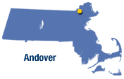
County: Essex
Population: 31,247
Size (sq.mi): 31 (76th)
Density: 1,005 (107th)
Crime Rate (1998): 19
Crime Rate (1999): 16.5 (152nd)
MCC: Larcenies
Hood Rating(0-10): 0
Town Type: Residential
Land Setting: Suburban (and some Rural, I guess)
Metro Center: Lawrence
Land distribution: How much space does certain property types take up?
Residential (Where people live): 88.45%
Commercial (Stores, offices, etc): 2.26%
Industrial (Factories, shipping, etc): 1.3%
Vacant Land (Empty land): 5.34%
Public Housing Units: State: 282, Federal: none
GETTING AROUND
How do you get here?
Routes 125 and 133. Also, I-95 & I-495
Public Transit
Rail: yes
Bus: yes
Local Rail: sort of
Local Bus: yes
Paratransit: yes
Andover has two commuter rail stops; (Zone 5: Andover) and (Zone 4: Ballardvale). Service times are pretty decent, for a commuter rail line, and you can go between North Station and Haverhill. Andover is also served by several routes off the MVRTA (Merrimack Valley Regional blah blah blah...)
21 Andover Shuttle
32 Andover
37 Beacon St
General hours of service are about around 5:45am to about 6:30pm. So if you're a daytime person and you live close to the railroad, then a car isn't really that necessary here. There used to be a commuter bus too, in addition to the commuter rail to Boston but I heard that they cancelled that service because one of the drivers were drunk and were swervin in and out of lanes on the highway.
Miles of public roads: 178.5
Distance from Metro Center: 4 mi S
Distance from Boston: 22 mi N
Who lives here?
91% of the population is white and 28% of the population is under 18.
Average single family property value: $316,470(38th)
Residential tax rate (as of 2000): $14.92 (161st)
(.49%) of Massachusetts residents live in Andover.
How was it like back then?
People came to what is now Andover in 1646. The land that it sits on was known as Middleton (1728), Lawrence (1847), and North Andover (1855). Then in 1879, Andover gave up a chunk of land to Lawrence and in 1903 exchanged some land with Tewksbury.
Andover has two famous private schools (Phillips Academy and Pike) but those just add to their public school system which is supposed to be one of the best. Also, this boring place is home to high-tech industries.
Andover also has 5 historic districts: Andover Village Industrial, Ballardvale, Central St, Main St-Locke St, and Shawsheen Village.
Personal: This is one of those preppy-suburb towns; one white dude even made rap song about it--I forgot his name though. It was called "Andover Hospitality" (edit of Southern Hospitality by Ludacris). I never talked to anyone from Andover, so I wouldn't know how people are around here but the landscape looks pretty nice.
-------------------------------------------------------
AQUINNAH (GAY HEAD) 02535
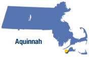
County: Dukes
Population: 344
Size (sq.mi): 6 (331st)
Density: 57 (306th)
Crime Rate (1998):
Crime Rate (1999): Not available. It's not like anything happens here anyway...
MCC: None
Town Type: Residential
Land Setting: Residential peninsula with beaches
Metro Center: Edgartown
Land distribution: How much space do certain property types take up?
Residential (Where people live): 43.5%
Commercial (Stores, offices, etc): 1.4%
Industrial (Factories, shipping, etc): None
Vacant Land (Empty land): 54%
Public Housing Units: State: None, Federal: None
GETTING AROUND
How do you get here?
State Road and the Edgartown-West Tisbury Road. This town is NOT on Massachusetts' main land so YES, you do need to take a ferry here.
Public Transit
Rail: no
Bus: no
Local Rail: no
Local Bus: no
Paratransit: yes
Aquinnah is served by the MVTA (Martha's Vineyard Transit Auth) but only with paratransit. Taxi's also play a big mass transit role. You make the choice... With only 8 miles of road here, who really needs a car when you got the taxi?
Miles of public roads: 8
Distance from Metro Center: 14 mi W
Distance from Boston: 80 mi S
Who lives here?
53% of the population is white and 36% of the population is American Indian.
Average single family property value: $392,792(19th)
Residential tax rate (as of 2000): $6.38 (342nd) Aquinnah has the 10th cheapest residential tax rate in the state
(>.01%) of Massachusetts residents live in Aquinnah.
How was it like back then?
This town exchanged land with Chilmark in 1855 and was incorporated in 1870 as Gay Head. In the mid-1990s, residents voted to have the name changed to Aquinnah. (I don't blame them...)
This is the only community in Massachusetts to have a significant Indian prescence in the 20th century.
Personal: N/A
------------------------------------------------------
ARLINGTON 02474 & 76

County: Middlesex
Population: 42,389
Size (sq.mi): 5.2 (336th)
Density: 8,183 (11th) Arlington is the state's 11th most crowded place.
Crime Rate (1998): 10
Crime Rate (1999): 10 (214th)
MCC: Larcenies
Town Type: Residential
Land Setting: Metro Suburb
Metro Center: Cambridge
Land distribution: How much space do certain property types take up?
Residential (Where people live): 94%
Commercial (Stores, offices, etc): 3%
Industrial (Factories, shipping, etc): (.13%)
Vacant Land (Empty land): 2.8%
Public Housing Units: State: 711, Federal: none
GETTING AROUND
How do you get here?
Routes 2, 2A, 16, 60, and US 3,
Public Transit
Rail: no, but see below
Bus: yes
Local Rail: no, but see below
Local Bus: yes
Paratransit: yes
Arlington is served by several routes off the MBTA:
62 ALEWIFE to Bedford V.A. Hospital via Lexington Ctr and Arlington Heights
67 ALEWIFE to Turkey Hill via Arligton Center
76 ALEWIFE to Hanscom/Lincoln Labs via Arlington Center
77 HARVARD to Arlington Heights via Mass Ave
78 HARVARD to Arlmont Village via Park Circle
79 ALEWIFE to Arlington Heights via Mass Ave
80 LECHMERE to Arlington Center via Medford Hillside
84 ALEWIFE to Arlmont Village
87 LECHMERE to Clarendon Hill or Arlington Center via Somerville Ave
350 ALEWIFE to North Burlington via Burl. Mall
351 ALEWIFE to Oak Park via Middlesex Turnpike
Arlington has no direct rail service but some of the towns around it do. The letters in caps above are subway stations, also bus terminals. Arliington area is also served by (Zone 1: Belmont) off the Fitchburg/So. Acton line and (Zone 1B: West Medford) off the Lowell line. With all the subway, bus, and rail options, you don't need a car here.
Miles of public roads: 56
Distance from Metro Center: 2 mi W--It's the next town over
Distance from Boston: 6 mi W
Who lives here?
90% of the population is white and 18% of the population is under 18.
Average single family property value: $298,413 (48th)
Residential tax rate (as of 2000): $13.17 (235th)
(.67%) of Massachusetts residents live in Arlington.
How was it like back then?
Since 1867, Arlington's original name was West Cambridge. Then in 1911, it exchanged land with Cambridge and changed it's name to Arlington. Dr. George Franklin was born here. He invented the golf tee.
This town has 3 historic districts: Arlington Center, Kensington Park, and Orvis Road.
Personal: This town is alright; it's one of those "just outside the city" towns. Mass Ave is the main road lined with businesses. The people here are really nice too and in some areas, you can even leave your door unlocked.
------------------------------------------------------
ASHBURNHAM 01430
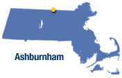
County: Worcester
Population: 5,546
Size (sq.mi): 39 (34th)
Density: 142 (270th)
Crime Rate (1998): 8.5
Crime Rate (1999): 20 (124th)
MCC: Burglaries
Town Type: Residential
Land Setting: Rural, I guess. With only 142 people per square mile, what would you expect?
Metro Center: Fitchburg-Leominster
Land distribution: How much space do certain property types take up?
Residential (Where people live): 62.6%
Commercial (Stores, offices, etc): 1.2%
Industrial (Factories, shipping, etc): (0.7%)
Vacant Land (Empty land): 32%
Public Housing Units: State: Don't know, Federal: none
GETTING AROUND
How do you get here?
Routes 12, 101, and 119
Public Transit
Rail: no
Bus: no
Local Rail: no
Local Bus: no
Paratransit: yes
Ashburnham has paratransit from the MRTA (Montachusett Regional Transit Authority) and thats it. Yes, you do need a car here.
Miles of public roads: 71.5
Distance from Metro Center: (Fitchburg: 9 mi N) and (Leominster: 12 mi NW)
Distance from Boston: 55 mi NW
Who lives here?
97% of the population is white and 29% of the population is under 18.
Average single family property value: $112,002 (293rd)
Residential tax rate (as of 2000): $18.31 (35th)
(.09%) of Massachusetts residents live in Ashburnham.
How was it like back then?
From 1765-67, Ashburnham was Dorch. Canada. In 1767, it was known as Ashby. 1785: Gave land to Gardner, 1792: Gave land to Ashby, 1815: Took land from Gardner, and in 1824 it took land from Westminster.
Personal: N/A-- I never even heard of this place
------------------------------------------------------
ASHBY 01431

County: Middlesex
Population: 2,845
Size (sq.mi): 23.5 (21st)
Density: 120 (276th)
Crime Rate (1998): 6
Crime Rate (1999): 10 (210th)
MCC: Burglaries
Town Type: Residential
Land Setting: Rural
Metro Center: Fitchburg-Leominster
Land distribution: How much space do certain property types take up?
Residential (Where people live): 66%
Commercial (Stores, offices, etc): 1.4%
Industrial (Factories, shipping, etc): (0.3%)
Vacant Land (Empty land): 27%
Public Housing Units: State: none, Federal: none
GETTING AROUND
How do you get here?
Routes 31 and 119
Public Transit
Rail: no
Bus: no
Local Rail: no
Local Bus: no
Paratransit: no
Yes you do need a car here, unless you have a donkey or a horse or something. Commuter Rail service to Boston is in nearby Fitchburg.
Miles of public roads: 51
Distance from Metro Center: (Fitchburg: 8 mi N) and (Leominster: 13 mi N)
Distance from Boston: 49 mi NW
Who lives here?
98% of the population is white and 28% of the population is under 18.
Average single family property value: $136,050 (233rd)
Residential tax rate (as of 2000): $17.17 (58th)
(.04%) of Massachusetts residents live in Ashby.
How was it like back then?
Ashby came from Ashburnham in 1767, formed by portions of Fitchburg and Townsend. More land was given in 1792 from Ashburnham and in 1829 from Fitchburg.
Personal: N/A
------------------------------------------------------
ASHFIELD 01330
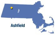
County: Franklin
Population: 1,800
Size (sq.mi): 40.3 (33rd)
Density: 45 (312th)
Crime Rate (1998): 4
Crime Rate (1999): 3.5 (262nd) Ashfield has the 8th lowest crime rate in the state, for towns that have a recorded crime rate (270)
MCC: Larcenies
Town Type: Farming community
Land Setting: Rural
Metro Center: Greenfield
Land distribution: How much space do certain property types take up?
Residential (Where people live): 47.6%
Commercial (Stores, offices, etc): 2.4%
Industrial (Factories, shipping, etc): 1.7%
Vacant Land (Empty land): 27%
Public Housing Units: State: none, Federal: none
GETTING AROUND
How do you get here?
Routes 112 and 116
Public Transit
Rail: no
Bus: no
Local Rail: no
Local Bus: no
Paratransit: yes, but limited
Limited paratransit is provided by the FRTA (Franklin Regional Transit Authority) through the Shelburne Council on Aging. Yes, you do need a car here.
Miles of public roads: 71
Distance from Metro Center: 20 mi S
Distance from Boston: 109 mi W
Who lives here?
97% of the population is white and 24% of the population is under 18.
Average single family property value: $137,774 (230th)
Residential tax rate (as of 2000): $15.90 (110th)
(.03%) of Massachusetts residents live in Ashfield.
How was it like back then?
In 1765, Huntstown changed its name to Ashfield.
Personal: N/A
------------------------------------------------------
ASHLAND 01721
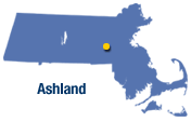
County: Middlesex
Population: 14,674
Size (sq.mi): 12.5 (284th)
Density: 1,182 (88th)
Crime Rate (1998): 6.5
Crime Rate (1999): 8 (237th)
MCC: Larcenies
Town Type: Residential
Land Setting: Suburban
Metro Center: Framingham
Land distribution: How much space do certain property types take up?
Residential (Where people live): 83.5%
Commercial (Stores, offices, etc): 3%
Industrial (Factories, shipping, etc): 2%
Vacant Land (Empty land): 10%
Public Housing Units: State: 40, Federal: none
GETTING AROUND
How do you get here?
Routes 126 and 135.
Public Transit
Rail: no, but see below
Bus: yes
Local Rail: no
Local Bus: yes
Paratransit: yes
Ashland doesn't have it's own Commuter Rail station, but the closest one is in nearby Framingham. You can get to Ashland by 2 routes off the LIFT (Local Inter-Framingham Transit).
Lift 5: FRAMINGHAM to Ashland & Hopkinton
Lift 6: FRAMINGHAM to Milford via Ashland & Holliston
So if you live closeby routes 126 or 135, you don't really need a car that bad, with the hourly bus service; unless you're impatient, always running late, and/or travel often at night.
Miles of public roads: 63
Distance from Metro Center: 3 mi SW
Distance from Boston: 22 mi W
Who lives here?
91% of the population is white and 25% of the population is under 18.
Average single family property value: $225,719 (88th)
Residential tax rate (as of 2000): $16.07 (100th)
(.23%) of Massachusetts residents live in Ashland.
How was it like back then?
In 1846, Ashland was known as Unionville and was part of Hopkinton. It then took land from Framingham and Holliston in that same year, and separated from Hopkinton in 1853.
The Boston Marathon passes through here.
Personal: This town is kinda on the boring side. It's one of those "just outside the city" type of towns. It's not bad though and the people are cool
------------------------------------------------------
ATHOL 01331 & 68

Nickname: Tool Town (it's a manufacturing center)
County: Worcester
Population: 11,300
Size (sq.mi): 32 (68th)
Density: 349 (208th)
Crime Rate (1998): 38
Crime Rate (1999): 38 (37th)
MCC: Aggravated Assaults
Town Type: Residential, Industrial
Land Setting: Urban/Suburban/Rural
Metro Center: Fitchburg
Land distribution: How much space do certain property types take up?
Residential (Where people live): 72.84%
Commercial (Stores, offices, etc): 4.6%
Industrial (Factories, shipping, etc): 1.4%
Vacant Land (Empty land): 18%
Public Housing Units: State: 93, Federal: none
GETTING AROUND
How do you get here?
Routes 2, 2A, 32, and US 202.
Public Transit
Rail: no
Bus: no
Local Rail: no
Local Bus: no
Paratransit: yes
You guessed right! Of course you'd need a car here, unless you're eligible for paratransit provided by the FRTA (Franklin-Montague Transit Authority).
Miles of public roads: 96.5
Distance from Metro Center: 25 mi W
Distance from Boston: 72 mi NW
Who lives here?
96% of the population is white and 25% of the population is under 18.
Average single family property value: $86,230 (335th)
Athol has the 6th cheapest single-family property value in the state, out of 340 towns who released that information (instead of 351 towns)
Residential tax rate (as of 2000): $15.63 (124th)
(.18%) of Massachusetts residents live in Athol.
How was it like back then?
In 1762, Athol was once known as Payquage. Then, in 1783, 1786, 1799, and 1803, Parts of Athol were turned into the smaller towns of Orange, Gerry, and Royalston x2 (respectively). Then, in 1806, 1816, 1830, and 1837, Gerry, Orange, and New Salem x2 separated from Athol (respectively).
Athol has its own daily newspaper.
Personal: N/A -- What kind of name is "Athol"?
------------------------------------------------------
ATTLEBORO 02703
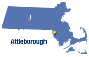
County: Bristol
Population: 42,068
Size (sq.mi): 27.5 (93rd)
Density: 1,529 (69th)
Crime Rate (1998): 35
Crime Rate (1999): 32 (50th)
MCC: Larcenies
Town Type: Residential, Industrial
Land Setting: Urban/Suburban
Metro Center: Providence, RI
Land distribution: How much space do certain property types take up?
Residential (Where people live): 82.9%
Commercial (Stores, offices, etc): 3.5%
Industrial (Factories, shipping, etc): 1.5%
Vacant Land (Empty land): 10%
Public Housing Units: State: 443, Federal: none
GETTING AROUND
How do you get here?
Routes 1A, 118, 123, 152, US 1, I-95, and I-295
Public Transit
Rail: yes
Bus: yes
Local Rail: sort of
Local Bus: yes
Paratransit: yes
Attleboro has 2 Commuter Rail stops, (Zone 7: Attleboro) and (Zone 7: So. Attleboro), off the Attleboro/Stoughton Line from South Station, with limited Providence service. Attleboro is also a member of the GATRA (Greater Attleboro & Taunton blah blah blah) and has a number of buses:
10 ATTLEBORO - So. Attleboro via No. Attleboro
12 ATTLEBORO - So. Attleboro
14 Briggs Corner - Plainville via ATTLEBORO
16 Seekonk - Plainville via ATTLEBORO
18 ATTLEBORO - Taunton via Norton
And yes, they do paratransit here too. General Attleboro buses run from about 5:30am to 6:30pm. So a car isn't all that necessary here, unless you travel late at night or are heading to the nearby Wrentham Outlet Mall.
Miles of public roads: 184
Distance from Metro Center: 12 mi N
Distance from Boston: 32 mi SW
Who lives here?
90% of the population is white and 25% of the population is under 18.
Average single family property value: $130,397 (250th)
Residential tax rate (as of 2000): $15.80 (113th)
(.66%) of Massachusetts residents live in Attleboro.
How was it like back then?
In 1694, Attleboro's land was bought at a price from Rehoboth; this was known as the "North Purchase". Attleboro then exchanged land with Rehoboth in 1710. Then, in 1747, a chunk of Attleboro's land was turned into (what is now) Cumberland, RI. In 1830, it gave A'boro gave some of its land to Wrentham and in 1887, another chunk of land was turned into North Attleboro. The official name has been "Attleborough" up until 1914.
Attleboro has one historic district (Hebronville Mill) and its own daily paper (Attleboro Sun Times)
Personal: Attleboro's not really all that active but it's not bad either. The people here are nice, and the young people are cool too. Of course you'll have to watch out not to be part of the "wrong crowd". Otherwise, its all good up here
------------------------------------------------------
AUBURN 01501
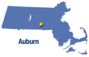
County: Worcester
Population: 15,901
Size (sq.mi): 15.7 (236th)
Density: 1,013 (106th)
Crime Rate (1998): 41
Crime Rate (1999): 42.5 (26th)
MCC: Larcenies
Town Type: Residential
Land Setting: Suburban
Metro Center: Worcester
Land distribution: How much space do certain property types take up?
Residential (Where people live): 85.5%
Commercial (Stores, offices, etc): 4.1%
Industrial (Factories, shipping, etc): 1.7%
Vacant Land (Empty land): 5.6%
Public Housing Units: State: 130, Federal: none
GETTING AROUND
How do you get here?
Routes 12, US 20, I-90 MassPike, and I-290
Public Transit
Rail: no (Worcester)
Bus: yes
Local Rail: no
Local Bus: yes
Paratransit: yes
Auburn is served by several routes off the WRTA.
25 Canterbury
26S Auburn Mall
42 Webster
All routes start in Downtown Worcester. General service runs from 5AM to about 10PM. Commuter Rail service to Boston and Metro West is available in Worcester.
Miles of public roads: 90
Distance from Metro Center: 8 mi S
Distance from Boston: 44 mi W
Who lives here?
97% of the population is white and 23% of the population is under 18.
Average single family property value: $135,487 (236th)
Residential tax rate (as of 2000): $12.94 (247th)
(.25%) of Massachusetts residents live in Auburn.
How was it like back then?
Auburn was known as Ward, until it got it name changed in 1837. Then in 1851, it gave up some of its land to form Millbury.
Personal: N/A.
Auburn has its own mall, the Auburn Mall
------------------------------------------------------
AVON 02322

County: Norfolk
Population: 4,443
Size (sq.mi): 4.35 (343rd) Avon has the 8th smallest land area in the state.
Density: 1,031 (103rd)
Crime Rate (1998): 39.5
Crime Rate (1999): 40.5 (30th)
MCC: Larcenies
Town Type: Residential/Industrial
Land Setting: Suburban
Metro Center: Brockton
Land distribution: How much space do certain property types take up?
Residential (Where people live): 77.6%
Commercial (Stores, offices, etc): 6.05%
Industrial (Factories, shipping, etc): 4.7%
Vacant Land (Empty land): 10.4%
Public Housing Units: State: 70, Federal: none
GETTING AROUND
How do you get here?
Routes 24 & 28
Public Transit
Rail: no (Brockton/Randolph)
Bus: yes
Local Rail: no
Local Bus: yes
Paratransit: yes
Avon has no direct commuter rail service but the nearest stops lie in Randolph and Brockton. Avon is served by 2 routes off the BAT (Brockton Area Transit) and 2 routes off the MBTA.
BAT
1 BROCKTON to Montello (Wal-Mart)
12 BROCKTON to Ashmont via Route 28
MBTA
238 QUINCY CENTER to Avon via South Shore Plaza and Randolph (Sundays only)
240 ASHMONT to Avon via N. Main St/Randolph
When it comes to public transit, Avon is in a good location so you don't really need a car here.
Miles of public roads: 22
Distance from Metro Center: 5 mi N
Distance from Boston: 17 mi Sbr>
Who lives here?
93% of the population is white and 23% of the population is under 18.
Average single family property value: $145,132 (219th)
Residential tax rate (as of 2000): $12.79 (259th)
(.07%) of Massachusetts residents live in Avon.
How was it like back then?
Avon became its own land when it separated from Stoughton in 1888. Then in 1889, It gave up ladn to Holbrook and Randolph.
Personal: This is a real quiet place; it looks nice and is pretty safe, contrary to the crime rate. If you like to speed, then don't do it here because them cops will pop up in the weirdest places.
------------------------------------------------------
AYER 01432

County: Middlesex
Population: 7,287
Size (sq.mi): 8.8 (312th)
Density: 826 (122nd)
Crime Rate (1998): 30.2
Crime Rate (1999): 24.6 (88th)
MCC: Larcenies
Town Type: Residential
Land Setting: Suburban/Rural
Metro Center: Brockton
Land distribution: How much space do certain property types take up?
Residential (Where people live): 84.42%
Commercial (Stores, offices, etc): 4.2%
Industrial (Factories, shipping, etc): 1.4%
Vacant Land (Empty land): 8.1%
Public Housing Units: State: 112, Federal: none
GETTING AROUND
How do you get here?
Routes 18, 123, & 139
Public Transit
Rail: yes
Bus: yes
Local Rail: no
Local Bus: no
Paratransit: yes
Abington has one MBTA commuter rail stop (Abington: zone 4) on the Plymouth/Kingston line, from South Station. There's also that Dial-a-bat paratransit bus and Carey's Bus Lines, a commuter bus that provides service from Abington & N. Abington to Boston. So basically, you need a car here.
Miles of public roads: 56
Distance from Metro Center: 4 mi E
Distance from Boston: 19 mi SE
Who lives here?
97% of the population is white and 26% of the population is under 18.
Average single family property value: $192,792 (132nd)
Residential tax rate (as of 2000): $16.05 (101st)
(.23%) of Massachusetts residents live in Abington.
How was it like back then?
Abington was a part of Bridgewater from 1712 until 1727. Since then, it gave up some of its land to the town of Hanover and until 1874, it was known as Rockland. In 1875, it changed its name to S. Abington, then later Abington.
Personal: It's kinda boring here. The highlight is Wal-mart, and I heard of some good restaurants & shops along route 18. There are also lots of elderly people here too.


 Click here for the official PVTA site.


