
San Gorgonio Summit
Vivian Creek Trail
May 16, 2001
After my last attempt failed at reaching the summit of San Gorgonio Mountain on May 3, 2001, I decided to try it again, via the same route but with some added wisdom gained from the first attempt. I planned to leave earlier, pack less and stay later on the mountain to increase my chances for a successful climb.
3:30am Woke up, gulped some honeynut oatmeal and a glass of juice and headed out the door toward the Mill Creek Ranger Station in the town of Mentone, Ca. just out of Redlands and N/E of the I-10 Fwy. Decided to take only my Lowe Contour Mountain 40 pack instead of my larger Gregory.I took less food and ditched my hydration blaldder even though I figured out why it leaked last time, (bite valve not installed properly at factory).
5:00am Arrived at the Mill Creek Ranger Station and filled out my day-use permit form at the outside desk. Drove east on S-38 toward Forrest Falls and continued toward the Falls parking lot like last time. Discovered that the seasonal gate was now open and it allowed me to drive up another 1/2 mile or so to the real Vivian Creek Trailhead Parking lot.
5:25am Since I parked closer to the trail I immediately started up into the wash looking for the trailhead. It was getting light but the Mills Creek Wash is shadowed in the canyon. I stumble around in the dark trying to find the trailhead again, just like last time. Can't believe I did it again, so I walk back across the wash and get on the dirt road at the parking lot and walk up creek about another 1/2 mile to the real trailhead sign. Waste of about another 1/2 hour.
5:50am Start hiking up the trail toward Vivian Creek up the steep and rocky switchbacks. Knowing how I burnt myself out last time I slow down and plod up the hill. About 1/2 way up I find a black mini-gaiter on the trail. I stuff it into my pocket for later posting on the San Gorgonio Assn Web Page for Lost & Found.
6:30am Reach the topo of the hill and start through the lovely Vivian Creek Camp area. It was cool, crisp and clean, about 40 degrees, great hiking weather. The trail has really greened up since last time 2 weeks ago and everything is lusher and greener.
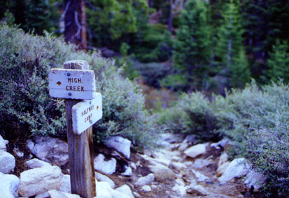
7:20am Reach Halfway Camp, stopped for brief 15 minute break, look around for something I lost last time and drank about 16 oz of water and gulped a power gel and ate a Clif bar to fuel me up to High Creek Camp. I'm feeling really good and my pack feels like an old friend. I start up the ridgeline and wind my way up for some great views heading back down the wash toward Riverside.
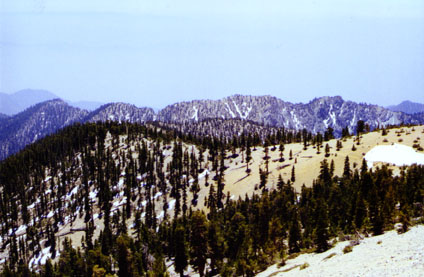
8:50am Reach High Creek Camp, feeling really good and stop for a 15 minute break. I'm about 1 1/2 hours ahead of schedule from last time and the lighter pack seemed like a brilliant idea. I set my altimeter and refill my water bottles from the creek. I go up the 200 yards to the real campground and check it out. I can't believe how much snow has melted in two weeks. Last time the east ridge was covered with snow, now there are only patches, I definitely won't need the crampons. Began the traverse up the switchbacks making great time.
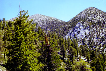
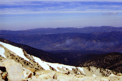
10:00am Crest the top of the east ridge and have a great view of San Jacinto Peak from the overlook. I stop to take some photos, swig some water, gulp two power gels and crunch on some pretzels. I follow the trail up another 50 yards or so to where I stopped last time. Now with the snow melted the trail is visible and I begin to follow it up the ridgeline. I'm two hours ahead of last time and I'm looking good. The trail gets steeper and rockier. I can tell the trail passes around the right side of the hilltop and continues up the ridgeline toward the peak to the left of San Gorgonio.
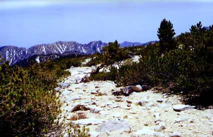
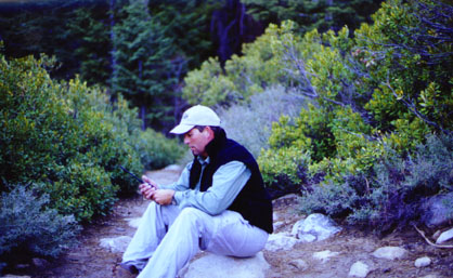
1100am, 10,500 ft. I start traversing the ridgeline toward the trail junction of Dollar and Dry Lake Saddle. The trail takes an abrupt turn straight uphill and becomes rockier. I begin to feel the altitude and start getting symptoms of AMS or Acute Mountain Sickness. I feel extremely tired, I can feel my pulse pounding in my temples, I'm starting to get nauseated and I can only walk about 20 feet without having to stop and collapse on the nearest flat boulder resting my head in my hands. It's wierd, I'm tired and I can breathe but I just don't feel like going any further. I briefly consider that it's not worth it to continue. Within 20 seconds I feel okay again and I stand up and lean on my trekking poles, whoa ! light headed and dizzy for a second. It goes away and I figure that I'm not getting any closer just standing here so I continue.
 11:30am I can see the trail junction of Dollar
Lake and Dry Lake along with the Skyhigh Trail. I have to cross one more snow patch
and it looks fairly level towards the summit. The sun is very intense and burning
the right side of my face. I'm glad I slathered on lots of sunscreen at high Creek
Camp. The air is crisp and cool, about 70 degrees and the sky is the bluest I've
ever seen. The views to the south are breath taking. I snap a few photos and
fight back the urge to vomit. I pass between the last two knobs can see the summit.
11:30am I can see the trail junction of Dollar
Lake and Dry Lake along with the Skyhigh Trail. I have to cross one more snow patch
and it looks fairly level towards the summit. The sun is very intense and burning
the right side of my face. I'm glad I slathered on lots of sunscreen at high Creek
Camp. The air is crisp and cool, about 70 degrees and the sky is the bluest I've
ever seen. The views to the south are breath taking. I snap a few photos and
fight back the urge to vomit. I pass between the last two knobs can see the summit.
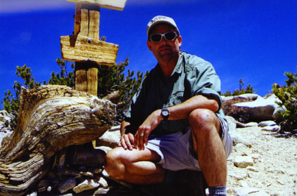
Finally on Top
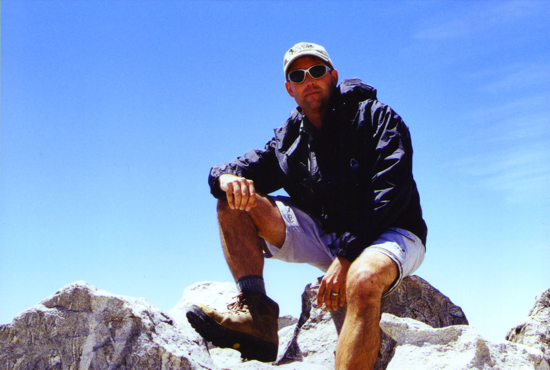
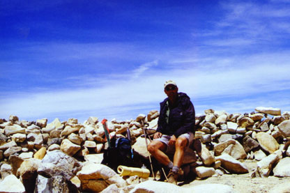
 12:00 noon I drop my pack and take in
the view. My goal of 12:00pm was perfect. I had planned to be on top until
1:00pm and start heading back down. I spend 15 minutes boulder-hopping trying to
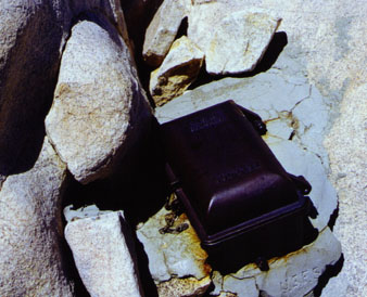
find the summit log. I see an intersting black box set in concrete with a USFS logo
stamp. I open it and find the steno pads with the sumit entries. This was the
first one I had seen and thought it would be actual log or form or something. I was
a little let down to find just a couple of steno pads. I started to read the entries
and check out the last summit prior to mine. I make my entry with the date, time,
conditions and brief description of my hike. I wanted to read the others but my head
was pounding. I feel a little worse now but not as bad as I expected it to be.
12:00 noon I drop my pack and take in
the view. My goal of 12:00pm was perfect. I had planned to be on top until
1:00pm and start heading back down. I spend 15 minutes boulder-hopping trying to
find the summit log. I see an intersting black box set in concrete with a USFS logo
stamp. I open it and find the steno pads with the sumit entries. This was the
first one I had seen and thought it would be actual log or form or something. I was
a little let down to find just a couple of steno pads. I started to read the entries
and check out the last summit prior to mine. I make my entry with the date, time,
conditions and brief description of my hike. I wanted to read the others but my head
was pounding. I feel a little worse now but not as bad as I expected it to be.
Summit Register Box
 I take some
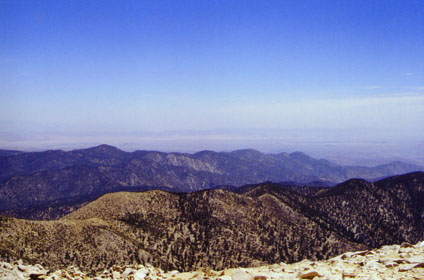
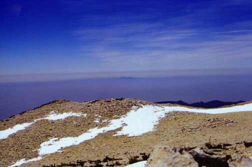
360 degree photos and can see far off to Barstow, Joshua Tree, Palm Springs, Big Bear, Mt.
Baldy and just about everywhere else. The visibility is about 100 Miles. Off
toward the coast I can see the inversion layer looming up over the coast and can see
Santiago Peak (Saddleback Mountain) poking up out of the clouds. I checked out
windbreaks and sat down to chug some water and eat another Clif Bar. Chipmunks come
out of the rocks and seem very friendly. I can hear them chatting at me begging for
my Chocolate Malt Clif bar.
I take some
360 degree photos and can see far off to Barstow, Joshua Tree, Palm Springs, Big Bear, Mt.
Baldy and just about everywhere else. The visibility is about 100 Miles. Off
toward the coast I can see the inversion layer looming up over the coast and can see
Santiago Peak (Saddleback Mountain) poking up out of the clouds. I checked out
windbreaks and sat down to chug some water and eat another Clif Bar. Chipmunks come
out of the rocks and seem very friendly. I can hear them chatting at me begging for
my Chocolate Malt Clif bar.
I eat some jerky, hard cheese and add Gatoraide to my iodined water.I took two 400mg Ibuprophen and checked my Yaesu VX-5R Radio for transmission range. I could hit repeaters as far away at Catalina, Barstow, Yucca Yalley, Palm Springs, Santiago Peak, San Diego, Los Angeles and via Linked repeaters out to Arizona and Bakersfield.
12:30pm I still feel pretty bad and know the only relief is to head to lower elevation while I still can. Climbing up to 11,500 ft from sea-level in 8 hrs has it's drawbacks and I start to head down. I feel better knowing I made it to the top and believe it or not I'm not that tired now as the 1/2 hour rest really helped.
2:00pm Reach High Creek Camp after an endless traverse around the East Ridge. I feel better now at 9200 ft. and decide to continue towards Halfway Camp. The ibuprofen seems to have helped but I still have a mild headache. I refill my water bottles and head out.
2:50pm arrive at halfway Camp and don't even stop. I'm going fast and furious, more like a controlled fall with trekking poles. I cruise through Vivian Creek Camp and start down the switchbacks above Mills Wash. This is where I tripped and took a header last time so I go really slow and methodical on the rocky trail.
3:45pm Cross the Mills Creek Wash and hoof it down the dirt road back to the car. By now my legs are getting really tired and I can feel every rock along the trail. I arrive at the parking lot and find it full of cars. I throw in my gear and open an ice cold drink and ate a sandwich I brought in an ice chest. Great idea and beats a heavy burrito at Del Taco.
