

date: 11/17/01, Leonid Meteor Shower
with: Dale Dean
mileage: 10
Dad and I started off at five in the evening, and were poking our beams through darkness by
CS 12. We rounded a knob up to the ridge. Clutching our hearts, a
knife, and a summer sausage, we were startled from an owlish-woman scream off the side of the
trail. It took us a full five minutes to recover and realize the demonic sound was a
bobcat. It was
close to us! After that it was over four miles of grey and black with circles of brown
revealed by our flashlights. When we got to Gregory Bald, our calves and hamstrings burned. (I can admit this because we were new to this exercise.)
After we settled next to a thicket illegally with our bags and pads, we sandwiched ourselves between
the bald and the starry sky. Our heads were facing East towards Leo. I thought of cats. I saw falling stars while chomping on summer
sausage and colby cheese. ...one falling star after another, and another, and
another. The Leonids showered us as my breath billowed into the night sky. I
turned to Dad, and turned back up to the heavens. That night, I dozed off with my eyes
blurry of meteors' zipping blackness. I dreamt of the bald. Our old family
endtables appeared at the head of the trail in my dream. I was upset to have to lug the
endtables back down to Cades Cove. Then I dreamt of meteors brilliantly falling into my
lap. I woke up. So I ate some
jerky for breakfast, shook the
frost off our sleeping bags, and joked about the morning deer licking our faces and the demonic
monster/bobcat last night. We wondered where all the birds were. I figured that some things are left best on the mountain you ascent... for a free descent.
This trip marks my first backpacking trip ever. I carried a cloth sack up the mountain
slung over my shoulder with sleeping pad, dried meat, cheese, and water. I carried my new
30 degree sleeping bag in my hands. After that, I was hooked to backpacking, and vowed to
gradually buy equipment, which, by the way, is dreadfully expensive.
date: 11/01 ?
with: Dale Dean
mileage: 12
I can't remember when we did this trip exactly, but it was a nice loop. We ended Rabbit Creek trail in the dark, and Dad mentioned that he didn't want to do any long dayhikes like this again because his leg bothered him towards the end. Cooper Road was flat. Hatcher Mt or Little Bottoms (?) was dry and a smaller trail. We made a short jaunt to Abrams Falls from Hatcher Mt. trail. On the way back we had to cross Abrams Creek to get to Scott Gap. Not much rock hopping, wading up to the knees!
date: 12/15/01
with: Dale Dean
mileage: 17
Dad and I started on Maddron Bald Trail from Laurel Springs Rd at about four in the afternoon. The OST was a narrow mossy trail of which we hiked into the dusk and night. As we rounded a knob, we could see a magnificent cotton candy sunset through gaps of rhododendron tunnels. We sweated in the cold and darkness while we darted our flashlights down the trail. The OST has wonderful crumbly chimneys and overgrown homesteads. It�s amazing what 70 years of weather and undisturbed plant growth will do to communities and roads. The OST is a perfect example of this, and I cannot wait to explore OST again in the daylight!! We reached the foot trail to McCarter Barn, and scurried towards the structure. After standing underneath an eave eating power bars, we pushed on to CS 33, which had an old chimney for a fire, and a huge lookout rock that hung over the rushing creek. An old road near the campsite was blocked by stones. The hike out the next morning was beautiful with several sunny meadows, huge chimneys, and old roads branching off from OST. It was roughly 7 miles back to Greenbrier. I found a weird brown jelly-like fungi on the trail.
date: 12/25/01
with: alone
mileage: 8.6
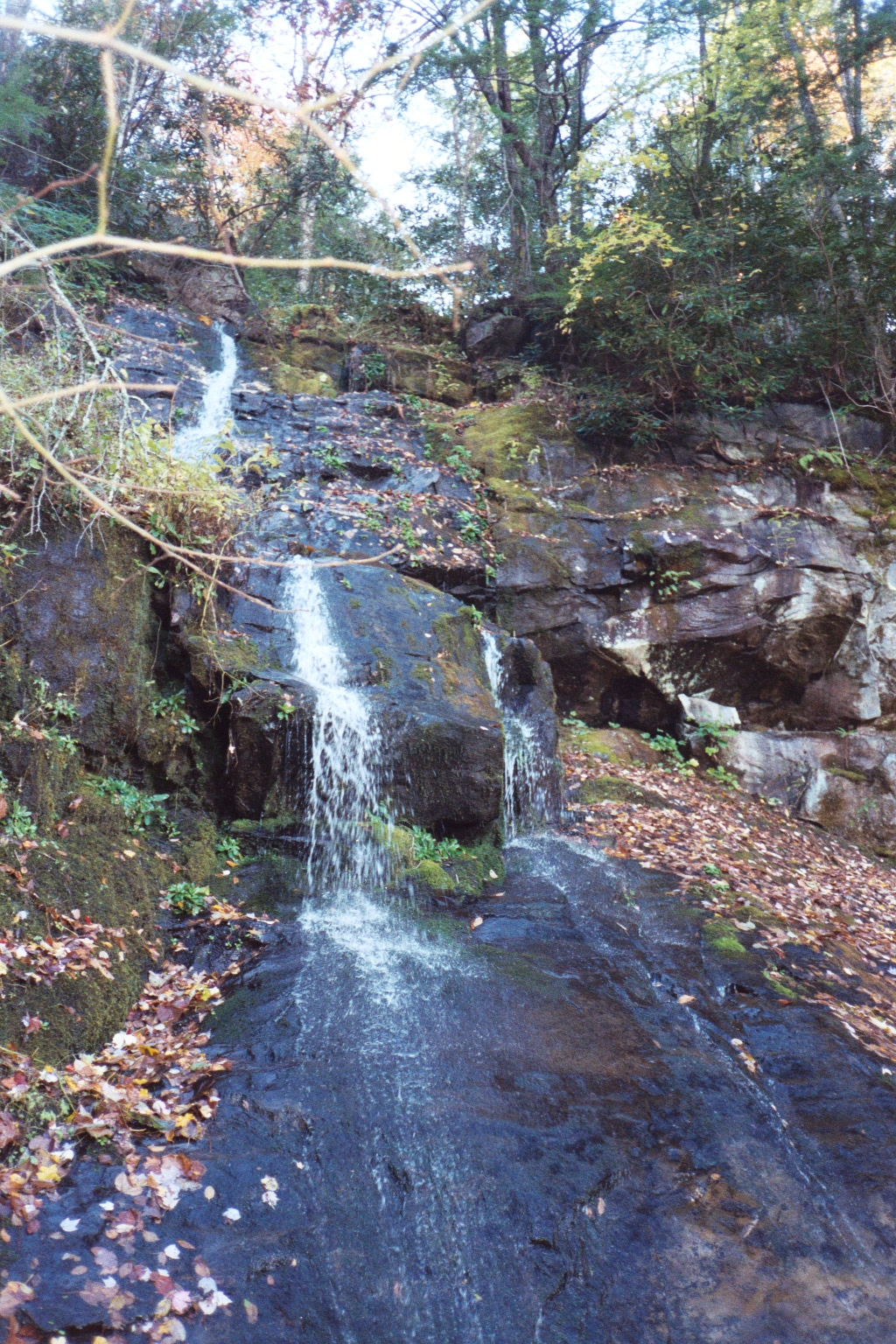
I started up Crooked Arm Trail at about ten til two. On the way up, I saw a small waterslide down to my right. I huffed up the ascent, and rounded the lip to the ridge. When I turned around, I breathed and drank in the brown lake of farmland called Cades Cove. When I passed Scott Mountain Trailhead, I was ridge-walking, and peering down into Dry Valley wondering where the Tuckaleechee Caverns might be. After awhile, I passed metal red poles with "U.S. Dept. of the Interior, Do not disturb" labels. Then, I came to a small trail leading up to three large stone slabs, and three smaller ones indicating an old foundation of a fire tower. I figured this spot was Cerulean Knob. I began descending the small trail back to the main trail when I noticed a small perfect pool supported by stones. Was it an old spring for the fire watchers? After passing the intersection that leads to Rich Mountain Road, I jogged back down to Cades Cove passing a half dozen huge wild turkeys that couldn't have cared less about me. Finches were flitting from tree to tree flicking their wings. I ran into another flock of turkeys. They noticed me! On the way down, the trail became rocky with little springs trickling on the left. I passed another waterslide, and came to John Oliver's old homeplace. I was back at my truck at about ten til five.
date: 12/29/01
with: Clark
mileage: 6.1
We parked in Elkmont, and wandered down the old road investigating the German-style cottages of which all are abandoned and deteriorating. The trail still resembles a gravel road that follows the right bank of Little River. I noticed some nice swimming holes for the summer. We passed the intersection with Cucumber Gap trail. Our feet scratched along the gravel. I imagined lumber railcars smoking their way into the deep woods. I wondered what the lumberjacks thought as they eased up the river. We saw a hog or bear trap as we passed Huskey Gap trail. After we stopped at Goshen Prong intersection for a snack, we were at CS 24 in no time. A few people had set up camp. We knodded and continued past on towards our destination, CS 30. The creeks we had to cross to get to the campsite were treacherous! I hadn't the money to buy gaitors and good waterproof boots yet so I paid dearly for it in other ways. I dropped my trail book in the December water. Luckily, it floated down to Clark. It froze into a brick that night, and I dropped it on my toe the next morning. The rocks were slick with thin layers of ice. The last creek crossing was just as hairy. It was worth it because CS 30 was lovely spot. We chose the site to the left up the hill in a grove of rhodendron. I explored some manways further up the hill where several rocky creeks were merging into one to eventually form the Little River. We had steaks and spirits that night, and stayed toasty even though it was ten degrees!! The next morning was sausage and eggs, and frozen socks. I tied plastic bags over my feets to prevent frost bite.
date: 01/05/02
with: Dale Dean
mileage: approx. 10
I parked my truck at Rich Mountain Road above Dry Valley. Dad parked his truck at the old Kinzel House. We started on Ace Gap Trail, but had to turn back because we forgot to look for Bull Cave. We found a big sink hole with a vertical cave into earth. There were other sink holes that looked like bowl-shaped depressions around the trailhead, but a small path leads to Bull Cave. Back on Ace Gap Trail, we hiked gently up and down for awhile. CS 4 had private property signs behind it near the stream. We hiked on to Governer Sundquist's home, which you cannot miss from the trail. We bristled at the re-routing of the trail of which led straight to his black-topped driveway near his front door!!!!! Anyway, we had filet mignons, soup, and hot chocolate at CS 7. (mm..good number for a campsite). Don't you just love frying up some good beef! We took the old railroad bed across from CS 7 out of the park. This old trail followed the creek and became wide as we traversed towards Rt. 321 below. After descending quite a bit, we arrived on lotted private properties. The old road/railroad was washed out pretty good. We headed northeast, and came to a weird abandoned clearing where someone dammed up the creek for a house site. Old car parts were glinting in the late sun. We finally ended up in someone's backyard near 321. We hiked 321 to the Kinzel House.
date: 01/12/02
with: Clark
mileage: approx. 14
The ascent on Wolf Ridge provided us beautiful views to our backs. CS 95 was a couple
tenths of a mile off the trail with streams running behind and in front. It looked like an
old road continued past the campsite. Onward, the trail became very deep like a gully all
the way to Parson Bald. Parson Bald was not as flat as Gregory Bald, but was incredible
with trees, shrubs, and nice gaps of grassy areas. Sheep Pen Gap campsite was
welcoming after the long ascent. We chose the spot on the left that was farthest back,
which had a beautiful view of Cades Cove and Maryville lights twinkling in the distance.
The wind
was whipping while we helped ourselves to steaks and butterpeas. Do you see a trend in my
winter backpacking menus? For the life of us, we could not get a fire started what with the
wind and our inexperience. We crawled into our sacks. In the morning, we enjoyed Gregory
Bald immensely. We descended Scott Gap, and down Long Hungry Ridge. We came across barely
legible weathered sign that said "Rye Patch." I traced my fingers over the carving to read
the elevation. After passing several springs on the way down, we reached CS 93 for snacks.
On the way down to this campsite, the creek was enclosed in a rhododendron tunnel, and I
thought there were good sitting spots underneath in the rocky creek. After CS 93, The trail
turns into an old railbed. We passed CS 92, which was right next to a wooden bridge
crossing the creek. We were glad
that several wooden bridges were provided on this trail because the creeks were awfully
deep, narrow, and rushing. After we passed the Twentymile Loop trail junction, we shouted
hallulujahs. Our aching legs carried us back to the parking lot.
date: 02/23/02
with: alone
mileage: 12
Trails: Crooked Arm, Scott Mountain, Schoolhouse Gap, Turkey Pen Trails
Parked in Cades Cove where I parked before for Rich Mountain Loop. I
headed up Crooked Arm
again, but this time I took Scott Mountain Trail towards Schoolhouse Gap. At CS 6, I
stopped dead in my tracks when I saw streams of quivering white toilet paper everywhere,
and a red ax stuck in a tree stump. I am sure there is a simple explanation to these items,
but... ? I continued on the trail, and explored a tiny foot trail that leads down to a
tiny
waterfall. You can hear the tinkling above on the trail. The main trail became tiny itself
after while.
I ambled along the skinny ledge of the trail with a steep dropoff. Warm pine needles smell
different than cold patches of pine needles. I inspected an oval-shaped firey orange
mushroom growing off a large rotted twig. I wondered what Red Cedar trees looked like. I
thought I spotted one with a round obtrusion growing out of its trunk. I haven't seen a
human soul since Crooked Arm. A beautiful view of a cove was near an NPS
sign nailed
onto a tree. I could hear roosters and crows carrying on in the valley below. I saw several
boundary markers along this trail and a driveway with an A-frame cabin. When I
arrived at the McClanahan's cabin and Schoolhouse Gap (Est. 1946, Ollie and Marie), I
noticed it was 9,135 miles to Bagdad, 712 miles to Ft. Polk, Lousiana, 8,445 miles to
Insirlik, and 5,865 miles to Belfast. After descending Schoolhouse Gap Trail, I took Turkey
Pen to
Crib Gap. Part of Turkey Pen is a dug trail that was knee-level deep with moss on both
sides.
I passed several interesting streams. Then my legs became tired. Very tired. The sun was
beginning to
set. I was hoping I would get closer to the road. I came to the largest stream yet. Its
sound was welcoming after the streamless stretch in the woods. After rounding the rest of the ridge-side, the trail and streams
criss-crossed resembling a figure 8. Finally, I could hear clear automobile
sounds. Near Finley Cane Trailhead, I walked across an old homesite with patches of
daffodils. I could see that Finley Cane Trail had a nice rock tunnel underneath the road. I
marveled at it. I followed the trail on the right side of the road, which eventually
crossed the road. By then, my leg movements were that of a sloth. I wasn't sure if I was on Lead
Cove Trail or what, but I came to Anthony Creek Trail and back into Cades Cove. The sunset was the color of passion.
date: 03/09/02
with: alone
mileage: 8
It was drizzling rain when I pulled into the Ramsey's Cascades Trailhead parking lot in Greenbrier. Whipped out that umbrella, and marched past rain-coated couples on an old road. I was in an on-a-mission mood, and the rain intensifying was not going to prevent me from enjoying this waterfall. I made it to the old turnaround where Greenbrier Pinnacle trail winds up the hill on the left. I decided to hike this trail a bit before I continued on to the Ramsey's Cascades trail. This is where I ran into "the Johns." John Hoover and another John (? last name). They were sitting underneath a makeshift tarp next to a creek enjoying the little storm that was passing through. They gave me a handwarmer, and we chatted a bit. Turns out they were from Ohio like me. I trotted back to the old turnaround to complete my mission. The trail was rocky, mossy, uphill most of the way, and riddled with tree roots. It follows a good-sized creek. I didn't think the trail was as strenuous as I have heard or read, but the roots and rocks were nice and tricky for fancy footing. The cascades were worth every drop of this soggy hike. The waterfall splashed from shelf to shelf and collected itself at the bottom on a rock waterslide. Patches of icy snow were still lingering around the pool.
date: 03/23/02
with: alone
mileage: approx. 7
Dear friends, think as you pass by.
As you are now, once was I.
As I am now, you must be.
Prepare in time to come to me.
This hike was fascinating. Old chimneys, rock piles, rusted pieces of metal found alongside
an old roadbed while West Prong's lulling roar drifts through the trees. Old Sugarlands
trail comes to a T. I wandered to the right towards the river and the site of an old
community now gone. I read that there was a bridge over the river in the 1920s. I ran into
some McCarters who were investigating where Pi Beta Phi school used to be. One McCarter man
showed me where his daddy used to eat lunch on this big ole rock underneath a nice tree. He
said his family used to live here in 1928. He remembered the CCC buildings before they were
torn down. We talked about Chestnut trees and how people back then would not hesitate to
walk into a neighbour's house to see what is for supper. The man likened the Sugarlands
community to a sixties commune. We walked back to the T where we parted. I started of the
left side of the T towards an old graveyard. As I mingled through tombstones tasting names
and dates, I came across an epitaph (above). I kneeled to trace the
engraved letters with my fingers (I like to trace engravings for some reason). I walked back to the main trail, and continued on the Old
Sugarlands trail to Cherokee Orchard, which was a wide gravel road. After reaching Bullhead
trailhead, I took Two-mile Branch trail back to the Old Sugarlands trail. The Two-mile area
trails are muddy and rutted by horses.
date: 03/29/02
with: Clark
mileage: approx. 9
We parked at Rainbow Falls trailhead parking lot to hike the Trillium Gap trail to Grotto Falls. This part of Trillium Gap trail follows the road through Cherokee Orchard into the old Roaring Fork Community. The trail is high above the road at times. Small white and light purple flowers (Spring Beauties, maybe?) were among tons of Bloodroot and of course, Trillium that had not unfurled their three petals yet. It was overcrowded when we reached Grotto Falls parking lot, which is expected since it was Good Friday. I loved the way the trail went behind the falls and on up to Trillium Gap. I was already planning another hike up to Trillium Gap and Mt. Leconte. We backtracked the wide trail back down to the Grotto Falls parking lot, and crossed the road trying to find where the trail continues on to Baskins Creek Trail. There were so many cars that we could not find it!! We hiked a trail on the left side of the road that ended near a sign labeled, "Dudley Stables 5.5 miles." We were looking forward to hiking Baskins Creek, and were utterly disapointed. We backtracked all the way to the Rainbow Falls parking lot. Clark had new hiking boots on hoping to break them in on several dayhikes. By the time we got back to the car, he was very quiet. He showed me later that he hiked a large section of his heel off. I could barely bring myself to look at his foot!! We passed the Baskins Creek Trailheads in the car, and made a mental note to come back.
date: 05/25/02
with: Clark
mileage: 15
We camped the Memorial Day weekend in Elkmont hoping to hook up with some TT'ers (Trail
Talk backpackers from thebackpacker.com). Our first of three dayhikes (totaling 40 miles)
that weekend started at the Jacobs Creek Trailhead gate. After a few tenths of a mile,
we took a left on Cucumber Gap and gently ascended and descended for over 2 miles. A jogger
passed us twice. Cucumber Gap trail was a lovely green path at the time. We came out
on the wide gravel Little River trail, crossed a few bridges, and made a left onto Huskey
Gap trail. I thought I heard a family of voices near the river as we began the ascent up the
ridge, but no one was on the river bank. We walked in silence as we wound our way up the
left side of the mountain. We came to Huskey Gap and Old Sugarland Mountain
intersection where we met a couple visiting from Missouri. We sat and talked a bit, then
continued on to CS 21. This campsite had large boulders of which one was the largest and
cracked. We sat on it for lunch, and watched deer graze in the sunny grasses on up the
trail. Clark and I thought CS 21 was awfully dark with it being a bright day. We continued
on until we were ridge-walking with steep drop offs on either side of the trail. I thought
I could see the backbone of the Smokies straight ahead of us on a high ridge perpendicular
to
ours. When we got to Rough Creek trail, we stretched our legs before our descent. Rough
Creek trail
was steep and pretty with several creek crossings. We came back out
on Little River trail.
date: 05/26/02
with: Clark, Towndawg, Jill, and Skidder
mileage: approx. 17
During Memorial Day weekend in Elkmont, we met up with the TT'ers the night before (Trail Talk backpackers from thebackpacker.com). We joined them for our second dayhike this weekend on an exciting and long hike up Mt. Leconte. We car-shuffled with Grotto Falls and Porters Creek trailhead parking lots. After breakfast at the Little House of Pancakes, we finally got to hiking up the wide gravel Porters Creek trail to Brushy Mountain trailhead, which is next to the Smoky Mountain Hiking Club cabin. Brushy Mountain trail wound its way beautifully up to Trillium Gap. It was a long gradual ascent, and at times the trail was narrow and overgrown with grass. We hooved our way up to Trillium Gap. Clark and I sat on a log next to the trail signs while I begged and whined for Clark to hike up to Mt. Leconte with me and the rest of the group. I used bribery, and finally he acquiesced. The trail up to the Leconte lodge was rocky. When we made it, we sat on one of the cabin porches with Jill and Skidder at the lodge to eat lunch. The lot of us decided to descend back down to Trillium Gap in search of Towndawg, but we found him shortly. We scrambled up the short rocky and rutted trail to Brushy Mountain. I wandered across the summit - sand myrtle and rosebay rhodendron were blooming. As we descended to Grotto Falls from Trillium Gap, we were greeted with a lightning storm. Clark and I ran to the car.
date: 05/27/02, Memorial Day
with: Clark, Towndawg, Jill, and Skidder
mileage: 9
We started our third dayhike and last of the Memorial Day weekend with our fellow TT'ers (Trail Talk backpackers from thebackpacker.com), which wrapped up our 40 miles. When we arrived at the Bunion, the view of Greenbrier valley and Horseshoe Mountain was something that I could not wait to see again. Clark and I reminded each other of our upcoming "AT thru the Smokies" trip, and I thought excitedly about being on the Appalachian Trail for an entire week - my first long backpacking trip!! Skidder and I investigated the area past the Bunion towards Dry Sluice Gap for the Porters Creek manway, which will be chewed up by us TT'ers on our September trip. We saw something that looked like a steep drainage sluice, and denied that it was the manway. This hike ended in another wet scramble back to the car. The rain was beating down as we ran out to the Newfound Gap parking lot.
date: 06/01/02
with: alone
mileage: 14
To continue knocking out all of the approaches to Leconte, I started on Rainbow Falls trail about 12:30 in the afternoon. When I made it to the second or third foot bridge, I turned to my left and saw the falls for ten seconds. The falls looked similar to Grotto Falls except that Rainbow Falls were about three times as big. I figured the trail would wound back around closer to the falls so I continued. After awhile, I figured I was wrong. Oh well, the ten-second picture in my head was beautiful all the same. Maybe I will come back some other time when I don't have a mountain to climb. I kept up a good pace all the way to the Rainbow Falls and Bullhead Trail intersection. I was pretty proud at myself for not stopping. The little spur trail before the intersection was incredible!! I guessed that the view was from West Point. I made it to the Cliff Tops to eat lunch and chat with the tourists. I met a young man from Knoxville who hiked up the Boulevard Trail. He was unsure of making it back to his car before dark so I invited him to hike down Bullhead trail with me. I would give him a ride up to Newfound Gap to his car. His name was Andrew, and was planning to go on a mission in Peru after he graduated. Bullhead Trail had several lovely overhangs, and a square block of rocks to look out over the trees into Roaring Fork valley. We ran down Bullhead to Old Sugarland trail that led us back to the Rainbow Falls parking lot. On the right, I spotted a tiny trail labeled "Trillium Gap Trail .1 mile to Rainbow Falls Trail."
date: twice, once in '95, again in summer of 2001, and once January 17, 2005.
with: Carie Johnson, Clark Allison, Pa, Holly, and Kerry
mileage: 5 - one way
Alum Cave Trail is nice, short, and steep. The ascent is gradual until you get to Alum Cave. My favorite part of the trail is the rocky ledge with the steel cable to balance yourself. One year I hiked up to Leconte this way on my birthday. My neighbours, Pa, and I crawled on the ice-covered ledge. They were brave and determined to get to the top - in turn, making me want to overcome my fear. I had heard that someone had lost his life this way. I can see how that could happen in winter.
date: 06/15/02
with: Clark
mileage: 5
Baskins Creek Trail was enjoyed immensely by Clark and I. We hiked from one end of Cherokee Orchard starting from the beginning of Roaring Fork Road to the other side. There is a gravehard on the side of a steep hill along with way. When we got to the other end of the trail, we backtracked Baskins Creek trail to an official or old trail on the right. We followed this little overgrown trail until it split. We argued over which direction to take until we settled on the left, which led us to the waterfall we read about. This waterfall was wonderful, and we had it all to ourselves!! We didn't run into anybody on this either, which was nice.
date: 07/13/02 - 07/20/02
with: Clark
mileage: 70
|
Shelter Nights:
Sat. - Birch Spring Gap Campsite (used to be a shelter) Sun. - Spence Field Mon. - Silers Bald Tues. - Mt. Collins Wed. - Pecks Corner Thurs. - Tri-corner Knob Fri. - Cosby Knob I am writing this 3 years later after I finished this trip. I learned so much on this 70-mile stretch. I almost want to go back and edit these pages, but I won't. They are preserved to preserve the "newbie" and the "green" I had, and still have about many things. After you learn, you grow (hopefully) and form different opinions. It tickles me to read this - what a great trip! 12/19/05 |
 Gee, I hope it isn't pouring rain the first day in Fontana. |
 The morning before Thunderhead, Spence Field |
 After Thunderhead, Overgrown AT at Derrick Knob |
 Between Mt.Collins and Newfound Gap, orange salamander with black dots, blurry tho. |
 Clark squeezed past tourists for this picture. |
|
This trip was incredible!
It rained on us the first 24 hours, and we spent the next few days drying out our stuff. I am so glad that I did not wear cotton! The second day, we were cooking our supper in the middle of Spence Field, and saw two wild boar scamper through high mountain grass. That following morning, we left Spence Field to hit the roughest stretch of the AT: Thunderhead and Rocky Top. That was our 13 mile day! Good Lord, what was wrong with me when I planned that itenary! Endless uphill, downhill, uphill... As I neared Siler's Bald shelter at dusk, I was whimpering downhill because I knew it meant uphill. My toe nails, arches, shoulders, hips, and inner thighs ached. The stretch from Silers Bald to Clingmans Dome was surreal. Mt. Collins was a lovely pine forest, but the shelter was ridden with mice and needed some fixing up. We pushed it on up to Newfound Gap, which was crazy with people. People stared and pointed at us; it was kind of weird. I washed up in the sink, and some lady made rude comments about me doing that. We left the Gap, and pushed on to Pecks Corner shelter - that was our 15-mile day (from Mt. Collins to Pecks). The stretch after Charlie's Bunion to Tri-corner was spectacular and beautiful and very close to my heart. My mind is permanently swirled in the caramel vanilla mint breeze among the plants around Mt. Guyot. Maybe it a Fraser Fir smell? The morning after we stayed at Pecks Corner, the mist was creeping along the trail with us. Our last night was at Cosby Knob with some really cool folks. We met one of the ladies earlier that morning. (She got lost, and spent the night under a tree on the side of the trail.) At nightfall at da Knob, the gentlemen whipped out their backpacker guitars and played an interesting repertoire; Violent Femmes, the Beatles, Pink Floyd, et al. The next day, Clark and I scrambled around packing, and hiked like the dickens to Mountain Mama's. This was our first big backpacking trip; and thoughts of a shower and cheeseburgers made us ecstatic. I definitely have respect for the long journey of thru-hiking the Appalachian Trail... |
date: 08/11/02
with: To Tops with Leann Grice and cousin Michael Holler, then Road Prong alone
mileage: 5
Chimney Tops Trail is pretty crowded, but I could see why because the Chimneys are magnificent! It reminded me of the rock outcropping of Charlie's Bunion, but the bunion is much smaller. The rock at the Chimneys is black, and the climb to the top of the outcrop can be dangerous. I took the real dusty dirty route of scrambling up an embankment so steep I had to pull myself up by the roots and branches. Several families would not go passed the "Go no farther" sign. Michael shot a video of us laughing at the sign, and me walking past it indignantly. As I sat ontop of the outcropping, I looked down the chasm to my right, which was scary to think about falling into it. I showed Leann the easier way of climbing up and made the mistake of standing behind someone crawling up dirt with loose rock. The slate-looking piece of rock cut my shin. I left Michael and Leann at the Chimneys so I could get a head start on the Road Prong trail up to Indian Gap, which is over a mile from Newfound Gap. Michael and Leann agreed to pick me up there in my truck.
Road Prong trail is beautiful and mossy. I wanted to dive into the stream when I saw a four-foot waterfall splashing in a deep pool on the left of the trail after crossing the stream. I have to find a way to get down there - the bank around that part of the stream was very steep!! Perfect swimming hole, absolutely naturally perfect!!! Road Prong is mostly uphill with seldom downhills. Numerous ferns and moss-covered stones. At the time, there were red, yellow, and white flowers swaying in the light breeze. I wonder if the road was as beautiful back in the 1800s when it was in use? I started from the Chimneys at 10 til 5, and I huffed up the incline to Indian Gap's sign at 6:15. Whiling waiting around for Michael and Leann, this man pulls up and hops out of his truck to fill up his cup full of sweet blackberries. I joined him hunting around the bushes except I dropped all of the lovely beads of purple fruit onto my tongue. I grew impatient of waiting and headed down to Newfound Gap in search of my ride of which I found after 15 minutes of walking.
date: 08/18/02
with: Clark
mileage: 4.5
Huge cumulus clouds were drifting over Sevier County as Clark and I sailed through the Gatlinburg by-pass, past the Sugarlands, Elkmont, and heavily populated Laurel Falls. We turned into Metcalf Bottoms picnic area, and started down the short Metcalf Bottoms trail to the old schoolhouse. Several families had the same idea, but after we passed the schoolhouse to push on to the Walker Sisters cabin, we found solitude for awhile. The Walker Sisters cabin is a beautiful homestead. When we walked in, I half-expected a feisty old lady crouching by the fireplace barking at me to get out of her house. We roamed around the cabin, corn crib, and refrigerator. I imagined the sisters sitting on the front porch drinking iced tea. Did they have iced tea? Maybe they got their tea from the woods? I thought about how separated we are from nature and from living pure. We struggle and stress in work, and run to and fro in our lives for excessive details when the sisters lived and subsisted off the land. I yearn for that life. I added that to my list of reasons that describe why I backpack. Filtering water and using your feet as a means of transportation. But backpacking is nomadic too... Hmmm... Lost in my deep thoughts, we backtracked up the road to the sign that indicated Little Greenbriar trail was up the trail. I was kind of confused about what trail we were really on, but I looked it up in my trusting trail guide of the Smokies. We were on Little Briar Trail. We hiked up to Little Briar Gap to the intersection of LIttle Greenbriar Trail. I hiked straight ahead down a trail out of the park a ways, but turned around and backtracked all the way back to Metcalf Bottoms. Clark and I planned to come back to this area to hike Roundtop Trail before the summer is over. Swimming at the Townsend Y after a sweaty hike - here we come, Roundtop!
date: 08/24/02
with: Alone
mileage: 12.9
My Dad was kind enough to follow me out to Smokemont and shuttle me to Kephart Prong trailhead. Bless his big paternal heart! I crossed the bridge over Oconaluftee River, and started the ever-so-gradual ascent to the Kephart Prong shelter. The trail looked like it was paved at one time in several spots. I passed some stone structures, one was a huge old chimney and an old water fountain. I wasn't sure what the third was, but it looked like a cross between a chimney and a big water fountain with a pool. As I was hiking, I thought it might have been an old vacation spot, but when I got home, I read in my guide book that it was remnants from an old CCC camp. I met Dennis at the shelter. He was laying on a rock staring at the sky. We chatted, and it turns out he lives in Alabama, has several horses, and is originally from Ohio! He was taking a nice loop to get away from the tacky commotion that Gatlinburg can be.
I started up Grassy Creek trail, which beared its name well. Parts of the trail was a grassy ledge, narrow and overgrown in some places. As I passed small seeps on the trail, I had to wade through flowers. I could feel my smile cracking open my face as I immersed myself in black-eyed susans, interesting orange petal formations(lady slipper or snap dragon?), and scarlet bee balm. I arrived at Dry Sluice Gap trail finally. To the right of the sign, there was a small fire ring. I sat there staring into a rhodendron cave eating trail mix. Then, I started down Dry Sluice Gap trail to Smokemont. trail was overgrown for over a mile. I finally reach the first stream after 2 miles, and crossed one stream about three times. Along the trail, I saw a small plant bearing a hot pink prickly ball. The pink ball was bursting open to reveal orange berries inside! I saw mushrooms that looked like jaw-breaker-sized snowballs. On my third mile, I came to a trail intersection, and turned left towards CS 49 on Cabin Flats trail. The cicadas were singing as I rounded the bend. I rounded another bend, and I couldn't hear them anymore.
Campsite 49 had perfect spots along the river, but the firepits were disgusting with unopened oatmeal packets and heavy butane cannisters. Idiots!! I whipped out my trashbag that I kept handy for a poncho, and picked up what I felt like carrying for the next 4 miles. A tent was up, and bags were swinging from the bear cables, but no one was around. I guessed they were enjoying a nice dayhike. Near one of the last tent sites down stream, I marveled at the makeshift stalls for horses. There were about a dozen stalls made out of long logs!
I hiked back down Cabin Flats trail passing a log completely covered with huge peach-colored mushrooms. Ooo! I got to Bradley Fork trail, and hiked over a nice old trestle bridge. Bradley Fork turned into a wide gravel road along a river. It reminded me of Little River trail except it was longer. I found a poncho and rain coat along the trail. I came out to the parking lot in front of the trailhead in Smokemont Campground. I saw my Dad's truck! It turned out that his transmission was screwed up, and his truck gave out on the way up to Newfound Gap. He had to call a tow truck, and was in Cherokee at a repair shop. He was waiting next to my truck so I could follow him. We stood around filling each other in, and drinking lemonade when a GSMNP volunteer walked by. Her name was Nancy. We all got to chatting. She is from Louisiana, retired, and addicted to hiking. We shared some tips and stories of our travels. My Dad and I thought she was such a spunky lady! Her and her husband were living in Smokemont while they volunteer for the park. We bid her goodby, and my Dad and I got in our trucks. I followed him up to the Gap with my flashers on. We cruised all the way down to Gatlinburg into the Smoky Mountain Brewery parking lot. I met some other nice folks there too. Regina and her husband were visiting from Memphis. Her husband proposed to her in Elkmont on Little River trail near the waterfall. They come here ever year for an anniversary trip and hike that trail.
date: 09/07/02 - 09/08/02
with: Towndawg, Skidder, and Georgia John
mileage: 22
Friday night, the 6th, I took off on Porters Creek trail at 7 in the evening. I scurried up the road, and began to soften from the work day after I crossed the long foot bridge further on Porters Creek trail. The path was high above the creek at times. It was growing dark so I scurried faster whizzing past huge trees as I neared CS 31. I could smell the boys' fire when the breeze was blowing right. The last 10 minutes, I had to use my flashlight. CS 31 is 3.7 miles. I made it by 8:30.
I slept under the bare sky that night - I sleep so much better without a tent. The wind blew on my face in the middle of the night. Towndawg cleverly thought of creative images he saw in the shapes before we fell asleep.
All night, I dozed and woke staring through a hole in the tree canopy. The branches and leaves against the night sky fooled my eyes with different shapes.
The next morning we all got up and readied ourselves for the big adventure. I prepared myself for the worst so it wouldn't be so bad. We backtracked a few yards down the trail and started up a small trail that was a dead end. We eventually started on the manway, which is past the campsite if you continue on the trail. The Porters Creek manway, also known as Dry Sluice manway, wound through rhodendron thickets, criss-crossed the creek, and led us through patch after patch of stinging nettles. We had to climb over this HUGE old chestnut log covered in moss. It was up to my chest! Finally the manway, after a mile or more, became steeper and more unruly. After this section of our hike, I really appreciated maintained trails! The trail became the creek bed, and then a drainage of which probably was a creek bed during rains. We climbed up slippery rocks and scrambled through moist soil and stinging nettles and briars as it got very steep. The last 200 yards was so steep that I felt like I was clinging to the side of the mountain. There were no tree roots to pull myself up - only briars and nettles!! I dug my toes in the dirt, and dug my fingernails in the earth to pull myself up. Nettles greeted my face while I crawled upwards. At one point, I started to panic because I couldn't find good footing. Panicing invites disaster so I swallowed it and scrambled up as fast as I could up the last 50 feet. I crawled out on my hands and knees onto the AT after Skidder. We were about a hundred yards away from the Dry Sluice Gap trail.
So we trucked on to Charlies Bunion, and on to Icewater Spring for water. We passed a few couples that congratulated us on accomplishing the hardest trail in the park - they were surprised that we made it with our full packs. They said they made it up later in the Fall with fanny packs. We also met this old man whose last name was Whaley. His great-great grandfather Whaley moved from North Carolina to Greenbriar via the manway.
We met up with Nowslimmer at Icewater Spring shelter. I was glad to finally meet the interesting fellow. We told him we would meet him at the Smoky Mountain Brewery around 2:30. Our group footpounded on to Boulevard trail. By the time Skidder and I reached Myrtle Point on Mt. Leconte, we were exhausted. I found out my whole role of pictures was bogus!
Mt. Leconte shelter was renovated. A nice young woman trotted past with a huge drum. I take it she was heading to Myrtle Point. When she came back, she sat and chatted for a bit. She was working at the Leconte Lodge until November. Then, she would move back to Asheville. She and her twin sister will be hiking the AT 2003.
The next morning we started down from Mt. Leconte on Trillium Gap/Brushy Mountain trails at 8:30. I got to the car after Skidder about 12:20. John showed up not long after. John and Skidder had to take off back to Georgia and Illinois so I waited on my tailgate for Towndawg. Once Towndawg came out, we went to the brewery for beer and pizza.
 Upkeep of the cairns |
 That was easy! |
|
 Nowslimmer, Skidder, Towndawg, and Smokygirl at Icewater shelter |
 Mmmmmm.... |
 Our piece to the gigantic cairn on Mt. Leconte |
date: 10/05/02 - 10/06/02
with: Jovial
mileage: 23
Saturday morning, we drove to Big Creek and crossed the metal bridge to Baxter Creek trail. This was Jovial's first trip, and I was so excited to introduce her to backpacking. She was really pumped up for the hike too. Baxter trail was majestic. We both commented that areas along the trail were fairyland. We entered areas with mossy stones and beautiful ferns. I smelled that wonderful caramel mint smell again. Jovial smelled it too. I have to find out what it is!! We hiked the six long miles up to Mt. Sterling. I climbed up the firetower. The view was spectactular up the first 3 flights of the firetower. The wind was blowing hard, and I was too chicken to go to the top. We breezed passed CS 38 and down Mt. Sterling Ridge. The grassy areas were beautiful. I was getting pretty fatigued that last 3 miles.
When we made it to the Laurel Gap shelter, we met two men from Chattanooga who were enjoying a few days out in the Smokies. LearJack and Glen were experienced backpackers and had incredible stories from all over the place. LearJack hiked alot of the AT, and also hiked all the trails in the Smokies, but he did not care to register with the 900 Mile Club. The two men were the epitomy of smoothing it in the woods. From the time we arrived at the shelter to the time Jovial and I left in the morning, I was surprised that LearJack and Glen did not have a sleigh and eight tiny reindeer. I am serious! They were the harbingers of some good glorious food in the backcountry. Listen! They had marinated steaks, pork chops, roasted corn, potatoes, calamara deli olives, Canadian Mist, apple brandy, and octopus. LearJack had about a 7500 cu pack. They gave us some olives and meat seared over the fire. And we were just going to eat spanish and mushroom rice for supper! The stars were out and indignant. I watched the campfire blaze and recede and blace and recede. I am not sure if LearJack was kidding or not, but he mentioned he had lemon meringue and pumpkin pie in his pack too. Good grief!! Another couple was staying in the shelter too. They had a goal similar to mine, which was to summit every mountain over 6000 feet in east of the Mississippi. I think it was east of ole Miss, but it might be just in Tenn. and the Carolinas or something.
The next morning, Jovial and I got our stuff together for the 12 miles ahead of us to the car. Gunter Fork was beautiful trail with lovely cascades. Big Creek trail was nice with the namebearing waterway next to the trail most of the way. The trail itself was not one of my favorites. It was rocky from horses, straight, and pretty flat. In the last two miles, we ran into a fisherman, Jobie Redman. I was glad to run into this nice fellow! He grew up in Waterville, and has fished Big Creek most of his life. He fly fishes, and he taught me a little bit about it while we walked down the trail. He showed me the 'Night Hole, and talked about his mom and dad fishing in the holes along this trail. His grandkids were fishing today too. He owns a grand amount of land near the I-40 exit to Waterville. In fact, he sold part of his land to the government for the Appalachian Trail. I asked him what he thought about that, and he said that he was happy to support such a good cause.

date: 10/13/02
with: Jovial
mileage: 14.7
Jovial and I started on the trail about 1:00, I think. It was cloudy, but the sun was poking in and out of the clouds as we made our way down Sweat Heifer after the short walk through the tourists on the AT. Sweat Heifer had beautiful streams. We crossed a large stream that had a nice footbridge, and in no time, we were at the Kephart shelter. After guzzling some gatorade and stuffing some yogurt-covered pretzels in my mouth, we huffed it up Grassy Creek to Dry Sluice Gap. I saw a lilac-colored mushroom! It seemed like we were making some awesome hiking time. When we reached the Dry Sluice Gap trail near the illegal camping site, we started back up to the AT. That part of Dry Sluice Gap trail was gorgeous. The sun completely hid itself, and clouds were misting over the trail. The wind starting blowing in gusts. I was in heaven. Spectacular. I was wearing a tank top, and was fine until now, but my body heat from the workout was keeping me warm.
We found ourselves at Charlies Bunion engulfed in clouds and wind. We sat and enjoyed the weather. I thought about hot apple cider. We huffed it along the AT past the Icewater shelter, and came to a stop at the junction of the Boulevard trail. Should we take a quick jaunt to the Jumpoff? It would increase our mileage to 14 miles. Yes. Jovial was all for it to visit the Jumpoff. It started raining. I didn't want to take my poncho out. We passed an illegal campsite on the Jumpoff trail, and made it to the little ledge. The soil around the Jumpoff felt spongy and I was thinking it was held only by the roots of the surrounding trees. I could feel the droppoff below us although all we could see was white thick clouds. Awesome! We half walked and ran back to the AT and down to Newfound Gap. It was almost dusk, and we passed a thru-hiker on the way back to the car. It was 7:00 when we made it to the Gap.
date: 10/19/02
with: Clark
mileage: 9.1
Clark and I drove on the Road to Nowhere to the Tunnel and Lakeshore trailheads. The trail signs in this area are confusing. I dropped my map in the tunnel and had to go back for it. I was glad I did because throughout the trip, I was constantly looking at it. The tunnel had alot of graffiti in it, and we speculated that it was a cool hangout for teenagers. The elevation throughout our loops was pretty low with some low key ups and downs. We hiked White Oak Branch trail and made it around to CS 74. We hiked back to the car via the Tunnel Bypass trail, which was really beautiful. I kept seeing signs on the trail saying Lakeshore trail with two arrows, which was confusing. Was it Tunnel Bypass or Lakeshore?
Anyway, the two loops we did made a nice dayhike. I spied little mushrooms that looked like lemon drops, and red mushrooms that looked like cherries. Anyway, along the Tunnel Bypass, the area looked like it was scorched at one time. I wonder if this area was burning last year when all those fires were set around Thanksgiving?
date: 10/26/02
with: alone
mileage: 8.6
Saturday afternoon, I descended into Cataloochee Valley on Cove Creek rd., and parked at the Caldwell Fork trailhead, which is .8 from Boogerman Loop. It was around 12:30 or so. During my hike, I kept up a fast pace, and passed about three sets of hikers on the Boogerman trail. The day was beautiful. Leaves were turning their peak colors. I felt swathed in blinding yellows, yellow-greens, burgundies, and oranges. I took so many pictures of the colored canopy above me, and partridge berries and mushrooms below me. I laid on the ground for several pictures, and got pine needles in my hair.
I passed three ladies who had a dog following them. The dog had a tracking collar. I thought it was their pet. After 3.8 miles,, I made it out of the Boogerman loop, hiked .4 to the end of Caldwell, then backtracked past Boogerman trailhead continuing along Caldwell towards the car, I passed the ladies again. The dog was not with them. They said it wasn't their dog, it was just hiking with them. After about 2 miles, I passed a man who had a walkie talkie. It turns out that it was his hunting dog. I gave him some information, and continued on. I passed his friends who were staked out at the beginning of Boogerman trailhead in case the dog came out that way. I informed them as well, and let my tired legs whisked me back to my car. It was about 3:30. I made awesome time, I thought! I didn't want to leave Cataloochee. Grey clouds graced the mountain tops and fiery blotches of leaves contrasted with the evergreens.

date: 11/09/02
with: Carol Ann
mileage: 20.1
Carol Ann met me out at my house around 7:00 Saturday morning. We made it to the Gabes Mountain trailhead in Cosby at about 9:00. We hiked to Hen Wallow Falls, which was a half waterfal/half cascade with a beautiful view of Cosby. There is a little spur trail at the top of the falls too where you can peer over the falls on a large boulder. The weather was beautiful. The trail was covered in colors. The sun was shining and gusts of wind would greet us every few miles or so.
We crossed a few streams and passed the campsite (can't remember the number). The site was a pleasant spot next to a stream. We pushed on to the Maddron Bald and Old Settler's trail junctions where we stopped for a snack. We sailed up the old road on Maddron Bald trail to Albright Grove, which was a small loop with huge stands of trees. Towards the end of the loop, we came to a sign indicating Snakeden was 4 miles. We hiked past a huge dead tree stuck in a washout. It was cut in three pieces, and we exclaimed how gigantic it was. A few tenths of a mile and we were at another sign back where we started Albright Grove. We backtracked to the first sign by the HUGE tree trunk, and began our ascent to the AT. As we climbed higher, I greeted the change of plant species. Lots of mountain laurel, and rosebay rhodendron with moss and mint-green coral-looking patches underneath. They felt like dried-up sponges. About a mile before CS 29, there is a little spur trail on the left with a nice view.
When Carol Ann and I came close to CS 29, ice graced the trailsides. I could feel cool air on my hot sweaty cheeks. When we saw the campsite, we both wished we had our tents, bags, and pads. Right next to a stream, the site was level spot in the fold between two ridges. We crossed the stream, and longingly glanced at the campsite as we continued our ascent. By the time we got to a crest covered in sand myrtle, the view of the Smokies backbone was on our right, and the understory was covered with snow or ice! Another small spur trail on the left gave a slightly better view. We descended only slightly and then ascended back up to the trail junction where it was .7 from the AT. We added up the mileage behind us and before us and guffawed in disbelief. I had originally thought the mileage of the loop was 18 miles. Our calculations put us at 19.8 once we would reach Cosby campground at the end of Snakeden trail. Ooops!
We hiked to Inadu Knob where two backpackers were standing on the AT next to a large rock outcropping. The wind was gusting and it was freezing! I quickly mixed more Gatorade and stuffed dried cranberries in my face, and followed Carol Ann back down the .7 to the Snakeden trail. After a few tenths of a mile on Snakeden, we ran into a few more backpackers that were headed to CS 29. I think there were about 6 of them altogether - each couple was spaced out about a few tenths of a mile apart.
Snakeden = steep. I was glad to go down Snakeden, but I gather our ascent on Maddron Bald wasn't much different. When Carol Ann and I came out to the Cosby campground, and found the .3 mile trail back to the picnic area, we were delirious. This marks the longest dayhike I have accomplished so far. 20 miles in one day was pretty ambitious.


date: 11/10/02
with: alone
mileage: 1.8
My Mother, Father, Tante Karin, Uncle Horst, and I all fought the crowds in Gatlinburg to visit Noah "Bud" Ogle's old homeplace. I figured it would be a good time to scamper down the Twin Creeks trail, and they could pick me up as they headed back out to Gatlinburg. I started on the nature trail at the Ogle farm. After I passed the #5, I saw the sign for the Twin Creeks trail, which indicated Grassy Branch trail was at 1.7. Grassy Branch? There must be two of these trails in the park because Grassy Branch trail is by Kephart shelter? Anyway, I crossed a stream and ran down the trail to the Twin Creeks road to the Resource Center. The stone walls there are very beautiful. I ran all the way to a trail sign that said Painter Ridge was .6 miles. You could turn right and go out Cherokee Road, or keep going straight to the end of the trail. I opted to go straight and walk the road back up to the sign. Painter Ridge must be a horse trail, and Grassy Branch too because I could not find any info about these in any of my trail books. It was a tremendous day in weather! The gusts were hard and strong with leaves swirling everywhere. It took my breath away... That night over 50 tornadoes touched down in Ohio and the Southeast.
date: 11/15/02 - 11/17/02
with: Jovial, Jill, and Clark
mileage: 33
Jovial and I hiked the two miles on Goldmine Loop to CS 67 to meet up with Jill. It was
raining. It did not stop. The three of us piled into my tent, and hung out.
We peered out of the door every now and then into thick darkness and rain. Clark was
supposed to meet up with us nighthiking, but we were thinking he might have stayed the night
in the car. It was so dark and foggy. The rain was unforgiving. I had awful dreams about
ditching the whole trip altogether until morning when Clark gave a yell for my name outside
my tent. It was still raining...
SonicJill, Jovial, and I got our stuff together while Clark made coffee. We humped the rest of Goldmine Loop out, and took the connectors to Bear Creek
trail. It was still raining. There are two words to describe this hike in
the rain up to Siler's Bald: Long Slog. My shoes and socks were saturated. 80 percent of my
clothing was saturated. When we got to Welch Ridge, it was 4 miles to Jonas Creek trailhead.
I counted about 8,500 footsteps that I did in 4 miles so I suppose that with my stride, it
takes over 2,000 footsteps to do a mile. Good to know!
Clark and I hiked behind Jill and Jovial. We hiked in the night before, but Clark hiked
in this morning so he was doing 2 miles more than our trek. We caught up with Jill
who was having intense heal blisters. We were over 2 miles away from the AT and Siler's Bald
on Welch Ridge trail. She was having serious considerations about calling it a night, but
found the strength to make it up to the shelter to a nice warm fire and supper.
Jovial rocketed up the ridge. I am sure she was there an hour before
us or at least a good while before we came along near dusk. Jill calculated the correct
mileage, which was 17 miles from CS 67. I felt awful for getting the itenary mixed up. I
think we were supposed to do the other leg of the loop first? Anyway, I had originally said
15 miles one way and 13 the other. Oops... I promised to be more careful and mindful next time I organize a public
trip.
A boy scout troop was at the Siler's Bald along with a man named Matthew and his parents.
After I cooked dinner and cleaned up, I snuggled into my sleeping bag. I put my damp
Smartwool shirt and a few socks at the bottom of my 30 degree bag. I laid there for what
seemed a half hour to get warm. I never got warm. I was so cold, it was terrible. I threw
out my damp items that I was hoping I could dry with my body heat. Then, I pulled in a dry
fleece scarf into my bag hoping it would keep me warm. I wrapped it around my feet, and
curled into a ball. I was still miserably chilled. I got out and crept near the fire, and
spent an hour drying my damp clothes and my down bag. I talked with Matthew a bit who was an interesting person. His mother is trying to hike all the trails like me! They were from
Cocke County. Finally, my down bag felt hot and cozy. I crawled back onto the lower
bunk, and snuggled back into my bag. I started to heat up, and I could finally drift
off into sleep. Never bring in damp clothing into a down bag no matter what!! Let it freeze
or be damp! Shew!
We all woke up the next morning to a white beautiful world on the ridge. My pack froze up in the bear cables. Some of the boy scouts shoes were frozen
stiff from the rain the night before. I made a water trip to the spring, and we got
our stuff together to start our day. Clark and I were originally going to hike for 3 more
days, but we decided that we didn't prepare good enough for the unexpectied cold. I needed my fleece
liner for my 30 degree bag, and our stuff was mostly wet. Not a good combination for
freezing weather when you expect to be out for a few more days. We headed back down the 14
miles with Jill and Jovial on Jonas Creek trail. After 4 or 5 miles, we said goodbye to
the snowy world on the ridge. It was a different world down below. The sun even came out for
a bit in between our stream crossings. Boy, I was glad we did not take that way up because
there were many deep stream crossings on Jonas Creek. The trail was even a stream for a bit.
The first 4 crossings, we scooted across fallen trees while straddling them above the creek
waters. That was kind of fun and tricky. I think it was the 5th or 6th one where there were
no rocks nor trees to save us. We either had to walk straight through with socks and shoes
in all, or go barefoot in the icy waters, but we all opted to walk straight through boots
and all. I tried going barefoot, but it was unbearable!
We finally made it through the tunnel and back to the parking lot.
 Group at Silers Bald |
 Jovial's predicament |
 Happy girls at abandoned tunnel |
date: 11/19/02
with: Clark
mileage: 8
Clark and I took Monday off after hiking up to Siler's Bald. We decided to do a dayhike on Tuesday instead of a one-nighter at Double Spring Gap shelter. I was wanting to be up there, but we still had a good time.
We parked off of Laurel Creek road (the road to Cades Cove) at Finley Cane and Lead Cove trailheads. We took Finley Cane, and made a left to the tunnel underneath the road. Then we backtracked and took the right to finish the rest of Finley Cane trail. It led us around the backside of the knob where we hiked in and out of the folds of the small ridge. The sun was shining, and the air smelled of leaves and I could smell that incredible caramel-and-rootbeer-with-a-hint-of-mint-and-vanilla smell. I think it haunts me or something.
Clark and I hiked up to Bote Mountain trail, where we made a left to hike a short .6 to West Prong trail intersection. Then, we backtracked and hiked right up Bote Mountain trail, which looked like an old road. We ascended with beautiful views on both our left and right. It was a wonderful trail, and we thought it would make a nice short trip up to Spence Field someday. We made it to Lead Cove trail intersection, and we took the steep Lead Cove trail back to our car.
date: 11/28/02, Thanksgiving
with: alone
mileage: 13
I left my house at about 9, and got to the Abrams Falls Ranger station off Happy Valley Rd by 10. Since my family celebrated Thanksgiving last week, I had time to walk and think. The drive out there was nice. Everyone's driveways were full of cars with family visiting. I felt like an outsider looking in, which is a feeling I treasure.
On Cooper Road trail, I ran into a guy that was scoping out good fishing holes for the Spring. After a few minutes, I passed three hikers, and then I didn't see a soul for the rest of the hike until I got back to my truck. Cooper Road was pine laden, and it smelled wonderful. When I got to Goldmine Road trail, it was .8 to the park boundary where I was in someone's backyard. I could see their chimney smoking, and kids playing before their Thanksgiving dinner. I took a snapshot of their barn, and half-jogged back to the trail junction.
I passed Cane Gap, and continued on Cane Creek trail to the next park boundary. I had to cross several streams along the way as well as CS 2, which was a lovely campsite. Way better than CS 1, I thought! When I made it to the end of the Cane Creek trail, I tippy-toed because I felt it kind of dangerous. I stopped at an old 1930s truck. I heard a gunshot, and swiveled around to march back to the park. Shew!!
 Old Logging Truck at NPS Boundary |
date: 11/29/02
with: Ductape
mileage: 15
I left my house at about 7, and got to the Cosby picnic area a little after 8. I apologized to Ductape for being late. We started up Low Gap trail to Low Gap. Snow was everywhere, and the trees were encased in white. It was just lovely!! At Low Gap, we ran into some hikers that were from Cincinnatti and Mississippi. All of them had nice hiking sticks.
We hiked along the AT to Cosby Knob shelter. After snacking, we continued until we got to Camel Gap trail, which was 4 miles down to Gunter Fork. The snow started to disappear on the way down, and we were greeted to a rushing, swollen river. The sun was out, and not a cloud in the sky. Perfect day to be out. My nose was running constantly from the cold. After hiking the flat, rocky roadbed for a mile, I was wishing we were at the Low Gap trail to ascend the AT. All the trails are beautiful in the Smokies, but if someone asked me if I wanted to hike a small trail with a steep ascent or an old rocky roadbed, I would definitely opt to huff and puff than have my arches stabbed over and over.
We started the ascent up Low Gap trail to the AT at Low Gap. We could see CS 37. I wondered if Bbinkley would be camping out there since it is his favorite spot. I found out later that he was there! Haha!
 Ductape in Low Gap |
date: 12/23/02
with: alone
mileage: 8
It took awhile to get to the trailhead because of deer james on the Cades Cove Loop! I heard Abrams Falls was a wide and easy trail, but it was a lot nicer than what I expected. It actually had a few ups and downs too with some rocky places before you get to the Falls. I passed several families and couples. I took in the falls for about 5 minutes. Last time I came to Abrams Falls, I hiked from the boundary of the park at Abrams Creek Ranger Station on Happy Valley Rd, which is only 40 mins from my house. I hiked the rest of the trail to the wide creek crossing. I was wanting to make a loop with Rabbit Creek trail, but the creek was so deep it looked like it was almost up to the high thigh or low waist!! I finally admitted defeat, and sat on a rock for awhile. Yeah, I was a big chicken. Not sure why that day compared to other days when I am not. I headed back to the car, and passed a couple and a family that were scurrying to the falls before dark. They asked me if they would make it before sundown, and I told them that they should not stay at the falls long. I was kind of worried about them...
date: 12/28/02 - 12/30/02
with: Jovial and Matthew
mileage: 27
My brother drove us to the Abrams Creek Ranger Station off of Happy Valley Rd. On the way, we ate at the Huddle House and stopped by the Little River Outfitters so I could get some Leki poles for my ankle. (I sprained my ankle on Christmas Day.) When we got to the ranger station, we filled out our permit, and the three of us started the hike on Rabbit Creek trail. My family thought I was crazy for going on the trip despite my injury, but I was really looking forward to Hannah Mountain and Gregory Bald trails. After the first mile, my brother turned back towards the car. He was visiting from Florida for the Holidays, and would be leaving the next day. Jovial and I continued onto Rabbit Creek trail ascending to a nice view that I had used to bait my brother to hike the first mile with us. Then, we descended into Scott Gap. I don't care for CS 16 much. It is at the junction, and close to the trail. My ankle started to feel hot as we hiked Hannah Mountain trail to CS 14. We were standing around the bend wondering when we would get to the campsite, then we took 5 steps, and there it was! I was so glad to rest! Six guys were crowded around a nice fire. They were from Kentucky, Indiana, and Ohio. Three of them were headed to Gregory Bald, like us. The other three were hiking out the way we came. All of them hiked from Cades Cove on Abrams Falls trail and were soaked from crossing Abrams Creek!! I can't believe they crossed it! I was too chicken the other day to do it, and I was on a dayhike!
After Jovial and I got settled, we cooked tuna alfredo noodles and chatted with everyone. After dark had set in for awhile, Matthew (a hiker we met on Silers Bald whose Mom is trying to hike all the trails in the Smokies too) hiked into the campsite. After he got settled, he came to the campfire and pulled three live lobsters from his pack. We all were laughing in astonishment. Matthew had a huge pot with white wine, and set it on the fire. He lined up the lobsters on a log next to me. I named them Fred, Joe, and Bob. I felt sorry for their imminent deaths, but I thought grateful prayers for them all as I watched them one by one go head first into the bubbling wine. Matthew shared the lobster with everyone. I ate with my fingers, of course. It was lovely!!
Throughout the night, I was terribly uncomfortable. My ankle was swelling under my ace bandage; it felt hot and icy. What an odd feeling! I woke Jovial up three times worrying about it. Jovial and my brother both warned me not to take off the bandage, but I just had to!! After I ripped it off, the hot icy feeling went away in minutes. I slept better. The next morning, it wasn't swollen. We slept in til 10, broke camp, and hit the trail by 11:30. CS 14 was a tiny site. The fire ring seemed like it was right on the trail! The rest of Hannah Mountain trail was soft and laden with pine needles. There was one nice view of Cades Cove before you get to Parson Branch road. It was such a beautiful day, and I was thankful that my ankle was not too bad to not enjoy this part of the Smokies. We had lunch at a clearing next to Gregory Bald trailhead. Matthew laid out shrimp, prosciutto ham, port salute cheese, a small loaf of bread, and some Pepperidge Farm Spritzer Key Lime cookies. It was heavenly, and I was just going to devour a power bar! What a treat! While we ate, Matthew let me use his ziplock back that had ice cubes and a pint of ice cream to ice my ankle.
Gregory Bald trail started out with a subtle ascent. After what seemed like less than two miles, we reached a gap (Panther Gap?) that one of the best views of Cades Cove. I sat down and mixed some Gatorade to drink, and marveled at how it looked like a brown lake. We hiked on until the trail was covered in snow, and made it to Sheep Pen Gap before sundown. The three guys from last night were already there and set up. We cooked mashed potatoes in the dusk. It was pretty cold up there; although the temp read 35 degrees. After Matthew cooked another gourmet meal (thick filet mignons and veggie caramel soup), Jovial, Matthew, one guy from the group, and I nighthiked the .5 mile to Gregory Bald to see the stars. It was incredible as always!!! By the time we hiked back to camp, I felt warm. After some time, the other guys went to bed, and we stayed up to chat a bit. Matthew warmed up some hot meade, and shared more champagne - he was carrying almost an 80-pound pack!
The next morning, we said farewell to the three guys, and broke up our camp. The three of us hit the trail by 9:30. We finished the rest of Gregory Bald trail to the AT. We hiked the AT to Birch Spring Gap for a short rest. You could see glimpses of Shuckstack firetower. We took a right onto Twentymile trail, which was an old rocky road. When we reached the junction of Twentymile Loop and Long Hungry Ridge trails, we breaked for lunch. It was 2:30. Jovial and I helped Matthew devour the rest of the shrimp, and we broke into the hummus. Yum!! It was 3:15 so we slung on our packs and scurried down Twentymile trail towards the ranger station. My left foot was getting a bad blister from overcompensating from my sprained ankle. When we got to the gate at 4:15, my Dad had left a note stating he was worried about us; it was 4:00, and that he was going up the road to use the cell phone. We just missed him! We sat and waited for his return. I tried to reach him with my cell phone (Christmas gift), but I could see why he went up the road. I hoped he got my message I left on his answering machine. After awhile, he came back. We drove 129 to Foothills Parkway to Cades Cove to drop Matthew off at his car, but the loop gate was already closed for the night. We got a ranger to let us in. The ranger was in a bad mood - apparently, someone got lost on the Abrams Falls trail. We zipped through Cades Cove loop, and laughed at how this was the fastest we would ever drive on this road because of all the tourists.
This trip marks the stupidest decision I made so far backpacking: hiking on a sprained ankle for 27 miles.
 View of Cades Cove from Hannah Mt. Trail |
 Jovial, Matthew Hood, and Tina |
date: 01/11/03 - 01/12/03
with: Clark
mileage: 21.3
Clark and I went up to Derrick Knob via Middle Prong and Greenbrier trail. Middle Prong reminded us of the Little River trail: wide, flat road next to a scenic river. It was about 11:30 or so in the morning. We passed a couple and a group of dayhikers. I had my eye out for little manways because I wanted to see the old Cadillac. I saw one manway, and the second one we took over the little ridge where a fallen tree blocked the trail, and there it was. It looked like a rusted frame! I was picturing an old 50's-looking Cadillac. This was really old like a Model T. Very interesting... Anyway, we kept on until we got to some switchbacks. We passed a ranger and two people of which we chatted with about our plans. He told us to not miss the falls ahead - the trail went to the right on the second switchback ahead, he said. The little trail to the falls was very icy, and I crawled for part of the way. The falls were awesome!! Three huge shelves - one you could see, and the second shelf was the level we were standing on. We walked down to the edge to see it. The third one we didn't even bother because the rhodendron were thick on the steep bank.
We took a small break at the junction of Lynn Camp Prong and Greenbrier trail, and then headed up the rest of Greenbrier trail to the AT - 4.3 miles. After a few miles, we began to see patches of crusty snow. When we got to the AT, we took a right. The trail was covered in iced hard snow. We arrived at the Derrick Shelter after the little ascent. It was about 4:00, and we covered 8.5 miles. I got out my bag and pad, set up my Thermarest chair, and put on my layers. Carol Ann lent me her windstopper shirt, which was fabulous, and her fleece jacket. Nice! Some kind souls left us plenty of dry wood, but the shelter was trashed! Wrappers, old socks, lighters, matchboxes - all kinds of stuff lazy dirty people left. I raked the floor, cleaned up, and began building a fire. Clark brought some lighter fluid, and drenched the wood to ensure a long-burning fire (much to my dismay and grumblings because I wanted to see if I could start one without it). He said to let the lighter fluid soak a little bit. I folded my arms with a humph, and waited. When we started the fire, the lazy dirty people that left the shelter a mess had two lighters in the fireplace of which exploded. Neat!
We were talking about dinner when a guy hiked into the shelter. His name was Robbie. He got a pack for Christmas, and decided to do his first backpacking trip. He hiked from Hot Springs on the AT, and will be finishing up his last day tomorrow hiking to Fontana Dam from Derrick Knob. Crazy!! His first trip and he was pulling 20-mile days in freezing temperatures! We all started chatting about backpacking, school (he goes to Wake Forest in Winston-Salem), food, etc. Clark and I both agreed that he was a very nice bunkmate. We ate our dinner, and the wind picked up. The wind never died down either. The temperature dropped. Robbie thawed out his bare feet before he climbed into his bag for the night. Clark and I got close around the fire for awhile, and then climbed into our bags by 7 or 8. I got toasty in my bag, and dozed in and out of sleep while the wind whipped all night long. I could feel the icy fingers creep into my bag when I widened my hole to get fresh air. (I get claustrophobic in my bag if I don't have a wide enough hole, and if I wake up with a small hole, I usually feel smothered, and I wrestle around frantically to get the hole bigger.) At the very crack of dawn, I could hear Robbie getting his stuff together to head out. Well after he was gone at about 8:00, Clark and I crept out of our bags and quickly put our stuff together. It was too dang cold to cook anything, and we wanted to get moving to warm up. Clark said his feet were cold all night. We practically ran away from Derrick Knob where the wind about knocked the breath out of you. We scrambled along the snowy, crusty AT to Miry Ridge trail. The sign said 1.8 miles, but the map indicated 2.6 between Derrick Knob and Miry Ridge. Go figure.
I had to use the bathroom. My fingers were sweating. I kept slipping and came close to twisting my weak ankle too many times in the frozen mud and snow on Miry Ridge. After the 2.5 miles on Miry Ridge, we came to the Lynn Camp Prong junction where it was warmer, and no snow. We cooked a big lunch. I felt 150 percent better. Miry Ridge was a nice trail. It wasn't as miry as I expected, but the springs we saw along the way were iced over and beautiful. After lunch, we hiked Lynn Camp Prong pretty fast, which was far more miry than Miry Ridge; however, the mud was frozen, and 3/4ths of it was difficult hiking. We crossed several small streams, and came to a junction. I thought it was Middle Prong, but was mistaken; it was Campsite 28, which was a flat area below the Lynn Camp Prong trail. It looked nice despite what Kenneth Wise says in his book. He describes alot of campsites as "unattractive." We hiked the rest of Lynn Camp Prong as fast as our legs could go. The rest was an old road and very easy hiking. We got to Middle Prong, and hiked to the Panther Creek junction. We noticed a few neat things on Middle Prong that we didn't notice the day before like an old collapsed bridge, and some nice perspectives of waterfalls. We finished up 13 miles. I was surprised at how sore I was on such a low-mileage trip. I wondered which manway on Middle Prong led to Defeat Ridge and Thunderhead?
date: 01/25/03 - 01/26/03
with: Clark, Skidder
mileage: 13.3
The road to Cades Cove had patches of snow and ice, but it was not bad at all. We parked, and got packs situated. My Dad was just going to day hike with us a little ways up Anthony Creek trail. His leg has been giving him problems so we will plan another trip soon where he can go. I remember coming out of Anthony Creek trail when I did my Scott Mountain, Schoolhouse Gap, Turkeypen, Crib Gap Loop awhile back. I knew it was by the picnic area. We walked around the campground hoping to find a quick access to the picnic area, but found ourselves back at our cars. I asked a ranger at the Cades Cove ranger station if he could direct us to the trailhead. He treated me like an idiot, and made smart aleck comments about if I was going to be backpacking, I needed to look at a map. He had a bad attitude.
Anyway, we had to walk down the road and into the picnic area to the very back to get to the trailhead. You cannot park your car at the trailhead overnight, by the way. Anthony Creek trail was a wide rocky road covered in a thin layer of snow. We crossed two wide bridges, a few footlogs, a horse camp, the Crib Gap junction, and finally came to the Russell Field trail junction. The four of us sat and chatted a bit. My Dad started back down to his car, and the three of us continued up Anthony Creek towards Bote Mountain trail. It was slow going and exhausting hiking in the snow, but it was beautiful and serene. Boughs were covered in snow, and the creek was rushing under slips of ice. Parts of the creeks were frozen enough to slide across!
We got to the Bote Mountain trail junction sweating. Another hiker from Lenoir City came down from Spence Field, and we all chatted about hiking and the Smokies, etc.
We continued on our way up Bote Mountain trail. The rhodedendron tunnels were lovely on this trail, but it was steep! We creeped up the mountain as the snow got deeper and deeper making it more work. As we rounded each bend, I could see the sky, and I kept thinking were were almost to the field. We were a few tenths of a mile away from the Spence Field shelter, and were breaking through knee-deep drifts of powdery snow. When we got to the shelter, there were three men already there. John was from Maryville, and the other two were from Nashville. They had a fire already going much to our delight! Skidder gathered wood. Clark and I made unpacked our stuff. He made coffee, and after awhile, I whipped out the shrimp cocktail, and the three of us gobbled up some icy shrimp. I fried up the steaks, and made the four-cheese potatoes with butter sprinkles. Our bellies were full. Before we went to bed, smoke filled the shelter forcing us all out until it cleared. The clouds had disappeared out of our black sky revealing bright constellations and thousands of little stars. We talked with our bunkmates, and then we cocooned ourselves in our bags to ward off the chilling night air.
In the morning, we talked about how warm we stayed all night long. Clark made some blueberry hotcakes using a coffee can lid difuser. They were great!! We had coffee too. The two men from Nashville had their stuff packed and bid us goodbyes. Clark worked on packing up his stuff (he was behind from making the hotcakes, which I must say again, they were great!). I swept the shelter while Skidder shoveled out the mound of ashes in the fireplace, and the extra dirt that I swept up. John from Maryville was out making himself a nice breakfast. Finally, we all were ready to push on to Russell Field shelter and down the Russell Field trail. We said goodbye to John, and waded through the snow a few miles. We came upon two men from Lexington who we met the day before while filling out our registration. They stayed at Russell Field, and were headed to Spence Field. They gave us some candy bars.
We passed the Russell Field shelter at the junction of the AT and Russell Field trail. A few tenths of a mile down the trail from the shelter, we crossed Russell Field. Skidder, Clark, and I made it to our cars by 1:00 on Sunday. Skidder went back to Waynesville, NC.
 Shrimp! |
 Tina, Clark, and Skidder |
date: 02/22/03 - 02/23/03
with: Clark
mileage: 18
I have already hiked Ace Gap, but Cades Cove Loop Rd was closed due to flooding. We originally planned to hike Cooper Road trail to Beard Cane, but alas, the weeks of rains would not allow that.
Clark and I started out on Ace Gap trail after inspecting Bull Cave. It was 60-degrees and very windy in February, which was odd. After hiking through Kelly Gap and past Ace Gap, we paused at a nice view where the Hurricane Mountain manway starts. We still had some miles to go so we whole-heartedly began Beard Cane trail. I gathered that this part of Beard Cane was the only part that was not flat. After a few tenths of a mile or so, all we could see was water below us. I stopped flabbergasted. ...we can try to make it across, can't we? Clark laughed and indicated that there was no way he was going to try to fight the raging current to the campsite let alone all of which was probably under water right now. I knew it was silly, but I just hated the thought of heading back in defeat. It was getting close to 4:00. I stood for awhile staring at the chocolaty waters of Hesse Creek racing by. You could not tell where the trail was on the other side. It was supposed to follow the creek all the way, so I bet it was completely ate up.
We made it back to CS #7 on Ace Gap trail. I was tired and disappointed. We set up camp, and I settled into my Thermarest chair while staring hopelessley at the black line of Hesse Creek on my map. I watched an incredible storm roll in from the South, and pink evening clouds creeped away on the opposite side of the sky. Hey, at least a storm was coming, and I love storms.
We cooked dinner. After we finished dinner and had our food hung up, it started raining and the winds picked up. We marveled at the tarp Clark set up in preparation. We eventually slithered into the tent to brace ourselves against the thunder and lightning. I fell asleep pretty hard - only waking every now and then to a loud clap and a gust of wind. I had my bag zipped open because it was pretty warm; however, in the middle of the night, I got really cold and zipped all the way up. The temperatures dropped drastically. I couldn't hear the rain anymore. In the morning though, I heard stuff sliding off the tarp. Ice and snow. When we zipped open the tent door, it was a winter wonderland. Everything was white. Amazing! All this in February!
After breakfast and breaking camp, we hiked back out Ace Gap. We both felt that we didn't accomplish much so we decided to dayhike an 8-mile loop including Rich Mountain Road, Indian Grave Gap, and Rich Mountain trail before we headed home.
Rich Mountain Road was a nice easy hike. There were some incredible views of Cades Cove before we reached the Indian Grave Gap trailhead. Indian Grave Gap trail was an old small road. It had a nice view of Cades Cove too. We reached Rich Mountain Loop trail, and hiked on to CS # 5 on Rich Mountain trail, which was the location of the old Rich Mountain shelter. There was a trap near the campsite of which I guessed was for those troublesome hogs. Rich Mountain trail from CS #5 to Rich Mountain road was incredible. There was an incredible view of Tuckaleechee Cove where a road cut into the mountain right below the trail. We thought it was a park service road, but was not sure. I thought about hiking it sometime just to see. It was downhill from there back to Rich Mountain Rd, and pretty steep. We sure were glad that we hiked it the direction we did!
 Clark at Beard Cane trailhead |
date: 03/01/03
with: Alone
mileage: 12
March 1st was a beautiful sunny day. It wasn't too cold either. My guess was about 50 degrees or higher, and about a quarter til 2:00 in the afternoon. I parked at the Townsend Wye and hiked Chestnut Top trail. I climbed up to the ridge from the Wye. After some time, the trail cuts sharply to the left around a rock outcropping. After that turn, you can hear the Little River rushing below from your left, and a smaller creek tumbling below from your right. I especially enjoyed that part.
The trail pretty much stays to the left of the ridge with an occasional glimpse of Townsend here and there through the trees. The views to the left were spectacular. I thought I understood Thunderhead until I saw it looming from this trail. What a nice perspective!
After awhile, I felt like running. So I started running. I ran and ran while my Camelbak swished with each step.
I ran all the way to Schoolhouse Gap trail, which is .2 miles from the Schoolhouse Gap. I turned left and ran all the way down to Laurel Creek road. I crossed the road, and hiked up Bote Mountain trail. When I got to West Prong trail after a mile or so on Bote Mountain, I met a couple from Knoxville and Jake who liked to trail run. We chatted for a bit about trail running and backpacking. They seemed really cool, and have been everywhere! I said farewell to them, and started down West Prong. I ran all the way down to the river where a campsite and footbridge was. I did not catch the campsite number (and could not remember from the map) but whether or not it was illegal site, it was absolutely perfect!! I walked up to the ridge from there, and then ran down past CS #18, and some false pretenses to CS #18 after it. I did not stop even when I got to Tremont road. I thought that West Prong trail was nice too. From the ridge to Tremont road, there were some beautiful little waterfalls in the folds of the ridge that I enjoyed running past. About 50 feet or so before Tremont Road, there was some nice grassy areas that I gazed at. By this time, my muscles ached. I could tell my heels were going to be mince meat, but it hurt more to walk than to run so I kept running. I ran all the way past the ranger's house on Tremont Road, and then walked to the Wye from there. It was after 5:00 when I reached my truck.
date: 03/15/03- 03/16/03
with: Clark
mileage: 20
We started from the parking lot a few tenths away from the Deep Creek trailhead on Newfound Gap road. We made the switchbacks and descent into this gorgeous green valley with a small stream running below. After the trail leveled out a bit, we passed through a beautiful young beech stand. The pale beige leaves stood out among all the rhodendron and moss. It was devastatingly beautiful and serene. We made another descent to be with Deep Creek for the rest of the way. It was perfect. Very mossy. The trail was very sandy in places. I loved the size of the trail. After we passed CS 53, the trail got rugged on the left rocky bank of Deep Creek. We had to cross several feeder streams and even a rockslide! Then the trail widened for the cluster of campsites.
When we reached our destination CS 56, it was full of fishermen. They were kind and told us about this sweet campsite a little farther around the bend. It was on the creek side of the trail and had a fire ring. We settled in our new home for the night. It had a small trodden opening to the creek bank with a moss covered area. We had dinner and breakfast there on Deep Creek. Nothing like eating breakfast amongst moss-covered stones, and lost in the rushing of the creek at your feet.
The next we broke camp, and headed towards CS 57, passing the neat bridge for Pole Creek trail along the way. We made a left up the ridge on Martin's Gap trail. This trail had a nice bridge across a rhodendron-infested stream. We passed two other hikers and reached the junction with Sunkota Ridge trail. The 4.8 miles on Sunkota Ridge was tiring. The trail was a skinny leafy ledge and gradually ascended along the ridgeline paralled to the one near Deep Creek that we descended the day before.
When we reached the Thomas Divide trail, we were bushed and .4 miles away from Newton Bald. Too tired to visit, we continued on Thomas Divide to the open area of the junction with Kanati Fork trail. The last mile to Newfound Gap road was hard. I was relieved to get to the road, but after we reached the road, we still had 1.5 miles of road-walking to the car. The road made my feet ache. We passed that popular view with a walkway on the road where I took a picture of the footpounding grounds that we experienced the past day. It was hard to imagine that we were just done there in that valley, and that we climbed those ridges on either side.
 Clark scrambling over rockslide on Deep Creek |
 View from our camping spot on Deep Creek |
 Footpounding Grounds of our Trip |
date: 04/05/03
with: Clark
mileage: 12
Saturday around noon, Clark and I parked by The Sinks on Little River Road. We road-walked to Metcalf Bottoms picnic area, and took the Curry Mountain trail up to the ridge. There were some lovely views on that trail. We thought it was funny that Curry He was actually Cherokee for a type of lettuce that is abundant in that area. The settlers used the phonetic Curry He, and named a neighbouring mountain Curry She!
We reached the Meigs Mountain trail, and took a short break at the junction. We continued on past a small graveyard to Meigs Creek trail junction. It felt like it was about 3 or 4 in the afternoon. We rockhopped in and out of creeks on the trail. It seemed like about a dozen of them. Meigs Creek was a beautiful trail. We came down from the ridge and could hear the people around the sinks. After we passed the swampy area, and rounded the rocky knoll, we were back at the parking lot. I tried to look for paw paw patches in the swampy area, but I could not pick them out.
date: 04/18/03 - 04/20/03
with: Clark
mileage: 29
On Good Friday, Clark and I drove the backroads from my house to the Foothills Parkway on 321 to 129, and took The Dragon to the Fontana Dam. We crossed the dam, and parked our car at the Appalachian Trail and the Lakeshore Trailhead. Ridgerunner Roger was there, and we chatted with him a bit while we got our packs ready. He warned us about Eagle Creek, but we were not willing to change our itenary. We agreed to meet Roger back here on Sunday to give him a report of the trails.
On Lakeshore Trail, we spotted several old cars along the way. It was a nice wide old road, with several good views of the lake. We were hiking merrily along until we came to a large snake. Its head looked really weird and contorted, and as we peered closer we realized that he had a frog in its mouth. We inched by the snake wondering if it was a timber rattler. It surely didn't look like a copperhead, but I could swear that its head looked poisonous, but it still was hard to tell since he had his mouth wrapped around a tasty frog. We continued on to campsite 90, which was very pretty at the mouth Eagle Creek emptying into the lake. It looked like a big horse camp, but was still a lovely place despite everyone's negative comments about that site.
We crossed an old railroad bridge (of which I read wasn't old, but was built by the NPS). We then passed the newly routed Lakeshore Trail, and started Eagle Creek Trail. I stopped at the bridge that crosses Eagle Creek to the old route of Lakeshore trail, and stared at the sign "Unmaintained Trail." This is where we will be coming out on Sunday. The new route of Lakeshore would add on too many mile to our loop so we would be taking the unmaintained trail. We chuckled to ourselves because all the water crossings had been bridges, but sure enough we came to Eagle Creek, and stared at it with our mouths gaping open. The current was swift and looked waist deep in places. Good grief!! Luckily we had poles, and extra dry socks and clothes in preparation for this journey. We scouted a good fording path through the creek (shouldn't this be named a river?). My poles were vibrating from the current as I waded through with my hiking boots. Clark changed into his water sandals. The trick is to carefully place your feet as you wade. I don't think I could have forded this if I couldn't have seen through the water to the bottom. One false step, and it was bad news all around.
After we crossed the first one, we were really proud of ourselves because we passed a backpacker heading out Lakeshore who was bailing out on his trip because of the water crossings, and the warnings from Ridgerunner Roger. We walked on happily, and stopped at the next water crossing. Good grief! After carefully fording that one, we walked on what seemed like a few tenths of a mile to the next one. They were close to the same size and depth as the first. And then the next one, and the next one, and the next one. In and out, in and out of the water. The trail seemed level for a good while - not gaining much elevation at all. For what seemed like the 10th or 11th creek crossing, the creek was getting smaller and less river-like, but this one was waist deep. The bottom of my pack got wet!! Shew!! After the 16th crossing, we were tired. It was getting dark. We passed campsite 96 way back, but we were thinking we past 97. Clark saw a campsite, but we didn't see a marker or cables. Unless it was right next to a creek that we were busy fording, we must have been in a hiker zen. The sunlight was fading fast, and I kept thinking 97 would be just up a little ways more. Pretty soon, it was almost dark, and the trail started getting real steep. I had a feeling we were not far from Spence Field, and 97 was a few miles behind us. Clark, I could tell, even though he was too patient and sweet to reveal, was annoyed at me. We backtracked down the steep hill to the last flat spot before the trail takes a steep angle. It was right next to the rushing creek, and we had to half yell at each otherduring the time we spent there. We hung our food up pretty high, and the next morning we broke camp making sure it didn't look like someone camped there.
Sure enough, the morning trail warmed up our legs quick. In two steep miles or more, we followed a small stream encased in white wildflowers until we reached the grasses of Spence Field. We camp up on the piped spring that we used when we were hiking the AT through the Smokies. Clark hung out at the shelter for awhile, and I went up on the field to sit in the sun. When we joined up, a few thru-hikers were passing through looking exhausted and relieved to get to a shelter except for one: Rumbler. He was from Mississippi, and joined us for lunch. We chatted and talked about hiking and beer. He was hoping to reach Newfound Gap and catch a ride into Gatlinburg. I told him about Smoky Mountain Brewery, and he seemed excited to get his lips on a frosty mug! I got a little sunburn on the mountain. We parted ways, and Clark and I continued our journey down Jenkins Ridge. It was a beautiful hike as well. We came to a grassy saddle, and the trail got steep, but then it went back up a knob again. This continued on for awhile. I would think the trail was going to started loosing elevation, and then we would be climbing again. Finally, the trail dropped down to Lakeshore. We made a right onto the unmaintained part of Lakeshore Trail, which was an old road. There were a few blowdowns, but we made it to old campsite 88 on the right side of the trail. The fire ring and bear cables were still there, and on the left side of the trail, a nice stream was flowing by - probably emptied into Eagle Creek. We splashed around in the creek a bit, and then set up camp and dinner.
Sunday, we woke up to a grouse beat. It sounded like a four-wheeler engine starting up. Very neat! It was a foggy morning, but after we broke camp and reached the Pinnacle Creek part of the trail, the sun was burning up the clouds. The fording on this creek was only shin deep. It was cookies compared to Eagle Creek. In no time, we were crossing the bridge over Eagle Creek back to where I stood on Friday staring at the "Unmaintained Trail" sign.
My feet started to bother me, so I high-tailed it out, and left Clark behind. I made it back to the car, and Ridgerunner Roger was there talking with a hiker. I chucked my shoes and socks off, and waited for Clark. He wasn't far behind me. We reported our journey to Roger. It was a very wet trip with over 10 miles the first day, 13 miles the second, and 6 miles out.
date: 06/14/03 - 06/15/03
with: Pa and Clark
mileage: 12
It was the Saturday before Father's Day. Me, my Pa, and Clark fought through Cades Cove traffic and bear jams to Abrams Falls Trailhead. We crossed the stream to the left of the trailhead, and started up Rabbit Creek trail. It was an old road - the old route to Happy Valley for the Cades Cove community. Warm and humid, in no time, we were covered in sweat. We continued on over 4 miles - was a nice ascent and descent down to campsite 15 by (I am guessing) Hannah Branch. CS 15 was very nice. It had a small steep access to the creek - we chose the campsite further back from the trail. We settled down, set up our tents, cooled down in the creek, and took naps. After I cooked a dinner of steaks and potatoes, we started a fire. It had not rained in a few days so some good dry wood was available. We played cards by firelight and headlamps until it started to rain, which was the perfect time to retire to our tents and go to bed.
Father's Day, we awoke. The rain had tapered off. We fed ourselves, had coffee, and packed up our stuff. Crossing Hannah Branch without getting your boots wet was tricky. We finished the rest of Rabbit Creek Trail reaching the junction of Hannah Mountain Trail and CS 16. We turned right towards Abrams Falls trail making our way up a rocky creek drainage. We reached the top of the hill, and gently ascended back down. We passed a pretty waterfall that Pa and I remembered from our Happy Valley/Rabbit Creek Trail hike a few years back. When we got to Abrams Creek to cross over to Abrams Falls Trail, I grinned, and slogged right through the steep, high thigh deep creek with shoes and all. Clark took off his shoes, and Pa slogged through too. We wringed out our socks, and continued to Abrams Falls where we stopped and ate. After Abrams Falls, we weaved through all the tourists back towards the car. It seemed as if everyone that we passed was carrying
towels and wearing flip flops - good grief!! 5 miles in flip flops! I saw some nasty towels and crap that people left near the falls too. Clark snickered at me and said "This is your nightmare."
Happy Pappy's Day, Daddy!
date: The end of July?
with: Clark
mileage: 20
Clark and I fought our way through Cades Cove to the Elijah Oliver parking lot. We got our packs on our back, and started down the Old Cooper road. It was a pretty easy trail with the usual ups and downs. Rocky in places from being an old road. Crossed some small creeks too. We made it to the junction of Hatcher Mountain (? i waited forever to post this so this might be wrong) and Beard Cane, and started down Beard Cane to campsite 11 in the Beard Cane valley next to a small stream. A father and son were already there sitting by the fire ring. We opted for a small spot further down the trail across the trail from the stream. After we had our camp settled, we laid down for awhile, and then put our boots back on to finish out the rest of Beard Cane trail to Hesse Creek. Back in February, we hiked Ace Gap trail to Beard Cane and started down it, but it was after some major storms. Hesse Creek was a raging muddy river that should/could not be crossed.
Beard Cane trail, for the most part, is muddy and wet from creek crossings. I would say that it was not particularly my favorite trail, but Campsite 3 is awesome site right on the large creek. We made it to Campsite 3 and the creek we could not cross back in February. We splashed around in the creek. It felt nice.
After a pleasant evening, the next morning, we broke camp and hurried back up to the junction of Hatcher Mountain and Cooper Road. We took Hatcher Mountain trail to Abrams Falls Trail. I vowed to not do this trail again for a long long time!! That part of Hatcher Mountain trail was nice with evergreens. We ended up passing father and son again who broke camp before us. When we finally made it out to Cades Cove via Abrams Falls, we took the short trail back to the Elijah Oliver Cabin and walked the road back to the parking lot with the other tourists. I made it in time to put on my NPS volunteer uniform and help out my friend who was finishing out his internship at Cades Cove. We were goint to lead a vista walk together and help out with the nightly hayride.
date: Labor Day Weekend, 2003
with: Clark and fellow TTers for Friday night Fun
mileage: 23.6
Friday Night: I dashed out of work on a Friday early evening, and gunned my little truck through the rain on 40 East towards Cocke County. When I got to the Cosby campground, I talked with the nice volunteer woman before I roamed through the campground to find TTers. I drove round and round peering out my window at campers wondering if I would recognize anyone I knew. I found myself staring at 3 people at a group camp site, and they were peering back with goofy smiles - it was HumanPackmule, Treebait, and Baume66!! I joined them with my car camping chair and cooler and cracked open a Southpaw. Nowslimmer and Clark showed up too, and not long after, Katibug and her crew came in. It rained a little and threatened to rain a little. Baume66 and Humanpackmule set a tarp over the picnic table and we crowded under it. I had a lovely conversation with TreeBait. I can't remember what order, but Brian, Angie, and Ghost showed. We headed off carpooling to the Front Porch - you know it!! Ewker surprised us in the parking lot, and TomBones (a fellow local) and his friend (can't remember name - sorry!) joined our table too. Before long, we were singing along to Rocky Top. The night wrapped up with the lot of us around the fire sharing stories. Currahee shared his cigars with Clark and Katibug.
Saturday: Bbinkley, Ductape, Opie, and Mrs. Opie arrived the next morning. Bbinkley brought biscuits for everyone. We chatted a bit, and then Clark and I headed down the Lower Mt. Cammerer trail and most everyone headed down with Katibug to do the Gabes Mountain/Snakeden loop. It seemed like the day would be nice - but may be some rain for the whole weekend. Lower Mt. Cammerer trail was very nice - especially the Sutton Ridge lookout (?), which was a nice view along the way. I was keeping my eyes peeled for the manway near CS 35 that goes up to the fire tower on Mt. Cammerer. I believe I did see it after we passed CS 35 so I am not sure if that was the one or what. There was a trail that went up the mountain, and a trail to the left coming from below and traversed the main Lower Mt. Cammerer trail. It was pouring down rain. Yes... it was.. and I was sweaty and getting irritated, for some reason. We huddled under a tree at the Lower Mt. Cammerer junction and the AT to get a bite to eat. The rain broke off and on and it was foggy as we slogged up the AT to Mt. Cammerer. We breaked near the trail that goes up to the firetower, but we didn't go up. We knew the view would be like last time - inside of a cloud. We headed down the AT towards Low Gap trail and Cosby - one big circle. The rain broke again and we passed a couple who were hiking with a radio to hear the UT game, of course we got the score! We got to Low Gap trail. The rain beat down on our heads again. All the way down to Walnut Bottoms. The rain broke enough for us to set up the tent. I put on a makeshift bathing suit, and splashed around in Big Creek. I dried off and felt better so we laid in the tent for a bit, but when we decided to cook, the rain came pouring down again. We resorted to our trail munchies broken hearted...we fell asleep to the rain.
Sunday:The next morning, we broke camp and head up four miles of Swallow Fork to the Mt. Sterling Ridge. I was in the state of mind of frustration, weariness, agitatedness... It just goes that way sometimes. Clark was enjoying himself - but on prior trips, he was in this state of mind, and I was enjoying myself. It's all mental, and it adds to my experience of being in the backcountry. So up we went Mt. Sterling Ridge, and down Pretty Hollow Gap. Stinging nettles everywhere. We finally made it out to Cataloochee Road and a sweet couple from Kentucky almost passed us in a red pickup truck. we flagged them down, and they kindly gave us soda and a ride in their truckbed to the campground where my dear, sweet Pa was waiting.
date: Thanksgiving, 2003
with: Pa and GeorgiaGrrl
mileage: 17
Thursday:
As we drove to Elkmont, it started to rain. It rained when we put
on our packs. It rained as we hiked down Little River Trail to Goshen
Prong. But that's okay, cause Goshen Prong is beautiful! It follows
the banks of, Fish Camp Prong, I think - sometimes right beside
cascades and slides, sometimes high above. There are two creek crossings
that required some wading - the first one we caught up with GeorgiaGrrl.
The three of us hiked to CS 23 where a tall man named Jack (we found
out later) was camped. We set our tents up in the rain, cooked our dinners, and rested.
Friday: After breaking camp in the rain, we hiked the rest
of Goshen Prong in the rain. Anyway, by the
time we reached the little cave high up on Goshen Prong Trail, the
rain turned to snow. I had to keep moving to keep warm, and so did
GeorgiaGrrl, but Dad stayed pretty warm! By the time we reached
over 5000 feet to the AT, there was plenty of snow. We turned right
and headed towards Siler's Bald. We passed a few hikers that looked
dressed for the weather, but were complaining about frozen toes.
By the time I passed the Welch Ridge junction, the elevation
marker, and Siler's Bald, I ran down the log steps to the shelter
hoopin and hollerin. GeorgiaGrrl and my Pa were not far behind.
A man was already shacked up in the shelter. His name was Dave,
and he asked if we saw a tall man when we were down at CS 23. That
was Jack. The two hike Thanksgiving weekend each year. Dave started
a day late because of the flu. The poor guy barfed on Clingman's
Dome before he started out in the snow! He had started a fire. It took me about 2
hours to warm up my sleeping bag. It was about 12 or 16 degrees.
It never stopped snowing. The wind blew the snow into the shelter on dusted my head.
Saturday:
The next morning, there were drifts. It was breath-taking, but I
was picturing my Pa and I scampering down Welch Ridge in the snow
on a ledge. It was 13 miles too down to Bone Valley. Not good. I didnt' feel comfortable dragging my Dad nor GeorgiaGrrl
who was not really dressed for cold weather through drifts on probably unbroken snowy trail. She asked Dave if she could hike out with
him to Clingman's Dome, and get a ride to Elkmont. Dave had no problem
with that. We all decided it would be best if we didn't continue the trip
down to Bone Valley and Fontana and hiked out with Dave to the Dome.
On the way out, we stopped at Double Spring Gap shelter. A group
of young men were breaking camp there. A few were from Michigan
and Mississippi. I decided to continue on the trail because my feet
were getting cold. I was breaking the snow for
most of the way to the Dome. What an great feeling to break the
snowy trail - no footprints before you! The last time I did this
stretch it was in July.
We all made it to the Dome in one piece. Snow wears you out. 441
was closed - only 4x4 allowed. The two men from Michigan got a ride
from the ranger out to Newfound Gap. We rode down in Dave's toasty
car, and bade goodbye to Dave and GeorgiaGrrl.
date: Christmas 2003
with: Pa
mileage: 6
We started out at 2:30 and hiked past Laurel Falls and the crowds and away from the paved part of the trail all the way to the junction of Cove Mountain Trail. Shew, that was a long sentence!
Anyway, there was snow on most of the trail after you pass the falls. The fall had three tiers, and you can stand on the little bridge in front of it. The rest of the trail flanks the ridges, and is pretty nice with a few views.
date: December 26, 2003
with: alone
mileage: 14
Pa dropped me off at the Little Briar Gap trailhead outside of Metcalf Bottoms. I hiked to Little Greenbriar Trail. The views of Wears Valley on Little Briar Gap Trail are incredible! Most of the trail was dry with pine needles and laurel. The sky was a beautiful blue and the sun was shining. It didn't take me long to fall into a zone.
Cove Mountain Trail was nice. I rate it up there with Deep Creek and Boulevard - I would definitely do this trail again! The views of Mt. Leconte are very very beautiful! You get to see a different angle of Mt. Leconte. The side I always see is of Huggins Hell. From this perspective, you get to see 4 little humps on the peak. Three are close together and one is further away. At least, I believe it was Mt. Leconte? Anyway, I reached the fire tower after one mile on Cove Mountain Trail. The first floor is closed off and you can hear the air monitoring instruments whirring inside. I taped up my feet and ate some dried fruit. There is a mint green shack behind the fire tower, and what looks like a park service road. This road is parallel to Cove Mountain Trail and in some places is only a few feet away from the trail, which is kind of odd.
After some time, I heard a rushing that sounded like traffic. I came around the bend thinking how loud the traffic sounded when I saw some skiers and the ski lift. It was the snow blowers! I could hear the walkie talkies of the ski patrol at Ober Gatlinburg. Very cool! Cove Mountain Trail took me close to a road, and in the backyard of someone's house with a nice wooden fence and gate. I started running. I ran, ran, and ran because my feet were hurting and it felt better to run. I tripped and fell - my lips were inches from the trail, and I said to myself alone in the woods, "I knew that was going to happen sooner or later." I brushed myself off. Limped a little for my own sympathy, and ran again. The trail started to descend finally and there were lots of rhodendron around me. I didn't see too much of it up on the ridge, of course. I finally came down to the base of the mountain and eventually to Cataract Falls, which is .1 from the headquarters building in the back. Very very sweet little falls and no one was there. I like these falls better than Laurel Falls!
date: December 28, 2003
with: Pa, Humanpackmule, and scouts
mileage: 17
My Pa and I parked at Newfound Gap parking lot, and hiked 5 miles of the AT to Mt. Collins shelter. The snow was thick everywhere, but the traffic on the AT made the going much easier. I had my new gaitors on.
After a beautiful hike with blue skies, we reached the shelter on Sugarland Mountain Trail. The last time I was in the area was in July a few years back. I am glad I got to see it in the winter - the area was so nice with evergreens. Humanpackmule and his group had been there since 2 or so. We arrived there a little before 5:00. I made dinner for me and Pa, and we all chatted. The Mule made an excellent fire, and the scouts were such gentlemen. The best scouts I have bunked with so far! It got down to just below freezing. I had no trouble keeping warm like I did at Siler's Bald a few weeks back.
The next morning, Pa and I broke camp and said our goodbyes. Then Pa and I said goodbye to each other. He was hiking out to the car at the Gap, and I was taking Sugarland Mountain Trail down to the Laurel Falls trailhead. I passed the spring for the shelter, and a flock of birds flitted away. They had been bathing in the spring. The snow was up to my lower thighs in places. The first mile was slow going. I had worried the night before about breaking the trail - the Mule said that the trail had not been used in awhile, but I remembered that the young men at Double Spring Gap on our Goshen Prong trip had hiked Sugarland Mountain from Huskey Gap so I imagined that the trail would have a trench in the snow, and it did. My worries were gone. I saw bobcat tracks along the trail from Mt. Collins to Huskey Gap. I looked down on Chimney Rock, the manway looked pretty intimidating! The views of Mt. Leconte were excellent, and at one point, you could see the tiny Newfound Gap road with shiny cars moving slowly back and forth between Gatlinburg and the Gap. I could see the space needle!
By the time I passed campsite 21 and Huskey Gap, my heals were flapping. I started to walk funny the last 3 miles. Just as I thought I was getting close to the Laurel Falls parking lot, I had to climb up this huge knoll. I was huffing and puffing to make it up, but I didn't stop. The trail steeply descends down to the parking lot. My Pa was there waiting.
date: January 25, 2004
with: Clark
mileage: 7
date: February 1, 2004
with: Clark
mileage: 12
date: sometime in April, 2004
with: Clark
mileage: 19
date: May?, 2004
with: Clark
mileage: 4
date: July?, 2004
with: Clark and Skidder
mileage: 21
date: after July 2004 sometime... it was colder so it must have been Fall 2004
with: Pa
mileage: 12 approx.
date: New Year 2005
with: Clark
mileage: 4
date: New Year 2005
with: solo, but met with a Sunday hiking Group at CS32
mileage: 6 roughly
date: early March 2005
with: Pa
mileage: 7 approx.
Pa and I set out up Injun Creek behind the ranger station in Greenbriar. It was a windy sunny day of which it seemed like a storm threatened to blow in. We had a lovely time hiking up to the cemetary and speculating how nice it would be to be buried on the hilltop. We read each grave that was hand-etched stone with funny handwriting and spelling. We hiked past CS32 to the junction of Dudley Creek. There were stone walls out there.
date: April 2,2005
with: Clark
mileage: 6
Clark and I were excited to go to Three Forks via Enloe/Hyatt Ridge Trails. Three Forks involved an unofficial trail and we were ready to crest Newfound Gap and take Straight Fork Road to the trailheads. This was the first day that all roads should be open in the Smokies ending the winter season. Sure enough, it was rainy and cold about 38 degrees when we left my house. When we got to the Sugarlands, the park ranger made us turn around. It was sleeting, and who knows what was going on at Clingman's Dome. Snow, snow, and more snow. I guess April Fool's was a day late. We were dejected driving into G-burg when Clark suggested we do a trail out of Roaring Fork/Cherokee Orchard that I haven't done. I was about to protest saying that I already had that area covered when I realized that the I lacked the last half of Grapeyard Ridge. We entered Cherokee Orchard Motor Trail in a winter wonderland. It was April! Everything was white, and the wet black grapevines stood out. It would have made a tremendous black and white picture! We found the trailhead of Grapeyard Ridge where it joins Baskins Creek Trailhead between milemarker 8 and 9. We fjorded two creeks, one was so deep we had to do barefoot and our toes froze until we got the blood pumping again while ascending the ridge. We hiked in the winter wonderland until we descended the ridge to the Dudley Creek junction (second one coming in from this side) where it was damp and rainy. I told Clark this is where my Pa and I head lunch the month before. We piddled around a bit and ascended back up into the snowline. After fjording the icy cold creeks a second time, we found that Roaring Fork was no longer snowy.
date: April 16,2005
with: Alone
mileage: 16
My Pa agreed to pick me up at Noland Divide trailhead below Clingman's Dome at 4 pm or so. As I started down Forney Ridge, I saw a patch of ice nestled between pine needles and rocks in the shade left over from winter. I loved this trail. The white-fringed phacelia was blanketed in the open valleys. The evergreens at the top smelled so good. It was warm and slight breezes cooled my face.
Right before I crossed Deep Creek, the abundance of white phacelia and bees buzzing and birds singing struck me in such a way that I stood for a full five minutes with my mouth hanging open. I crossed the creek to join the Deep Creek trail where I started running. I ran past two fishermen of which I paused to talk and exchange greetings. When I ran to Pole Creek Trail, I stopped at the foot bridge to eat lunch. I scarfed down water, and began the ascent back up to Clingman's Dome Road. I passed a few snakes on the ascent, and did some stretching at the Noland Divide junction. Noland Divide was kicking my butt. By the time I could hear cars on the road above me, my body was dragging. When my Pa saw me, he laughed. I must have looked very funny hiking so slow. I felt like I was very close to the ground and the ascent was pretty steep. I chugged alot of water and thanked my Pa for picking me up.
date: July 8-10,2005
with: Alone
mileage: 22
Friday, after work, I hustled down 129 to Fontana and got on the water by 6:30 or so. I paddled to the mouth to the Hazel Creek, whipped out my backpack and gear, then stowed my kayak. I passed CS 86 where a group of boys were camped out. I crossed the bridge by the house in what was once Proctor, and hiked up Hazel Creek to CS 85. After I crossed the trestle below Horseshoe Ridge, it was after dusk and I had my headlamp on. I was a bit anxious. I pushed on and when I got to CS 85, I let out a holler to the darkness outside my headlamp halo. My pack was heavy because I brought 4 books with me. I read for awhile and dozed off.
Sat. morning, I made coffee and broke camp. I hiked passed CS 84 after crossing a few more bridges. Woo, these bridges were nice! I got to CS 83 where I made my reservation. The spot was open and gold-green with Hazel Creek rushing by. I chose a spot in the back near the confluence of Bone Valley and Hazel Creeks. After setting up my tent and hanging up my backpack, I grabbed my water bottle and dipped it into Bone Valley Creek. I began a hike to the Cold Springs Trail junction where I peered into a cabin filled with beds and picnic tables. Then, I hiked back and started up Bone Valley Trail to Hall Kress Cabin. No bridges here - I took my boots off and on crossing the creek about 5 times. It cooled my heels and arches as my feet grew soft during the break from hiking (had an ankle injury end of April). I drank from Bone Valley and pricked my ears and eyes for bears. If I was a bear, I would be hanging out here. After sitting on the steps of the Hall Kress Cabin enjoying the sound of a far-off thunderstorm, I started back - another grumbling was sounding off in my stomach.
I made lunch of beanie-weenies and instant mashed potatoes. After hanging up my food again, I walked back down to CS 84 and started the ascent to the former Jenkins Ridge Trailhead. It was a good ascent and got my cheeks red. I sat at the sign taking in the sun and the environment with bugs buzzing around my face. I let out another holler as I had completed my goal for the day. I remember coming down Jenkins Ridge on a prior trip - shew!
After a nice night of supper, reading, writing, and fireflies, I broke camp, packed up, and headed up the hilltop to visit the cemetary there. Then, I hiked back to my kayak, packed away my backpack and gear, and paddled back to the marina. I was still drinking water from Bone Valley up and down 129 to home.
date: July 23-24, 2005
with: Pa, Miles, Johnny, and Brian
mileage: approx. 23
Saturday morning, our motley group pushed off from the parking lot and under the Lakeshore
Road bridge up Noland Creek Trail, which is an old road. We passed the spur trail to CS 65
in no time and veered to the right along the creek. I hiked with a man saturated with moxie,
named Johnny. We were ahead of Pa and Miles. (This was
Miles' first backpacking trip.) We were lured from the trail by a non-native bush that Johnny pointed out. He said it marked an old homesite. We stopped to investigate and Johnny pointed out a pipe lying at the
top of the foundation that had a stamp of "Charlotte." We continued on chatting, hiking, and
sweating to CS 64 where we shared lunch. I was very greedy with the smoked oysters, and
Johnny was lucky that I didn't bite off his finger. He shared cheese with me even though I didn't deserv it. We waited
for Pa and Miles who already took a break and chatted in the humidity. I hung up my pack at
64 while the three banded together to push on to CS 63.
Sweating profusely, I headed up Springhouse Branch and about ten gnats decided to do the
same thing at the same speed. I enjoyed this trail. I saw small orange balls stuck in a
slime mold, an Atlas of a dung beetle, old fence posts, and Indian Pipe. I rounded a
dry ridge and veered to the right chasing a neon green fly. The water I had splashed on my
face as I passed each creek down below had already turned to sweat again. I reached the
junction with Forney Ridge and sat down to release my feet. Two flies sat on my leg and
fiddled their front and back legs. I was amused. I looked around and listened for awhile,
then headed back down to my pack, put it on, and rejoined the group at CS 63.
Johnny's friend Brian joined us while we were snacking. Johnny caught fish and cooked them over the fire. I made some chicken curry on my stove and we ate like kings and queens. Two
women camping nearby joined us around the fire.
Sunday morning, the usual morning things went on like coffee and questions like "Did you
sleep good?" Eventually, my pack was sealed and I was ready to experience Noland Divide. I
said my goodbyes and hiked up past CS 62. I stopped at CS 61 to wring out my socks from
fjording. I was too lazy to take them off. The air was still humid and the forest buzzed
continuously. After CS 61, the trail turned right up the ridge. I climbed up and eventually
was swishing my legs through wildflowers on a grassy ledge. Parts of the trail were eroding
down the mountain so I picked my way through carefully. I took advantage of a spring to the
right of the trail before I reached Beaugard Ridge. My companions at CS 63 were the last
human souls I saw until I descended down into Deep Creek Campground - what a nice surprise,
my Pa hiked up the trail a little to meet me! My favorite part was Lonesome Pine Overlook.

date: July 29-31, 2005
with: Johnny
mileage: approx. 24
Friday night after work, I tailgated a North Carolinian from the Sugarlands in Tennessee
into their home state on 441. When I arrived at Deep Creek parking lot, there were leftover
tubers still rambling up Deep Creek Trail. (The word "tubers" makes me laugh!) I passed a
few. I was in a hurry. Because... it was dusk and although night hiking can be fun, I prefer
the miles to be limited in the dark. It's stressful hiking in the dark. A short nighthike can be nice though. I strode past both junctions of the loop trail and
disappeared into the dark woods on the high bank of Deep Creek. After clicking on my
headlamp and descending back down to Deep Creek, two horseflies feasted on my legs while I
cursed and flailed over a patch of mud. I saw the marker for the Baumgardner Branch
Campsite, turned off my headlamp, and creeped through the pines... someone was waiting for
me at this campsite.
Saturday morning, Johnny and I relaxed around great breakfast and coffee - compliments of the
feisty One himself! The sky was overcast, and remained that way all day. Two dayhikers, that
were also working on doing all the trails in the park, passed us on our morning trek to
Bryson Place. The issue of referring to campsites by numbers or names came up. I definitely
prefer names over numbers, but my habit is contrary to my preference. Names are so much more
valuable. Deep Creek Trail meandered along and away from the creek and past Campsites 59 and
58 (!), which had nice settings. Bryson Place, or Campsite 57, didn't have as nice of a
setting as the prior two, but convenient for my other hike that I was going to do after we
shucked off our backpacks. It was well into the afternoon. Johnny, who has great taste in
food and for food, whipped out a jalapeno-themed lunch especially for me. After I was
wonderfully full, I grabbed my water bottle and started up Martin Gap Trail. At the junction
at the top of the ridge, I headed down the other side of the ridge to Indian Creek, and
crossed the creek on a foot log. The trail stayed on the left side of the creek and
eventually turned into an old road that led to the Deeplow Trail junction. I stood at the
Deeplow Trail sign for a full 30 seconds and decided to push on up Indian Creek Motor Trail
to Thomas Divide. I did not want to interrupt my rhythm. So far, I had seen Yellow-fringed
Orchid, which was a beautiful creamy orange, a good-sized patch of Indian Pipe, and red Bee
Balm. There were a good-sized pine tree before the Deeplow Trail junction too. As I headed
back up the ridge, Indian Creek left in my ears. My foul boots took their toll, once again,
on my heels. I should burn these boots. I wondered how many fish Johnny was catching. I
hadn't seen anyone on the trail. My mind flitted around. I sang some songs I knew. I was
tired when I got back, but I wasn't spent, which made me feel good about myself. I finished
a total of 14 miles. Johnny said he had one of the greatest days of fishing, and seemed very
pleased. Noticing I was tired, he offered to help. Later on, we feasted on chili dogs compliments of him. (Some descriptive words like "moxie" have great fiery
connotations.) Later in the night, we heard strange sounds coming down from the ridge. We
couldn't figure out if it was an owl, people, or coyotes. I have to admit that I enjoyed
being spooked by the weird sounds.
After another great breakfast and coffee, we parted ways. I headed back up Martin Gap to
Sunkota Ridge Trail. After about a mile on Sunkota Ridge, I ran into a Hound Dog. I wasn't
sure what it was at first. I clanged my hiking sticks. The Hound trotted over to me, and
cried out like she hadn't seen a person in days. I bet she was what we heard the night
before! She followed me all the way down Sunkota Ridge. I was hoping that her owner would
find her in Deep Creek - she had a radio collar. I liked the sourthern part of Sunkota Ridge
trail as much as I liked the northern section I completed awhile ago. My face seemed to spit
out sweat as much as my brain did thoughts. I thought about evil as black/white and then as
grey - great conviction inspires me, and I contemplated grace. Thank God for Grace! I took a
right towards Deep Creek Trail. My toes were screaming when I reached Deep Creek Trail, and
if they weren't necessary to me, I would consider chopping them off. I bet old school
medicine had a tincture treatment for aching feet... I picked my way through the tuber patch
and bumped into one. I thought this was hilarious! If I had been hiking with someone, I
would have laughed like a hyena for a good five minutes! My car was a glorious sight - King
Johnny left me a beautiful orange.
date: August 6, 2005
with: Miles, Pa
mileage: approx. 7.5
Saturday morning, after dropping a car off at the Townsend Wye and getting a ride out to Metcalf Bottoms, we eased up the ridge. After what we thought was two miles, the trail curved right to prominently follow the backbone of the ridge. We stopped for lunch. While we were finishing up, a lady came down the path. She lived off the trail close by, and hiked it regularly. We chatted a bit.
I saw Yellow-fringed Orchids and Trout Lilys fringing the trail most of the way. Trout Lily in its speckledness. Dappled. Like me. The trail switch-backed and descended steeply near an old route. On the dry backs of the ridge, there was alot of pine devastation. I was ahead of Miles and Pa and came to an inner fold in ridge where I stopped. A hummingbird zipped down on me. I stood still thinking it was attracted to the red and pink in my bandana. It came so close to my face that I could feel its tiny wings beat air on my cheeks. I could see its eyes and its toothpick beak. The body was dark with a blue band on its tail wings, and was the size of my thumb. I continued to stand still and it flew left to right, away and close around my face. Then, it flew up on a branch above my head and perched cocking its head and piercing the air with its sharp beak with its high-pitched tweats. I have never seen a hummingbird perch before. They visit my mom's birdfeeder and come close to your face, but I thought it was interesting to see it stand still. Miles and Pa came up and it disappeared with my reverie.
We rounded the side of the ridge to the left and began the descent down to the clamour of the Wye. Families, couples, and teenagers scrambled in the water, over rocks, jumped off the rock face, and sat in chairs in the shallow part of the Little River. We crossed without getting our boots wet. Pa and I watched Miles jump off the rock and rated his splashes for him. The water felt so good after the hot hike. A thunderstorm eventually arrived and when it started raining, mayhem and chaos streamed out of the river and its banks and flowed onto 73 through Townsend.
date: August 13-14, 2005
with: The King of Moxie, Johnny Molloy
mileage: approx. 22
Saturday morning, Johnny followed me out to Thomas Divide Trailhead where I left my car. Then, he dropped me off at Cooper Creek behind the trout farm off of Route 19. I hiked up to the waterfall. I sat for awhile feeling the cool air and drops of water randomly flying out. I forgot my pen and mentally slapped myself for it. I thought about many things that amused and engaged me, and that made me feel good. After seeing two hummingbirds, I pushed on past the waterfall up to Thomas Divide. The last few red petals of echinacea still clung onto their hairy centers. I didn't stop when I reached the junction descending down the other side of Thomas Divide towards Indian Creek Trail, where I had stood two weeks before. I had not seen this side of Deeplow Gap, and I concluded that this trail as a whole was very nice.
After winding down along Indian Creek, I took the spur trail on the right up to a gated cemetary. The only headstones I could read had the last name of Parris and Kitchens. I continued on to the Loop Trail to take another right up the ridge to Sunkota Ridge Trail where I came down two weeks before with the hound I found. After backtracking the half mile, I continued my trek on Indian Creek Trail to Indian Creek Cascades to meet up with tubers, hikers, and fishermen. It wasn't until then that I heard the storms predicted making their way over the folds of the Noland Divide and Deep Creek. I turned around after reaching Deep Creek Trail and headed back for Stone Pile Gap Trail. I crossed the two footlogs and headed out of the damp drainage onto a nice dry ridge. My pace, my sweat, and the sound of the impending storms were steady and streaming all the way up the side and down Thomas Divide to my awaiting car.
After a lovely Saturday evening that was blended with rain, jalapeno Vienna sausages, and a dip in Noland Creek in front of Bearpen Branch, I woke up Sunday morning groggy with more miles in front of me. I fenced off the thoughts of Monday as we rambled down to the Road to Nowhere. I continued down Noland Creek Trail to the campsite on the lake, and then took the paved gated road back up the parking lot. I had two more dayhikes to go, and I was ready to experience them. I drove to Deep Creek Campground area, and swiftly walked up towards JuneyWhank Falls from the parking area. I could not cross because the falls were blocked from traffic due to previous storm damage. I took the corner of Deep Creek Horse Trail (had two corner routes), and in no time I was down on Deep Creek Trail again hearing the screams of young tubers. I marched down towards the parking lot along Deep Creek and took the right up the .2 of JuneyWhank Falls Trail. I passed the falls again, but continued on to the other end of Deep Creek Horse Trail. I had finished all miles in the Deep Creek area. I have one more trip to Bryson City for the Lakeshore Trail. Then, I will have finished the trails in the Bryson City area as well. You don't know how great I feel! After finishing Deep Creek, I drove up to Newfound Gap road to do Kanati Fork Trail. Half way up to Thomas Divide, I felt I was dragging myself along the trail. I stretched at the top; I was amazed I was up there! By now, the sun slowly came out and burned off the fog and clouds from last night's rain. I could see light blue sky and a breeze came over the ridge every other minute. On the backtrack down to Newfound Gap Road, my body kicked into robot mode. My rhythm was more important then my aching calves, thighs, and feet. I can tell you that I drove home very pleased. I will finish my trek of the Smoky trails before the end of this year.
date: August 20-21, 2005
with: Carol Ann
mileage: approx. 15
CA and I took off to Raven Fork section Friday night, and was denied by the gate at Balsam Mountain Road. We wanted to stay at Spruce Mountain campsite, but was not aware that the road was closed after dark. We were disgruntled and stayed at a secret hiding place that no one knows about of which we remained until daylight. We took our morning coffee down to Flat Creek Falls. Part of the trail was pretty overgrown with summer flowers and the morning dew covered us.
At the spur trail, we left our empty cups and slowly descended to the upper and lower parts of the falls. It was fun scrambling back up the steep rock.
We returned to the car and headed to Spruce Mountain Trailhead. We packed a lunch of smoked oysters and M&Ms and ate them up near the old chimney at the top of Spruce Mountain. It was beautiful up there. We laughed like hyenas and smelled oysters everywhere we went. The campsite seemed nice, but would be nicer up near the chimney.
We were on a roll and drove on to the second Beech Gap Trailhead. This time we whipped out our backpacks and trekked to McGhee Spring Campsite. This trail was pretty steep! The mile to the campsite was very pretty cresting a fern-covered knob and descending to three firerings and a set of bear cables. Yellow flowers (looked like Black-eyed Susans without the black eyes) and Cardinal Flowers filled the area. We set up the tarp and begin our adventure to Three Forks.
We are crazy gals and stinging nettle was the enemy. Starting at the spring, we followed the overgrown drainage down the backside of the ridge. Carol Ann was wearing "short pants" and I had on long ones. I lead the way so I could stomp down the chest-high stinging nettle for Carol Ann's legs. I don't know how she endured it, but she did! She's a powerhouse! Anyway, we faltered a bit, but kept going until we reached the stream at the bottom. A piece of blue tape marked the spot. When we came to the first pool, Carol Ann decided to stay put because she fell and cut her hand a bit. Her spirits were deflated. I continued on a ways - I could see the valley opening up the closer I went downstream. I got to a huge blowdown and what looked like an old mudslide on the right hillside. I decided it was best to turn around for fear of leaving CA alone and not being able to enjoy Three Forks with another human. I wanted to share it with someone. After we bathed and scrambled back up to the campsite, we had a superb dinner by the fire.
After a breakfast of bananas dipped in peanut butter, we hiked back down to the junction where we parted. She hiked back down to the car, and I hiked Hyatt Ridge to Enloe Creek junction. Hyatt Ridge was beautiful! Enloe Creek was pretty rocky most of the way.
date: September 3-6, 2005
with: Johnny & Brian
mileage: approx. 37
It was a Saturday morning rush to get up over the mountain before the first Vols game of the season. Johnny dropped me off at the Road to Nowhere tunnel. UT scored the first touchdown when I got out of the tunnel. (I had a little crank radio with me!) Johnny was headed to Cable Cove to meet up Brian. Then, the two of them will meet me at Campsite 76 along with a glorious cooler full of food on ice! Woohoo! This was a great idea concocted by the King, himself!
It wasn't long til I reached the first campsite on Lakeshore, 74. There were people camped out there, probably boaters. I ran into some day boaters while I was getting a look at the lake. Blue skies! I headed up ridge after ridge. I really liked this trail. I felt warm and cool breezes off the lake every now and then. In and out of the ridges, I battled against radio reception and spider webs. I ate lunch rather late a couple miles before I reached Johnny and Brian. I smelled their fire on the Lakeshore Trail. As I rounded the old road bend, the sight of Johnny's flannel quickend my steps. Ahhh...Good food, great company.
The next morning, I parted with the hearty canoers. Johnny dropped off Brian back in Cable Cove. We resumed the canoe-hike fest at Campsite 81. On the way to this campsite, I hiked through overgrown late summer wildflowers. At Pickney Creek, I turned right up the hill to a high knoll with a cemetary. I laid on the moss and enjoyed myself. I hiked back down and took a peek at the lake. There was a very long picnic table and blue tarp set up of which I gathered it was for people who came to visit their family buried here. The Lakeshore Trail went up from there over the umpteenth ridge. I took another break at Campsite 77 (can't think of any of these campsite names!). I had thought that accessing this campsite was too arduous by water. I continued on and reached 81 in no time. I waited at the shore for Johnny , but got antsy and meandered back to the main fire ring further up the creek to gather firewood. I was bent over gather sticks when I noticed something out to the corner of my eyeball. I turned around and jumped back 5 feet cursing at the size of a Timber Rattler! It was beautiful so I stuck around to see who would move first. Eventually, she started to curl up slowly into a defense position. I decided it was best to let her disappear with the sun patches so I headed back to the lakeshore. The sun had moved behind the ridge. Johnny appeared around the point and I jumped up. He said he had a heck of a time looking for this cove and ended up bushwhacking up to the ridgetrying to determine where I was. I was so glad he made it!
It was Monday morning, and we parted once again. We would rendezvous later at Lost Cove Campsite for our last night. I hiked over Welch Ridge to Hazel Creek Campsite, 86 and ate lunch on the steps of the Calhoun House where hundreds of hikers probably have before me. The house smelled sharply of abandonment, and I only naturally felt sad for it. I was excited for the new part of the Lakeshore Trail. I stoppped at a graveyard where the first settler of Hazel Creek, Proctor, was buried. I had wondered why there were cedar trees in the graveyard and sure enough, it used to be Proctor's homesite. I stopped at another graveyard that had about a dozen people buried - with their toes pointed east. It was steep and the view up there was nice! I continued on to pass an old chimney, a rusted sign, and what seemed like more remnants of inhabitants than most of the Lakeshore Trail - probably because it was new and now officially maintained. I remembered Johnny saying he saw an old homesite and a bunch of stuff laying around when he scrambled the day before. There are probably lots to see off the trail and this got my head spinning.
Eagle Creek's sound was moonshine for my ears. Johnny was lounging on nice campsite across the creek from the main campsite. I was so glad to be there and we had a wonderful last night with more great food and ice, and of course, great company!
My last morning. I was a bit sad for this, but I still had a great hike in front of me. We parted and I headed up to the Lost Cove Trail. I passed through the campsite on that trail and headed up the steep route to the AT. Along the way, I heard some rustling to my left and small yearling bear stopped his grazing to look at me. I stopped hiking. MY FIRST BEAR ON THE TRAIL!! (Cades Cove bear sightings do not count.) I looked around for a possible Momma, but figured out that it was independent... I stomped my foot to make it scared of me, but it looked at me bewildered. I yelled, then started up the hill and it scampered away. Yes! After I reached the AT, I headed down to the Twentymile Loop Trail and crossed the creek. I started a nice jog at a steady pace and kept it up all the way to Wolf Ridge Trail. This trip ended at Twenty Mile where Johnny was waiting. I was so tickled about my 37 miles, the bear that I saw, and how fun it was to hike and meet Johnny by water. The most poignant moment was standing at the lake's shore watching the bats swarming in the pink dusk...

date: September 17, 2005
with: alone
mileage: approx. 12
I was on a mission to pick up island pieces of trails left over from past trips. Sunday morning, I drove to Lead Cove trailhead outside of Cades Cove to hike the piece of Bote Mountain from Lead Cove to Anthony Creek Trail. After that, I drove out to Top of the World from the Foothills Parkway, and turned left onto Flats Road. I came to the fishing pond before you reach the lake and jumped out to ask a fisherman how I can access Gold Mine Trail. He pointed to Park Line Heights houses and was very friendly. I thanked him and drove further down past the fishing pond. I took a right where the Park Line Heights sign was at. I saw a trail with a No Trespassing sign. This was not comforting. I drove up and took a right on Steffner Circle. When I came to a bend in the road and saw an unmarked trail without any of the disconcerting No Trespassing signs. I took this trail .1 mile down to a crushed stable and the NPS trailhead sign Gold Mine Trail .8 mile to Cooper Road. Yes! I was here over a month ago trying to find it and it was right here under my nose! I hiked out to Hatcher Mountain/Beard Cane trailheads to pick up the 1.7 section of Cooper Road. I passed some riders and found a horseshoe!
date: September 24, 2005
with: alone
mileage: approx. 19
I parked my car at the Clingman's Dome parking area at noon. I forgot it was National Public Lands Day, and it was packed! The GSMNP Volunteers were out there with a booth, drinks, and hybrid vehicles. I used the bathrooms, and then started down the steps towards Andrew's Bald. I didn't want to get caught up in a conversation because I had a long ways to go and I wanted to try and make it to Jonas Creek instead of the CCC campsite. I passed several families taking a stroll before I reached the junction of Forney Ridge and Forney Creek Trails. I peered down Forney Creek and imagined myself huffing up it the next day.
When I reached Andrews Bald, at his request, I took a picture of a man and his daughter. He had on a shirt that said "24 Hours, 2005 Pisgah" with a picture of a mountain bike. I told him that my friend entered that race with 2 other people. He did it solo. We chatted a bit while his daughter played with my trekking pole. She looked about 4 years old and was tired from the hike. I continued on and enjoyed Andrews Bald. There were lots of different birds flitting over the grass from tree to tree. A large dark bird, with a squaw I hadn't heard before or couldn't remember, soared overhead. The wind picked up slowly to blow the white clouds over the mountains around me - blue skies between. This is why I keeping going and going and going. Over one mountain, over one ridge, down to one creek and on to the next. I will never stop. This living is too good!
After what I thought was Buckhorn Bald, which seemed like another forested ridge with grass, I saw a head with a book in front of it below. I called out a bit startled. Once I get a rhythm going when I am by myself, I get startled easily. The head and book turned out to be a man taking a break. After chatting with him, his wife came up the trail and we all talked for awhile. They were doing the same loop I was, but in reverse. I was glad I was coming down Forney Ridge, that's for sure! They lived in Knoxville and she had completed all 900 miles. He was working on his. She told me about the time she saw a panther in the Smokies. I was in awe! It was nice meeting them...
It wasn't long at all when I reached Springhouse Branch Trail. I took a break and analyzed how Board Camp Gap was different when I was hear over a month or two ago. No flies were amusing me, and it felt more comfortable now. I remember looking up the Forney Ridge Trail as it were condemning me, but I was turning over doing this loop in reverse back then.
Springhouse Branch Trail had lots of nice springs, of course, and an old well at the bottom near the CCC camp. The horsepackers that were there were keeping some food cool in it. The horses whinnied at my trekking poles as I passed through the camp. I said hello to the horsepackers and took notice of backpacker belongings on the other side of the camp. I definitely was aiming for Jonas Creek. I stopped to rub my feet. A horserider talked about a bees nest at the first crossing on Jonas Creek. It wasn't long before I reached the Jonas Creek campsite, had my camp set up, and food cooked. I made a little fire for kicks before I went to bed and read until I felt tired enough to sleep.
Sunday morning, I did my usuals and headed up Forney Creek Trail. Crossed the wide creek several times along an old railroad grade until I reached 69 or Huggins (?). Some old train parts were laying next to the fire ring. I wondered where the locomotice wreck would be off the trail. From then on until Steeltrap, or 68 A and B, I kept my eyes peeled for it, but never saw it? I did admire the nice stone wall of the railroad grade. This was a great trail, and I liked it better than Forney Ridge. I took a break at Steeltrap and liked the site. I hiked up a half mile and ran into another sign for 68 and was confused, then I saw that someone had wrote in permanent marker "68 B half mile -->." I made a note to come back to Steeltrap A. A waterslide with nice pools and old rails crumpled over the water! From then on, I huffed it. Just like I imagined the day before. I longed for the Clingman Dome breezes and sure enough, I would hear the roars die down to whimpers as the cool winds graced my face. I entered the Spruce-Fir zone and it smelled heavenly. I yelled when I got to the junction and took a break to rub my feet for the last mile. When I got to my car, I threw my pack in, changed into comfortable shoes and pants, then passed everyone up to the lookout tower to gaze at my accomplishment.

date: October 8, 2005
with: alone
mileage: approx. 7
I decided to pick up two small trails that went unnoticed on my map before the afternoon UT football game. I started at the Farm Museum in Oconaluftee and ran the 1.5 miles to the Indian Reservation and back.
Then, I went up Newfound Gap Road to the Towe String Rd. Made a right over the bridge, then a left down the Dead End Road. I saw the Towe String Trailhead and parked. I hiked Towe String and crossed two unmaintained trails, one of which was the old Hughes Ridge trail. After I hiked out to the Public Water Road off Bradley Fork, I turned around and took the Smokemont Stables trail until it intersected back with Towe String after a mile. I took a break at the Luftee Baptist Church. Very nice! I remember being a bit confused at the Smokemont Stable trail being part of the Benton MacKaye Trail?
date: October 14-16, 2005
with: Johnny
mileage: approx. 21
After work, I put on this little Spartan hat I have that has a warrior feather plume. I gunned my car through the mountains to Cataloochee in weekend-warrior style. I was to meet Johnny at Pretty Hollow Gap campsite. I had hoped to be there before dark. As I marched with my backpack past a group of people riding mules to the horse camp at Pretty Hollow trailhead, I stole glances at the creek and the turning leaves. It didn't take long to pass Little Cataloochee Trailhead and then Palmer Creek. Johnny had met some fellow East Tennesseean campers. The night was cool and we sat around the fire eating Knockwursts. Mmmm!
I am serious about food. I am a food lover. It's not only fuel, but celebration for me. I appreciate a cook - especially one that volunteers to feed me all weekend. Yes! So after french toast and coffee, I spent the rest of my morning hiking up Palmer Creek to Balsam Mountain Road and back. I ran into some backpackers that road-walked nine miles because Polls Gap Trail was closed. After I was done with Palmer Creek, I hiked back out to Pretty Hollow trailhead to meet Johnny for lunch. We hopped in his car and headed to Mt. Sterling Gap. Along the way, we stopped to eat sardines, crackers, hummous, cheese, veggies, and dip. I was dropped off at Mt. Sterling Trail around 2:30. The wind picked up in the gap. Blustry fall days are one of my favorites. I hiked up to Long Bunk Trailhead. Long Bunk was a very nice trail winding down to Little Cataloochee. Towards the end, I stopped at the graveyard and read the names and dates. After reaching Little Cataloochee, I decided to skip the mile out to the road for now and vowed to pick it up at a later time. LIttle Cataloochee was mostly and old road passing cabins, a church, and graveyards. THe church was beautiful. I forget the name of the cabin, but Johnny said it was restored by Log Cabin syrup, which was interesting. There was a stone house near it right before the trail climbed a steep ascent. I reached a saddle in the trail where two hitching posts were on either side of the trail. Another trail led up the side of the hill. I guessed that there was a graveyard at the top. I was too tired to explore as my day ended with 16 miles total. We had chicken and cheese Quesadillas that night for dinner!
Time to pack up and go home. However, I had one last stretch of trail to do before I could take my Spartan hat off. Johnny dropped me off at the Purchase Knob gate, and I hiked up past the cabin and research center to Cataloochee Divide Trail. When I got to McKee Branch junction, I made a right towards Taylor's Turnaround, which was a good view to the right. After awhile, I came to a fantastic view of Cataloochee Valley on the left with a little log to sit on. I snacked there, and continued to my car of which we dropped off at Cove Creek Gap.

date: October 22-23, 2005
with: alone
mileage: approx. 22
My plans for this weekend was to head up to Tricorner on Balsam Mountain Trail before Balsam Mountain Road closed for the winter. I drove to the Blue Ridge Parkway before Cherokee and took a left onto Balsam Mountain Road. I passed the campground, which was closed already for the season. It was getting colder day by day. I eventually made it to the first Beech Gap Trailhead after passing Balsam Mountain Trailhead. I clocked the road between the trails being 4.7 miles. I imagined myself walking the road...then, I imagined a car being at Balsam Mountain Trailhead waiting for me so I could hitch a ride! Beech Gap up to Balsam Mountain Trail junction was steep and rocky 2.5 miles. I made a left on Balsam Mountain and headed to Laurel Gap shelter. That's where I met Satisfied and Gettin There. They had graduated from University of Tennessee in 1971 and 1972. Satisfied had section-hiked the AT and was hiking all the trails in the GSMNP too. They had reservations for Tricorner, but was contemplating going out to Breakneck Ridge instead. I met so many nice folks on the trail that day. After I passed them, I ran into a group of 900 milers - some were already and some trying. We chatted about hiking and working. I was wanting to make it to the shelter by UT Vs. Bama kickoff as I had brought my crank radio with me. I moved on and up Balsam Mountain Trail. The views on both sides was white-outs and spits of cold rain dropped from the sky and trees as I huffed it up to Tricorner. What a beautiful trail! I was excited to come back down the next day with a different perspective!
When I got to Tricorner I changed my mind about not making a fire. After I turned on the game, I gathered wood in between commercials. During half-time, I was gathering some wood on the AT and saw Satisfied and Gettin There come down the trail. They decided to stick with their original plan. 3 UT graduates at a shelter listening to the game. Only in the Smokies, right?! I cooked rice noodles with tuna, curry, and red pepper for dinner. Later on, we were joined by 3 boys on Fall Break from Taylor University in Indiana who were death-marching the AT through the Smokies. THey had hiked 25 miles from Spence Field. They were hiking out the next day so they could go to school on Monday. That night, I got out of my sleeping bag. It had taken awhile to get warm (my Thermarest had died) so I was very reluctant. I was glad when I stepped out of the shelter and passed the piped spring though. The half moon lit up the mountain-side and the Fall constellations gleamed through the slate-colored canvas. I stood there with my head thrown back surprised at how the sky cleared off after being in white-outs all day. I wished there was a dry area and that my Thermarest was alive so I could soak in the image before I fell back asleep.
The next morning, we all pretty much woke up right before it got light. I started the fire back up. It really makes it easier to get going in the morning. I made instant garlic mashed potatoes for breakfast, said farewell, and headed back down Balsam Mountain Trail. I stopped at Laurel Gap to eat my salami and cream cheese sandwich. A couple from Atlanta backpacked out with their baby, which was great to see! They shared the shelter with two guys from Minnesota, one of which was a canoe-kayak guide. They talked about the Boundary Waters. They were all very nice and funny. I moved on and hiked past the junction of Beech Gap to finish the 2.3 mile section of Balsam Mountain. This trail was up and down. I imagined it to be just down like Beech Gap Trail the day before, but it rolled over and up several knobs, and was much nicer than Beech Gap, I thought. When I made it down to the road, there was no car. I conjured up one coming around the corner. I started walking. About 2.5 miles later, a Jeep came down the one-way road. They were backpackers that stayed at Spruce Mountain. They kindly gave me a lift to my car at Beech Gap Trailhead.
date: November 4-6, 2005
with: Johnny
mileage: approx. 30
Friday morning found me in a beautiful warm Autumn day. I drove out to Big Creek and took the Mt. Sterling gravel road to Little Cataloochee trailhead. The leaves were at their peak and if I were to choose a perfect day, it would be this one. I pulled up the same time a couple and their son, who looked about my age, hopped out of their vehicle with their hiking apparel. They were nice and interesting people. Their son, Stacy, thru-hiked the Appalachian Trail. We chatted the mile to Long Bunk Trailhead. They continued on in the direction of Pretty Hollow, and I turned and ran the mile back to the car.
I drove the forest road to Cataloochee and was thankful for not having to come in through Cove Creek. I met up with Johnny at Big Fork Ridge trailhead. That was the first time I had ever crossed the bridge past Pretty Hollow Gap horse camp to the end of Cataloochee Valley. I had wanted to poke around before in that end of the valley, but I thought it would be good to keep it unknown until I was going to hike there. We got our stuff together and hiked past the Elk Release area, which was pretty neat. The trail was kind of dry until we got deeper into the woods. I like seeing lots of moss and green ground cover. The ascent was fairly easy. We approached Caldwell Fork junction and made a right past McKee Branch and eventually past Hemphill Bald junctions to Caldwell Fork Campsite 41.
After we gathered wood and started a fire, a nice fellow camping by himself joined us. He was from Indiana and was hiking all the trails in the GSMNP too. His name was Mike. He created his own stove and backpack! We all talked and eventually made dinner. We made stuffed onions and squash. Mmmmm!
The next morning, Johnny and I split. He went to Campsite 40 Big Hemlock. I left my pack at Caldwell Fork and hiked up McKee (originally known as McGhee) Branch up to Cataloochee Divide where I had hiked in from Purchase Gap previously. I took a right and hiked the boards to the Swag. The Swag had an area with a Gazebo and chairs. The view was stunning. I saw a sign called Rod's HideAway or something to that effect. The Swag's Nature Trail parallels with Cataloochee Divide Trail for a bit. After passing this bed and breakfast on the boundary of the park, I hit Double Gap junction and took Hemphill Bald trail down. I rain into two men that were taking pictures. They were hiking to their wives and family to the Palmer Church and hoping to catch some big trees along the way. Hemphill Bald trail was a bit rock at the top, but thankfully, they were mostly flat. I ate lunch at Caldwell Fork, then with my backpack, I hiked and caught up with Johnny at Big Hemlock. I visited the huge tree near the hitching post along the way. Big Hemlock campsite is small, but I really enjoyed the setting.
Sunday morning found us. We broke camp and hiked out past the Woody House to our cars. It was windy and grey. Johnny lent me his raincoat because I forgot mine at home. We left my car where it was, and he drove me to a secret place. He was such a big help to me and has made pleasant camps that feel like home. I really appreciate all the driving and good ideas that he has incorporated into my mission. With his help, I mysteriously appeared at Double Gap junction. I hiked up to Hemphill Bald. The wind roared and the sun wanted to come out, but never did. The stone table up on Cataloochee Ranch was neat! I hiked on and on getting good views everywhere. I switchbacked down and hiked along a ledge with rock face. Eventually, I made it to Polls Gap where I snacked a bit, but got cold fast. I kept on down Rough Fork trail and made it to Big Hemlock the same time I did to meet Johnny the previous day. Only the campsite was vacant with only the flat leaves of where our tent was the night before. I thought about this for awhile, then quickly moved on past the Woody House. This is where I broke into a run. My muscles were tired of hiking.
date: November 12, 2005
with: Pa
mileage: approx. 4
I had left off a small section of the AT from Route 32 to Chestnut Branch. Pa and I drove out and hiked in past the shelter and then back. As we were descending back down to our cars, I ran into some Southbounders, one of which, I had just read about on the internet! Crazy! Lavoie was from Maine and had 250 miles to go.
I kept going on the AT while Pa drove the car down to the Interstate 40. I wanted to see what that small piece outside the park was like. I hiked underneath the powerlines and followed a small pretty stream to some cascades not far from the road in Waterville.
date: November 24-27, 2005
with: Alone
mileage: approx. 36
This trip was special. There was a possibility that I would meet up with Crash Bang, but it was unsure. Other than that, I would trek alone. My first night would be on Siler's Bald. I checked with the park to see if others would be up there. There were 5 other people that had reserved spots. My Pa dropped me off in Elkmont and I started on Jakes Creek. I passed campers at Campsite 27. They were enjoying their Thanksgiving fire. I did not stop and pushed on to Jakes Gap. I had been here two times before. Once to hike up Blanket Mountain and another coming up from Panther Creek. I walked new miles of Miry Ridge. Up on the left, was a nice lookout and the sun was shining although it was snowy and cold. The trail was very sloshy from the snow. I took a break at Campsite 26 (name? Johnny said he adopted this campsite at one time). I fixed tape around my left heel. It was shady and very cold. I didn't tarry around too long - that's for sure! I went on past Rough Creek junction and the snow got less slushy and thicker. I really enjoyed the first section of Miry Ridge. The part of Miry Ridge that I had trekked was a skinny ledge and I concentrated on my footing in the snow. When I got to the AT, the snow was ankle to shin-deep. Thankfully, there were yesterday's footsteps to follow all the way up the steep knob of Siler's Bald. No one was there. Everyone had bailed obviously and I had the shelter to myself. I ate steak with the sunset, had a fire, and read an entire book before I fell asleep.
Friday morning, I hurried to get away from Siler's Bald. It was cold, windy, and inhabitable up there. I was anxious for lower elevation. I followed yesterday's footsteps to the junction with Welch Ridge where yesterday's footsteps stopped. It was fresh, untracked snow. I breathed in and marched on. Drifts in the gaps were up to my knees. I followed animal tracks and even saw fresh bear tracks. When I got to Hazel Creek junction, I stopped to assess the direction of the trail. If I were a paranoid person, I would have worried about loosing the trail. But I wasn't, I figured an idiot would only get lost in the Smokies. The trail was pretty evident because of its obvious maintenance if one paid attention. I eventually hiked Hazel Creek out of the snow to the old railgrade. I crossed and re-crossed the creek many times. It wasn't too high, but I did end up getting my feet wet. I could have avoided two crossings by taking the trail up the bank, but my ankles were getting tired from ledge-hiking. I was so happy to reach Calhoun (82) campsite. It was sunny. There was no snow and no one was there. It was about 30 degrees. I set up camp and gathered wood. I had an excellent fire and ate very well. I rewarded myself with hot chocolate and tea under shooting stars framed by the crooked fingers of bare trees. I had no book to read...
Saturday morning, I broke camp pretty quickly. I was anxious about High Rocks. I was elated about reaching Hazel Creek. I had attempted this trail 2 other times and had to bail with my group because of snow. I had no one to think about except myself and it was fitting that I completed this trail alone. I thought about this and other memories of my Smokies hikes as I hiked the rest of Hazel Creek to Cold Springs Gap Trail. After crossing Hazel Creek, I began the trek up to Cold Springs Gap. Sometimes people hate a perfectly good trail because of the mindset. Either it was my mindset or the condition of the trail, but I would never intentionally plan to do this trail again. (After my trip was over, a ranger asked me the condition of this trail and it was what he expected). I lunched at Cold Springs Gap and muttered nasty things about the trail in good humour. I was overjoyed at the thought of High Rocks and the snow was broken and had not blanketed this part of the park. As I approached High Rocks off Welch Ridge trail, I ran into the first person I had seen since Jakes Creek. And sure enough he said, "You must be Tina." I was shocked. Then he said that he camped with Crash Bang at Bear Creek! This man's name was Dave. His cousin Curt came down from High Rocks and we stood chatting in the snow for awhile. It turned out later that Dave and Curt eventually hiked down to Lost Cove and ran into the same group that Clark and I camped with the year before! Small hiking community and I love this! Anyway, we parted, and I practically ran up the steps to High Rocks. I stood there with the sun beating down on the rock. Patches and strips of snow laid in the shade. The Nantahalas stretched out behind the curling shining slug of Fontana Lake. It was a glorious feeling! I had .3 to do to reach Bear Creek and then 3.6 miles of Enloe Creek... then, it would be over...
I had Bear Creek Campsite (75) to myself. I celebrated with a nice big fire for my last night. I was relaxed and even kind of sad that my journey was ending in the morning. I wanted to keep on, and had just adjusted to this little life within my life. Rain would be coming, but I wasn't sure when. The show of stars wasn't as spectacular as Hazel Creek and I was roughly the same elevation. I arranged the fire so the hot coals would be facing my tent door. I was tired of sitting so I stretched out in my sleeping bag and stared into the fire until my eyes fluttered.
Sunday morning, I woke up before it got light. I had my headlamp on and started a small fire. I made coffee and took a mini-bath with hot water and a sponge. It felt great and I smelled good. I packed quickly while the world started to brighten to a lighter grey. A few drops of rain came and went. I didn't have a watch, but I felt good about my timing. I hiked out Bear Creek and Lakeshore Trail at a fast pace. In the tunnel, I was grinning from ear to ear. I got to the parking lot and chatted with the ranger while I waited for my Pa to pick me up. We ate at the Mexican restaurant in Maggie Valley and ran into Skidder!
date: December 2-4, 2005
with: Johnny , Carol Ann, Skidder, Pa
mileage: approx. 18
This was it. My last trip where the new offical GSMNP miles begin and end. I had been imagining the feeling of this triumph for the past 4 years. Oh the moxie that I would earn for the GSMNP official trails! I wanted to run over Hughes Ridge and scramble over Raven Fork and up to Hyatt Ridge, but I contained myself...
My Pa joined me for my last trip. He had to be there. He was there when I found a new love in backpacking on one of my first trips, Gregory Bald. I remember running into a couple on the way down Gregory Ridge the next morning. They had camped at campsite 12. The man had laughed at me for carrying my sleeping bag and having a shoe-string backpack without a hip belt. My Pa and I must have looked real funny! I stood a bit straighter and told the man that I would buy the gear bit by bit and start hiking everywhere. The man said that he had sunk almost $2000 in his and it paid off. Pa and I had chatted a bit more, and then we hiked back to the car. That night, I talked rapidly about our experience on Gregory Bald to a few friends and buried my head in a Smokies map. Not-so-needless to say, I kept my head buried in Smokies maps planning, revising, dreaming, and confirming trails, mileages, campsites, and routes for 4 years. I learned about camping, about weather, and about gear. I learned about my Pa trying to drag him from trip to trip! I've always been interested in history, and I feel that keeping living simple is what backpacking is for me.
So Friday night, Carol Ann, my Pa, and I walked to the back of the Smokemont campground and hiked Bradley Fork to Lower Chasteen Creek campsite to meet up with Johnny . He had a great fire going. (His new haircut and clean-shaven face was most handsome in the firelight.) I was excited for Johnny to be there. I admire his moxie, of course, but in the recent months, I appreciate his willingness to help and his encouragement. People that are good like this are rare. Our Lakeshore trip back in the summer was such a good time and his idea! I was so glad that Carol Ann could make it too as she was my roommate for some time and had watched me chip this goal away. She also understood the physical stamina because she is very involved in outdoor sports, especially mountain-biking. The four of us settled down and drank holiday beverages. We ate the Giant Meatballs, Johnny's baked potatoes and onions, and had Carol Ann's peppermint schnapps with hot chocolate. Before we knew it, it was midnight...
The next morning we were sipping our coffees (again, made from real grounds - compliments of Johnny) when Skidder hiked up to join our crew. It was great that SKidder joined us - I hiked most of the Leconte approaches with him and did Porters Creek Manway. Pa and I ran into him in Maggie Valley after I finished up my Miry Ridge-Hazel Creek trek. Johnny made raisin pancakes for all of us. We were wrapping up breakfast when it began to rain lightly. This put an extra spark in packing up our stuff. We hiked to Upper Chasteen Creek (48) and set up camp there. It was sleeting and raining off and on. I wanted to run to Enloe Creek and was not even going to take lunch because I was so excited, but Carol Ann and Johnny talked me into reason. It would roughly be 10 miles without my pack from the campsite. Skidder was going to hike with me. Carol Ann joined us up to the junction with Hughes Ridge. She would be hiking back all the way to her car to her seat warmers! It was cold and my wet rain jacket flaked with ice. Skidder and I continued on in the sleety grey and brown day. We embarked on Enloe Creek Trail. This trail switched-backed down to a beautiful creek - one of the prettiest in the North Carolina side of the Smokies, I thought. The trail was very muddy before we got to the footlog. We traipsed along the left bank getting beautiful glimpses of green pools and cascades along the way.
Raven Fork Campsite (47) was at the mouth of the bridge. It looked perfect for a weekday overnighter in the summer! There was an old bear pole and the bear cables were attached to ther bridge! We ate lunch under a boulder overhang. I was about to start chattering when I suggested we continue to hike. We crossed the bridge. My body warmed up as I huffed up to the gap. My last mile shrunk to about 50 feet. I could see the sign and the gap above me. Everything rose up to my throat. I started to pray. I thanked the Lord for everything these past 4 years. All the lessons I learned! To bless all the people that helped me and that I hiked with! And most of all, for the person I had become. I got to the sign at the junction of Hyatt Ridge and turned around to face Skidder with a WOOOHOOOOOO - my arms up in the air! I thought about how I was a different person than I was when I came down off Gregory Bald in 2001. My goal to hike all the trails in the GSMNP was not a physical goal. It was not an goal to have bragging rights. These were only benefits. It was a declaration to do something that was all my own. It was a declaration to be the person I wanted to be. So, you see... it sounds crazy, but that dream that I had up on Gregory Bald in 2001 about lugging the family furniture up on the mountain (see that first excerpt) was symbolic. I look back on all this now. I imagine lugging lots of my past burdens to the Smokies peaks and leaving them there. This was something I needed to do for me. I imagine all the personal stories that I intentionally and unintentionally told to these mountains... turning my own page.
Skidder and I hiked back to Upper Chasteen Creek. Our legs were wobbly. The ridge was slick with ice and Chasteen Creek rocks were unkind to our bodies. We could smell Johnny's fire going. I like hiking to his fires. That night, Pa made some wienie sticks for roasting and we threw sweet potatoes packs in the fire. We finished the rest of the egg nog and ate caramel corn. The next morning, I found out that a mouse ate all my M&Ms! I didn't get one dang M&M. We hiked back to the car and parted ways. Pa and I went to Smoky Mountain Brewery... of course!


