Site hosted by Angelfire.com: Build your free website today!

Atlantis and the Arctic Baffin Bay

Links

Atlantipedia: Athanasius Kircher
Atlantipedia: Great Plain of Atlantis
Atlantipedia: A Greenland Atlantis?
Atlantipedia: Mario Dantas
Atlantipedia: 2008 Athens Atlantis Conference

visit website . . .  Made in New Zealand Next Page  Made in New Zealand . . . visit website


ATLANTIS

A contemporary topographical 'Dry Earth' image of the northern hemisphere from the May 1991 publication of Scientific American. Look closely at the polar region centered on Greenland and compare it with the above line art map of Atlantis published by Athanasius Kircher. A image presenting the Canadian Hudson Bay to the bottom right,then Baffin Island,Baffin Bay and Greenland. The two islands of Iceland and Svalbard Island and the curved coastline of Scandinavia lie off Greenlands east coast and towards the top of the image. Compare this with the line art map to the far right. What similarities can you see? What differences can you see? IBCAO Publication: Baffin Bay and beneath all the water, the massive Baffin Basin an enormous 500 km long and 2.4 km deep chasm formed in current scientific literature, by gradual tectonic action. 

Was it instead a site of devastation that destroyed an empire? Did this chasm form 11,600 years ago in a single day and night rather than as a gradual widening over millenia as popular science dictates?

visit website . . .  Made in New Zealand Next Page  Made in New Zealand . . . visit website

If you would like more

of research into the

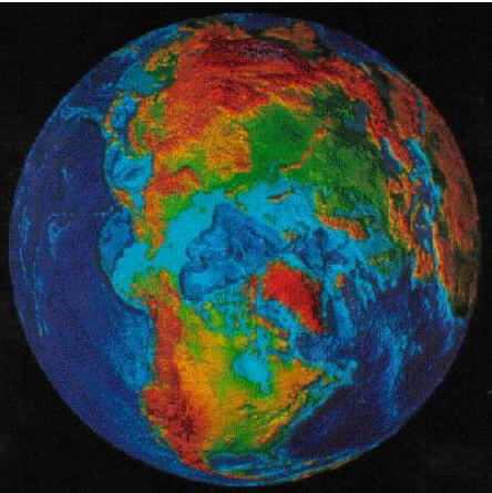
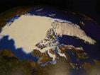
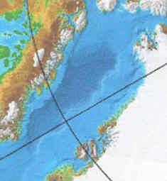
Atlantis: Beneath Basin Bay theory

and Kircher's map in relation to

the geography, climate and oceanography

of the arctic

12,000 years ago

... the legend ...

... or discusions of other location theories ...

Email the author:

bruce_bond@hotmail.com

visit website ...  Made in New Zealand Next Page  Made in New Zealand . . . visit website

Copyright Ian Fox 1998, 2002, 2006, 2008

Atlantis: Beneath Baffin Bay Theory

Inverness_Courier_Jan_2005.jpg