

Tornadoes
Links
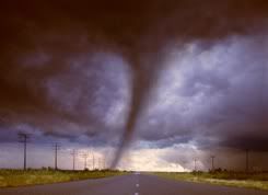
Basic Twister Info.
Tornado Links
Tornado Video Clips
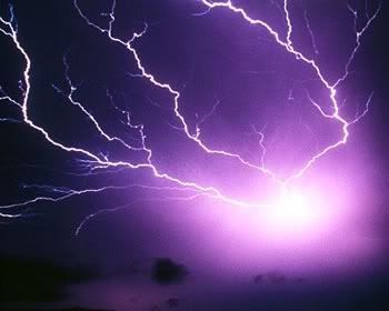
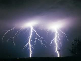
Lightning Video Clips
Etymology
The word "tornado" comes from the Spanish word for "turned", which in turn comes from the Latin word torqueo, meaning "to twist." The latin word derives from the PIE root tar–, and is etymologically related to the Norse Thor(ţórr). Some common, related slang terms include: twister, whirlwind, wedge, funnel, willy-willy, finger of God, Devil's tail, rope, or stovepipe. However, willy-willy usually refers to a dust devil in Australia.
| Video and Code Provided by BoFunk.com |
Definitions
A tornado is defined by the National Weather Service (NWS) as "a violently rotating column of air in contact with the ground and...a thunderstorm."[6] A tornado does not necessarily have to be visible; however, the low pressures caused by the fast wind speeds (see Bernoulli's principle) usually cause water vapor in the air to condense into a visible condensation funnel. In strong tornadoes, dirt and debris kicked up at the surface can contribute to the visibility of the tornado, in addition to changing its color depending on the color of the debris.
Stronger tornadoes are often observed to have multiple vortices, or many columns of violently spinning air rotating around a common center. However, a satellite tornado is a term for a weak tornado which forms very near a large, strong tornado, often lasting no more than a minute. The satellite tornado may appear to "orbit" the larger tornado (hence the name), giving the appearance of one, large multi-vortex tornado. However, a satellite tornado is a distinct funnel, and is much smaller than the main funnel.
A waterspout is a tornado over water. In general, most tornadoes over land are associated with a severe thunderstorm; however, the National Weather Service in the United States considers all waterspouts—including "fair weather" waterspouts—to be tornadoes. These weaker relatives of classic tornadoes are almost always very weak (F0 on the Fujita Scale), and form from weak, non-rotating thunderstorms, or even regular summer showers. Typically, waterspouts moving onto land cause little or no damage, and dissipate within minutes. However, strong waterspouts from supercells can cause significant damage if they impact land areas. In addition, strong tornadoes can move over lakes or over the ocean, becoming waterspouts, without losing intensity.
A landspout is an unofficial term for a tornado not associated with a mesocyclone. Known officially as a dust-tube tornado, it is usually weak, features a small condensation funnel which often does not appear to reach the ground, and is often marked by a tall tube of dust and/or debris reaching as far up as the parent cloud. Though usually weaker than ordinary tornadoes, they are tornadoes, and can cause serious damage[3][6].
A gustnado is a small, vertical swirl associated with a gust front or downburst. Because they are technically not associated with the cloud base, there is some debate as to whether or not gustnadoes are actually tornadoes.[3] [7] These usually cause localized areas of heavier damage among areas of straight-line wind damage caused by the gust front.
A sequence of images showing the birth of a tornado. First, the rotating cloud base lowers. This lowering becomes a funnel, which continues descending while winds build near the surface, kicking up dust and other debris. Finally, the visible funnel extends to the ground, and the tornado begins causing major damage.
Life Cycle
Most tornadoes follow a recognizable life cycle.[6] The cycle begins when a strong thunderstorm develops a rotating mesocyclone a few miles up in the atmosphere, becoming a supercell. As rainfall in the storm increases, it drags with it an area of quickly descending air known as the rear flank downdraft (RFD). This downdraft accelerates as it approaches the ground, and drags the rotating mesocyclone towards the ground with it.
As the mesocyclone approaches the ground, a visible condensation funnel appears to descend from the base of the storm, often from a rotating wall cloud. As the funnel decends, the RFD also reaches the ground, creating a gust front that can cause damage a good distance from the tornado. Usually, the funnel cloud begins causing damage on the ground (becoming a tornado) within minutes of the RFD reaching the ground.
Initially, the tornado has a good source of warm, moist inflow to power it, so it grows until it reaches the mature stage. During its mature stage, which can last anywhere from a few minutes to more than an hour, a tornado often causes the most damage, and can in rare instances be more than one mile across. Meanwhile, the RFD, now an area of cool surface winds, begins to wrap around the tornado, cutting off the inflow of warm air which feeds the tornado.
As the RFD completely wraps around and chokes off the tornado's air supply, the tornado begins to weaken, becoming thin and rope-like. This is the dissipating stage, and the tornado often fizzles within minutes. During the dissipating stage, the tornado becomes highly influenced by the direction of surface winds, and can be blown into fantastic patterns.
As the tornado enters the dissipating stage, its associated mesocyclone often weakens as well, as the rear flank downdraft cuts off the inflow powering it. In particularly intense supercells, tornadoes can develop cyclically. As the first mesocyclone and associated tornado dissipate, the storm's inflow is concentrated into a new area closer to the center of the storm. If a new mesocyclone develops, the cycle may start again, producing a new tornado. Occasionally, the old, or occluded mesocyclone, and the new mesocyclone produce a tornado at the same time.
Though this is a widely-accepted theory for how most tornadoes form, live, and die, it does not explain the formation of smaller tornadoes, such as landspouts, long-lived tornadoes, or tornadoes with multiple vorticies. These each have different mechanisms which influence their development—however, most tornadoes follow a pattern similar to this one.
Characteristics
A wedge tornado, nearly a mile wide. A rope tornado in its dissipating stage. The horizontal lines in the foreground are power cables. A multiple-vortex tornado outside of Dallas, Texas on April 2, 1957.
Shape
Most tornadoes take on the traditional appearance of a narrow funnel, a few hundred yards across, with a small cloud of debris near the ground. However, tornadoes can appear in all manner of shapes and sizes.
Small, relatively weak landspouts might only be visible as a small swirl of dust on the ground. While the condensation funnel may not extend all the way to the ground, if winds at the surface are greater than 40 mph (64 km/h), it is considered a tornado.
Large single-vortex twisters, often violent, can look like a large wedge stuck into the ground, and are known as wedge tornadoes or wedges. Wedges can be so wide that they appear to be a block of dark clouds. Even experienced storm observers may not be able to tell the difference between a low-hanging cloud and a wedge tornado from a distance.
Tornadoes in the dissipating stage can appear like narrow tubes, or ropes, twisting into all manner of curls, twists, and s-shapes. A tornado such as this is roping out, or becoming a rope tornado.
Multiple-vortex tornadoes can appear as a family of swirls circling a common center, or may be completely obscured by debris, appearing to be a single funnel.
In addition to these appearances, tornadoes may be obscured completely by rain or dust. These tornadoes are especially dangerous, as even experienced meteorologists might not spot them.
Size
In the United States, an average tornado is around 500 feet (150 m) across, and stays on the ground for 5 miles (8 km).
Weak tornadoes, or strong but dissipating tornadoes, can be exceedingly narrow, sometimes only a few feet across. In fact, a tornado was once reported to have a damage path only 7 feet (2.1 m) long.[8]
On the other end of the spectrum, a tornado which affected Hallam, Nebraska on May 22, 2004 was at one point 2.5 miles (4 km) wide[2]. In terms of path length, some meteorologists believe that the Tri-State Tornado, which affected parts of Missouri, Illinois, and Indiana on March 18, 1925, was on the ground continuously for 219 miles (352 km). However, without a modern damage survey, it is impossible to determine whether or not the deadly event was a single tornado or a series of violent tornadoes produced by the same storm. The longest modern-day tornado track was a tornado which was on the ground for 160 miles (257 km) in northeastern North Carolina on November 22, 1992.
Appearance
Tornadoes, depending on the environment in which they form, can have a wide range of colors. Tornadoes which form in a dry environment can be nearly invisible, marked only by swirling debris at the base of the funnel. Condensation funnels which pick up little or no debris can be grey to white. While travelling over a body of water as a waterspout, they can turn very white or even blue. Funnels which move slowly, ingesting a lot of debris and dirt, are usually darker, taking on the color of debris. Tornadoes in the Great Plains can turn red because of the reddish tint of the soil, and tornadoes in mountainous areas can travel over snow-covered ground, turning brilliantly white in the process.
These are two photographs of the Waurika, Oklahoma tornado of May 30, 1976, taken at nearly the same time. In the top picture, the tornado is front-lit, with the sun behind the east-facing camera, so the funnel appears nearly white. In the lower image, where the camera is facing the opposite direction, the tornado is back-lit, with the sun behind the clouds.[9]Lighting conditions are also a major factor in the appearance of a tornado. A tornado which is "back-lit", or viewed with the sun behind it, will appear to be very dark. The same tornado, viewed with the sun at the observer's back, may appear grey or brilliant white. Tornadoes which occur near the time of sunset can be many different colors, appearing in hues of yellow, orange, and pink.
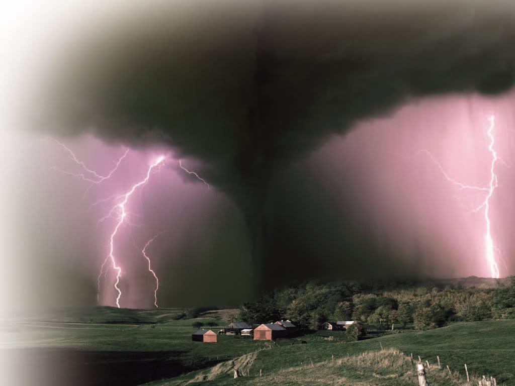
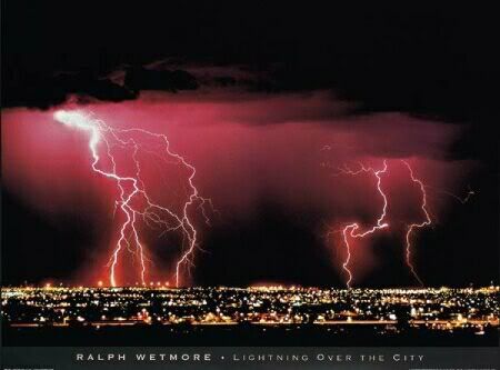
Dust kicked up by the winds of the parent thunderstorm, heavy rain and hail, and the darkness of night are all factors which can reduce the visibility of tornadoes, making them "invisible", in essence. Tornadoes occurring in these conditions are especially dangerous, since only radar observations, or possibly the sound of an approaching tornado, serve as any warning to those in the storm's path. Fortunately most significant tornadoes form under the storm's rain-free base, or the area under the thunderstorm's updraft, where there is little or no rain. In addition, most tornadoes occur between the hours of 4 and 8 pm, when the bright sun can penetrate even the thickest clouds. Also, night-time tornadoes are often illuminated by frequent lightning.
There is mounting evidence, including doppler radar images[10] and eyewitness accounts[11], which suggest that most tornadoes have a clear, calm center with extremely low pressure, akin to the eye found in tropical cyclones. This area would be clear (possibly full of dust), have relatively light winds, and be very dark, with the light blocked out by swirling debris on the outside of the tornado. Lightning is said to be the source of illumination for those who claim to have seen the interior of a tornado.
Rotation
Tornadoes normally rotate in a cyclonic direction (counterclockwise in the northern hemisphere). Large-scale storms always rotate cyclonically because of the Coriolis force. Tornadoes usually rotate the same way; however, they are too small in scale to be directly affected by the rotation of the earth, and about 1 tornado in 100 rotates in an anticyclonic direction. Usually only landspouts rotate anticyclonically. However, on very rare occasions, an anticyclonic supercell develops, producing a tornado that is typical except for its direction of rotation.[12]
Intensity and damage
Tornadoes vary in intensity regardless of shape, size, and location. While strong tornadoes are typically larger than weak tornadoes, there are several instances of F5 tornadoes with damage paths less than 500 feet (150 m) wide.
For many years, before the advent of home movies and doppler radar, scientists had nothing more than educated guesses as to the speed of the winds in a tornado. The only evidence indicating the wind speeds found in the tornado was the damage left behind by tornadoes which struck populated areas. Some thought they might exceed 500 mph, and perhaps even be supersonic.
In the 1950's however, evidence mounted that the actual wind speeds were much lower than this. On April 2, 1957, a slow moving tornado traversed the south and east parts of Dallas, Texas. Before this day, only a few photographs and motion pictures of tornadoes were known to exist. However, because of many factors, including the tornado's high visibility, slow forward motion, and proximity to an urban center, it became (and still may be) the most filmed and photographed tornado in history. Frame-by-frame analysis of several pieces of footage taken that day showed that the debris flung about by the tornado was travelling at speeds up to 170 mph.[13]
Major damage to homes in Stoughton, Wisconsin caused by an F3 tornado on August 18, 2005.In 1971, Dr. Tetsuya Theodore Fujita introduced the idea for a scale of tornado winds. With the help of colleague Allen Pearson, he created and introduced what came to be called the Fujita scale in 1973. The scale was based on a relationship between the Beaufort scale and the Mach number scale; the low end of F1 on his scale corresponds to the low end of B12 on the Beaufort scale, and the low end of F12 corresponds to the speed of sound at sea level, or Mach 1. In practice, tornadoes are only assigned categories F0 through F5.
The TORRO scale, developed by the Tornado and Storm Research Organisation (TORRO), was developed in 1974, and published a year later. The TORRO scale has 12 levels, which cover a broader range with tighter graduations. It ranges from a T0 for extremely weak tornadoes to T11 for the most powerful known tornadoes.
[14]
There is some debate as to the usefulness of the TORRO scale over the Fujita scale—while it is helpful for statistical purposes to have more levels of tornado strength, often the damage caused could be created by a large range of winds, so it is nearly impossible to narrow the tornado down to a single TORRO scale category. Worldwide, the preferred scale for measuring the intensity of a tornado is the Fujita scale. The United Kingdom and some other areas of Europe use the TORRO scale. The ranking of a tornado on either scale is determined by Doppler radar wind speed data (if available), videogrammetry (frame-by-frame analysis of video footage), and empirical data derived from damage to structures and vegitation.
In the United States, F0 and F1 (T0 through T3) tornadoes account for 80% of all tornadoes. On the other hand, violent tornadoes (stronger than F4, T8), account for less than 1%.[15] Worldwide, strong tornadoes account for an even smaller percentage of total tornadoes. Violent tornadoes are extremely rare outside of the United States.
Research conducted in the late 1980s and 1990s suggested that, even with the implication of the Fujita scale, tornado winds were notoriously overestimated, especially in significant and violent tornadoes. Because of this, in 2006, the American Meteorological Society introduced the Enhanced Fujita Scale, to help assign realistic wind speeds to tornado damage. The scientists specifically designed the scale so that a tornado assessed on the Fujita scale and the Enhanced Fujita scale would receive the same ranking. The EF-scale is more specific in detailing the degrees of damage on different types of structures for a given wind speed. While the F-scale goes from F0 to F12 in theory, the EF-scale is capped at EF5, which is defined as "winds ≥ 200 mph (≥ 320 km/h)".[3] In the United States, the Enhanced Fujita scale will be used for tornado damage assessments beginning February 2, 2007.
The first observation which confirmed that F5 winds could occur happened on April 26, 1991. A tornado near Red Rock, Oklahoma was monitored by scientists using a portable Doppler radar, an experimental radar device that measures wind speed. Near the tornado's peak intensity, they recorded a wind speed of 115-120 m/s (257-268 mph or 414-432 km/h). Though the portable radar had uncertainty of ± 5-10 m/s (± 11-22 mph or ± 18-36 km/h), this reading was probably within the F5 range, confirming that tornadoes were capable of violent winds found nowhere else on earth.
Eight years later, during the Oklahoma Tornado Outbreak of May 3, 1999, another scientific team was monitoring an exceptionally violent tornado (one which would eventually kill 36 people in the area near Moore, Oklahoma). At about 7 pm, they recorded one measurement of 318 mph [1], 50 mph faster than the previous record. Though this reading is just short of the theoretical F6 rating, the measurement was taken more than 100 feet in the air, where winds are typically stronger than at the surface.
