
| Las Trampas 50K | Updated: 2/3/2003 |
|---|---|
| Results 2002 | |
| Results 2001 | Results 2000 |
| Photos 2000-2001 | |
I'm sorry to report that the Las Trampas 50K is not coming together this year. The most significant reason is the continuing ambiguous relationship between the park and the run. Last year we were confronted by park personnel ("this has every appearance of being a race..."), and to avoid a catastrophic outcome this year, I think it's wiser to postpone until these issues are fully settled.
For the run to re-emerge next year may require a change of format. One possibility is to go official, with insurance and permits. Another possibility make the event smaller and fully private -- in other words, by invitation only, with 20 or fewer participants.
I'll certainly consider any feedback in trying to figure out what to do.
P.S.: Bad news for the Las Trampas 50K may be good news for another idea of mine. Is anyone interested running the length of the Lost Coast of California? This would be an invite-only, two-day wilderness stage run through a 70-mile, almost roadless section of mountainous California coast that lies between Eureka and Mendocino.
| Date: | Saturday, February 16th, 2002 |
| Time: | Start anytime between 6:30 AM and 9:30 AM. |
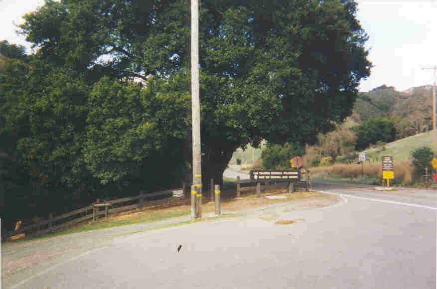
| Location: | Las Trampas Regional Wilderness, one of the East Bay Regional Parks, near San Ramon, CA, at the northern end of Bollinger Canyon Road. To reach the park from I-580 in Castro Valley, take Crow Canyon Road north to Bollinger Canyon Road and turn left. From I-680 in San Ramon, take Crow Canyon Road west to Bollinger Canyon Road and turn right. See Yahoo Maps. |
| Parking: | Just outside the main gate, on the left side of the road, near the Elderberry trailhead. By parking outside the gate, you avoid the need to worry about the fact that it closes at 4:30pm. Don't block the signed firelane. |
| Format: | Two stages. Finish the first stage (30K) by 12:30 PM, and the second stage (another 21K) by 4:30 PM. Start each stage as late as you dare. Finishers that make both deadlines will be ranked by the sum of the differences between their starting times and the deadlines. |
| Permit: | None. This is an informal birthday run, not an official event. |
| Course: | Steep trails and firetrails. Over 20,000 feet of elevation change. Mud, probably in plague-like quantities. |
| Markings: | None. See detailed course instructions, park map, and elevation profile. |
| Aid: | Limited. Water every 10K. You will also encounter your vehicle once at 30K; I will probably have some additional stuff at this same location, but no guarantees. |
| Contact: | Eric Robinson
5644 Oak Grove Ave Oakland, CA 94618 510-290-9315 ericjr77@yahoo.com |
| Statistic | Stage I | Stage II | Total |
|---|---|---|---|
| Miles | 18.64 | 13.10 | 31.74 |
| Kilometers | 30.00 | 21.08 | 51.08 |
| Elevation Gain | 6060' | 4213' | 10273' |
| Elevation Loss | 6060' | 4213' | 10273' |
| Elevation (Start/Finish) | 960' | 960' | 960' |
| Elevation (High) | 1960' | 1960' | 1960' |
| Elevation (Low) | 360' | 520' | 360' |
| Grade (Average) | 12.3% | 12.2% | 12.3% |
How long will this take? More time than you think. Participants in this run have a history of underestimating the difficulty of the course. You can probably expect to spend almost the same amount of time as a flat fifty miler.
| Stage I — complete the first 30K by 12:30p | ||||||||||
|---|---|---|---|---|---|---|---|---|---|---|
| Location | Miles To Go |
50K Pace | ||||||||
| 10 Hrs |
9½ Hrs |
9 Hrs |
8½ Hrs |
8 Hrs |
7½ Hrs |
7 Hrs |
6½ Hrs |
6 Hrs |
||
| Start | 18.64 | 6:30a | 6:57a | 7:14a | 7:32a | 7:49a | 8:07a | 8:24a | 8:42a | 8:59a |
| South Ave | 12.26 | 8:30a | 8:50a | 9:02a | 9:13a | 9:25a | 9:36a | 9:48a | 9:59a | 10:23a |
| Staging Area | 6.30 | 10:22a | 10:38a | 10:44a | 10:50a | 10:56a | 11:02a | 11:07a | 11:13a | 11:25a |
| Finish | 0.00 | 12:20p | 12:30p | 12:30p | 12:30p | 12:30p | 12:30p | 12:30p | 12:30p | 12:30p |
| Stage II — complete the last 20K by 4:30p | ||||||||||
| Location | Miles To Go |
50K Pace | ||||||||
| 10 Hrs |
9½ Hrs |
9 Hrs |
8½ Hrs |
8 Hrs |
7½ Hrs |
7 Hrs |
6½ Hrs |
6 Hrs |
||
| Start | 13.10 | 12:20p | 12:33p | 12:46p | 12:58p | 1:11p | 1:23p | 1:36p | 1:48p | 2:12p |
| Staging Area | 6.30 | 2:30p | 2:36p | 2:42p | 2:48p | 2:54p | 3:00p | 3:06p | 3:12p | 3:24p |
| Finish | 0.00 | 4:30p | 4:30p | 4:30p | 4:30p | 4:30p | 4:30p | 4:30p | 4:30p | 4:30p |
Times shown are time-of-day. The chart adjusts for terrain, and assumes a nominal 1.8% slowdown from the first stage to the second. Keep in mind that most people tend to slow down much more than this. Sunrise is at 6:57 am, and sunset is at 5:48 pm.
Historical Finisher List
| Finisher | Year | Number of Deadlines Made |
Elapsed Time | Adjusted Time | Official Score | ||||
|---|---|---|---|---|---|---|---|---|---|
| Stage I | Stage II | Total | Total | Stage I | Stage II | Total | |||
| Kevin Sawchuk | 2001 | 2 | 3:34:30! | 2:25! | 5:59:30! | 5:56:30! | 3:37! | 2:40! | 6:17! |
| Kevin Sawchuk | 2000 | 2 | 3:46 | 2:30 | 6:16 | 6:16 | 4:04 | 2:45 | 6:49 |
| Fred Brooks | 2:36 | 6:22 | 6:22 | ||||||
| Ken Gregorich | 2000 | 2 | 3:46 | 3:01 | 6:47 | 6:47 | 3:51 | 3:07 | 6:58 |
| Wendell Doman | 2001 | 2 | 3:54 | 3:08 | 7:02 | 6:47 | 3:44 | 3:20 | 7:04 |
| Kirk Boisseree | 2001 | 2 | 4:20 | 3:31 | 7:51 | 7:42 | 4:16 | 3:35 | 7:51 |
| Bob Pearson | 1998 | 2 | 3:54 | 3:00 | 6:54 | 6:54 | 4:03 | 3:50 | 7:53 |
| Tim Hicks | 2001 | 2 | 4:43 | 3:31 | 8:14 | 8:05 | 4:51 | 3:35 | 8:26 |
| Mark Overhoff | 1999 | 2 | 4:29 | 3:38 | 8:07 | 8:07 | 4:50 | 3:41 | 8:31 |
| John Robinson | 2001 | 2 | 4:19 | 2:58 | 7:17 | 7:17 | 5:23 | 3:15 | 8:38 |
| Clement Choy | 2001 | 2 | 4:41 | 3:35 | 8:16 | 8:13 | 4:59 | 4:03 | 9:02 |
| Chuck Wilson | 2001 | 2 | 4:48 | 4:12 | 9:00 | 8:51 | 5:00 | 4:15 | 9:15 |
| Eric Robinson | 2000 | 2 | 5:08 | 3:48 | 8:56 | 8:56 | 5:17 | 3:49 | 9:16 |
| Clement Choy | 1999 | 2 | 4:47 | 4:04 | 8:51 | 8:51 | 5:08 | 4:10 | 9:18 |
| Joe Florio | 2001 | 2 | 5:11 | 4:09 | 9:20 | 9:14 | 5:17 | 4:12 | 9:29 |
| Kevin Sawchuk | 1998 | 2 | 4:08 | 2:39 | 6:47 | 6:47 | 4:56 | 4:35 | 9:31 |
| Chuck Wilson | 2000 | 2 | 4:33 | 3:47 | 8:20 | 8:20 | 5:15 | 4:18 | 9:33 |
| Chuck Wilson | 1999 | 2 | 4:29 | 4:02 | 8:31 | 8:31 | 5:09 | 4:32 | 9:41 |
| Gary Dudney | 2000 | 2 | 4:44 | 3:42 | 8:26 | 8:26 | 5:23 | 4:21 | 9:44 |
| Catra Corbett | 2001 | 2 | 4:53 | 3:33! | 8:26! | 8:23! | 5:09 | 4:39 | 9:48! |
| Jim Winne | 2001 | 2 | 4:53 | 3:33 | 8:26 | 8:23 | 5:09 | 4:39 | 9:48 |
| Catra Corbett | 2000 | 2 | 6:10 | 3:44 | 9:54 | 9:54 | 6:19 | 4:06 | 10:25 |
| Kevin Sawchuk | 1999 | 2 | 3:45 | 2:58 | 6:43 | 6:43 | 5:18 | 5:10 | 10:28 |
| Jeff Collins | 2001 | 2 | 4:58 | 3:01 | 7:59 | 7:56 | 5:51 | 4:49 | 10:40 |
| Wendell Doman | 2000 | 2 | 4:02 | 3:20 | 7:22 | 7:22 | 6:02 | 5:57 | 11:59 |
| Mike Topper | 2000 | 1 | 3:46 | 3:05 | 6:51 | 6:51 | 4:04 | n/a | |
| Kevin Rumon | 2000 | 1 | 3:46 | 3:06 | 6:52 | 6:52 | 4:04 | n/a | |
| Ken Gregorich | 1998 | 1 | 4:13 | 3:16 | 7:29 | 7:29 | n/a | 3:26 | n/a |
| Joe Florio | 2000 | 1 | 5:20 | 4:13 | 9:33 | 9:33 | 5:27 | n/a | |
| Eric Robinson | 2001 | 1 | 5:12 | 4:31 | 9:43 | 9:28 | 5:08 | n/a | |
| Stan Jensen | 1998 | 1 | 5:24 | 4:14 | 9:38 | 9:38 | 5:30 | n/a | |
| Bob Ross | 2000 | 1 | 5:51 | 4:28 | 10:19 | 10:19 | 6:04 | n/a | |
| David Baltazar | 2001 | 1 | 5:24 | 5:00 | 10:24 | 10:21 | 5:51 | n/a | |
| Bob Ross | 2001 | 1 | 5:59 | 5:45 | 11:44 | 11:35 | 6:10 | n/a | |
| Eric Robinson | 1997 | 0 | 3:55 | 3:25 | 7:20 | 7:20 | n/a | ||
| David Kim | 1997 | 0 | 4:42 | 3:29 | 8:11 | 8:11 | n/a | ||
| Eric Robinson | 1999 | 0 | 4:24 | 4:06 | 8:30 | 8:30 | n/a | ||
| David Kamp | 1998 | 0 | 5:02 | 3:36 | 8:38 | 8:38 | n/a | ||
| Stan Jensen | 1997 | 0 | 4:52 | 4:03 | 8:55 | 8:55 | n/a | ||
| Eric Robinson | 1998 | 0 | 4:57 | 4:03 | 9:00 | 9:00 | n/a | ||
| Clement Choy | 2000 | 0 | 4:59 | 4:05 | 9:04 | 9:04 | n/a | ||
| Bob Ross | 1997 | 0 | 5:43 | 4:56 | 10:39 | 10:39 | n/a | ||
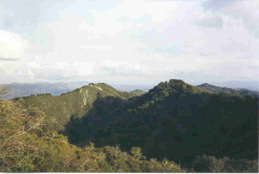
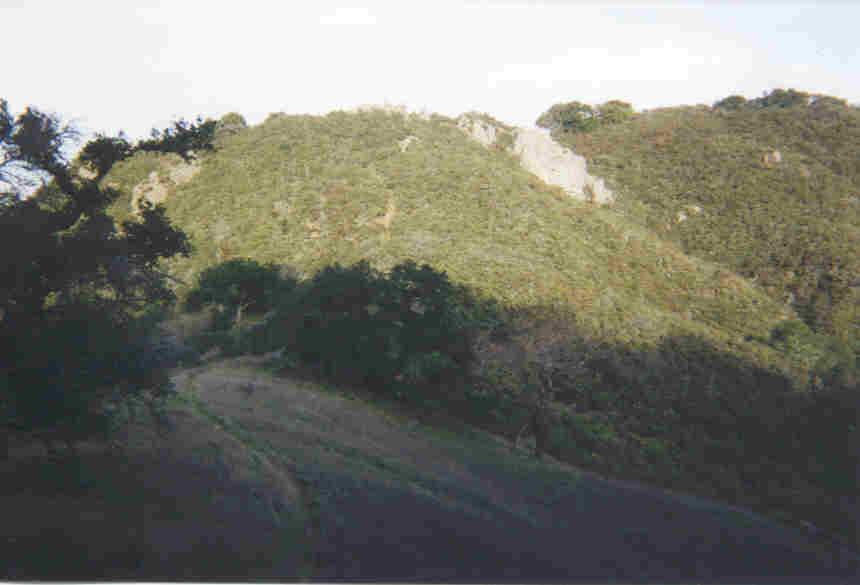
Be sure to check out the course map and profile.
The overall layout of the course is a big counter-clockwise loop, done twice. On the first loop, we add three out-and-backs (Starview Drive, South Avenue, and Las Trampas Peak).
Start at the park's main gate, near the Elderberry trailhead. Make sure that your departure time is recorded on my clipboard.
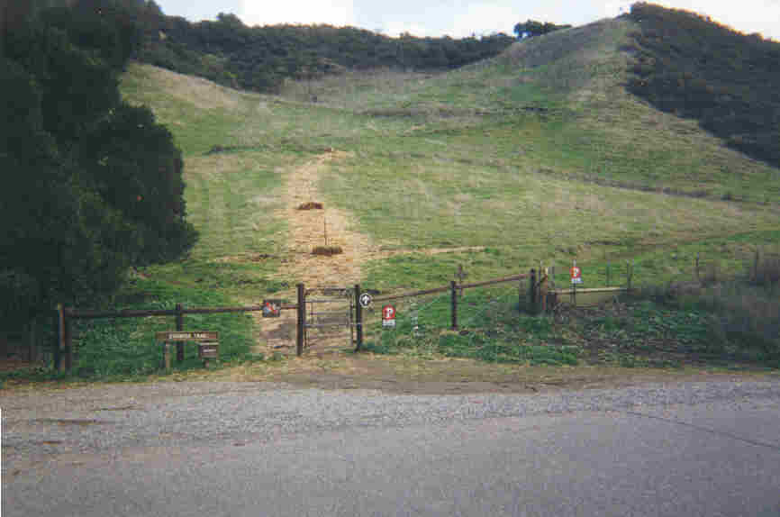
Run north on Bollinger Canyon Road about 0.3 mile to the Chamise Trailhead, located on the right side of the road. Turn right and get on the Chamise trail, the one that switchbacks steeply up the grassy slope.
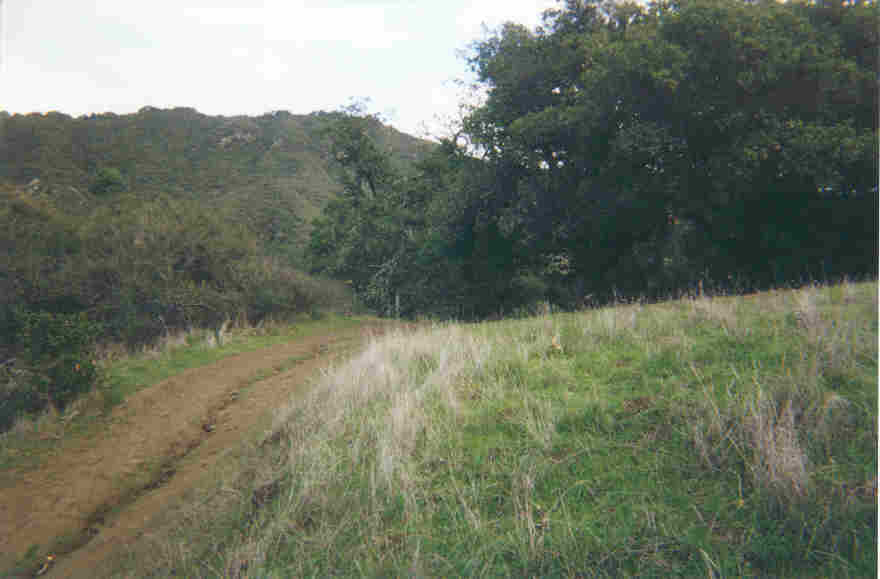
Stay on Chamise for only about 300 yards (where the grassy slope ends and the trail encounters scrub and trees). Turn right on Mahogany, a very narrow trail which immediately descends into trees, first crossing a horse-proof barrier, and further down hill, a small stream.
Mahogany then climbs to an intersection with Trapline. Turn right on Trapline, which eventually climbs across the top of Las Trampas Ridge. Continue straight, crossing the Las Trampas Ridge Trail, to descend on Sulphur Springs Trail.
At the bottom of Sulphur Springs is an animal trough, and indeed, a smelly spring. The trail angles to the right and widens to firetrail. Climb to the saddle with the Del Amigo Firetrail.
Turn left on Del Amigo, which soon curves to the right and descends (very steeply, with a decent view of Mt. Diablo). Continue on Del Amigo straight past the single track Virgil Williams Trail, but make a note of its location, since we will be returning to Virgil Williams after making the out-and-back to Starview Drive.
Continue on Del Amigo as it becomes a single track easement which leads past a creek and behind some private property to end on Starview Drive. Turn around and return to Virgil Williams.
Turn right on Virgil Williams, which descends gently at first, rolling through a pleasant woodlands. The trail gets steeper and emerges onto an unmarked firetrail (Madrone). Ignore Madrone, hugging the fenceline to continue straight on the single-track Virgil Williams. It curves around the former estate of playwright Eugene O’Neill (The Iceman Cometh), then descends to a creek before re-emerging further along Madrone.
The second intersection with the Madrone Firetrail is also unmarked, but turn right. Climb about 100 yards to yet another unmarked intersection, a T between two firetrails. Turn left to continue climbing on Madrone. Climb about half a mile to a Y-intersection with the Corduroy Hills Firetrail (this one is actually marked). Take the right fork to stay on Madrone and start an out-and-back segment to South Avenue.
Half a mile later is another intersection between two firetrails. Turn right to descend on the one marked To South Ave. About a quarter mile later (not 0.59 as the map suggests), the trail enters a few sharp curves and then intersects with the single track portion of the South Avenue Trail.
Turn left onto the single track and descend to a stream. Ignore the Hemme trail on the near side of the bank; stay on the South Avenue Trail to cross the stream and climb a small ridge. Then descend about 200 yards to the paved driveway at the end of the trail (South Avenue). There should be an unmanned water stop located here. Turn around.
Return all the way back to the intersection with the Corduroy Hills Firetrail and turn sharply to the right. Climb on firetrail for about half a mile to what appears to be an unmarked Y-intersection. Actually, both branches rejoin each other in a short distance to form a cul-de-sac. Follow either branch around to the rear (i.e. top) of the cul-de-sac, and continue uphill on the single track portion of the Corduroy Hills trail.
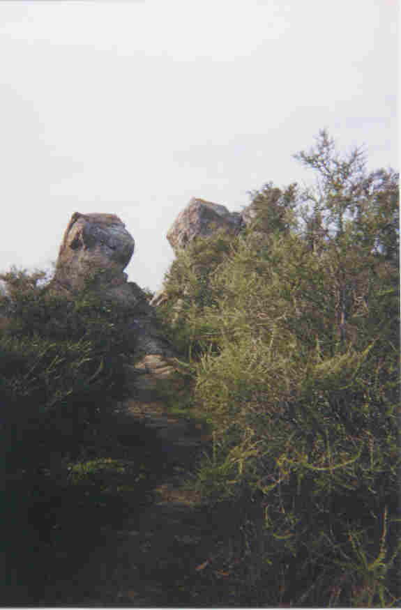
The trail is narrow in places, and there is one tricky turn near the top of Eagle Peak. It's marked, but easy to miss. Just before the summit the vegetation changes radically as the trail emerges into a stand of shrubs. The correct trail bears to the right, behind one of the clumps of shrubs, and then drops steeply through a short section of rock formations. (The incorrect trail goes straight, and climbs about 50 yards to a park bench situated on the summit).
Cross the saddle between Eagle and Vail Peaks, and emerge on the Las Trampas Ridge Trail near Vail Peak. (The signpost here has fallen down, but there are still markers on the reverse side of the fence). Turn right on the Las Trampas Ridge Trail.
Watch for the intersection between the Las Trampas Ridge trail and a trail signed as the Bollinger Canyon Trail (though it merely says "0.17" on the map). The right hand trail stays on the ridgeline, while the left hand trail drops steeply into Bollinger Canyon. During the first stage, we stay right on the Las Trampas Ridge Trail; during the second we turn left on the Bollinger Canyon Trail.
First stage instructions: stay right on the Las Trampas Ridge Trail and start the final out-and-back, this time to Las Trampas Peak. Stay right again when the trail merges onto firetrail (known as the Las Trampas Ridge Firetrail). Continue on the firetrail for another half mile (including a sizable descent and steep climb) to another junction on Las Trampas Peak. The sign here says "End", but turn left on firetrail and climb about 75 yards to the actual summit before turning around. Retrace your steps to the intersection between the firetrail and the single track portion of the Las Trampas Ridge trail. Bear right, descending on the firetrail, which after this point is called the Bollinger Canyon Firetrail.
Second stage instructions: turn left onto the Bollinger Canyon Trail (a.k.a. "0.17" trail). This is a shortcut to the Bollinger Canyon Firetrail. When you reach it, turn left and go downhill.
Descend to a an unmarked Y-intersection in Bollinger Canyon's saddle. Bear left, still going downhill.
Continue on the Bollinger Canyon Firetrail for about 300 more yards until reaching several large oak trees. Watch carefully for the turn onto Creek Trail; turn right on this single track and cross the stream. Follow the Creek trail to the paved Staging Area. This is the 20K point and a water stop. Record the time of day on the clipboard.
Turn right on the paved Rocky Ridge Trail. Climb for half a mile to the intersection with the Cuesta Trail. Do NOT make the "hard" left turn onto Cuesta, but instead make the "soft" left onto the dirt version of the Rocky Ridge Trail (marked "0.22" on the map). This cuts straight up the slope to an intersection with the Upper trail, near the park's transmission tower.
Turn left onto the Upper Trail, which tops the ridge in another quarter mile. Continue south on Upper, paralleling the boundary fence for about half a mile.
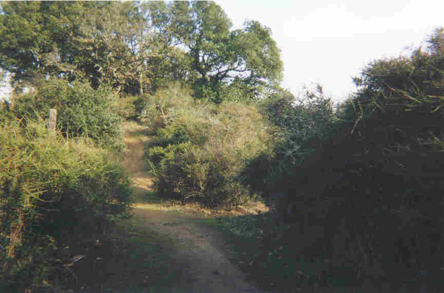
The fence eventually falls away where the single track becomes firetrail. Stay on this firetrail for only about 100 yards. Look for the wooden post that marks the Sycamore trail.
Turn right and descend on the somewhat faint Sycamore Trail. If it's foggy, it's easy to lose this trail as it crosses a grassland bowl, intersected by various cow paths. The correct trail descends gently, crossing the bowl and reaching some exposed rock formations about a quarter mile away. (Try to avoid the false paths that drop steeply leftwards into a ravine).
After the rock formations, Sycamore descends steeply and eventually crosses Cull Creek (most likely a wet crossing). A bit later, Sycamore ends at Devil's Hole.
Turn left on the aptly-named Devil's Hole Firetrail. Odds are, we get to contend with some especially nasty mud. Climb the firetrail all the way to the top of the ridge again, where it joins with the Upper trail.
Turn right on Upper. After descending along the spine of the ridge for about half a mile, turn sharply left onto the Elderberry Firetrail.
Follow Elderberry as it first descends, then rolls, then descends again to a large picnic area named Corral. A right turn quickly leads to the completion of the first stage at the park's main gate. Congratulations. Record your arrival time on my clipboard.
For the second stage, repeat all of the above, but don’t include the three out-and-backs that were used for the first stage.
