
Mattole River, Shelter Cove Rd. to Ettersburg, III (IV), 10 miles
John Lester, © 1999
On the Gold Country Paddler's President's Day Weekend Eel River Extravaganza (put together by Elaine Baden), between runs of the Outlet Ck./Dos Rios and Pillsbury sections of the Eel, Gunnar Krueger, Jenny Riley, and I ran the stretch of the Mattole River from the Shelter Cove Road crossing to Ettersburg. This somewhat esoteric stretch of river has not yet made it into the guidebooks. This is an unusual river in that it lies very near the ocean, paralleling it past the "Lost Coast" of California; the put-in is only about 5 miles as the crow flies from the Pacific. After amassing whatever advance information we could the night before, we headed north, hopeful that the flow estimates and difficulty assessments we'd gathered would be correct. It had rained pretty consistently earlier, so we also hoped for a good flow. The Mattole has a very small drainage and no snowpack, so winter is really the only time to do this run. It was cold out, and the clouds looked very eerie as they clung to the hillsides as we motored north. After breakfast in Willits, the clouds lifted, the sun came out for what promised to be a good day on the river. As we headed further and further from "civilization," we passed through groves of centuries old giant redwoods. When we reached the put-in, Gunnar complained that there were only 5 radio stations, and all of them played country! We found 20% of the SF Eel at Leggett to be fairly accurate flow predictor. The Leggett gauge read 1,513 cfs, and we figured we had about 400 cfs, which seemed to be a good flow.
The river flowed through a canyon reminiscent of the Noyo, but with
more playspots and more frequent and difficult rapids.
 |
 |
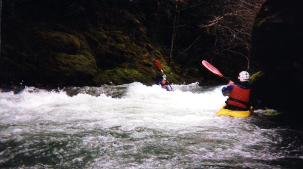
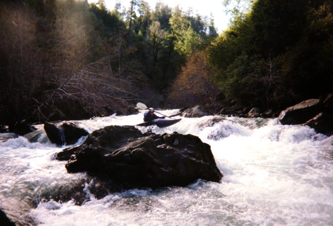
The trees were tall and sheltered the river, so all the rocks were coated in moss and ferns covered any ground available. After about 2-3 miles of class II and III rapids we came upon the first IV. Recognition: The river splits around an island. The left (correct) channel is narrow and there is a log wedged on its downstream side. There is a house on river right at the top of the canyon. Take the left channel and eddy out. Wed been warned that this rapid might be unportageable, and wed heard reports of a near pin/swim here. Our intrepid European representative went ahead and ran the rapid (though whether he managed it without flipping is a matter of contention)! We were considering tossing our boats in and fishing them out below, when I found a portage path on the left bank about 50 ft. upstream. This headed up 50 yds to a dirt road and then another very steep, but passable trail 20 ft down the road that heads back to the river, where after bringing down the boats, I removed the strainer.
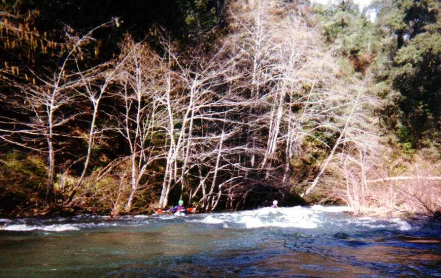
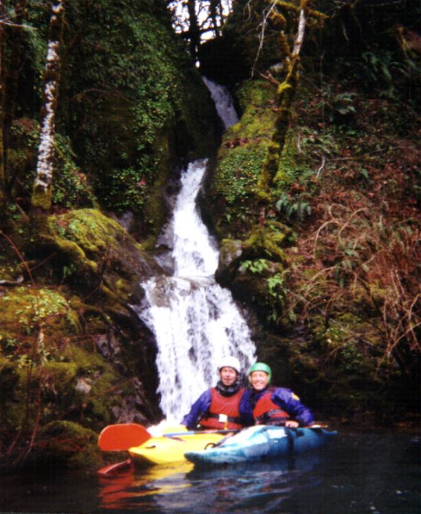
The Mattole continued past beautiful verdant forest, cascading waterfalls,
and many II and III rapids.
 |
 |

Surfing, hole playing, and "looping" were the order of the day.
At about mile 5, you abruptly enter an area that has been logged more
recently and get a lesson in the damage that clearcutting does. Willows
now choke the streambed that once was as beautiful as the upstream section,
and one area in particular has become a willow maze, which could be dangerous
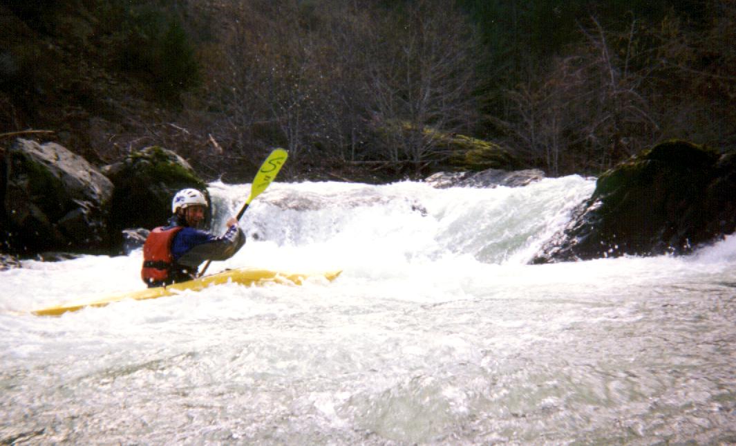
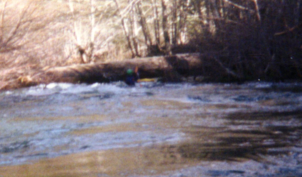
at high flows. Soon after this maze, we reached the second class IV rapid.
After boat scouting, and running the first drop, we scouted the second
part of the rapid. It currently (2/99) has an avoidable, but potentially
dangerous strainer in it halfway down on the left. It was moving a bit,
so it may be gone after the next rain.
 |
 |
There were several channels to choose from, and we all had good lines
through this exciting rapid. Portage was easily possible on the right.
Following this, there was another area of willow mazes that weren't really
all that fun. Also around mile 7 was a huge riverwide strainer. We were
just able to limbo under it on the right, but any more water would make
that impossible, and a portage mandatory. You could see it coming from
a ways off.
 |
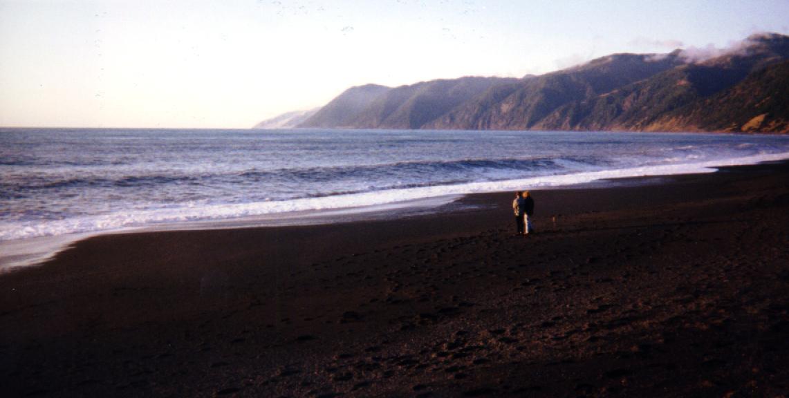 |
The last few miles are class I and II, and the canyon opened up even further. A magnificent bald eagle passed over our heads as we began looking forward to seeing the takeout bridge. Jenny in particular craned her neck with high expectations around every bend. Eventually it arrived, and after loading up, we headed down the road to Shelter Cove to watch the sunset on the black sand beach. Giant waves crashed on the rocks sending spray 50 feet in the air. When the show was over, our hunger took over and we beat feet back to Ukiah. We even made it back to the hotel in time to use the hot tub!

Directions:
101 N to Garberville. 1st exit. Go through "town", cross
freeway and head west on Redway Dr., following signs to Shelter Cove. After
passing a shopping center in Redway, Turn Left on Briceland-Thorne Rd.
(again signed Shelter Cove). After a long ways, Briceland-Thorne Rd. heads
right up a hill, and Shelter Cove Rd. heads left down a hill. The Takeout
is the first river crossing you come to on the B-T road. To reach the put-in,
follow Shelter Cove Rd. until you reach the river soon after bearing right
at Thorne Crossing. You'll reach the takeout perhaps 30-40 min. after leaving
101, and the drive back to the put in takes about 20 min.
