

Location
Western Europe, occupying five-sixths of the island of Ireland in the North Atlantic Ocean, west of Great BritainGeographic Coordinates
53 00 N, 8 00 WMap References
EuropeArea
Area comparative
Land boundaries total
360 kmborder countries
UK 360 kmCoastline
1,448 kmMaritime claims continental shelf
not specified exclusive fishing zone: 200 nm territorial sea: 12 nmTerrain
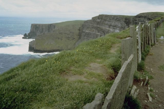
mostly level to rolling interior plain surrounded by rugged hills and low mountains; sea cliffs on west coastElevation extremes
lowest point; Atlantic Ocean 0 m highest point; Carrauntoohil 1,041 mNatural resources
zinc, lead, natural gas, barite, copper, gypsum, limestone, dolomite, peat, silverLand use
arable land:13% permanent crops:0% permanent pastures:68% forests and woodland:5% other:14% (1993 est.)Irrigated land
NA sq kmNatural hazards
NAEnvironment
current issues water pollution, especially of lakes, from agricultural runoffGeography
note strategic location on major air and sea routes between North America and northern Europe; over 40% of the population resides within 97 km of Dublin