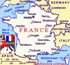
 France - Alsace-Lorraine
France - Alsace-Lorraine
France - Alsace-LorraineAugust 2014
Trip Photos
Click here to make these pictures larger
We wanted to have an extended Bank Holiday and initially the idea was to re-visit Luxembourg to do a more in-depth visit but when we looked on the map to see what was near Luxembourg, I realised that the Alsace-Lorraine region was next door and that neither of us had ever been there. The trip would be made up as we went along using hotels and camping.
Usually, we grab a late night ferry and drive overnight but Wendy wanted to get across the Channel and then stay in a hotel. So I booked a 21:30 ferry from Dover on Wednesday August 20th and the Hotel Du Beffroi in downtown Calais. The only issue with this was the earlier ferry and it was touch and go to get over the Dartford Bridge crossing during the rush hour.
The ferry arrived at 23:40. The hotel had said the reception would be closed but when we arrived there just after midnight there was someone to let us in. Once settled in the room, Wendy asked me to go to the car to get a few extra things. We had been given an access code to get back into the hotel and when I came downstairs, the reception was closed and the front door locked.
The car was parked outside. When I returned to the front door, the access code did not work. A Dutch couple arrived back. They had the same access code and it did not work for them. The hotel was dark and silent. There was no telephone number to call but a leaflet on the door said in French that if you needed access to the hotel to go to a hotel down the road, The Dutch couple set off to find it and I waited in case someone came out of our hotel. The couple arrived back to say that that hotel was also closed. In the end, we flagged down a police car who put on their siren to try and wake someone up. An Irish guy stuck his head out of a window and we yelled up. He let us in to the amusement of the policemen. I found Wendy fast asleep. I had been outside for an hour. Thanks Wendy!
We had never visited any of the Somme battlefields from World War One and this was our destination on the Thursday morning. Some of the fiercest and most futile battles of World War One took place around Arras and Albert. We drove through Arras which we decided could be done on another visit and headed for the Vimy Ridge 8km north where Canadian soldiers fell in their thousands. Known as Hill 145 it took two years of awful trench warfare to capture in April 1917. The surrounding land is still churned up and is full of unexploded devices underneath the pine trees which have grown over it. On the brow of the ridge, over-looking the slag heaps of Artois is a massive white monument reaching for the heavens. It is inscribed with over 11,000 Canadians and Newfoundlanders whose bodies were never found. It looked inspiring even if it represented a futile battle. We came across a vast British cemetery up the road as well.
One of my favourite singers/lyricists Fish had written a suite of songs about a battle on the Somme called High Wood. I had found some information on the battle on the internet and we went off to find this tiny site. It took us an age to find it because I kept missing the turn off from the centre of Longueval (I thought it was outside the village) but while searching we did come across a memorial to the ‘Liverpool Pals’ battalion.
The real name of High Wood, as used before the War and as marked on French maps today, is Bois des Fourcaux, relating to pitchforks. It is not large, but was of tremendous significance during the Battle of the Somme. The wood was first attacked on 14th July, 1916, but the British were unable to take it. It became the last of the major woods in the Somme offensive of 1916 to be captured by the British. Despite a whole series of attacks spanning two months, High Wood held out until September the 15th, 1916. It was never fully cleared after the war, and it is estimated that the remains of around 8000 soldiers, British and German, still lie today in High Wood. The vivid green wood lay in in front of recently harvested fields of yellow bales. We found the English cemetery. The wood was off limits but driving around the sandy track, we came across a memorial where we could enter. We found an pond full of green algae. This was obviously the remains of a large explosion.
Crucifix Corner was the name given to several road or track junctions on the Western Front where there was a wayside crucifix, of the type that were and still are a common sight across France. However, at the Crucifix Corner south of High Wood, the original crucifix can still be seen today - complete with holes and scars from damage sustained during the war nearly 90 years ago. This Crucifix Corner, located where several tracks and roads intersect is just to the north of Bazentin-le-Grand. It was on the natural route up to the High Wood area for troops - which led through what became known as Death Valley, as, although safe from view, the Germans knew that it would be a natural transport route and shelled it mercilessly. It was nice to put a picture to the lyrics that Fish had written about his grand-fathers serving in the War here.
Leaving late in the afternoon, we were not sure where we would stay but we looked for camping signs and were delighted to find a quiet campsite by a canal in a small village. We attempted to pitch the larger tent, found it was damaged and then pitched my smaller tent (good job I bought it). The first night’s camping is always strange. You have to remember how to pitch a tent and get everything organised and then cook a meal on a gas stove. Then you get into a routine and it is easy.
After a leisurely breakfast and packing up all the camping gear which was soaked from the dew, it would be a long day’s travel using the A-roads to Verdun in the region of Lorraine. We headed for St Quentin and then south. Before us, stood on top of the only hill in sight, was an imposing cathedral. We had to go and explore. It turned out to be Laon which looks out over the plains of Champagne from the spine of high narrow ridge. Still protected by its gated medieval walls dominating the town and visible for miles around are the five great towers of one of the earliest and finest Gothic cathedrals in the country.
The Upper town – ‘Ville Haute’ full of grey stone streets, stood on the hill surrounding the Cathedrale Notre-Dame which was built in the second half of the 12th Century. It was a trendsetter and it’s gabled porches, imposing towers and arcades were copied at Chatres, Reims and Notre dame in Paris. The spires have mountain goats on them to represent the animals which lugged the masonry up the hills. Inside, it was wonderful and dramatic where the high white nave is lit by ruby, sapphire and emerald stained glass. It was one of the best interiors I had seen in a cathedral. Wendy was convinced this was the cathedral used for the original ‘Hunchback of Notre Dame’ movie. Recommended.
Driving on to Reims, the champagne capital of the world, we made an attempt to find its famous cathedral but there were no signs. The one way system drove me nuts and there was no sign of the cathedral. We abandoned Reims and left it for a future visit when we have more time. Entering Lorraine, I finally joined a Peage (toll motorway) for a few junctions to get us to Verdun. I think I was worn out by following tractors and large trucks on the A-roads. It cost us about £5 but made the last 50 miles easier.
The Rough Guide says “Verdun lies in the bend of the River Meuse. Of no great interest in itself, what makes this sleepy provincial town remarkable is its association with the ghastly battle that took place on the bleak uplands to its north between 1916 and 1918”. In the aftermath of the German victory in 1870-71,Verdum became the lynchpin of France’s north-eastern defences. In 1916, aiming to break the stalemate of trench warfare, the Germans chose Verdun as the target for an offensive that ranked one of the most devastating ever. The troops advanced within 5km of Verdun but never captured the town and gradually the French clawed back the lost ground. The French and German armies fought each other from Feb 21st to Dec 19th 1916. More than 300,000 men died (163,000 French/143000 German soldiers) and 540000 were wounded during the battle. A huge area (17,000 hectares or 28 football pitches) was called the ‘red zone’ and was handed over to the French forestry commission to re-plant trees. Most of the pines were planted over the shattered landscape between 1927-34.
We headed out of Verdun into the hills overlooking it and through the pine forests along a dirt track road. We first came across Fort de Souville which was the furthest point of the German advance. The fort itself lay half hidden by scrub. I would walk up to the other section later in the day where gun turrets still existed. The old trenches were filled in but the outlines were visible.
Then we found the French war memorial called the Douamont Ossuary which was built 1920. The white building shaped like a sword or a cross pushed into the ground. It looks very space age for something built a century ago. Rough Guide called it “vast and surreal with a central tower shaped like a projectile aimed at the heavens.” Inside there was along corridor of plaques and the basement was filled with bones of un-identified soldiers who died on the battlefield. In front of the Ossuary divided by a large French flag were two sizeable graveyards of white crosses containing 15,000 men including the Muslims of the French colonial regiments.
Fort Douamont lies a kilometre from the cemetery. Completed in 1912, it was the strongest of the 38 forts built to defend Verdun. It is 400 metres in length and there are several kilometres of passageways inside. The fort’s protective shell is more than 6 metres thick (stone, sand, concrete and earth). Ironically, the Germans took it easily in 1916 and 3000 soldiers (it was designed for 800) held onto it for to it for 8 months while under continuous siege by the French. Infested with fleas and lice and plagued by rates that attacked the sleeping and dead soldiers. Like the Somme, it was interesting to be able to visualise something that I had only read about. We found a campsite in Verdun called ‘Camping Les Breuils’. It was larger and busier than last nights. We were faster at erecting our tent and producing an evening meal. It rained all night but we stayed dry.
On Saturday August 23rd, we left Verdun and headed southeast across Lorraine towards Alsace. Bypassing Nancy, we came across a sign to the ‘Chateau de Luneville’ and decided to go and explore. This turned out to be a formidable place. It had belonged to the Dukes of Lorraine since the Thirteenth Century and was rebuilt as “the Versailles of Lorraine by Duke Leopold between 1703 and 1723. In 1801, a peace treaty between France and Austria was signed here. It was badly damaged in fighting to liberate the area in 1944. A fire in 2003 also destroyed quite a bit of the interior which is being rebuilt. The façade of the central building is still impressive and the equestrian statue of General LaSalle cuts an imposing figure outside the front entrance. He was a French cavalry general during the Napoleonic Wars. Les Bosquets, the chateau’s extensive gardens with fountains, statues and flower-lined walkways have been restored to their former glory.
Eventually we entered Alsace over the hills and through thick Vosges forests. The first attractive village we came across was Kaysersberg. The high fortress at Kaysersburg dominates the town and serves as a reminder of both its strategic importance and its warlike past. It is one of the finest wine growing areas in Alsace. The first vines were brought here in the 16th century from Hungary and wine production is still an important aspect of the town’s economy today. But it is the ‘Hansel and Gretel houses and fortified bridge’ (Rough Guide) which attracts the tourists. Decked out in window box geraniums, the old stone and half-timbered buildings in multiple pastoral colours were a lovely backdrop to sit and drink the local wine.
We were now on the picturesque ‘Route de Vin’ and mile upon mile of green terraced vineyards with grapes growing on them lined very hill in sight. We moved onto Riquewihr which was even better than Kaysersberg. As one of the few towns in the area not to be badly damaged during World War Two, it looks more or less as it did in the 16th Century. The Rough Guide said it was “Exceptionally well preserved.” The town is surrounded by its medieval fortifications and is overlooked by a castle from the same period. It is a popular tourist attraction for its historical architecture and a surplus of medieval houses lining the cobbled streets. It is also known for the Riesling other great wines produced in the village which is a member of the “Most beautiful villages of France” association.
Ribeauville lay at the foot of the Vosges Mountains. It is surrounded in part by ancient walls, and has many picturesque medieval houses, and two old churches but wasn’t a patch on the previous two villages. What it did have was one wonderful garden awash with red and white geraniums and cartoon characters doing things in the garden. We weren’t the only car to stop to take pictures. It looked fabulous.
We just had time to fit in a quick visit to Colmar which with a population of 66,000 was the largest town south of Strasbourg, The town is situated along the Alsatian Wine Route and considers itself to be the "capital of Alsatian wine." The city is renowned for its well preserved old town, so we spent an hour having a pottering around as well as a beer before returning north and finding SAS Camping de Riquewihr which was another quiet camping site. It poured with rain all night.
Sunday morning started with a climb up to the medieval Haut-Koeningsbourg Castle. It is situated in a strategic location on a rocky spur overlooking the Upper Rhine Plain; as a result it was used by successive powers from the Middle Ages until the Thirty Years War when it was abandoned. From 1900 to 1908 it was rebuilt at the behest of the German emperor Wilhelm II. Today it is a major tourist site, attracting more than 500,000 visitors a year but we just went to take a photo.
Deep in the forests and hills of the Vosges, west of Barr Le Struthof Concentration camp was the only Nazi concentration camp to be built on French soil. I had to follow my nose from Barr and it was many kilometres before I came across a traffic sign, but it was a beautiful drive through the lush forests with the sunlight coming through.
Set up shortly after Hitler’s occupation of Alsace-Lorraine in May 1941. It is thought that over 10,000 people died here. The total number of prisoners reached an estimated 52,000 over the three years. Inmates originated from various countries, including Poland, Soviet Union, Netherlands, France, Germany, Slovenia and Norway. When the Allies liberated it on Nov 23rd, 1944, they found it empty – the remaining prisoners had already been transported to Dachau.
The barbed wire and watchtowers are as they were, though only two of the prisoners’ barracks remain, one of which is a museum. Stepped terraces cut into the hillside originally held the other barracks with fantastic views over the Bruche valley. At the foot of the camp is the crematorium with its ovens still intact (currently closed for renovation). There was also a gas chamber outside the main camp. Josef Kramer a former commandant was executed for his crimes, including the murder of Jews in the gas chamber here. Wendy had never been to a concentration camp before and was fascinated. The overcast, threatening to rain clouds made the atmosphere brooding but it was interesting to potter around though nothing was in English.
Back down the mountains and through the forests, we arrived at picturesque Obernai (pop 11000). Miraculously unscathed by the two world wars, it has retained almost its entire rampart system with 15 towers along with street after street of carefully maintained medieval houses. We had an hour here walking along the streets and admiring the architecture and flowers. A quick return south took us to our last village Dambach La Ville with its walls and three fortified gates all intact. It was a sleepy Sunday afternoon and it was virtually deserted. Dambach La Ville is the largest wine-producing village in Alsace.
Strasbourg the ‘City of the roads’ owes its wealth to its strategic position on the west bank of the Rhine. Along with the rest of Alsace, the city was annexed by Germany from 1871 to 1918 and again from 1940 to 1944. It now contains the Council of Europe, the European Court of Human Rights and the European Parliament as part of the European Union government. The Rough Guide “Prosperous, beautiful and easy to get around, Strasbourg has a metropolitan feel without being in the least overwhelming.”
On Sundays there was free parking with the result that there appeared to be no free parking spaces anywhere. We finally found one and headed for Strasbourg’s historic city centre, the Grand Island (which is surrounded by River III and a canal). This was classified as a World Heritage site by UNESCO in 1988. We entered it via the Barrage Vauban with the medieval bridge ‘Ponts Couverts’ containing four tall brick towers. This was a lovely area with the river flowing through gaps and yet most the water millstone quiet and reflections of the buildings covering the surface.
The city is known for its pink sandstone Gothic Cathedral de Notre Dame with its thin filigree spire which soars out of the close huddle of medieval black and white timbered houses. The Rough Guide called it “one of the loveliest cathedrals in France” and while impressive from the outside with it intricate carving, we found the interior dark and gloomy and not a patch on the cathedral at Leon. There were plenty of stain glassed windows, a famous astronomical clock and the ‘Pilier des Abges’ which is a slender triple tiered central column, decorated with some of the most graceful and expressive statuary of the thirteenth century. The huge organ was perched precariously above one of the arches and further down, the fifteenth century pulpit was also finely carved. The cathedral was packed with visitors which also shortened our visit.
We preferred to explore the Petite-France district or Gererviertel (‘tanner’ district) alongside the river Ill and the streets and squares surrounding the cathedral. It was a lovely sunny evening and the Au Pont Saint Martin restaurant was decked out in flowers and had a view over the River. They also had a set meal of smoked salmon, a mixed grill salad and chips and tart of the day/Crčme Brule. It was excellent and the quiet oldy-worldly restaurant had a lovely ambience. We also sampled some white Alsace wine.
It was only a quick visit to Strasbourg. We didn’t see any of the European Parliament stuff. The old medieval city centre seemed to fit in with all our other villages we’d explored. By the time we got away, I headed for the nearest large place out of Strasbourg which was Haguenau on the lookout for a campsite. We did find a sign which said follow the signs to the hospital. But these eventually stopped. We never even found the hospital! Eventually darkness fell and it was too late to camp. It would have to be a hotel. I spotted an Ibis sign and when we arrived there was a normal Ibis Hotel and a ‘Budget Ibis’ behind it. The budget one had no reception open. You inserted your credit card, paid for a room and got an access code to the front door and your room. It was like a Travelodge en-suite room with TV. It was so nice after three nights not to have to erect a tent and blue up an air mattress. We also caught up with the BBC World News and charged batteries to our electrical stuff. Luxury.
Bank Holiday Monday August 25th saw us set off for the Four a Chaux 30 minutes north. My old guide book said the tours started at 10.30am but when we arrived, they had started at 10am. The next one was 1.30pm. Initially we thought about moving on, but Wendy was keen to see it so we thought we’d occupy ourselves by exploring the local area with nothing planned whatsoever.
The Maginot Line Background “The objective was to keep the Germans out of France. A vast network of defensive fortifications spanning the entire length no the French-German border was constructed between 1930 and 1940. The mains section of the line consisted of a continuous chain of underground strong points linked by anti-tank obstacles and equipped with state-of-the-art machinery. When put to the test in 1940, it proved to be worse than useless the Germans simply violated Belgium neutrality and attacked through the Ardennes” (Rough Guide).
The Four a Chaux was one of the Maginot forts that you could visit. On our drive around we came across another one called Fort de Schoenenbourg. This was closed until 2pm when you could do a self -guided tour. We climbed up on top of the roof to look at the old gun turrets. The vineyards in this area of Alsace had been replaced by apple orchards for cider.
We made our way to Wissembourg (White Castle), right on the German border (but only 60km from Strasbourg). Rough Guide called it a “small cobbled town of higgledy-piggledy prettiness.” We found the area called ‘Little Venice’ with the modest River Lauter and the Gothic church of St Paul et St Pierre. It was the Maison du Sel (1450) which caught our eye. The pitched roof was a huge wooden tiled affair with long thin narrow windows and everything buckled. This was the town’s first hospital though originally the town’s salt house. There were many 15th and 16th century timber frame houses around it. I think it was a Bank Holiday in France as well, because locals were sunning themselves son seats in the parks. It was another nice place to visit.
We returned to the Four a Chaux for the 1.30pm tour. We joined about 20 others – mostly French but some German and Canadians. The friendly knowledgeable guide did it in French but would break out into English in some parts. We had our own written guides to follow. A "four ŕ chaux" is a lime-kiln in French, and the fort was located in the area of a limestone quarry and kiln, which operated until 1939. Four ŕ Chaux was bombarded by the invading Germans in late June 1940 during the Battle of France with both aerial attacks and artillery bombardments. It survived to surrender at the end of the month. Block 1 was destroyed by the Germans before retreating in the face of American advances in 1945. During the 1950s the fort was renovated and reoccupied against a perceived threat from the Soviet Union. It fell out of use in the 1970s, and is now operated as a museum.
The Four-ŕ-Chaux had a position of medium importance on the Maginot Line (which was protecting a French oil well in this area in the 1930s), covering an area of 26 hectares, 4.5 km of subterranean galleries and six combat blocks. The fort comprised eight blocks, with six combat blocks and two entries. The significant change in level between the combat blocks and the ammunition entrance required an inclined gallery immediately after the ammunition entrance. There is a 24 meter elevation difference between the ammunition entrance and the higher personnel entrance. This vast subterranean fort with its own ventilation, heating systems and command headquarters housed more than 500 soldiers, each of whom did a monthly stint underground in 3 x 8 hour shifts. The temperature inside was currently 13’C. The two hour tour was excellent. I had never seen anything like this before. It must have been like living in a self -sufficient submarine. They had enough water, food and oil to last for three months without having to open the front door. Recommended.
It was time to head for Luxembourg for our last night. We dipped in and out of Germany and as we entered Luxembourg it started to pour with rain. It would still be raining at 6am the following morning. We bypassed Luxembourg City where we had stayed in June when I did the Luxembourg City Marathon and headed north. I filled up the petrol tank. Luxembourg’s petrol is the cheapest in Europe – it was 20p cheaper a litre than France!
The rain was so heavy that camping was a no-no. But have you ever tried to find a hotel in Luxembourg outside the capital? Ironically there were loads of campsites. We tried Mersch, Ettlebruck and Diekirch (there was one there costing 93 Euros). It was dark by now and still pouring with rain. There were only two things we wanted to see in Luxembourg and Vianden castle was one so we headed there in desperation. Ironically, there were plenty of hotels here, but mostly geared to the tour groups and very pricey. Some had closed down for the season. Eventually we tried the Hotel Heinz on the Grand Rue. We had to wait for the owner to come down from the third floor but they had a lovely room for 80 Euros. We had no choice on that but I did have the choice of avoiding an extra 7 Euro car parking charge and leaving it in a public car park for free over-night.
In the room we set to on the remaining snacks and bottles of red wine we had whilst getting steadily louder and animated as we watched the 2nd Scottish referendum debate between ‘charisma free’ Alistair Darling – he makes ashtrays interesting and Mr Chippy himself Alex Salmon. We were yelling at the TV so much that a neighbour knocked on our room to complain about the noise. 54 years old and I’m making too much noise! That’s Luxembourg for you.
Tuesday August 26th was our final day. The rain let off long enough for us to pack and head for a view of the majestic Vianden Castle with its morning mist swirling around the valley. The castle was built between the 11th and 14th centuries and became the seat of the counts of Vianden. It was further developed until the 18th century but with the departure of the Counts of Luxembourg to the Netherlands combined with the effects of fire and an earthquake, it slowly deteriorated. It was slowly restored form 1977 and now is the most impressive structure in Luxembourg. Vianden itself is a nice little town with cobbled streets. It is also remembered as the last place in Luxembourg to be freed from the Germans in World War II in February 1945 when the Americans completed Luxembourg's liberation.
We dashed west to the small (pop 300-ish) village of Esch sur Sure (pop around 300) which had a gorgeous location, and a prominent castle draped over a hill within a sharp meander of the River Sauer. The river was tranquil and ripples allowing for more wonderful reflective photography.
The Battle of the Bulge (16 December 1944 – 25 January 1945) was a major German offensive campaign launched through the densely forested Ardennes region of Belgium, France and Luxembourg on the western Front toward the end of World War Two in Europe. Hitler planned the offensive with the primary goal to recapture the important harbour of Antwerp. The surprise attack caught the Allied forces completely off guard. United States forces bore the brunt of the attack and incurred the highest casualties for any operation during the war. The battle also severely depleted Germany's war-making resources. I only mention this because during our drive across Luxembourg we came across quite a few memorials to this battle.
Crossing into Belgium, we retraced the route I had driven in June via Namur, Charleroi and Mons bypassing everything on the motorways. The rain was bucketing down again and the driving was treacherous with all the spray coming off the trucks. We called into Tournai to give it a quick look. It is the oldest city in Belgium and is considered to be one of the most important cultural sites in Belgium. The mixed Romanesque and Gothic style cathedral of Notre Dame and the belfry are the oldest in Belgium and have been jointly designated a World Heritage site by UNESCO. Unfortunately for us, some TV company had pulled the interior apart to erect seating for some kind of show involving paper-mache animals and characters. The place was a mess and we didn’t hang around. There’s always the next time we are passing. Europe. The town centre looked ok. We had time to do a modest supermarket/wine run in Calais before joined the endless queues to get past border control and board the 1710 ferry back to Dover.
I was really impressed with Alsace. I would call it ‘twinky’ with lovely scenery, beautiful forests and villages, decent wine and a relaxed ambience. We didn’t really explore Lorraine. It was great to see the World War One battlefields especially with the media pumping out all the centenary stuff this year. There are so many different parts of France. Its growing on me.